Federal Travel Alerts Issued for Texas as Tropical Storm Bertha Targets Gulf Coast State-Lines
Federal alerts warn Texas travelers of potential flight chaos and flooding as Tropical Storm Bertha approaches the Gulf Coast this July.
Editorial disclaimer: Opinions and analysis on Keep TX Red are editorial content — not statements of fact. See our editorial standards.
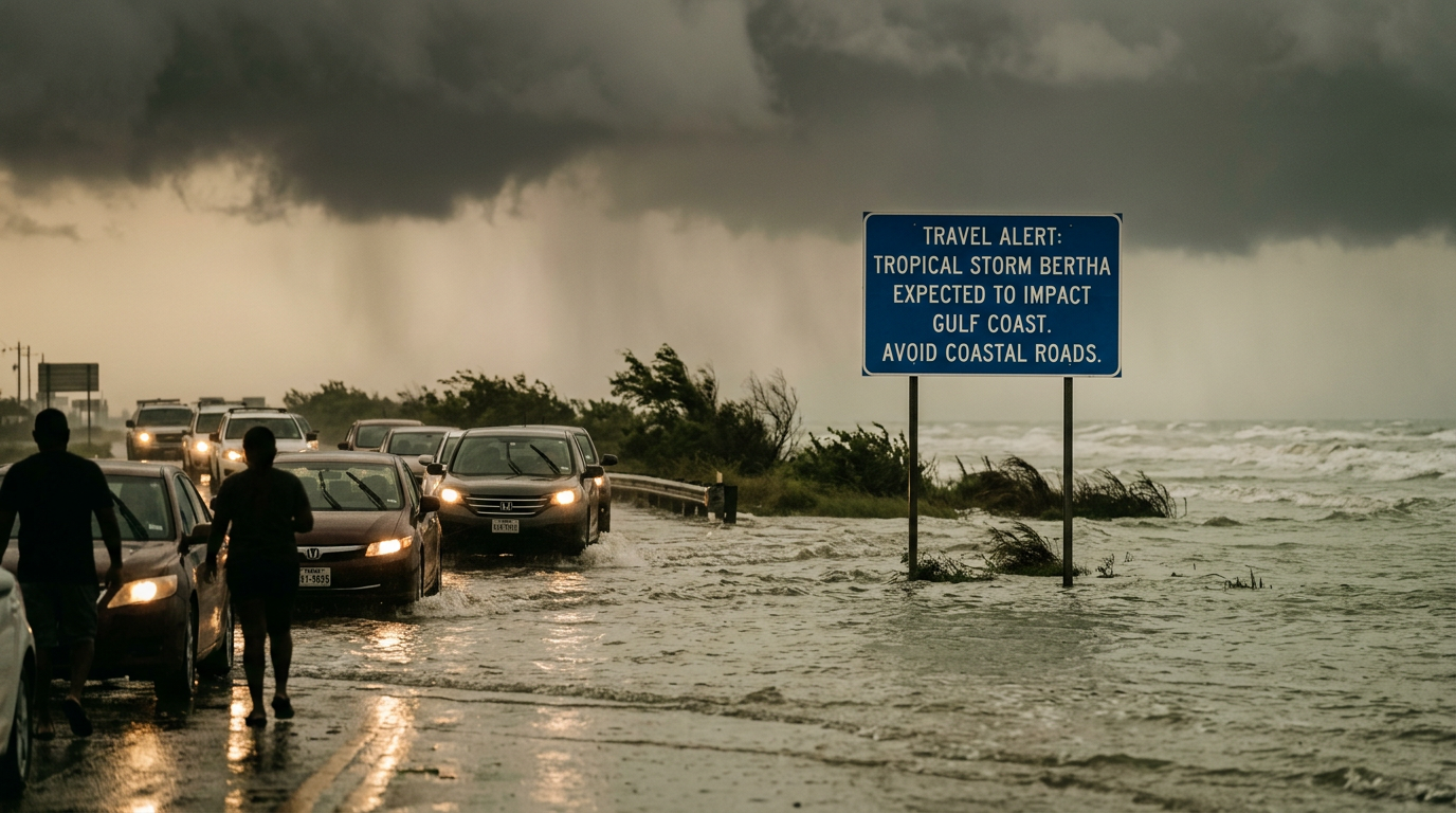
Federal authorities issued a significant travel alert on July 21, 2026, for the Texas coastline and neighboring Gulf states as Tropical Storm Bertha develops into a major holiday threat. The storm is currently projected to bring a storm surge of up to four feet alongside widespread flash flooding and hazardous beach conditions. Travelers planning to visit Texas beaches or fly through regional hubs are being cautioned about imminent disruptions to summer holiday schedules. Historically, July storms in the Gulf of Mexico have a tendency to intensify rapidly due to warm water temperatures, making early warnings critical for coastal safety. This specific alert encompasses the entire coastline from Florida through the Rio Grande Valley, marking one of the most widespread summer storm warnings in the last several seasons. The timing of the storm coincides with heavy summer travel, which historically creates significant logistical challenges for the Lone Star State. Texas has a long history of managing tropical systems, with the state’s Gulf Coast serving as a perennial frontline for seasonal weather patterns originating in the Caribbean. Previous systems like Beryl and Alberto have demonstrated how even mid-range tropical storms can cripple power grids and transportation networks. The current advisory for Bertha serves as a preemptive measure to ensure that residents and tourists alike prioritize safety before the system reaches peak intensity off the coast of the Texas-Louisiana border.
Texas relevance
Texas residents and tourists along the Gulf Coast from South Padre Island to the Louisiana border are under direct notice to monitor local conditions. Major transit hubs in Houston and coastal cities like Galveston and Corpus Christi are particularly vulnerable to the predicted four-foot storm surge and potential flight delays. In previous years, even moderate tropical systems have caused significant infrastructure strain in Harris and Galveston counties, making this federal alert a priority for local emergency management teams. The Texas Department of Transportation and local port authorities are currently in the process of evaluating readiness as the surge projections threaten low-lying evacuation routes frequently used by those fleeing coastal inundation.
Historical Context of July Storms in Texas
Texas has historically dealt with the volatility of July tropical systems, which often arrive during the hottest weeks of the year when the Gulf of Mexico's water temperatures are at their highest. These warm waters act as fuel for developing low-pressure systems, allowing relatively minor disturbances like Bertha to rapidly gain strength before land contact. In the past, the Texas coast has seen storms that were initially underestimated causing major disruptions to the state's energy and tourism sectors.
The precedent set by previous seasons shows that even a four-foot storm surge can be devastating for communities along the Bolivar Peninsula and the barrier islands. The state's reliance on coastal tourism during the summer months means that thousands of visitors are often unfamiliar with the speed at which a tropical system can deteriorate driving and swimming conditions. This familiarity—or lack thereof—is why state officials are echoing the federal travel alert with such urgency this week.
Furthermore, the Texas energy corridor, stretching from Corpus Christi to Lake Charles, often requires significant lead time to secure offshore assets and refinery operations. When a travel alert of this magnitude is issued, it serves as a signal to the industrial sector to begin preparations for potential shutdowns or limited staffing. This proactive approach is a direct result of lessons learned from past systems that caused significant environmental and economic damage due to delayed preparedness.
Projected Impacts on the Texas Coastline
The primary concern for the Texas shoreline involves the projected four-foot storm surge. This level of rising water can lead to significant coastal erosion and the inundation of low-lying roads, particularly along the Bolivar Peninsula and sections of the Texas City dike. Residents in these areas are encouraged to secure loose outdoor property and monitor tide levels closely as the system approaches. The surge is expected to impact the timing of tide cycles, potentially causing water to remain inland longer than a typical storm.
Flash flooding also poses a severe risk for inland areas. Tropical systems often carry heavy moisture that can stall over metropolitan areas like Houston or Beaumont. The current alerts suggest that localized rainfall totals could overwhelm municipal drainage systems, leading to hazardous driving conditions during the peak of the summer travel season. Local officials in Harris County have already begun clearing storm drains and checking water pump readiness in anticipation of the storm's northern bands.
The combination of surge and rainfall creates a 'double threat' for coastal Texas cities. When the sea level rises due to the surge, inland water has nowhere to drain, which significantly increases the risk of residential flooding in areas that are not normally prone to it. This hydrological bottleneck remains one of the most difficult challenges for Texas emergency responders during systems like Bertha.
Aviation and Transportation Disruptions
Aviation officials are warning of possible flight chaos as the storm nears the Gulf Coast. Major Texas airports, including George Bush Intercontinental and William P. Hobby Airport, often face scheduling delays or cancellations when tropical weather patterns disrupt air traffic control corridors. The federal travel alert emphasizes that holiday travelers should maintain flexible itineraries. Because Houston serves as a massive international gateway, disruptions here often ripple across the entire United States flight network.
Road travel is equally affected by these weather warnings. High winds and heavy rain can make transit on major arteries like I-45 and Highway 87 dangerous. Transportation authorities typically advise against travel in these corridors once storm conditions begin to deteriorate to avoid trapping motorists in flooded zones. The Texas Department of Public Safety (DPS) is currently monitoring high-traffic vacation routes to ensure that those departing the coast can do so safely and efficiently.
For those planning to use the Texas ferry systems, particularly the Galveston-Bolivar ferry, operations are likely to be suspended if tide levels exceed safety thresholds. These closures can isolate coastal communities, making it imperative for residents to stock up on supplies or relocate before the alert escalates. Transit authorities emphasize that once a 'travel alert' is elevated to a 'warning,' the window for safe movement closes rapidly.
Beach Safety and Marine Hazards
Public safety officials are highlighting the danger posed to swimmers and boaters. Tropical Storm Bertha is expected to generate powerful rip currents and significantly high surf well ahead of its landfall. These conditions make recreational swimming extremely dangerous, even for experienced swimmers, prompting likely closures of public beaches along the Texas coast from Galveston to Port Aransas. Blue flag warnings or outright beach closures are expected as the system moves closer.
For the commercial and recreational fishing industries, the storm surge and gale-force winds necessitate early docking and securing of vessels. The Texas maritime community is being urged to pull smaller craft from the water and ensure that larger vessels represent minimal risk to pier infrastructure during the expected surge. Coastal marinas often enact mandatory evacuation protocols for boats when a surge of four feet or higher is forecasted to prevent collisions and sinkings.
The environmental impact on the Texas shoreline should also not be overlooked. High surf and surge can displace local wildlife and damage sensitive dune systems that protect inland property. State park officials at Mustang Island and Galveston Island State Park are already preparing for potential closures to protect both the public and the natural habitats that are most vulnerable to tropical surge events.
Gulf Coast Regional Coordination
While Texas remains a focal point of the alert, the proximity of Louisiana, Mississippi, Alabama, and Florida highlights the regional scale of the threat. Coordination between state emergency agencies is standard during these events to manage resources like utility repair crews and emergency medical services. The shared coastline means that a shift in Bertha's trajectory could quickly alter the impact level for Texas ports. Joint task forces often share real-time data on surge heights to better predict where the eye of the storm will make its final approach.
The alert serves as a trigger for state agencies to begin pre-positioning assets. This includes checking the readiness of high-water rescue vehicles and ensuring that evacuation routes are clear of construction or obstacles. The synchronicity of the warnings across five states underscores the potential breadth of the storm's reach, making it one of the largest early-warning events of the 2026 season. Texas emergency management teams are in constant contact with the National Hurricane Center to monitor for any sudden changes in Bertha’s intensity.
By coordinating at a federal level, the United States aims to reduce the pressure on local resources. When travel alerts are issued across the southern coast, it allows for a more organized distribution of federal aid and emergency personnel if one specific area, such as the Texas upper coast, takes a direct hit. This regional strategy is essential for maintaining the integrity of the Gulf’s critical shipping lanes and oil production facilities.
Preparing for Power and Infrastructure Strain
Tropical systems frequently result in localized power outages caused by wind-blown debris or flooded electrical equipment. Utility providers along the Texas coast typically increase staffing levels in response to such travel alerts to handle potential downed lines. Residents are advised to prepare for the possibility of short-term service interruptions during the peak of the storm, as high winds may prevent technicians from safely accessing repair sites until conditions subside.
Infrastructure vulnerability is a recurring theme in Gulf Coast weather planning. The combination of a four-foot surge and heavy rainfall assesses the limits of sea walls and levee systems. In Texas, the longevity of these structures is vital for protecting residential communities located just behind the immediate coastline. Engineering teams are currently inspecting tide gates and drainage pumps to ensure that the infrastructure can handle the massive volume of water projected to arrive by the weekend.
Long-term communication strategies are also being tested. State and local authorities are utilizing emergency alert systems (EAS) to keep the public informed of road closures and shelter openings. For many Texans, the alert is a reminder of the necessity of a 'go-bag' and a family emergency plan, as the transition from a tropical storm to a more severe hurricane can happen with very little notice in the warm Gulf waters.
Analysis
The issuance of a multi-state federal travel alert suggests that the National Weather Service and aviation authorities are prioritizing proactive displacement of travelers to avoid the 'stranding' incidents seen in previous summer storms. For Texas, the economic impact of such an alert is substantial, potentially affecting millions in tourism revenue during the peak July season. However, the risk of litigation and infrastructure failure often outweighs the immediate economic loss. The emphasis on 'flight chaos' reflects a broader concern regarding the fragility of the nation's air traffic network when faced with localized extreme weather at major hubs like Houston and Atlanta. For the Texas political and emergency management landscape, Bertha presents a test of the updated coastal drainage and seawall reinforcement projects funded over the last legislative biennium.
Source attribution
This story was reported using a public release from the Texas Travel Stories (Google News). Keep TX Red rewrote the coverage independently and links to the official statement for verification.
Frequently Asked Questions
- What is the expected storm surge for the Texas coast?
- Current federal forecasts predict a storm surge of approximately four feet. This can cause flooding in low-lying coastal areas and significant beach erosion.
- Will flights in Texas be cancelled because of Tropical Storm Bertha?
- While specific cancellations depend on the airlines, the federal alert warns of 'flight chaos' and potential disruptions. Travelers are advised to check their flight status frequently.
- Is it safe to visit Texas beaches during the storm?
- No, officials are warning of dangerous beach conditions, including high surf and powerful rip currents. It is highly likely that many public beaches will be closed to swimmers.
- Which Texas cities are most at risk from Tropical Storm Bertha?
- Coastal cities like Galveston, Corpus Christi, and Beaumont are at the highest risk for surge and wind, while Houston faces significant flash flooding risks.
- How can travelers stay updated on the storm's progress?
- Travelers should monitor the National Hurricane Center, local Texas news outlets, and sign up for emergency alerts from the Texas Department of Public Safety.
Official Sources
Take the next step
Browse the Newsroom →Read more about Keep Texas Red → Our full guide to what Keep Texas Red means and why Texans support it.
Related Articles



Get Texas updates delivered weekly.
Independent Texas reporting on politics, policy, and daily life. One email a week. Unsubscribe anytime.
Keep TX Red Newsroom
The Keep Texas Red Editorial Staff produces nonpartisan explainers, policy breakdowns, and educational resources to help Texans understand how their government works. All content is reviewed for accuracy and updated regularly.
About Keep TX Red →