Major Magnitude 5.5 Earthquake Impacts Central Peru Region Near Sicaya
USGS reports a significant 5.5 magnitude earthquake striking near Sicaya, Peru, prompting a Yellow PAGER alert and assessments of local infrastructure.
Editorial disclaimer: Opinions and analysis on Keep TX Red are editorial content — not statements of fact. See our editorial standards.
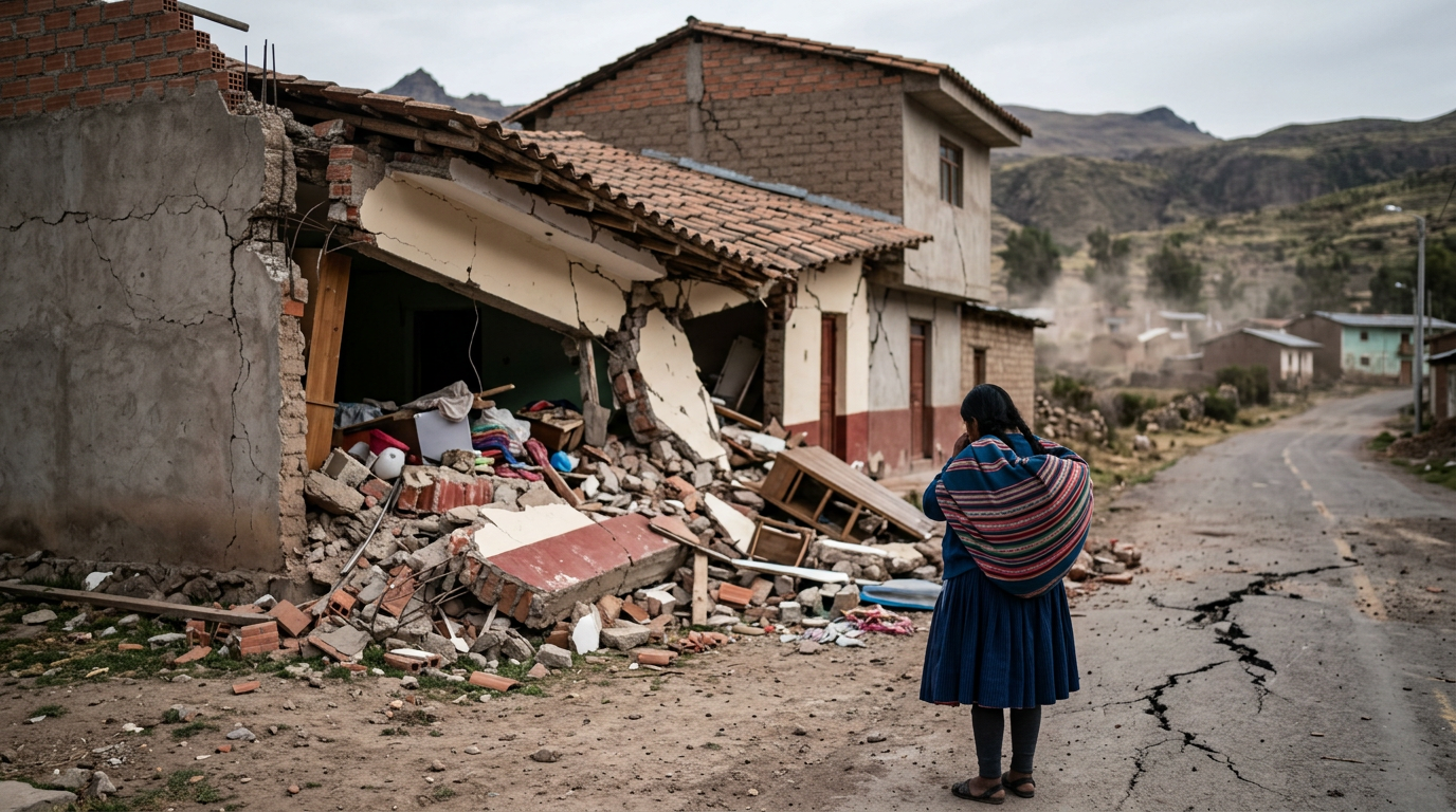
On July 19, 2026, at approximately 02:24 UTC, a notable seismic event occurred in central Peru, specifically centered about 2 kilometers west-southwest of the town of Sicaya. The United States Geological Survey (USGS) recorded the tremor as a magnitude 5.5 event, which is categorized as moderate but capable of causing localized damage. The quake's epicenter was located at coordinates 12.043°S and 75.301°W, with a relatively shallow depth of approximately 10 kilometers. This shallow depth contributes to the intensity of the shaking felt at the surface, which is often more destructive than deeper quakes of similar magnitudes. Historically, the Andean region of South America is one of the most seismically active zones on Earth due to the subduction of the Nazca Plate under the South American Plate. This geological phenomenon has historically resulted in some of the world's most powerful earthquakes, though this specific 5.5 magnitude event remains on the lower end of that catastrophic scale. For over a century, Peru has faced frequent tremors that have shaped its building codes and emergency preparedness protocols, similar to the ways in which Texas has had to adapt its own regulatory frameworks in response to shifting geological conditions and industrial impacts. In the immediate aftermath of the tremor, initial data suggested shaking intensities reached Level VII on the Modified Mercalli Intensity Scale, indicating very strong perceived shaking. This level of intensity often leads to negligible damage in buildings of good design and construction but may cause slight to moderate damage in well-built ordinary structures and considerable damage in poorly built or badly designed infrastructures. Residents in the Junín Region reported significant swaying, with falling objects and shelf disturbances common throughout the local area.
Texas relevance
While this earthquake occurred thousands of miles from the Lone Star State, the monitoring and reporting of such events are deeply relevant to Texas geological science and the energy sector. Texas has experienced its own surge in seismic activity over the last decade, particularly in the Permian Basin and the Eagle Ford Shale. Observing how the USGS manages PAGER (Prompt Assessment of Global Earthquakes for Response) alerts provides a benchmark for how Texas authorities, including the Railroad Commission and the Bureau of Economic Geology at UT Austin (TexNet), communicate risk to residents of Midland, Odessa, and San Antonio. Furthermore, Texas maintains strong economic and agricultural ties with South American nations, and disruptions in Peruvian infrastructure can have ripple effects on international shipping and logistics sectors that utilize Texas ports like the Port of Houston.
Geological Context of the Sicaya Tremor
The earthquake originated at a depth of 10 kilometers, which the USGS classifies as shallow. In seismic terms, depth is a primary factor in determining the destructive potential of an earthquake. Shallow quakes distribute their energy closer to the surface, resulting in more violent ground motion directly above the epicenter. This specific event took place in the central highlands of the Andes, a region characterized by complex fault systems that accommodate the immense pressure of tectonic plates pushing against one another.
The Junín region, where Sicaya is located, is no stranger to these events. However, the 5.5 magnitude represents a significant test for the local community's resilience. Unlike coastal Peru, which often faces the threat of tsunamis following large offshore quakes, the dangers in this inland mountainous area primarily include landslides, rockfalls, and the structural collapse of older adobe buildings. The USGS ShakeMap revealed that the most intense vibrations were concentrated in a relatively small radius around the epicenter, potentially limiting the scope of the most severe damage.
Initial Damage Assessment and PAGER Alerts
The PAGER system is an automated tool used by the USGS to provide preliminary estimates of earthquake impacts. The 'Yellow' status issued for this event indicates that some fatalities are possible and economic damages are likely but potentially limited to the local level. This serves as an early warning for international aid organizations and local government agencies to prepare for potential recovery efforts. Past events in this category have resulted in millions of dollars in losses due to damaged roads and utility disruptions.
According to 'Did You Feel It?' (DYFI) reports, users across central Peru submitted accounts of intense shaking. Many reported that the event lasted for several seconds longer than typical minor tremors, which often increases the psychological impact on the population. Community members in nearby Huancayo felt the shaking acutely, leading to many people self-evacuating from homes and businesses into the streets to avoid potential debris from facade failures.
Infrastructure Vulnerability in the Andean Highlands
Small municipalities like Sicaya are representative of many rural areas where infrastructure development has struggled to keep pace with modern seismic safety standards. The use of reinforced concrete is becoming more common, but a significant portion of the residential housing stock remains vulnerable to lateral forces. When an earthquake with a Level VII intensity occurs, these older structures become the primary concern for emergency responders.
Utility networks, including water pipelines and electrical grids, are also susceptible to ground displacement. Even a moderate 5.5 magnitude quake can cause pipe bursts that leave thousands without clean water in the hours following the event. Repairing this infrastructure in mountainous terrain is notoriously difficult, requiring specialized equipment and heavy investment, which can strain local municipal budgets already stretched thin by economic factors.
The Role of the USGS in Global Seismic Monitoring
The United States Geological Survey plays a crucial role in monitoring earthquakes not just in the U.S., but globally. By using a vast network of seismographs, the agency can triangulate the location and magnitude of an earthquake within minutes. This data is vital for people in Texas and beyond, as the science of seismology relies on a global data set to understand how different types of crustal structures respond to stress.
For Texas researchers at TexNet, analyzing the data from a 5.5 magnitude event in Peru helps refine the models used to predict ground motion in North American plates. While the tectonic settings are different, the physics of wave propagation remains a shared area of study. The coordination between international agencies and the USGS ensures that even remote locations receive the benefit of high-tech monitoring, which can save lives through rapid information dissemination.
Emergency Response and Local Coordination
Following the tremor, Peru’s National Institute of Civil Defense (INDECI) mobilized to assess the situation on the ground. Their protocol involves checking critical infrastructure such as hospitals, schools, and government buildings first to ensure that secondary disasters, such as fires or structural collapses, do not occur. In areas near Sicaya, local police and fire units were tasked with clearing debris from roads to ensure that emergency vehicles could access remote mountain villages.
Communication remains a challenge in high-altitude regions after an earthquake. Cell towers can be knocked out of alignment, and heavy traffic on the network often leads to a collapse of digital communication. Residents are encouraged to use text messaging rather than voice calls to report emergencies to keep bandwidth available for first responders. This strategy is a universal best practice in disaster management, frequently promoted by Texas emergency management agencies during hurricanes or severe weather events.
Comparative Seismic Activity: Peru vs. Texas
Comparing the seismic profile of Peru to that of Texas highlights the difference between plate-boundary activity and intraplate activity. Peru is subject to constant, high-energy tectonic movement. In contrast, Texas primarily deals with induced seismicity or the awakening of ancient, dormant faults. However, the reaction of the public is often the same: sudden ground movement causes immediate concern and highlights the need for better instrumentation.
Texas has made significant strides in the last decade by installing scores of new seismometers across the state. This enables the state to detect much smaller events that might precede a larger one. While a 5.5 magnitude quake in Texas would be a record-breaking and potentially catastrophic event for the state's infrastructure, in Peru, it is a manageable but serious occurrence. Both regions benefit from the sharing of engineering data on how buildings handle the specific frequencies of seismic waves.
The Economic Impact of Moderate Earthquakes
While a 5.5 magnitude earthquake is not usually a 'total loss' event for a nation, the localized economic impact can be devastating for small-scale farmers and business owners. In the Junín region, agriculture is a primary driver of the economy. If irrigation systems are damaged or if roads to market are blocked by landslides, the loss of income for a single season can be immense for families living on the margin.
The cost of seismically retrofitting older buildings is often prohibitive for small communities. This leaves them in a cycle where they must rebuild after every moderate event rather than being able to invest in long-term resilience. International development groups often focus on these specific scenarios, advocating for low-cost seismic reinforcement techniques that use local materials to improve the safety of adobe and unreinforced masonry homes.
Looking Ahead: Predictive Science and Preparedness
The scientific community continues to move closer to better understanding earthquake precursors, although exact prediction remains impossible. Data from the Sicaya earthquake will be added to the USGS database to help refine shakemap algorithms and PAGER accuracy. For the residents of Peru, the focus now shifts from the immediate shock to the long-term recovery and the inevitable reality of the next tremor.
Education remains the most effective tool in earthquake zones. Public safety campaigns that teach 'Drop, Cover, and Hold On' have saved countless lives. In Texas, where the risk of major earthquakes is lower but growing, these same safety principles are being introduced into school curriculums and workplace safety manuals. Preparation is a global necessity, regardless of whether the threat comes from an Andean subduction zone or a North Texas fault line.
Analysis
The designation of a Yellow PAGER alert by the USGS is a significant detail that suggests the potential for both casualties and economic loss, though on a localized scale. From an observer's standpoint, this event serves as a reminder of the fragility of rural infrastructure in seismic zones. While modern skyscrapers in Lima may be built to withstand these vibrations, the smaller towns like Sicaya often rely on older masonry or traditional building techniques that are far more vulnerable. For Texas, which does not face the same subduction-zone risks but deals with human-induced or shallow faulting tremors, the takeaway is the critical importance of rigorous construction standards and proactive monitoring of ground movements.
Source attribution
This story was reported using a public release from the USGS Earthquakes — Texas. Keep TX Red rewrote the coverage independently and links to the official statement for verification.
Frequently Asked Questions
- Was there a tsunami warning after the Peru earthquake?
- No. Because the earthquake was located inland in the Andean highlands and not offshore, there was no risk of a tsunami. Tsunami warnings are typically only issued for large subduction zone earthquakes occurring under the ocean floor.
- How does a 5.5 magnitude compare to earthquakes in Texas?
- A magnitude 5.5 is significantly stronger than most earthquakes recorded in Texas history. While Texas has seen an increase in seismic activity, most events are between 2.0 and 4.0. A 5.5 magnitude event would likely cause noticeable structural damage in Texas cities not built to handle seismic loads.
- What does the Yellow PAGER alert mean?
- The USGS uses the Yellow alert color to indicate that the quake has the potential for some casualties and damage. It is a middle-tier warning that signals the event is serious and requires a response, but it is not expected to be a national-scale catastrophe.
- Are there ongoing risks after the initial tremor?
- Yes. Residents in the area should expect aftershocks, which are smaller earthquakes that follow the main event. These can cause further damage to buildings already weakened by the first quake and can trigger landslides in mountainous terrain.
Official Sources
Take the next step
Browse the Newsroom →Read more about Keep Texas Red → Our full guide to what Keep Texas Red means and why Texans support it.
Related Articles



Get Texas updates delivered weekly.
Independent Texas reporting on politics, policy, and daily life. One email a week. Unsubscribe anytime.
Keep TX Red Newsroom
The Keep Texas Red Editorial Staff produces nonpartisan explainers, policy breakdowns, and educational resources to help Texans understand how their government works. All content is reviewed for accuracy and updated regularly.
About Keep TX Red →