Dual Weather Threat as Tropical Storm Bertha Approaches Texas Coast During Extreme Heat
Texas faces a double threat as heat indices exceed 100 degrees while Tropical Storm Bertha tracks toward the Gulf Coast.
Editorial disclaimer: Opinions and analysis on Keep TX Red are editorial content — not statements of fact. See our editorial standards.
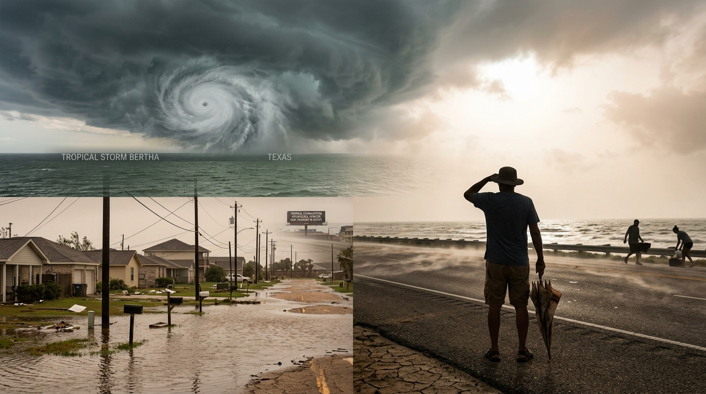
On July 20, 2026, weather monitoring services confirmed that Tropical Storm Bertha is officially tracking toward the Texas coastline, presenting a significant meteorological challenge for the region. Simultaneously, a severe heat wave has pushed the heat index above the 100-degree mark across much of the state, complicating preparation efforts. Historically, Texas has often faced the convergence of tropical moisture and excessive thermal heat during the peak of the summer months, a combination that frequently leads to volatile atmospheric conditions and high humidity levels. This current system follows a pattern of Gulf activity where early-season storms interact with established high-pressure ridges responsible for the record-breaking temperatures seen this week. The historical context of Texas weather patterns suggests that these dual-threat scenarios are increasingly complex for emergency responders. In years past, tropical systems entering the Gulf of Mexico have disrupted the localized high-pressure systems that typically keep Texas dry and hot. However, current data indicates that Bertha is struggling to displace the massive 'heat dome' sitting over the central United States. This conflict creates a scenario where the moisture from the storm is essentially 'cooking' in the high temperatures, leading to an environment where the air is thick with humidity and surface temperatures remain dangerously high even in the presence of increased cloud cover.
Texas relevance
The threat is localized specifically to the Texas Gulf Coast and inland regions like San Antonio and Houston, where residents must balance heat safety with tropical storm readiness. Texas infrastructure, particularly the ERCOT power grid, often faces its highest demand during triple-digit heat indices, making the added threat of a tropical system a critical concern for state utility management. Previous tropical events in Texas, such as Harvey or Beryl, have demonstrated that even weaker tropical storms can cause massive flooding if they stall over the coastal plains, meaning any movement from Bertha is under intense scrutiny by local emergency management teams. Across the Lone Star State, from the refineries in Beaumont to the suburban stretches of San Antonio, the logistical strain of managing storm evacuations while maintaining a stable power supply during an extreme heat event represents a significant test of state resilience.
The Rise of Tropical Storm Bertha
Tropical Storm Bertha has consolidated its center of circulation and is currently moving across the Gulf of Mexico with a trajectory aimed at the Texas shoreline. Meteorologists are closely tracking the system's wind speeds and internal pressure to determine if the warm Gulf waters will facilitate further intensification before it reaches the continental shelf. The current atmospheric setup is a classic example of maritime tropical moisture meeting continental heat, which can often result in rapid intensification if the vertical wind shear remains low.
Local weather authorities have emphasized that while the storm’s final path is subject to shift, the outer bands are expected to bring increased moisture to the region. This influx of humidity, when paired with existing high temperatures, is what has driven the heat index to dangerous levels for coastal and inland counties alike. Forecast models are showing a wide cone of uncertainty that covers a large portion of the Texas coast, making it vital for residents from Brownsville to Port Arthur to remain alert for sudden updates.
Historical Context of Dual Hazards in Texas
Texas is no stranger to the peculiar combination of extreme heat and tropical development. In several past instances, the 'pre-storm heat' has often caught residents off guard. This phenomenon occurs as the outer edges of a tropical system compress the air ahead of it, causing temperatures to spike just before the clouds and rain arrive. This historical trend has been observed in various Gulf storms over the last two decades, frequently resulting in heat-related medical calls rising even as the storm approaches.
Comparing Bertha to previous July storms, meteorologists note that the current sea surface temperatures in the Gulf are slightly above average. This serves as high-octane fuel for tropical systems. In the past, similar conditions have led to storms that were predicted to be minor intensifying into major rain-makers. The state's readiness protocols have evolved since the 2017 season to better account for these rapid changes, ensuring that local shelters are equipped with both flood protection and high-capacity air conditioning systems.
Understanding the 100-Degree Heat Index
The heat index, often referred to as the 'feels-like' temperature, has already surpassed 100 degrees in several major Texas metropolitan areas. This measurement combines actual air temperature with relative humidity to provide a more accurate assessment of how the human body perceives heat and its ability to cool itself through perspiration. When humidity levels are high, as they are now due to Bertha's vicinity, evaporation slows down, drastically increasing the risk of the body overheating during physical tasks.
Emergency services in South and Central Texas have issued reminders for residents to stay hydrated and avoid prolonged outdoor exposure. The combination of high heat and the physical labor often required for storm boarding and sandbagging creates a hazardous environment for those readying their homes for Bertha’s arrival. Health officials have noted that heat stroke can occur in as little as 30 minutes under these specific conditions if proper hydration and shade breaks are not prioritized.
Coastal Vulnerability and Storm Surge Concerns
For the Texas coast, the primary concern remains the potential for storm surge and localized flooding. As Bertha approaches, the counter-clockwise rotation of the storm pulls water toward the shore, which can lead to inundation in low-lying areas even before the center of the storm makes landfall. Coastal counties like Galveston, Brazoria, and Nueces are particularly susceptible to this 'push' of water, which can trap people in their homes if they wait too long to move to higher ground.
Preparation in these areas is often a race against time. Because the heat index is hovering at such high levels, work crews and residents are forced to take frequent breaks, slowing the pace of critical infrastructure reinforcement. This highlights the compounding difficulty of managing two distinct natural hazards simultaneously. Harbor masters and port authorities are already enacting their heavy weather protocols to secure ships and industrial equipment that could become hazards in the event of rising tides.
Potential Impact on the Texas Power Grid
The simultaneous occurrence of extreme heat and a tropical storm puts significant pressure on the state's energy resources. High temperatures drive up air conditioning usage, keeping the demand for electricity at near-peak levels throughout the afternoon and evening hours. ERCOT, the agency responsible for most of the Texas grid, is monitoring the situation closely to ensure that the increased load does not lead to an imbalance in the system while crews are also prepping for potential storm damage.
If Bertha brings high winds or heavy rainfall to the coastal regions, localized power outages could occur due to downed lines or flooded substations. Losing power during a period where the heat index exceeds 100 degrees would elevate the risk of heat-related illnesses for those without access to cooling centers. Utility companies like CenterPoint and Oncor have pre-staged crews at the edges of the projected storm path to ensure rapid response, though the safety of these workers is also a concern given the heat-intensive nature of their tasks.
Stakeholder Responses and Local Preparations
City leaders in Houston and San Antonio have already initiated their emergency response frameworks. This includes coordinating with the Texas Division of Emergency Management (TDEM) to ensure that high-water rescue vehicles and cooling buses are ready for deployment. School districts and local businesses are also assessing whether to adjust hours if the storm’s path becomes more certain over the next 24 hours, seeking to minimize the time people spend commuting in both the heat and potential rain.
Farmers and ranchers in the Rio Grande Valley and the coastal plains are also facing a difficult choice. While some rainfall is desperately needed to combat dry soil conditions, the threat of high tropical winds can damage crops like cotton and citrus. The agricultural community is moving quickly to move livestock to higher ground and secure irrigation equipment, all while battling the same triple-digit heat indices affecting the rest of the state.
Meteorological Forecast and Long-Term Outlook
The current forecast models suggest that Bertha will continue its northwestern trek over the next 48 to 72 hours. While some models indicate a weakening upon landfall, the sheer volume of tropical moisture associated with the system remains a threat for heavy, persistent rainfall in the Houston and San Antonio corridors. Meteorologists are particularly concerned about 'training' storms, where multiple bands of rain pass over the same area repeatedly, leading to rapid flash flooding.
Long-term trends for the 2026 season have suggested a more active Gulf, and Bertha represents a significant milestone in that seasonal prediction. Weather experts will continue to monitor the interaction between the storm’s moisture and the high-pressure system currently parked over the southwestern United States. This interaction often determines whether a storm will move through quickly or stall out, the latter of which is the worst-case scenario for the flood-prone Texas coastal regions.
Public Safety and Preparation Protocols
State officials urge Texans to finalize their emergency kits, which should include enough water and non-perishable food for at least three days. Given the heat, these kits should also include supplies for cooling, such as battery-powered fans and electrolyte replacements. It is also advised to keep important documents in waterproof containers and to ensure that all digital devices are fully charged in anticipation of potential outages.
Communicating with family members and establishing a clear evacuation or sheltering plan is essential. As the heat index stays above 100, checking on elderly neighbors or those without reliable climate control becomes a critical community responsibility during the lead-up to the storm. Local fire departments recommend that residents review their flood insurance policies and take photos of their property now, before any adverse weather arrives, to facilitate potential claims.
Analysis
The intersection of a tropical system and a triple-digit heat index creates a unique 'danger zone' for public safety. While the wind from a tropical storm is the most visible threat, the primary concern in the short term remains the life-threatening heat that precedes the storm's arrival. Residents participating in outdoor storm preparations—such as boarding windows or clearing drainage paths—are at an elevated risk for heat exhaustion. Furthermore, the atmospheric pressure changes associated with Bertha could potentially trap heat in certain inland corridors, extending the duration of the current heat advisory even as cloud cover begins to increase along the shoreline. This 'compound hazard' scenario serves as a stark reminder of why Texas emergency management focuses heavily on individual household readiness before the storm center enters the immediate coastal zone.
Source attribution
This story was reported using a public release from the Texas Storm Video (Google News). Keep TX Red rewrote the coverage independently and links to the official statement for verification.
Frequently Asked Questions
- What is the difference between air temperature and the heat index?
- Air temperature is the literal measurement of the heat in the atmosphere, while the heat index accounts for humidity. High humidity prevents sweat from evaporating quickly, making it feel much hotter to the human body than the thermometer suggests. In Texas, indices over 100 are considered dangerous for extended outdoor activity and require frequent cooling breaks.
- Is Tropical Storm Bertha expected to become a hurricane?
- As of the current July 20 report, Bertha is classified as a tropical storm. While intensification is always possible over warm Gulf waters, meteorologists are primarily focused on its current track and the heavy rainfall it is expected to bring to the Texas coast. Residents should remain prepared for a Category 1 hurricane scenario just in case.
- How can I prepare for a storm during extreme heat?
- Preparation should be done in the early morning or late evening when the heat index is lower. If you must work during the day, take frequent breaks in the shade, drink plenty of water, and wear light-colored, breathable clothing. Never leave children or pets in cars, and ensure that your storm preparation includes plenty of drinkable water.
- What should I do if I lose power during the storm and the heat stays high?
- If you lose power, seek out local cooling centers publicized by your city or county. Keep your blinds closed to trap cool air inside your home as long as possible. If you use a generator, ensure it is placed at least 20 feet away from your home to prevent carbon monoxide poisoning while you run fans or portable AC units.
Official Sources
Take the next step
Browse the Newsroom →Read more about Keep Texas Red → Our full guide to what Keep Texas Red means and why Texans support it.
Related Articles



Get Texas updates delivered weekly.
Independent Texas reporting on politics, policy, and daily life. One email a week. Unsubscribe anytime.
Keep TX Red Newsroom
The Keep Texas Red Editorial Staff produces nonpartisan explainers, policy breakdowns, and educational resources to help Texans understand how their government works. All content is reviewed for accuracy and updated regularly.
About Keep TX Red →