Seismic Activity Shifts West as magnitude 4.3 Earthquake Shakes California Desert Near Johannesburg
A magnitude 4.3 earthquake strikes Southern California, raising awareness for Texas residents on seismic preparedness and energy infrastructure safety.
Editorial disclaimer: Opinions and analysis on Keep TX Red are editorial content — not statements of fact. See our editorial standards.
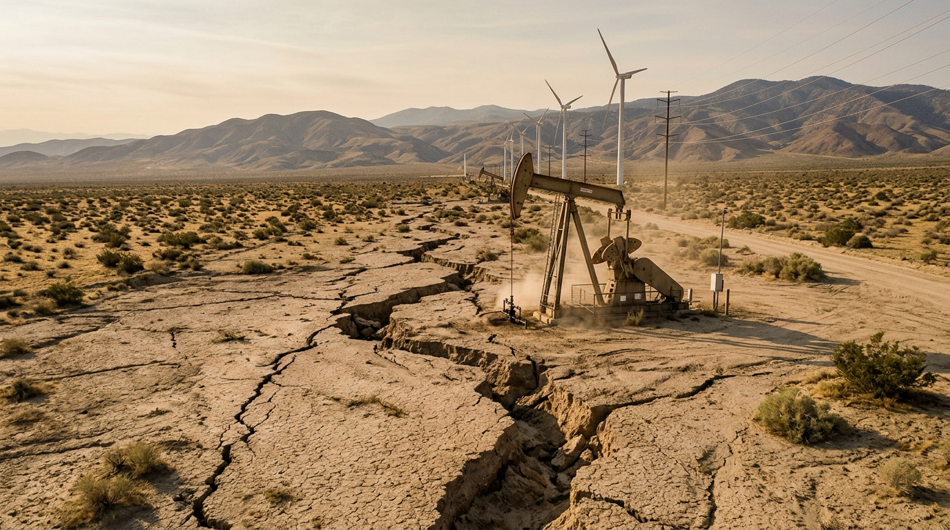
On July 13, 2026, a significant seismic event occurred in the Southern California desert, specifically located approximately 11 miles west-southwest of Johannesburg. The United States Geological Survey (USGS) recorded the tremor as a magnitude 4.3 earthquake, striking at a depth of roughly 4.7 miles below the earth's surface. While the event occurred in the Mohave region, the vibrations were felt across a wide radius, prompting the USGS to issue a Green Pager alert, indicating a low likelihood of casualties or regional economic damage. Historically, seismic events in this corridor are linked to the complex fault systems running through the American West, serving as a reminder of the volatile nature of the continental crust. In recent years, the frequency of mid-range earthquakes has increased across several states, moving beyond the traditional hotspots of the Pacific Coast. Texas has seen a similar trend, particularly in the Permian Basin and the Eagle Ford Shale regions, where seismic monitoring has become a critical component of state safety protocols. This California event provides a case study for geologists to compare fault line behavior across the southwestern United States, as the energy transfer within the North American plate affects multiple states. Understanding the ripple effects of a 4.3 magnitude quake is essential for emergency management teams who must prepare for sudden infrastructure stressors.
Texas relevance
While this earthquake originated in California, its implications are deeply relevant to Texas, a state that has experienced its own surge in seismic events over the last decade. Texas currently maintains one of the most advanced earthquake monitoring networks in the nation, known as TexNet, managed by the Bureau of Economic Geology at the University of Texas at Austin. Observations from out-of-state tremors like the Johannesburg quake help Texas scientists refine their predictive models for the Delaware Basin and Scurry County, where magnitude 4.0+ events have become more common. Protecting Texas’s critical energy infrastructure—including miles of pipelines and refinery facilities—requires a constant analysis of how these geological shifts impact the stability of the ground across the entire Southern belt of the United States.
Technical Breakdown of the Johannesburg Tremor
The earthquake occurred at 4:40 PM UTC, catching residents in the sparsely populated desert regions of Kern and San Bernardino counties by surprise. The depth of 7.55 kilometers is considered relatively shallow for this type of strike-slip movement, which typically results in more intense surface shaking compared to deeper events. The USGS 'Did You Feel It?' (DYFI) system reported level IV intensity, which translates to light shaking that can be felt by most people indoors but rarely causes structural failure in modern buildings.
Seismologists focus on these mid-magnitude events because they often serve as markers for stress accumulation along larger fault complexes. While the Johannesburg area is not directly atop the San Andreas Fault, it sits within a network of smaller fractures that can trigger larger movements if the pressure isn't released periodically. This specific event has provided a wealth of data regarding wave attenuation, which is the study of how quickly seismic energy dissipates as it moves through different types of soil and bedrock.
Infrastructure Implications for Texas Energy
Texas residents and industry leaders often look toward West Coast seismic data to gauge the risks posed to the national power grid and fuel transportation networks. A 4.3 magnitude quake is significant enough to trigger automatic shut-off valves in high-tech pipeline systems, a safety feature also utilized across the Texas Permian Basin. Monitoring these occurrences helps Texas engineers determine if current safety thresholds are adequate or if they need to be adjusted for higher-intensity vibrations.
Furthermore, the shared geological heritage of the American Southwest means that the mechanical stress causing the Johannesburg quake is part of the same tectonic system influencing West Texas. As Texas continues to lead the nation in energy production, the structural integrity of concrete pads, storage tanks, and high-pressure lines remains a top priority. Learning from the California experience allows Texas to implement proactive maintenance rather than reactive repairs following a future local event.
Communication and Early Warning Systems
The rollout of the ShakeMap and Pager systems by the USGS for this specific event demonstrates the efficiency of modern emergency alerts. In Texas, the TexNet system provides similar real-time data to the public and the Railroad Commission of Texas. For Texans, the ability to receive rapid notifications about seismic shifts is vital for those living near active saltwater disposal sites or areas with a history of tectonic movement.
Rapid communication helps prevent panic and allows for immediate inspection of bridges and public transport routes. Although Texas generally experiences fewer earthquakes than California, the rapid urbanization of the I-35 corridor means that even a minor tremor could impact more people today than it would have thirty years ago. Digital infrastructure must be hardened to ensure that these warning systems remain online during any significant event.
Comparing Texas and California Seismology
There is a distinct difference between the tectonic earthquakes found in California and the 'induced' seismic events that have been more frequent in Texas. California’s activity is primarily driven by the movement of the Pacific and North American plates. In contrast, the majority of recent Texas tremors have been linked to fluid injection processes in the transition zones of oil-producing regions. However, both types of events require the same monitoring technology and emergency response strategies.
By analyzing events like the one near Johannesburg, Texas researchers can better distinguish between natural background noise in the earth's crust and localized anomalies. This distinction is crucial for Texas lawmakers when drafting environmental and industrial regulations. Keeping Texas red means protecting the state’s economy from unnecessary over-regulation while still ensuring that the physical safety of citizens is grounded in sound scientific observation.
Historical Context of Desert Tremors
The area surrounding Johannesburg and nearby Ridgecrest has a storied history of seismic activity, most notably the major earthquake sequence of 2019. Those events caused significant damage and were felt as far away as Las Vegas. The 4.3 magnitude tremor on July 13 is part of a long-tail pattern of adjustments in the earth's crust following those massive shifts. This historical perspective is important because it shows that seismic activity often occurs in clusters over several years.
Texas has seen its own version of this clustering, notably in the Panhandle and near Midland-Odessa. Just as the California desert has become a focal point for USGS research, the West Texas landscape has become a living laboratory for the University of Texas. Both regions serve as critical data points for understanding how the North American continent is slowly twisting and shifting under the weight of tectonic forces.
Emergency Preparedness for the Future
The USGS Green Pager status for the Johannesburg quake is the best-case scenario for a magnitude 4 event, but it should not lead to complacency. Emergency management agencies in both California and Texas recommend that households maintain basic disaster kits. This includes water, non-perishable food, and a clear communication plan. In Texas, where the ground was long thought to be stable, the psychological shift toward accepting seismic risk is still ongoing.
Moving forward, the coordination between state and federal geological agencies will be the primary defense against earthquake-related disasters. For Texas, this means continuing to fund the Bureau of Economic Geology and ensuring that local first responders are trained for 'low-probability, high-impact' scenarios. Whether the震源 is in the high desert of California or the plains of Texas, the fundamental principles of structural resilience and public safety remain the same.
Analysis
From a policy perspective, this seismic event underscores the necessity for Texas to maintain its independent and robust approach to geological oversight. Unlike California, which has long-established and highly restrictive building codes due to fault line proximity, Texas must balance its rapidly growing industrial sector with the emerging reality of increased ground activity. The Johannesburg quake serves as a reminder that seismic events do not respect state lines; the economic connectivity between California’s energy markets and Texas’s production means that any localized disaster on the West Coast can ripple through the supply chains of the Lone Star State. Texas regulators should continue to emphasize data-driven responses rather than reactionary federal mandates, ensuring that the state remains resilient against both natural and man-made tremors.
Source attribution
This story was reported using a public release from the USGS Earthquakes — Texas. Keep TX Red rewrote the coverage independently and links to the official statement for verification.
Frequently Asked Questions
- Was the earthquake felt in Texas?
- No, a magnitude 4.3 earthquake does not have the intensity to be felt thousands of miles away in Texas. However, the data gathered from the event is analyzed by Texas geologists to understand broader tectonic movements affecting the southern United States.
- What is the 'Green Pager' alert system?
- The Pager system is a tool used by the USGS to quickly estimate the impact of an earthquake. A 'Green' status means there is a low probability of fatalities or significant economic losses, indicating the quake was likely limited to minor shaking.
- How does this event affect Texas energy policy?
- While the quake was in California, it reinforces the importance of Texas's own seismic monitoring (TexNet). Texas uses this information to regulate industrial activities and ensure that pipelines and refineries are built to withstand tremors of similar or greater magnitude.
Official Sources
Take the next step
Browse the Newsroom →Read more about Keep Texas Red → Our full guide to what Keep Texas Red means and why Texans support it.
Related Articles



Get Texas updates delivered weekly.
Independent Texas reporting on politics, policy, and daily life. One email a week. Unsubscribe anytime.
Keep TX Red Newsroom
The Keep Texas Red Editorial Staff produces nonpartisan explainers, policy breakdowns, and educational resources to help Texans understand how their government works. All content is reviewed for accuracy and updated regularly.
About Keep TX Red →