Rio Grande Water Levels Rise Near Laredo at Juárez-Lincoln Bridge
Laredo officials monitor the Rio Grande as water levels reach 17.5 feet at Bridge II, signaling potential changes for the South Texas border region.
Editorial disclaimer: Opinions and analysis on Keep TX Red are editorial content — not statements of fact. See our editorial standards.
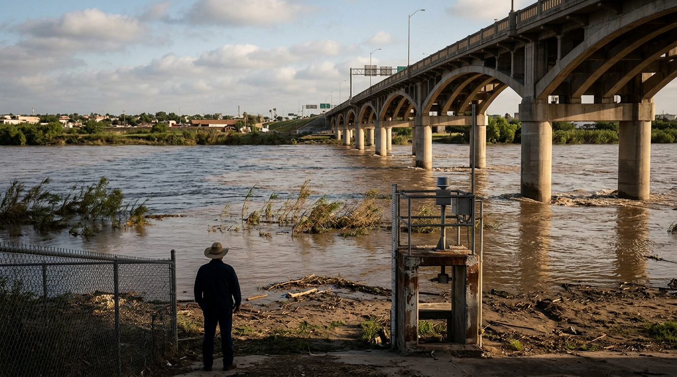
In a routine but critical observation of the South Texas landscape, water levels at the Rio Grande reached a crest of 17.5 feet at the Juárez-Lincoln International Bridge, commonly known as Bridge II, on the morning of July 19. This measurement provides a snapshot of the ongoing hydrological shifts occurring along the United States-Mexico border. Monitoring river stages in this region is a historical necessity, as the Rio Grande serves as a primary source for municipal water and irrigation while also posing intermittent flooding risks during seasonal shifts or upstream releases. Historically, the Rio Grande's flow has been heavily regulated by the 1944 Water Treaty between the U.S. and Mexico, which dictates how water from the river and its tributaries is shared. In recent decades, Laredo and its neighboring communities have invested heavily in flood wall infrastructure and alert systems to manage the volatility of the river, ensuring that both commercial traffic and residential safety remain uncompromised during periods of elevated water levels.
Texas relevance
The Rio Grande is the lifeblood of Webb County and the city of Laredo, serving as the definitive boundary between Texas and Tamaulipas. For Texans, the height of the river at Bridge II is more than just a measurement; it is an indicator of the feasibility of international trade and the stability of local utility intake systems. Laredo acts as the largest inland port in the United States, and any significant fluctuation in the Rio Grande's status can impact the thousands of trucks that cross the international bridges daily. Elevated river levels also require the attention of the Texas Department of Public Safety and local emergency management teams who oversee the security of the riverbank areas. Because much of South Texas relies on the Amistad and Falcon Reservoirs for agricultural water, these readings provide essential data for the Lower Rio Grande Valley's long-term planning and drought mitigation efforts.
The Strategic Importance of Bridge II
The Juárez-Lincoln International Bridge sits at the heart of the Laredo trade corridor, connecting Texas directly to the industrial hubs of Mexico. As one of the busiest ports of entry in the world, the bridge is designed to withstand significant environmental pressures, including the rushing waters of the Rio Grande. The 17.5-foot measurement recorded on July 19 indicates a healthy flow that necessitates standard observation but does not immediately threaten the structural integrity or the functional capacity of the bridge spans.
Maintaining the bridge involves a collaborative effort between the City of Laredo, the federal government, and various Texas state agencies. When water levels fluctuate, authorities must ensure that the pillars and lower-level drainage systems remain clear of debris that often washes downriver from the Sierra Madre Mountains. This ongoing maintenance ensures that the flow of goods—ranging from automotive parts to fresh produce—continues to move into Texas without the delays that often plague other, less-prepared border crossings.
Historical Context of Rio Grande Flooding
The Rio Grande has a storied history of dramatic fluctuations, with major flood events recorded in 1954 and more recently during the 2010 season following Hurricane Alex. During those historic peaks, the river far exceeded the current 17.5-foot mark, reaching heights that submerged portions of the lower riverfront and required the closure of international crossings. By comparing current readings to these historical benchmarks, hydrologists can better predict the potential for downstream impacts in Eagle Pass or further south in Brownsville.
The modern management of the river is vastly superior to the methods used during the early 20th century. Today, the International Boundary and Water Commission (IBWC) works alongside Texas officials to coordinate dam releases at the Amistad Reservoir. This coordination helps to 'shave the peaks' off high-water events, redistributing the volume of the river to prevent the catastrophic flooding that once devastated downtown Laredo and Nuevo Laredo. The current reading of 17.5 feet suggests that these management systems are functioning as intended, keeping the river within its primary banks.
Impact on Local Agriculture and Irrigation
Beyond commerce, the Rio Grande is the primary source of water for the vast agricultural fields of the Rio Grande Valley. Higher water levels often signal an increase in the available supply for local irrigation districts, which are essential for Texas's citrus and vegetable production. For farmers in Webb County, the river's status is a daily concern, as the cost of pumping water and the availability of allotments are directly tied to the river's stage and the levels of the Falcon and Amistad reservoirs.
However, a rise in water levels can also introduce challenges, such as increased siltation and the movement of invasive species like giant cane (Arundo donax) along the riverbanks. Texas water managers must balance the benefit of increased volume with the technical difficulties of treating water that may have higher turbidity due to recent rains or upstream runoff. The 17.5-foot mark provides a stable baseline for these managers to calculate the efficiency of water treatment plants that serve the Laredo metropolitan area.
Public Safety and River Security Protocols
Government agencies, including the Texas National Guard and the Department of Public Safety (DPS), monitor river levels for operational reasons. When the Rio Grande rises to certain thresholds, the current strength can increase significantly, making it more dangerous for any activity near the water. A height of 17.5 feet often means that river banks are narrow and the water is moving at a swifter pace than during the dry season, which forces a shift in how water-based operations are conducted by state personnel.
Laredo's fire and police departments also maintain water rescue teams that are placed on higher alert when the river reaches these levels. While 17.5 feet is not a flood stage for Bridge II, it is a level that prompts the clearing of low-lying brush and the monitoring of parks along the riverfront, such as the areas near the Laredo Water Museum. Ensuring public safety requires a proactive approach to these recurring hydrological events to prevent accidents near the river’s edge.
Technological Advancements in Water Monitoring
The precision of the 17.5-foot reading at Bridge II is made possible by advanced telemetry systems used by the IBWC and the United States Geological Survey (USGS). These sensors provide real-time data that is accessible to both the public and government officials, allowing for transparent management of Texas's natural resources. This technology allows for immediate response times should the river begin to rise at an accelerated rate, providing a layer of security that was not available to Laredo residents in decades past.
In addition to physical sensors, satellite imagery and drone surveillance are now used to map the Rio Grande's basin. This data helps Texas engineers understand how sediment is shifting the river's path and how changes in the riverbed might affect the depth readings at key points like Bridge II. As the state continues to grow, the integration of this data into city planning and emergency preparedness becomes increasingly vital for the long-term sustainability of border cities.
Future Outlook for the Laredo Riverfront
As Laredo continues to expand its footprint as a global logistics hub, the relationship with the Rio Grande will likely involve more sophisticated waterfront developments. Current city plans often discuss the 'Binational Park' concept, which would revitalize the riverbanks near Bridge II and Bridge I. Understanding the consistent behavior of the river, including its typical 17-foot ranges, is essential for designing parks and commercial spaces that are resilient to the river's natural ebb and flow.
The long-term health of the Rio Grande remains a top priority for Texas legislators who represent the border region. Ensuring that the river remains a viable resource for the next century requires a commitment to both conservation and infrastructure. Today's measurement at Bridge II is a small piece of a much larger puzzle involving international diplomacy, environmental stewardship, and the continued economic dominance of the Great State of Texas.
Analysis
While a 17.5-foot reading at Bridge II is noteworthy, it typically falls within the manageable range for Laredo's robust infrastructure. From an editorial standpoint, the consistent monitoring of the Rio Grande highlights the complex relationship Texas maintains with its natural borders. It underscores the perpetual need for state and federal investment in river management—balancing the demands of a growing population with the environmental realities of a desert-adjacent river system. The stability of these water levels is crucial for maintaining the 'Texas Miracle' in terms of trade efficiency and agricultural output. If levels were to rise significantly higher, we would see the onset of localized flood protocols, but at the current stage, the data reflects a healthy, albeit active, river system. This event serves as a reminder that the river remains an unpredictable force that requires constant oversight to ensure the safety of the Lone Star State's critical infrastructure.
Source attribution
This story was reported using a public release from the r/texas. Keep TX Red rewrote the coverage independently and links to the official statement for verification.
Frequently Asked Questions
- Is 17.5 feet considered a floor stage for the Rio Grande in Laredo?
- No, 17.5 feet is generally below the official flood stage for the Rio Grande at the Juárez-Lincoln International Bridge. Flood stages are typically much higher, but this level does indicate an active flow that requires standard monitoring by the IBWC and local Laredo officials.
- How does river height affect international trade in Texas?
- The international bridges in Laredo are built high enough to withstand significant river rises. Only during extreme historical floods have the bridges been closed. The current levels do not impact the movement of goods between the U.S. and Mexico.
- Who is responsible for measuring the water levels at Bridge II?
- The International Boundary and Water Commission (IBWC) and the USGS primarily handle the measurement and reporting of Rio Grande water levels. This data is shared with the City of Laredo and Texas state agencies for public safety and resource management.
Official Sources
Take the next step
Browse the Newsroom →Read more about Keep Texas Red → Our full guide to what Keep Texas Red means and why Texans support it.
Related Articles



Get Texas updates delivered weekly.
Independent Texas reporting on politics, policy, and daily life. One email a week. Unsubscribe anytime.
Keep TX Red Newsroom
The Keep Texas Red Editorial Staff produces nonpartisan explainers, policy breakdowns, and educational resources to help Texans understand how their government works. All content is reviewed for accuracy and updated regularly.
About Keep TX Red →