North Texas Weather Alert: Western Storms Precede Surge in Regional Temperatures
Storms are moving through western North Texas today, followed by a forecast for significantly higher temperatures across the DFW metroplex.
Editorial disclaimer: Opinions and analysis on Keep TX Red are editorial content — not statements of fact. See our editorial standards.
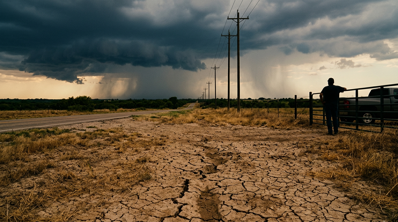
Weather systems are currently tracking across the western reaches of North Texas as of July 19, 2026, signaling a volatile transition in the regional atmosphere. Local meteorological reports from NBC 5 Dallas-Fort Worth indicate that while these storm cells are providing immediate precipitation to the western outskirts, they are also the precursors to a major shift in seasonal conditions. This weekend development highlights the typical variability of the Texas plains, where localized severe weather often gives way to periods of intense thermal activity. The current movement of these storms serves as a brief reprieve before a projected rise in temperatures takes hold of the DFW metroplex and surrounding counties later in the week. Historically, North Texas has served as a primary corridor for convective activity during the transition between summer pressure shifts. The region often experiences a phenomenon where dry lines and moist Gulf air collide, sparking rapid storm development in the western counties of the Cross Timbers before the skies clear for oppressive heat. Previous years have shown that these specific patterns are often the catalyst for the season's highest heat indices, as the humidity left behind by the departing storms interacts with an building high-pressure ridge. Local officials and meteorologists often look to these western storm tracks as a definitive lead indicator for the stability—or instability—of the North Texas power and health infrastructure during the peak months of July and August.
Texas relevance
Residents across the Dallas-Fort Worth corridor and western North Texas are the primary stakeholders in this weather transition, as the immediate threat of storms impacts outdoor activities and local infrastructure. Specifically, western counties must monitor the current movement of these weather cells, while the broader North Texas region prepares for the incoming heat increase that follows such systems. In Texas, the arrival of significant heat after rainfall often results in high humidity levels, placing additional strain on the state's energy grid managed by ERCOT and public health resources during the peak of the summer season. The DFW area, which serves as the economic hub for millions, faces unique challenges when weather shifts this rapidly. Urban drainage systems in Fort Worth and Dallas are put to the test by sudden western storms, while the subsequent heat wave impacts everything from construction schedules to local water conservation efforts. For North Texans, the relevance of this forecast extends beyond personal discomfort; it influences the state's overall readiness for seasonal weather extremes that define the regional lifestyle and business environment.
Storm Movement in Western Counties
The current weather activity is concentrated primarily in the western portions of the North Texas region. These storms are moving steadily, bringing rain and potential wind to areas that often serve as the first point of contact for weather systems moving inland from the west. Local forecasts indicate that while these systems are mobile, their impact on local visibility and travel should not be ignored by residents in the path of the cells. As these systems expand, they may potentially trigger localized flash flood warnings in low-lying areas that are characteristic of the North Texas prairieland.
As these storms traverse the western landscape, they interact with the existing warm air over the DFW area. This interaction is what frequently creates the localized turbulence reported by meteorologists in the region. Monitoring these movements is essential for agricultural sectors in western North Texas that rely on precipitation but must also guard against the risks associated with sudden convective activity. The movement of these units typically follows a west-to-east trajectory, often losing steam as they hit the urban sprawl of Tarrant and Dallas counties, though they can leave significant moisture in their wake.
Historical Context of Summer Storm Cycles
Texas weather has long been defined by its volatility during the mid-summer months. The current scenario, involving storms moving from the west followed by a spike in temperature, mirrors several historic weather patterns seen over the last decade. In previous years, these 'clearing storms' have signaled the end of any mild weather for the remainder of the summer, as the high-pressure domes that follow tend to settle over the state for weeks at a time.
In the past, these transitions have prompted the Electric Reliability Council of Texas (ERCOT) to issue conservation appeals, as the combination of high temperatures and humidity leads to record-breaking air conditioning usage. Understanding this historical precedent helps residents realize that today's storm is not an isolated event, but part of a larger, predictable shift in the regional climate that requires long-term seasonal planning and resource management.
Transition to Extreme Heat
Following the passage of the current storm front, meteorological data suggests a sharp pivot toward higher temperatures. This is a characteristic feature of North Texas weather, where the atmosphere stabilizes quickly after a disturbance, allowing solar radiation to heat the ground and lower atmosphere more efficiently. The forecast indicates that the 'increasing heat' will likely be the dominant weather story for the remainder of the week, with triple-digit temperatures becoming a real possibility for many inland counties.
This temperature surge is expected to affect the entire Dallas-Fort Worth metropolitan area. Residents should anticipate a consistent climb in the mercury as the moisture from current storms evaporates, potentially leading to higher heat indices. Preparing for this shift involves checking cooling systems and ensuring that sensitive populations have planned access to climate-controlled environments. High-humidity days often feel 5 to 10 degrees hotter than the actual temperature reading, making heat safety even more critical.
Stakeholder Impact: Energy and Labor
The shift to intense heat directly impacts two major Texas stakeholders: energy providers and the outdoor workforce. As the humidity rises following the rain, the demand on the Texas power grid will inevitably surge. Grid operators monitor these shifts closely, as the change in temperature can happen over just a few hours, forcing a rapid ramp-up in power generation to meet cooling needs across millions of homes in the DFW area.
For construction and agricultural workers, the transition requires a change in operational safety. Work crews in North Texas are often advised to adjust their schedules to the early morning hours to avoid the peak heat of the afternoon. Employers are reminded that the window of safety narrows significantly when humidity levels are high immediately following a rain event, as the body's ability to cool itself through perspiration is slowed by the saturated air.
Regional Infrastructure and Road Safety
The immediate impact of the storms in western North Texas may include minor localized flooding or wind-related debris, which are common occurrences during the transit of such systems. Local authorities often monitor these developments to manage road safety and utility responses, particularly along major arteries like I-20 and I-30. However, the secondary impact—the heat—requires a different type of community readiness focusing on hydration and energy conservation.
Infrastructure in North Texas is built to withstand high temperatures, but the rapid swing from storm activity to heat can stress materials and biological systems alike. The transition seen this July 19 is a reminder of the dynamic nature of the Lone Star State's climate, where residents must remain versatile in their response to changing daily forecasts. This atmospheric change also marks a period where road surfaces can become slick as rain mixes with accumulated oil, followed by rapid drying and potential surface buckling during the subsequent heat wave.
Meteorological Context for DFW
The DFW metroplex sits at a geographic crossroads where different air masses frequently collide. The current reports of storms moving across the western sector reflect this typical regional behavior. Meteorologists track these patterns to provide advance warning for the urban density of Dallas and Fort Worth, which can experience 'urban heat island' effects that exacerbate the incoming temperature increases, making the city cores even hotter than the surrounding rural counties.
When storms clear out, the high-pressure systems that often follow them tend to settle over the region, trapping warm air and leading to the forecasted heat. Understanding this cycle helps North Texans predict how their local environment will react in the days following a significant storm event. The humidity levels are expected to remain elevated for at least 48 hours after the rain stops, which is a key factor in the heat index calculations used by the National Weather Service.
Future Outlook and Climate Trends
Looking ahead, the shift toward higher temperatures is expected to persist through the end of the month. Long-range models suggest that the ridge of high pressure will remain anchored over the Southern Plains, potentially leading to a prolonged dry spell once these initial storms depart. This is a common occurrence in late July, often referred to as the 'dog days' of summer in Texas, where rainfall becomes increasingly rare and heat waves become more intense.
Residents are encouraged to clear debris from storm drains now to prevent future flooding while also beginning water conservation measures in anticipation of the drier weeks to come. Local water districts often issue guidelines during these periods to ensure that the water supply remains stable during the highest demand months. Staying informed through local weather outlets ensures that communities are not caught off guard by the rapid shifts that define North Texas summers.
Analysis
The current weather pattern fits a long-standing trend in North Texas where storm systems act as a boundary between varying air masses. The immediate presence of storms in the western portion of the region suggests that the atmospheric instability is localized, but the following heat forecast indicates a strengthening of the ridge over the southern United States. For Texans, this transition is a critical reminder of the need for seasonal readiness, particularly as the state enters the hottest months where heat-related advisories become more frequent following storm events. The shift from convective rain to high-pressure dominance often catches residents off guard, leading to a rise in emergency room visits for heat exhaustion. This cycle emphasizes the importance of following local meteorological updates, as the 'cooling' effect of a storm is often short-lived in the Lone Star State.
Source attribution
This story was reported using a public release from the Texas Storm Video (Google News). Keep TX Red rewrote the coverage independently and links to the official statement for verification.
Frequently Asked Questions
- Where are the storms currently located?
- The storms are primarily reported in the western portions of North Texas, including counties west of Tarrant, though they are moving eastward and may affect surrounding areas as they progress.
- What should residents expect after the storms pass?
- According to the latest meteorological data, the region should prepare for a significant increase in temperatures and higher humidity, leading to elevated heat index values through the coming week.
- Is this weather typical for North Texas in July?
- Yes, it is common for North Texas to experience periodic storm activity followed by periods of intense heat during the summer months due to the region's geography and the influence of high-pressure systems.
- How can residents prepare for the incoming heat wave?
- Preparation includes servicing air conditioning units, hydrating frequently, avoiding outdoor activities during peak sun hours, and ensuring that pets and elderly neighbors have access to cool environments.
Official Sources
Take the next step
Browse the Newsroom →Read more about Keep Texas Red → Our full guide to what Keep Texas Red means and why Texans support it.
Related Articles



Get Texas updates delivered weekly.
Independent Texas reporting on politics, policy, and daily life. One email a week. Unsubscribe anytime.
Keep TX Red Newsroom
The Keep Texas Red Editorial Staff produces nonpartisan explainers, policy breakdowns, and educational resources to help Texans understand how their government works. All content is reviewed for accuracy and updated regularly.
About Keep TX Red →