Massive 7.3 Magnitude Earthquake Near Southern Mexico Sparks Gulf Coast Monitoring
A powerful 7.3 magnitude earthquake struck near Puerto Madero, Mexico, prompting seismic monitoring and regional activity assessments across the Gulf.
Editorial disclaimer: Opinions and analysis on Keep TX Red are editorial content — not statements of fact. See our editorial standards.
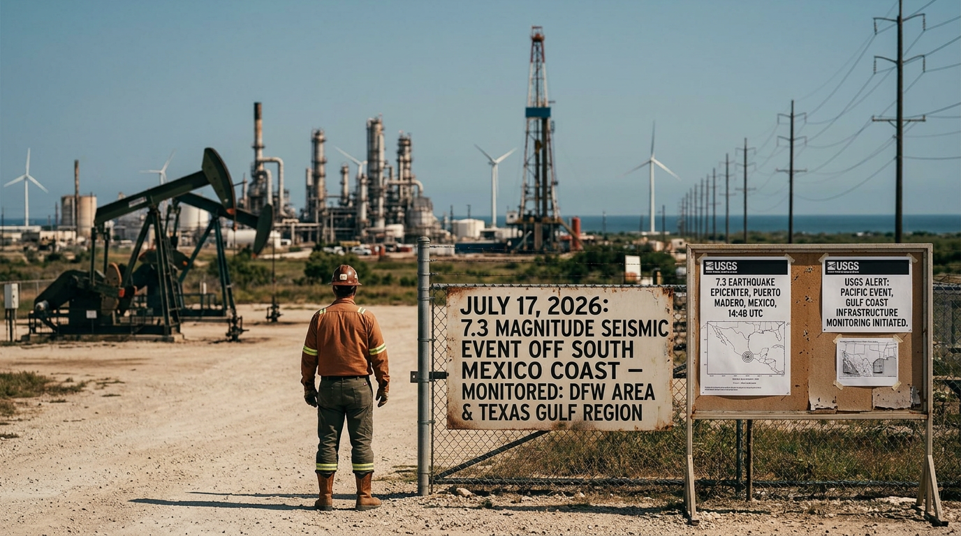
On July 17, 2026, a significant seismic event occurred off the coast of Chiapas, Mexico, measuring 7.3 on the Richter scale. The United States Geological Survey reported the epicenter approximately 58 kilometers west-southwest of Puerto Madero at a depth of roughly 18.6 kilometers. This powerful tremor, occurring at 14:48 UTC, triggered 'Yellow' PAGER alerts, indicating a potential for localized casualties and economic damage near the source. While the event was centered in the Pacific region, the sheer magnitude of the displacement has led to increased monitoring of tectonic plates that interact with the broader North American system, including those affecting the Gulf of Mexico basin. Historically, large-scale events in the Pacific-Central American subduction zones have served as critical data points for Texas-based researchers studying long-range seismic wave propagation. While Texas is often considered a low-seismic-risk state compared to its neighbors to the west and south, the state has seen an uptick in induced and natural seismic activity over the last decade. Events of this magnitude in the southern neighbor often prompt immediate communication between international geological surrogates to ensure that secondary effects, such as atmospheric pressure changes or deep-well fluid shifts, are documented. This latest event stands as one of the most powerful in the region for the 2026 calendar year, necessitating a comprehensive review of regional stability and emergency response protocols across the international border.
Texas relevance
For Texas, a 7.3 magnitude event in Mexico is more than just distant news; it is a reminder of the interconnected nature of the North American Plate. The Texas Gulf Coast and the interior Permian Basin are home to sensitive energy infrastructure that requires precise monitoring for even minor subterranean shifts. The University of Texas at Austin’s Bureau of Economic Geology often tracks how large global events affect local stress loads on fault lines within the Lone Star State. Furthermore, Texas emergency management officials maintain contingency plans for localized disruptions that can occur when significant displacement happens within the regional proximity, particularly regarding deep-sea communication cables and port logistics in the Gulf of Mexico.
Geological Breakdown of the Puerto Madero Incident
The earthquake struck at a shallow depth of 18.58 kilometers, which typically translates to more intense surface shaking compared to deeper events. The USGS PAGER system, which estimates the impact of earthquakes based on population density and local infrastructure, issued a yellow alert. This suggests that while widespread catastrophe was avoided, the shaking intensity reached level VII on the Modified Mercalli Scale near the epicenter, which is strong enough to cause slight to moderate damage in well-built structures.
The proximity to the Middle America Trench makes this region one of the most seismically volatile areas in the Western Hemisphere. The subduction of the Cocos Plate beneath the North American Plate creates a constant buildup of tectonic pressure. When this pressure is released, as it was in this 7.3 event, the energy propagates thousands of miles. In Texas, sensitive instrumentation often detects these waves, even if residents do not physically feel the ground move under their feet.
Seismologists are currently analyzing the 'Did You Feel It?' reports, which initially showed level V intensity perceptions. This data helps researchers calibrate their models for future events. For Texas, understanding these propagation patterns is vital for reinforcing state-wide building codes, particularly in areas like the Dallas-Fort Worth metroplex or the Permian Basin, where the ground composition may respond differently to distant seismic waves.
Immediate Response and Regional Impact
In the hours following the tremor, local authorities in Mexico initiated search and rescue protocols in the rural areas surrounding Puerto Madero. Initial reports focused on cracked roadways and power outages, which are common for tremors exceeding a 7.0 magnitude. Because the event occurred offshore, there was an immediate evaluation of potential tsunami threats, although the USGS and the Tsunami Warning Center provided rapid clarifications to mitigate public panic.
The societal impact in the region involves not just physical damage but the disruption of trade routes. Puerto Madero serves as a critical maritime hub for southern Mexico and its Central American neighbors. Disruptions in this port can have a ripple effect on the logistics chains that eventually reach Texas border crossings. Texas businesses that rely on agricultural and raw material imports from this region often monitor these geological events to adjust their supply chain timelines.
Furthermore, the psychological impact on regional populations cannot be understated. Following the primary shock, a series of aftershocks were recorded, ranging from 4.0 to 5.5 in magnitude. These aftershocks complicate recovery efforts and keep emergency services on high alert. The consistency of these tremors serves as a reminder to the entire North American continent about the volatility of our shared tectonic boundaries.
Monitoring the Gulf of Mexico Basin
While this earthquake occurred on the Pacific side of Mexico, its massive energy release has implications for the Gulf of Mexico’s geological stability. The sediment layers in the Gulf are particularly sensitive to large vibrations, which can occasionally trigger underwater landslides or shifts in salt domes. Texas geologists monitor these phenomena to protect offshore drilling platforms and undersea pipelines that are essential to the American energy sector.
The Texas coastline, stretching from Brownsville to Orange, is buffered by the shelf, yet the deep-water regions of the Gulf are not entirely immune to the effects of massive crustal shifts. Studies from previous decades have shown that large earthquakes in the Pacific can sometimes lead to fluctuating water levels in wells as far away as the Texas Hill Country. This phenomenon, known as a hydroseismic response, is a key area of study for the Texas Water Development Board.
Ensuring the integrity of these water systems is paramount for Texas agriculture. If a large enough event were to cause significant shifts in aquifer pressure, it could temporarily affect crop irrigation and municipal water supplies. By tracking the Puerto Madero event, Texas scientists gain valuable data on how much energy is required to influence these distant hydrological systems.
The Role of TexNet and State Preparedness
Texas has invested significantly in the TexNet Seismic Monitoring Program, a state-funded initiative designed to provide accurate data on ground motion. While TexNet focuses primarily on local events, it utilizes data from massive regional earthquakes like the 7.3 Puerto Madero event to calibrate its sensors. This ensures that when a local tremor occurs, the data produced by the state is as accurate as possible for emergency responders.
The Governor’s Division of Emergency Management (TDEM) also watches these international events closely. Training for Texas first responders often includes scenarios where regional infrastructure is compromised due to cascading effects from natural disasters. A massive earthquake in a neighboring country provides a live-fire exercise for communication channels between federal, state, and international agencies.
The collaboration between the USGS and Texas institutions underscores the importance of a unified scientific approach. Data sharing allows Texas to refine its earthquake hazards maps, which are used by insurance companies and urban planners to determine the risk factors for new developments. As the Texas population continues to boom, the necessity for robust, science-based planning becomes even more urgent.
Historical Context of Regional Seismic Events
The 7.3 magnitude event near Puerto Madero is part of a long history of intense seismic activity in the region. Southern Mexico has previously seen earthquakes exceeding 8.0, such as the devastating 1985 and 2017 events. Each of these occurrences provides a wealth of data that is studied by the Texas seismic community. The patterns observed in the subduction zone provide clues to how the southern edge of the North American plate is evolving over time.
In the past, major tremors in this region have been known to cause 'seiches'—standing waves in enclosed or partially enclosed bodies of water—as far north as the Great Lakes and the Texas Gulf Coast. While these are usually minor, they demonstrate the incredible reach of seismic energy. Documenting these occurrences helps Texas maritime authorities understand the potential for sudden water movement in bayous and ports.
Looking back at the geological record, the interaction between these plates has shaped the topography of the entire continent. For Texans, the primary takeaway is that geographical borders do not stop the movement of the earth. The stability of the Texas landscape is inherently linked to the activity occurring along its southern and western perimeters, making the study of the Puerto Madero quake a matter of state interest.
Technological Advancements in Detection
The speed at which the 7.3 magnitude was reported—within minutes of the actual event—is a testament to the advancements in real-time monitoring technology. For Texas, this means that warning systems for secondary effects can be activated almost instantaneously. The use of satellite-based synthetic aperture radar (SAR) now allows scientists to see exactly how much the earth moved during the event, providing a digital map of the displacement.
This technology is being integrated into Texas infrastructure projects to monitor for ground subsidence and fault movement. By comparing the 'normal' state of Texas ground to the variations caused by large-scale events, engineers can build more resilient bridges, dams, and skyscrapers. The data from the Puerto Madero earthquake will be fed into these same models to improve the predictive capabilities of Texas-based engineering firms.
Furthermore, the public now has access to this data through mobile applications and live feeds from the USGS. This transparency helps demystify geological events for the average Texan, fostering a culture of preparedness rather than fear. As we continue to refine our ability to detect and analyze these events, the residents of the Lone Star State can feel more secure in the knowledge that their infrastructure is being monitored with the latest global data.
Analysis
OPINION: The occurrence of a 7.3 magnitude earthquake so close to the North American mainland highlights the ongoing need for Texas to maintain its independent seismic monitoring network, TexNet. While the primary damage remains localized to the Chiapas region, the sheer energy release of such an event should serve as a wake-up call for infrastructure hardening in Texas cities. As our state continues to grow, our reliance on stable ground for high-density housing and massive energy facilities increases. We should view these international events as free lessons in disaster preparedness, ensuring that Texas remains resilient regardless of the geological instability found in neighboring territories.
Source attribution
This story was reported using a public release from the USGS Earthquakes — Texas. Keep TX Red rewrote the coverage independently and links to the official statement for verification.
Frequently Asked Questions
- Was the earthquake felt in Texas?
- While the 7.3 magnitude earthquake was extremely powerful, it was not reported as being physically felt by the general public in Texas. However, sensitive seismic instruments across the state, including the TexNet system, were able to detect the arrival of the seismic waves shortly after the event occurred.
- Could this earthquake cause a tsunami in the Gulf of Mexico?
- No. The earthquake occurred off the Pacific coast of Mexico. Because the landmass of Mexico and Central America sits between the epicenter and the Gulf of Mexico, there is no direct water path for a tsunami to reach the Texas coast from this specific location.
- Why does an earthquake in Mexico matter to Texans?
- Large earthquakes in neighboring regions can affect the pressure in deep-water wells, influence the stability of sensitive Gulf infrastructure, and provide critical data for Texas scientists who study how seismic energy travels through the North American Plate. It also impacts regional trade and migration patterns.
Official Sources
Take the next step
Browse the Newsroom →Read more about Keep Texas Red → Our full guide to what Keep Texas Red means and why Texans support it.
Related Articles



Get Texas updates delivered weekly.
Independent Texas reporting on politics, policy, and daily life. One email a week. Unsubscribe anytime.
Keep TX Red Newsroom
The Keep Texas Red Editorial Staff produces nonpartisan explainers, policy breakdowns, and educational resources to help Texans understand how their government works. All content is reviewed for accuracy and updated regularly.
About Keep TX Red →