Texas Rivers Guide: 10 Essential Waterways Shaping the State's Landscape
Discover the historical and ecological significance of ten iconic Texas rivers that sustain agriculture, recreation, and local economies across the state.
Editorial disclaimer: Opinions and analysis on Keep TX Red are editorial content — not statements of fact. See our editorial standards.
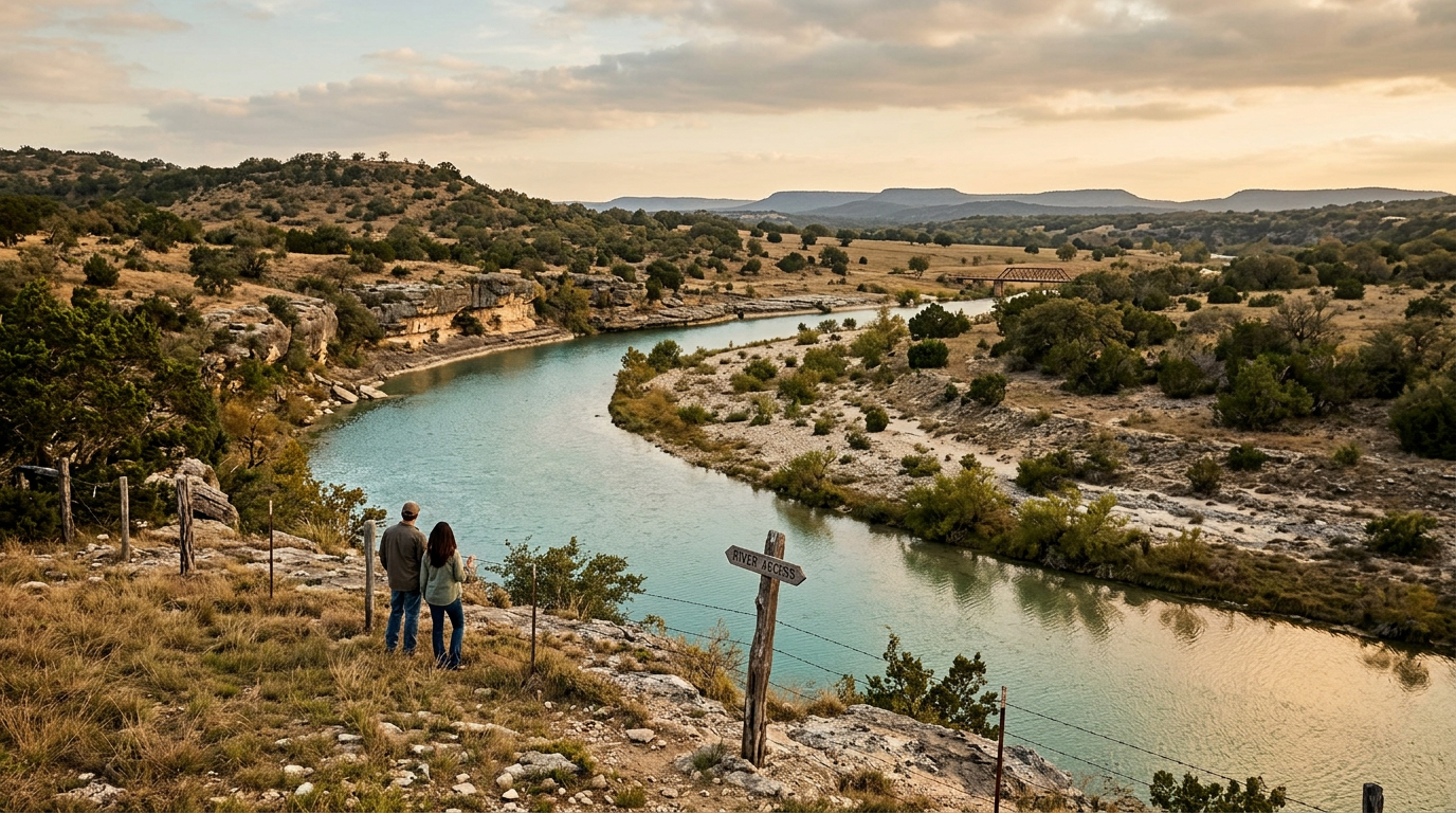
Texas is defined as much by its flowing waters as it is by its vast plains and rugged mountains. From the muddy banks of the Red River to the crystal-clear currents of the Frio, the state's waterways serve as the lifeblood of its various regions. Throughout the centuries, these rivers have dictated where major cities were built and how agricultural borders were drawn. They are not merely geographical features but are central to the cultural identity of every Texan. Historically, the management of these resources has been one of the most contentious issues in the state legislature, predating even the founding of the Republic. As the state population swells, the demand for these natural resources continues to outpace historical levels of supply, making a clear understanding of our river systems more important than ever. This exploration delves into the unique characteristics of ten specific Texas rivers that have shaped our communal heritage and continue to drive the state's economic and environmental health.
Texas relevance
Water policy is the single most critical factor for future growth in Texas, directly impacting property rights, agricultural yields, and urban expansion. In regions like the Hill Country and the High Plains, the health of the river systems determines everything from local tourism revenue to the availability of residential drinking water. Texas law uniquely balances private property rights with the public trust of navigable waterways, making every river a focal point for local governance. The ten rivers discussed here represent the diverse ecological zones of the state, from the eastern piney woods to the western deserts, highlighting how the Lone Star State remains dependent on sustainable water management to maintain its status as a global economic powerhouse.
The Rio Grande: A Continental Border and Lifeline
The Rio Grande stands as one of the most recognizable rivers in North America, stretching for hundreds of miles to form the international boundary between Texas and Mexico. Its significance extends far beyond geopolitics, as it provides the primary source of irrigation for the fertile soil of the Rio Grande Valley. This region is a major contributor to the nation's citrus and vegetable production, relying heavily on the seasonal flow managed through an intricate series of dams and international treaties.
However, the Rio Grande is also a river in crisis, frequently suffering from low flow levels due to prolonged droughts and heavy upstream usage. The Big Bend sector of the river offers some of the most dramatic scenery in the state, with towering limestone canyons that attract thousands of visitors annually. Protecting the integrity of this waterway is essential for both the ecological health of the Trans-Pecos region and the diplomatic relations regarding water sharing agreements between the U.S. and Mexico.
The Colorado River of Texas: Powering the Heart of the State
Distinct from its namesake in the Grand Canyon, the Texas Colorado River flows entirely within the borders of the Lone Star State. It is the lifeblood of the Texas Hill Country and the growing Central Texas tech corridor. This river has been engineered into a series of 'Highland Lakes,' which serve as the primary source of drinking water for the City of Austin and surrounding municipalities while also generating hydroelectric power through the Lower Colorado River Authority.
The management of the Colorado River is a balancing act between the needs of urban residents and the downstream farmers in the coastal plains who require water for rice cultivation. The river's path through the capital city represents the intersection of Texas government and nature, providing a scenic backdrop for the state's political soul. As the region continues to experience record population growth, the Colorado River remains the most scrutinized and regulated water body in the entire state.
The Brazos: The Longest River in the Lone Star State
Winding over 800 miles from the High Plains to the Gulf of Mexico, the Brazos River is the longest river in Texas. It serves as a literal and figurative dividing line in the state's history, often referred to in historical documents as the 'Arms of God.' The Brazos basin supports a massive agricultural economy, including cotton and livestock, while downstream reaches are critical for industrial operations near the Gulf Coast.
Ecologically, the Brazos is known for its diverse habitats, ranging from the salt-crusted beds of the upper reaches to the lush bottomlands further south. It has also played a major role in Texas folklore and literature, served as a primary transportation route during the early days of Texas colonization. Today, it faces challenges from sedimentation and periodic flooding, requiring constant oversight by the Brazos River Authority to ensure it remains a viable resource for the millions who live within its watershed.
The Guadalupe: Recreation and Economic Utility
In terms of recreational value, few rivers can compete with the Guadalupe. Popular for tubing, kayaking, and fly fishing, it generates significant seasonal revenue for small towns like New Braunfels and Gruene. The river originates from the Edwards Plateau springs, flowing through the rocky terrain of the Hill Country before reaching the San Antonio Bay. Its water is also vital for the state's vibrant tourism sector, driving millions in local commerce through park fees and hospitality.
Beyond the inner tubes and vacationers, the Guadalupe is a workhorse for the region. It supports several hydroelectric plants and provides essential water to industrial hubs downstream. The constant tension between maintaining sufficient water levels for recreation and meeting the needs of industrial and agricultural users is a hallmark of Guadalupe River management. This river exemplifies the modern Texas challenge of preserving natural beauty while supporting a booming business environment.
The Pecos River: A Frontier Icon
Historically, the phrase 'west of the Pecos' denoted the start of the true American frontier, where the law was often whatever a man carried in his holster. The Pecos River flows through some of the most arid and challenging terrain in Texas, serving as a critical water source for livestock in the Permian Basin. Despite its rugged surroundings, the river maintains a unique saline biology that makes it different from other Texas waterways.
The Pecos is characterized by its deep canyons and remote access points, making it a favorite for those seeking the solitude of the old West. However, the river faces significant ecological threats from invasive species like salt cedar, which consume vast amounts of water and displace native vegetation. Efforts by state conservationists to restore the Pecos are ongoing, aiming to preserve this iconic piece of Texas heritage for future generations of ranchers and outdoorsmen.
The Trinity River: The Urban Arterial
Flowing through the heart of the Dallas-Fort Worth Metroplex, the Trinity River is perhaps the most human-altered river system in the state. For decades, it was treated as a drainage canal for urban development, but recent decades have seen a massive push for revitalization. The Trinity River Project in Dallas represents one of the largest urban park developments in the country, aimed at reconnecting the city with its natural riverfront.
The Trinity is also vital for the logistics and shipping corridors of East Texas, eventually emptying into Galveston Bay. It carries a heavy load of the state's treated wastewater, showing the critical importance of water quality monitoring in urban settings. The transformation of the Trinity from a neglected industrial asset to a centerpiece of urban renewal is a testament to the changing priorities of Texas city planners and environmentalists alike.
The Red River: The Northern Borderlands
Defining the boundary between Texas and Oklahoma, the Red River is famous for its distinctive reddish silt, a result of the clay soil it carries from the Texas Panhandle. This river has been the subject of numerous boundary disputes between the two states, most recently resolved by the U.S. Supreme Court. It serves as a vital resource for irrigation in the North Texas region and provides a home for unique wildlife in the Caddo Lake area.
The Red River’s flow is highly variable, often shifting its course and creating new land mass which can complicate property lines. It is also an important site for recreational activities like airboating and fishing. Because it is a shared resource between states, the Red River Compact plays a crucial role in determining how much water Texas can pump from the river, highlighting the complexities of interstate water management in the American South.
The Frio and Sabinal Rivers: The Springs of the South
The Frio River, meaning 'cold' in Spanish, lives up to its name thanks to the spring-fed waters that stay chilled even during the hottest Texas summers. Located in the southwestern reach of the Hill Country, the Frio is a sanctuary for Texans escaping the heat. Garner State Park, located on the Frio, is the most visited overnight park in the entire state system, demonstrating the immense value Texans place on as-yet-unspoiled river environments.
Similarly, the Sabinal River provides a smaller but equally beautiful landscape, known for its vibrant fall foliage—a rarity in many parts of the state. These spring-fed systems are highly sensitive to the health of the Edwards Aquifer. When aquifer levels drop, these rivers can slow to a trickle, threatening the local economy and the survival of species endemic to the region. They serve as a primary reminder of the underground-surface water connection that many Texans rely on daily.
Analysis
Opinion: While some view these rivers primarily as spots for weekend recreation like tubing or fishing, they are actually the state's most strategic assets. The growing tension between urban centers like Austin and rural agricultural districts over water rights suggests that the 'Water Wars' of the 21st century are already beginning in Texas. Strengthening the infrastructure around these ten rivers is not just an environmental goal; it is a necessity for maintaining Texas's sovereignty and economic independence. Without robust state-led preservation and storage efforts, the very features that define the Texas landscape could become points of failure for its future prosperity.
Source attribution
This story was reported using a public release from the Texas Monthly. Keep TX Red rewrote the coverage independently and links to the official statement for verification.
Frequently Asked Questions
- Which Texas river is the longest?
- The Brazos River holds the title of the longest river in Texas, covering approximately 840 miles from its origin to the Gulf of Mexico.
- Why is the Colorado River in Texas different from the one in the Grand Canyon?
- Although they share a name, the Texas Colorado River is an entirely different waterway that begins in the Llano Estacado and flows through Austin to Matagorda Bay, never leaving the state.
- How are Texas water rights governed?
- Water rights in Texas are managed by the Texas Commission on Environmental Quality (TCEQ) and regional river authorities, following a 'first in time, first in right' doctrine while protecting public navigation rights.
Official Sources
Take the next step
Browse the Newsroom →Read more about Keep Texas Red → Our full guide to what Keep Texas Red means and why Texans support it.
Related Articles



Get Texas updates delivered weekly.
Independent Texas reporting on politics, policy, and daily life. One email a week. Unsubscribe anytime.
Keep TX Red Newsroom
The Keep Texas Red Editorial Staff produces nonpartisan explainers, policy breakdowns, and educational resources to help Texans understand how their government works. All content is reviewed for accuracy and updated regularly.
About Keep TX Red →