Dawson County Faces Severe Flooding Threats Amid Intensive West Texas Rainfall
Emergency warnings issued for Dawson County as heavy downpours create dangerous flash flood conditions across Lamesa and surrounding West Texas routes.
Editorial disclaimer: Opinions and analysis on Keep TX Red are editorial content — not statements of fact. See our editorial standards.
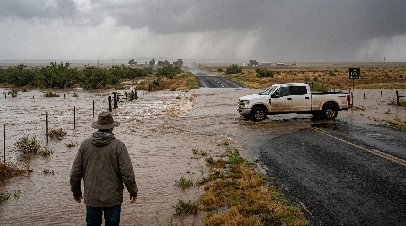
On July 18, 2026, the National Weather Service issued an urgent flash flood warning for Dawson County as a slow-moving storm system dropped significant precipitation across the West Texas region. The weather event triggered immediate safety protocols for residents in Lamesa and surrounding rural areas as low-water crossings began to fill beyond safe capacities. This specific warning follows a pattern of erratic weather shifts in the Permian Basin, where long periods of drought are often punctuated by sudden, high-volume rain events that the thirsty ground cannot instantly absorb. Local emergency management teams have been deployed to monitor vulnerable infrastructure, particularly along the routes frequently used by agricultural and energy sector workers. Historically, Dawson County has sat at the center of the 'dry line' weather phenomenon, where air masses collide to create atmospheric instability. In decades past, similar events have caused significant damage to the state's rural highway network, prompting recent legislative shifts toward more robust rural disaster funding. This latest storm serves as a stark reminder of the volatile nature of the Llano Estacado climate, where conditions can shift from extreme heat to life-threatening floods in less than an hour.
Texas relevance
For residents of Dawson County and the greater West Texas area, these flood warnings represent a significant threat to life and property due to the unique topography of the region. Unlike the coastal areas of Texas, West Texas relies on a complex network of arroyos and man-made drainage systems that can become overwhelmed in minutes. The state’s investment in flood mitigation often focuses on the high-population centers of the I-35 corridor, making local alerts in Dawson County critical for the safety of rural Texans who operate heavy machinery and transport goods across the state's vast western highways. Lamesa, serving as a hub for both the agricultural and petroleum sectors, faces specific risks to its economic flow during these weather events.
Historical Context of West Texas Flash Floods
Dawson County is no stranger to the volatile nature of Texas weather. Historically, the region has experienced cycles of extreme dryness followed by monsoonal moisture patterns that originate from the Pacific or the Gulf of Mexico. When these moisture plumes meet stagnant cold fronts over the flat plains of West Texas, the result is often a concentrated deluge that outpaces the local drainage capabilities.
Previous years have shown that even a few inches of rain in a short window can turn dusty creek beds into raging torrents. This historical precedent is why the National Weather Service reacts with such urgency when atmospheric conditions mirror past catastrophic events. The soil in this part of the state often contains high clay content or hardened caliche layers, which act as a barrier to water absorption, forcing runoff into roads and homes.
In the late 20th century, Lamesa and surrounding Dawson County communities faced several major flooding events that lead to the redesign of local culverts. However, as precipitation intensity increases during summer months, these older systems are frequently tested beyond their design limits. The current warning emphasizes that even modern infrastructure can fail when the volume of water exceeds three inches per hour, a rate common in these localized Texas downpours.
Impact on Local Infrastructure and Transport
The primary concern during this July event involves the stability of local roadways. Dawson County serves as a vital artery for the transport of cotton and oilfield equipment. When flash floods strike, the integrity of asphalt on rural farm-to-market roads can be compromised, leading to washouts that trap residents or cause severe accidents for unsuspecting travelers.
Public safety officials emphasize that the majority of flood-related fatalities in Texas occur within vehicles. As the storm system moved over Lamesa, the risk to motorists increased significantly as nightfall reduced visibility. The local government has prioritized the identification of high-risk zones, yet the unpredictable nature of these downpours means that any low-lying patch of road can become a hazard in an instant.
Furthermore, the Texas Department of Transportation (TxDOT) monitors these events for potential impact on State Highway 137 and U.S. 87. These corridors handle significant commercial traffic. When these routes flood, the supply chain for the Texas Permian Basin can experience delays that ripple through the state's energy economy. Local law enforcement is often spread thin during these events as they move to block dangerous crossings.
Agricultural Ramifications of Excessive Rain
While rain is generally welcomed by the farming community in Dawson County, the timing and intensity of this specific storm create a double-edged sword. For cotton farmers, heavy rain during certain growth stages can damage young plants or lead to fungal issues if water remains standing in the fields for too long. The economic health of Lamesa is tied directly to these crops, making weather monitoring a financial necessity.
Beyond immediate crop damage, the sudden influx of water can lead to significant soil erosion. The topsoil in West Texas is a precious resource, and high-velocity runoff can strip away the nutrients necessary for future planting seasons. Farmers are currently assessing the impact on their acreage, hoping that the moisture will eventually provide a subsoil boost without the immediate destruction of current yields.
Livestock producers in the county also face logistical nightmares when flooding occurs. Cattle often seek low ground for shelter from wind, which perversely places them in the path of flash floods. Ranchers in Dawson County must move herds to higher ground before the heaviest rains arrive, a task that becomes increasingly difficult when mud makes pastures inaccessible to vehicles and trailers.
Emergency Response and Public Safety Measures
Dawson County Emergency Management has utilized automated alert systems to reach residents on their mobile devices. The agency's protocol involves staging rescue equipment in areas known for drainage failures. This proactive stance is part of a broader Texas initiative to lower response times during natural disasters by delegating more equipment to the county level.
Residents are encouraged to keep emergency kits prepared and to monitor local radio and weather apps. The 'Turn around, don't drown' campaign remains the centerpiece of the regional safety message. In rural Texas, where help may be miles away, the responsibility often falls on individuals to make sound judgments when encountering water-covered bridges or intersections.
Volunteer fire departments in Dawson County play a critical role during these events. These men and women are often the first on the scene when a vehicle becomes submerged. Their ability to navigate the backroads of the county ensures that even the most isolated residents have a lifeline during the worst of the weather. State authorities continue to urge citizens to trust these local experts when evacuations or road closures are advised.
Meteorological Causes Behind the Downpours
The July 18 weather event was driven by a combination of high atmospheric moisture and a stalled low-pressure system. Meteorologists noted that the storms were moving at a speed that allowed for maximum accumulation over a single geographical area. This 'training' effect, where storms follow one another like cars on a train track, is a leading cause of flash flooding in the American Southwest.
As the system continues to churn over Dawson County, the cumulative rainfall totals are expected to challenge local records. Climate scientists monitoring the region suggest that the intensifying heat earlier in the week likely contributed to the violent nature of the storm development, as the atmosphere held more energy and moisture than usual for mid-summer.
The specific interaction between the Caprock escarpment and these moist air masses can further intensify rainfall. As air is forced upward by the rising terrain, it cools and releases moisture more rapidly. This orographic lift is a key reason why Dawson County, sitting just on the edge of the high plains, can experience significantly more intense rainfall than neighboring counties to the west.
Future Outlook and Long-Term Mitigation
Looking ahead, Texas leaders are increasingly focusing on the Texas State Flood Plan to address the vulnerabilities seen in Dawson County. This long-term strategy aims to provide better data for localized flood mapping, which is often outdated in rural counties. Improved mapping would allow for better zoning and infrastructure planning to prevent future losses.
For now, the focus remains on recovery and immediate safety. As the waters eventually recede, Dawson County officials will begin the laborious process of assessing bridge integrity and roadbed stability. These inspections are vital for reopening the county to full commercial capacity. The resilience of West Texans will be on display as neighbors help neighbors clear debris and repair fences.
Community stakeholders are also discussing the potential for more retention ponds around Lamesa. By capturing excess runoff before it hits the city streets, the community could mitigate the flashier aspects of these storms. However, funding for such large-scale civil engineering projects remains a point of debate in the state legislature, where rural needs compete with urban growth demands.
Source attribution
This story was reported using a public release from the r/texas. Keep TX Red rewrote the coverage independently and links to the official statement for verification.
Frequently Asked Questions
- What should residents in Dawson County do during a flash flood warning?
- Residents should stay informed through local weather alerts, avoid traveling if possible, and move to higher ground if they live in flood-prone areas. It is essential to have an emergency kit and a plan for communication with family members. Monitoring the National Weather Service radio and local news is highly recommended.
- Why is it dangerous to drive through flooded roads in Texas?
- Just six inches of moving water can knock an adult off their feet, and twelve inches of rushing water can carry away most small cars. Additionally, the road beneath the water may have collapsed or been washed out entirely, making it impossible to gauge the true depth or danger. In Texas, more people perish in vehicles during floods than in any other circumstance.
- How long will the flood warning remain in effect?
- The duration of a flash flood warning is determined by the National Weather Service based on radar data and ground reports. Typically, these warnings last for a few hours but can be extended if additional storm cells develop. Residents should continue to monitor official channels until the 'all clear' is given by local authorities.
Official Sources
Take the next step
Browse the Newsroom →Read more about Keep Texas Red → Our full guide to what Keep Texas Red means and why Texans support it.
Related Articles



Get Texas updates delivered weekly.
Independent Texas reporting on politics, policy, and daily life. One email a week. Unsubscribe anytime.
Keep TX Red Newsroom
The Keep Texas Red Editorial Staff produces nonpartisan explainers, policy breakdowns, and educational resources to help Texans understand how their government works. All content is reviewed for accuracy and updated regularly.
About Keep TX Red →