Texas Rainfall Triggers Dangerous New Flash Flooding Emergencies
Dangerous flash flooding conditions have prompted new emergency alerts across Texas as heavy rainfall overwhelms local drainage systems.
Editorial disclaimer: Opinions and analysis on Keep TX Red are editorial content — not statements of fact. See our editorial standards.
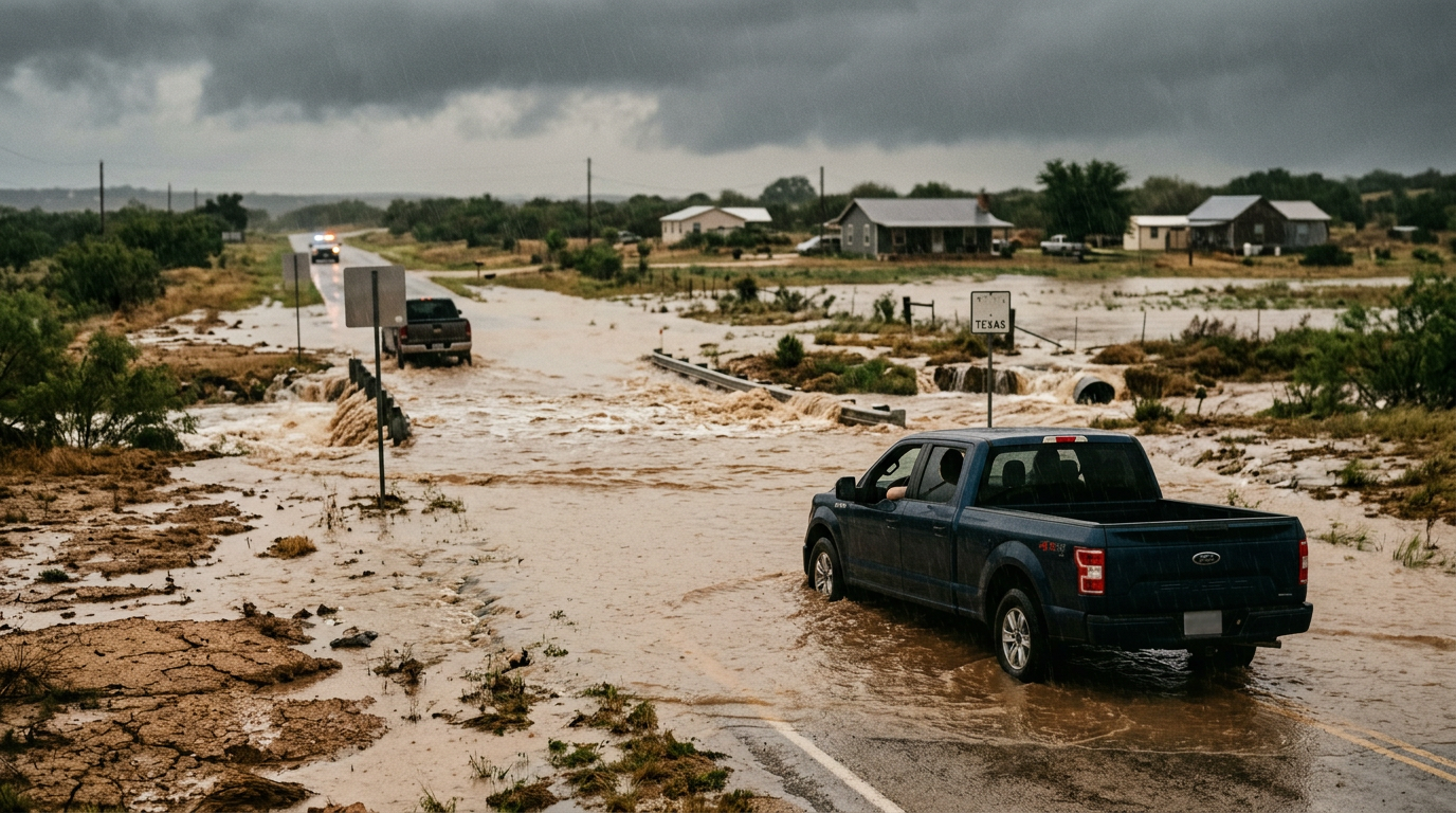
On July 17, 2026, state authorities and meteorologists issued a series of new flooding emergencies across Texas following a period of intense and sustained precipitation. These alerts highlight an immediate threat to life and property as local waterways exceed their banks and drainage infrastructure reaches maximum capacity. The sudden nature of the rainfall has created hazardous conditions for motorists and residents in low-lying areas, necessitating a rapid response from local emergency management teams to ensure public safety. Historically, Texas has been prone to such rapid-onset flooding due to its unique topography and the presence of vast urban surfaces that struggle to absorb high volumes of water in short durations. Previous events like this have demonstrated the critical importance of early warning systems and the need for residents to adhere to official evacuations or shelter-in-place orders. This latest round of emergencies underscores the ongoing challenge the state faces in managing extreme weather patterns that can shift from dry spells to deluge conditions in a matter of hours. This specific weather event is characterized by its high intensity, where localized cells are dumping several inches of rain per hour, far exceeding the design capacity of 25-year or even 50-year storm drain systems.
Texas relevance
Residents throughout Texas, particularly those in coastal and central regions, are directly impacted by these flooding emergencies. The safety of Texas families depends on real-time information regarding road closures and water levels. Furthermore, the economic impact on the state can be significant, as infrastructure damage to Texas highways and local businesses often follows these major weather events. Local municipalities are currently on high alert, activating emergency operations centers to coordinate rescues and monitor critical dam and levee systems. In the context of previous state-wide disasters, or localized events like those in the Hill Country or Coastal Bend, this event serves as a reminder of Texas's inherent vulnerability to torrential moisture flows coming off the Gulf of Mexico.
Rapid Accumulation and Infrastructure Stress
The intensity of the recent rainfall has put an immense amount of pressure on the state's existing flood control measures. In many areas, the volume of water fell so quickly that natural soil absorption was impossible, leading to immediate runoff into streets and residential neighborhoods. This phenomenon, often seen in the flash-flood-prone regions of the state, transforms standard roadways into dangerous rivers within minutes. The sudden weight of water on bridge pylons and the scouring of asphalt can lead to structural failures that are not immediately visible to the naked eye.
Engineers and public works officials are closely monitoring the integrity of bridges and culverts. When water levels rise this sharply, debris often clogs essential drainage points, causing water to back up into homes that may have previously been outside of traditional flood zones. The current situation remains fluid as authorities assess which specific corridors require immediate closure to prevent vehicle-related drownings. In several counties, public works crews are working through the night to clear blockages, but the conditions are often too dangerous to operate heavy machinery in swift water.
Emergency Response and High-Water Rescues
Emergency services across the impacted regions have transitioned into a high-readiness posture, deploying high-water vehicles and swift-water rescue teams. These units are specifically trained to navigate the treacherous conditions inherent in urban flooding, where hidden obstacles and strong currents pose a constant threat to both rescuers and those in need of assistance. State-level resources, including the Texas A&M Task Force 1, are often placed on standby during these triggers to support local departments that might become overwhelmed by the sheer number of calls.
Public safety officials emphasize that the majority of flood-related fatalities occur in vehicles. As such, the primary focus of the current emergency response is to discourage travel and provide immediate aid to individuals trapped by rising waters. Local law enforcement has been tasked with erecting barriers at known low-water crossings to prevent drivers from attempting to navigate submerged paths. Despite these warnings, emergency dispatchers continue to receive reports of motorists ignoring barricades, leading to high-stakes extraction operations that pull resources away from other life-saving tasks.
The Impact on Texas Agriculture and Rural Areas
While urban flooding often captures the most media attention, the rural Texas landscape is also suffering under the weight of these emergencies. Large tracts of farmland are currently underwater, which can lead to significant crop loss and soil erosion. For Texas ranchers, the sudden rise in creek levels necessitates moving livestock to higher ground, a task that becomes increasingly difficult as more acreage becomes inaccessible. The long-term economic damage to the ag sector could be felt for months as standing water rots seedlings and washes away topsoil that has taken years to cultivate.
Rural infrastructure, which often consists of gravel roads and smaller bridges, is particularly susceptible to being washed out. This can isolate entire communities, making it difficult for emergency medical services to reach those in remote areas. State agencies are working to ensure that communication lines remain open in these regions even as the power grid faces intermittent stress from the storm. In some cases, helicopter drops or boat transfers are the only way to deliver essential supplies to those cut off by the rising rivers and creeks that feed into larger Texas basins.
Atmospheric Patterns Driving the Deluge
The current weather pattern involves a stalled frontal system that is tapping into high levels of moisture. This setup allows for continuous redevelopment of thunderstorms over the same geographic locations, a process known as training. When storms move over the same area repeatedly, the cumulative rainfall totals can easily reach double digits, surpassing even the most robust drainage designs. This atmospheric 'conveyor belt' can be particularly devastating if it aligns with the state's major river basins, such as the Brazos or Colorado, which can lead to downstream flooding later in the week.
Meteorologists are utilizing advanced radar and satellite imagery to predict where the next cell will develop. However, the exact placement of these heavy rain bands remains difficult to pinpoint with total precision. Consequently, the issuance of flood emergencies serves as the final, most urgent tier of warning for residents to take immediate action to protect themselves. The interaction between the humid air from the Gulf and the cooler air from the stalled front creates a volatile environment that can produce rain rates of several inches per hour, blinding drivers and making evacuation routes impassable.
Stakeholder Interests and Community Coordination
The response to these flooding emergencies involves a wide array of stakeholders, from the Governor’s Office to local non-profits and faith-based disaster relief groups. Coordination is managed through a hierarchy of command centers that prioritize life-safety missions above all else. Private utility companies are also key stakeholders, as they must navigate floodwaters to restore power lines knocked down by saturated soil and falling trees. Their ability to work safely depends on the recession of floodwaters, which can lead to prolonged outages in the most affected neighborhoods.
Community members are often the first line of defense, utilizing local alert apps and neighborhood watch groups to share information about rising waters. In recent years, the integration of crowdsourced data with official emergency management has allowed for a more granular understanding of how water moves through specific neighborhoods. This grassroots information cycle is vital for identifying vulnerable elderly populations or those who may not have access to motorized transport during an evacuation. The synergy between government action and community-level awareness remains the most effective deterrent against loss of life.
Long-Term Reconstruction and Future Outlook
Once the immediate threat subsides, the focus will shift to the long-term recovery of impacted Texas communities. This phase involves damage assessments that determine eligibility for state and federal disaster relief funding. For many homeowners, the challenge becomes navigating the insurance process, particularly if their property was not located in a designated flood zone. This recurring event highlights the importance of the Texas State Flood Plan, which aims to provide a data-driven approach to reducing long-term flood risk through strategic regional projects.
Looking ahead, the threat of flooding is expected to persist as long as the current weather system remains stationary. Even after the rain stops, the danger does not immediately dissipate. Runoff from higher elevations will continue to flow into rivers and streams, meaning that downstream flooding could occur days after the initial storm has passed. Constant vigilance is required throughout the weekend, as the ground remains fully saturated, and any additional rainfall—even a minor amounts—could trigger a new round of flash flooding. The state remains in a heightened posture until the frontal system finally clears the border.
Analysis
The current emergency situations highlight a recurring issue in Texas: the rapid expansion of impervious surfaces—like concrete and asphalt—in growing metro areas. While state and local officials have invested billions in flood mitigation, the sheer volume of water delivered by these stalled weather fronts often bypasses even the best modern engineering. This highlights the need for continued investment in state flood planning and regional coordination, as water does not respect county or city lines. Future legislative sessions may see renewed pressure to fund more resilient infrastructure to protect the state's economic centers from being paralyzed by weather events that were once considered rare but are now occurring with increased frequency.
Source attribution
This story was reported using a public release from the Texas Emergency Video (Google News). Keep TX Red rewrote the coverage independently and links to the official statement for verification.
Frequently Asked Questions
- What should I do if a flash flood emergency is issued for my area?
- You should immediately move to higher ground. Avoid walking or driving through floodwaters, as just six inches of moving water can knock you off your feet and two feet of water can carry away most vehicles. If told to evacuate, do so immediately.
- Why is the flooding so severe in Texas right now?
- A combination of a stalled weather front and high moisture levels has caused storms to 'train' over the same areas. This leads to rainfall totals that overwhelm the soil's ability to absorb water and the capacity of drainage systems.
- How can I check which Texas roads are currently closed?
- The best resource for road conditions is the DriveTexas.org website, which provides real-time updates on closures due to flooding, accidents, or construction. You can also monitor local law enforcement and TxDOT social media accounts.
Official Sources
Take the next step
Browse the Newsroom →Read more about Keep Texas Red → Our full guide to what Keep Texas Red means and why Texans support it.
Related Articles



Get Texas updates delivered weekly.
Independent Texas reporting on politics, policy, and daily life. One email a week. Unsubscribe anytime.
Keep TX Red Newsroom
The Keep Texas Red Editorial Staff produces nonpartisan explainers, policy breakdowns, and educational resources to help Texans understand how their government works. All content is reviewed for accuracy and updated regularly.
About Keep TX Red →