Severe Flash Flooding Claims Life in Kerr County as Hill Country Rivers Overflow
Storm systems in the Texas Hill Country lead to a confirmed fatality and widespread water rescues in Kerrville and Comfort following historic rainfall.
Editorial disclaimer: Opinions and analysis on Keep TX Red are editorial content — not statements of fact. See our editorial standards.
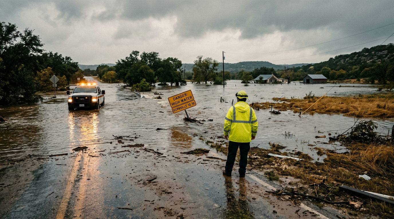
Recent catastrophic weather patterns across the Texas Hill Country have resulted in at least one confirmed fatality following a series of intense thunderstorms that triggered flash flooding. Governor Greg Abbott confirmed on July 16 that state and local officials are currently working to verify the identity and circumstances surrounding the victim found in the Kerrville area. The region, known for its steep terrain and rapid runoff, experienced several inches of rain within a narrow window, causing the Guadalupe River and its tributaries to swell beyond their banks. This event follows a historical pattern of 'Flash Flood Alley' behavior where the Edwards Plateau funnels water into lower elevations with deadly speed. Historically, the Texas Hill Country has been the site of some of the most significant flooding events in the United States, including the devastating 1978 and 1997 floods that redefined emergency management in the state. The current situation mobilized the Texas Division of Emergency Management (TDEM) and local first responders who performed dozens of high-water rescues throughout the night. Local law enforcement has urged residents to remain off the roads as secondary crests are expected along the river systems. The meteorological setup involved a stalled frontal boundary that tapped into deep Gulf moisture, a common but dangerous atmospheric recipe for the central Texas corridor.
Texas relevance
Texas residents in the Kerrville, Comfort, and Fredericksburg areas remain under high alert as the ground is fully saturated, making even minor additional rainfall a threat to life and property. For millions of Texans who travel to the Hill Country for summer recreation, this event serves as a grim reminder of the region's volatility during the monsoon-like summer storm cycles. The state's infrastructure, particularly low-water crossings in rural counties, remains a primary point of failure during these surges, necessitating ongoing investment in flood mitigation and early warning systems across the Edwards Aquifer recharge zone.
The Anatomy of a Hill Country Flood
The geography of Central Texas is uniquely predisposed to the type of flash flooding witnessed this week. The thin soils and limestone bedrock of the Edwards Plateau offer little absorption, meaning that when heavy rain falls, it almost immediately becomes runoff. This water is funneled into narrow canyons and creek beds, gaining velocity and volume as it moves toward major arteries like the Guadalupe River.
In the specific case of the July 16 storms, the rainfall rates exceeded three inches per hour in localized pockets. This intensity is enough to transform a dry creek bed into a raging torrent in less than thirty minutes. The sudden nature of these rises often catches residents and motorists by surprise, especially during nighttime hours when visual cues of rising water are obscured by darkness.
Meteorologists note that the atmospheric conditions were ripe for 'training' storms, where multiple cells follow the same path over the same area. This concentrated the water volume in the Kerrville and Comfort watersheds, leading to the rapid rise that ultimately resulted in the reported fatality and significant property damage in low-lying residential sectors.
Emergency Response and Search Operations
Following the initial reports of rising water, the Kerr County Sheriff’s Office and Kerrville Fire Department initiated multiple water rescue operations. These teams utilized specialized high-water vehicles and swift-water rescue boats to reach individuals trapped in vehicles and homes. The Texas Department of Public Safety (DPS) also provided aerial support to survey the extent of the flooding and identify stranded motorists who might be out of range of terrestrial sightlines.
Governor Abbott’s office has remained in constant communication with the Texas Division of Emergency Management to ensure that local jurisdictions have the assets they need. This includes the staging of additional swift-water rescue personnel from neighboring counties and the deployment of the Texas A&M Task Force 1 if the situation warrants further search-and-recovery efforts. The priority remains life safety, followed by the restoration of critical infrastructure.
Communication during the event was hampered by power outages in some rural pockets, but emergency alerts sent to mobile devices played a critical role in keeping the majority of the public informed. Officials are currently assessing the functionality of local dams and spillways to ensure that no structural failures occur as the flood pulse moves downstream toward the Highland Lakes and the coastal plains.
Impact on Local Infrastructure and Roadways
The impact on local transportation has been severe, with several key bridges and low-water crossings in Kerr and Kendall counties remaining closed until engineers can verify their structural integrity. Substantial debris, including uprooted trees and sediment, has blocked drainage systems, complicating the receding of water from urban streets in Kerrville. TxDOT crews are currently on standby to begin clearing operations as soon as the water levels drop to safe margins.
Power cooperatives in the region reported that falling branches and high winds accompanying the storms took down lines, leaving thousands without electricity during the height of the flood. While crews have restored power to many, some remote areas remain inaccessible. This lack of power complicates the use of well pumps, leaving some rural residents without potable water until the grid is fully repaired and the wells can be tested for contamination.
Small businesses along the riverfront in Comfort have also reported significant water intrusion. These local stakeholders often face a difficult recovery process, as standard insurance policies frequently exclude flood damage. The economic ripple effects of this weather event will likely be felt throughout the summer tourism season, which is a vital component of the Hill Country's local economy.
Hydrological Outlook and Future Risks
The National Weather Service continues to monitor the river gauges as the crest moves through the system. There is a secondary concern regarding the saturated soils, which will now respond even more aggressively to any future rainfall. Forecasters suggest that the weather pattern may remain unsettled for several days, meaning the threat of additional flash flooding has not completely passed for the central Texas region.
Downstream communities in Comal and Guadalupe counties are also bracing for the influx of water. While the Canyon Lake reservoir is designed to capture much of this runoff, the uncontrolled tributaries below the dam can still cause localized flooding in New Braunfels and Seguin. Water managers are working around the clock to balance reservoir levels while minimizing the impact on downstream property owners.
Long-term recovery will involve the assessment of public parks and river access points. Many of these areas sustained significant erosion, and the sheer volume of the water has rearranged the riverbeds in some popular swimming and fishing holes. Local officials are asking for patience as they work through the lengthy process of debris removal and safety inspections.
Human Impact and Community Response
Behind the statistics and meteorological data is a community grieving the loss of a neighbor. While the identity of the victim has not been officially released pending family notification, the local community in Kerrville has already begun organizing support for those displaced. Local churches and community centers have opened their doors as temporary shelters for residents whose homes were deemed unsafe due to water damage.
The resilience of Hill Country residents is well-documented, but the frequency of these 'hundred-year' events seems to be testing that resolve. Stories of neighbors helping neighbors have emerged, from towing stalled cars to providing food for first responders. This grassroots response is a hallmark of Texas culture, where local aid often arrives faster than state or federal assistance.
Public health officials are also issuing warnings regarding the dangers of floodwaters, which can contain sewage, chemicals, and displaced wildlife such as snakes and fire ants. Residents are urged to avoid contact with floodwater and to be cautious when cleaning out flooded structures. The recovery phase is often more dangerous than the storm itself due to these environmental hazards and the physical strain of cleanup.
Analysis
OPINION: While the state government's response under Governor Abbott has been swift in terms of deploying search and rescue teams, this tragedy highlights the ongoing tension between rapid suburban development and natural floodplains in the Hill Country. As more people move into these scenic but high-risk areas, the burden on local volunteer fire departments and county emergency resources continues to grow. Texans should view this not just as a weather event, but as a call to prioritize personal preparedness and respect for the 'Turn Around, Don't Drown' protocols that are too often ignored during the urgency of a commute.
Source attribution
This story was reported using a public release from the Texas Standard. Keep TX Red rewrote the coverage independently and links to the official statement for verification.
Frequently Asked Questions
- What should I do if my home is located near a rising creek in the Hill Country?
- You should evacuate immediately to higher ground if local officials issue a warning or if you notice water rising rapidly. Do not wait for an official order if you feel your safety is at risk. Hill Country flash floods occur with extreme speed, often leaving little time for last-minute preparations.
- Is it safe to drive through standing water if I am in a large truck?
- No. Most flood-related fatalities occur in vehicles. It only takes 6 inches of water to lose control of a car and 2 feet of moving water to sweep away most SUVs and trucks. The roadbed beneath the water may also be washed out, creating a hidden pit that can trap a vehicle.
- Where can I find the latest information on Texas road closures?
- The best resource for real-time updates is DriveTexas.org, which is maintained by the Texas Department of Transportation (TxDOT). It provides information on closures due to flooding, accidents, and construction across the entire state.
Official Sources
Take the next step
Browse the Newsroom →Read more about Keep Texas Red → Our full guide to what Keep Texas Red means and why Texans support it.
Related Articles



Get Texas updates delivered weekly.
Independent Texas reporting on politics, policy, and daily life. One email a week. Unsubscribe anytime.
Keep TX Red Newsroom
The Keep Texas Red Editorial Staff produces nonpartisan explainers, policy breakdowns, and educational resources to help Texans understand how their government works. All content is reviewed for accuracy and updated regularly.
About Keep TX Red →