Hill Country Flash Flooding Forces Texas Youth Summer Camp Evacuations
Powerful storms and rising river levels in the Texas Hill Country have forced Camp La Jita to evacuate as other regional youth camps remain on high alert.
Editorial disclaimer: Opinions and analysis on Keep TX Red are editorial content — not statements of fact. See our editorial standards.
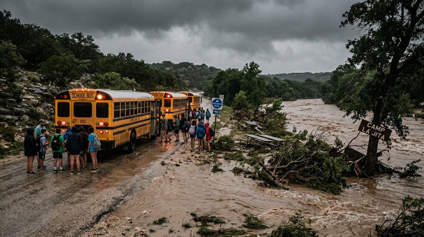
Recent atmospheric instability over the Texas Hill Country has triggered life-threatening flash flood conditions, leading to the immediate evacuation of at least one prominent youth summer camp in Uvalde County. The Girl Scouts of Southwest Texas confirmed that Camp La Jita, situated along the banks of the Sabinal River near Utopia, moved all campers and staff to safety this week as water levels surged beyond safe thresholds. Historically, the Hill Country is known as 'Flash Flood Alley' due to its thin soil and limestone terrain, which causes rainwater to run off rapidly into narrow canyon riverbeds. This geographic reality has long shaped the emergency protocols of the region's densely concentrated summer camps. The decision to evacuate follows a pattern of extreme weather events in the region where localized downpours can transform calm streams into raging torrents in a matter of minutes, a phenomenon that has previously caused significant property damage and loss of life in Central Texas. While Camp La Jita took the proactive step of clearing its grounds, several other neighboring camps located along the Frio and Guadalupe rivers have entered a state of heightened surveillance. These facilities are coordinating with local emergency management offices and the National Weather Service to determine if further departures are necessary as the weather front continues to stall over the Edwards Plateau. The safety of hundreds of children remains the primary focus for camp directors who are balancing the traditional summer experience with the stark reality of Texas weather volatility.
Texas relevance
The Texas Hill Country serves as a critical economic and recreational hub, hosting a high concentration of the state's most storied summer camps. Uvalde County and the surrounding areas rely heavily on the seasonal influx of visitors, and any disruption to these programs impacts local businesses and families across the state. This specific weather event highlights the ongoing vulnerability of Texas infrastructure and rural emergency response systems when faced with the rapid-onset flooding characteristic of the Edwards Plateau. For Texas parents and residents, the situation underscores the importance of the various state and local monitoring systems, such as the Low Water Crossing cameras and the Texas Colorado River Authority's gauges, which provide real-time data to help rural communities prepare for sudden inundation.
Regional Impact and the Geography of Risk
The current flooding crisis is not an isolated incident but part of a broader meteorological pattern that has plagued the Hill Country for generations. The region is characterized by steep slopes and non-porous rock, meaning that when heavy rains hit, the water has nowhere to go but down into the valleys where camps like La Jita are located. The Sabinal River, which runs directly through the Girl Scout property, is notorious for its ability to rise ten feet or more in a very short window of time.
Local emergency responders in Uvalde and Real counties have been working around the clock to monitor low-water crossings that often become traps for motorists. The geography of the Edward’s Plateau creates a 'funnel effect' where rainfall from twenty miles away can cause a flood in a location that hasn't seen a single drop of rain. This makes the job of camp directors exceptionally difficult, as they must monitor upstream gauges rather than just looking at the sky above their own cabins.
Because many of these camps are situated in 'dead zones' for cellular service, many have invested in satellite-based weather monitoring and radio systems. The coordination between the Girl Scouts of Southwest Texas and local sheriff's departments reflects a mature emergency response network that has been refined over decades of dealing with the erratic nature of the Central Texas climate.
Safety Protocols and Evacuation Logistics
Evacuating a summer camp is a logistical challenge that involves coordinating bus transport, notifying hundreds of parents, and ensuring that all equipment is secured. At Camp La Jita, the staff utilized established 'flood tiers' to determine the exact moment when the risk outweighed the benefit of remaining on-site. These tiers are based on specific water levels measured at North Sabinal River gauges, allowing for an orderly departure rather than a panicked flight.
Other camps in the vicinity, including those along the Frio River near Concan, have reported that they remain in 'monitoring mode.' This involves constant communication with meteorologists and keeping staff on high alert for overnight weather shifts. Many camps have moved their activities to higher ground within their properties, avoiding riverfront areas while still attempting to maintain some semblance of a normal camp schedule for the children.
The financial implications of these evacuations are significant, but most Texas camps maintain robust insurance policies and emergency funds specifically for weather-related disruptions. The primary goal remains the safe return of campers to their families, a task that becomes much more complex when rural roads and bridges are washed out by rising floodwaters, cutting off access to major highways like US-83.
Historical Context of Hill Country Flooding
To understand the severity of the current situation, one must look at the history of the region, including the devastating floods of 1998 and 2002. During those events, rivers in the Hill Country reached record heights, destroying homes and claiming lives. The memories of those disasters drive the conservative approach taken by camp administrators today. They understand that the Sabinal River is a powerful force that demands respect.
In previous decades, notice of an approaching flood might have come via word-of-mouth or a manual siren. Today, the integration of automated USGS streamflow data provides a level of precision that was previously impossible. However, technology cannot change the fundamental reality that certain areas of Uvalde and Bandera counties are inherently high-risk zones during the summer storm season.
The culture of safety in Texas youth organizations has evolved to prioritize transparency. Parents are now given detailed weather contingency plans weeks before their children ever arrive at camp. This transparency helps build trust, ensuring that when an evacuation is called, parents understand it is based on data and a commitment to their child's well-being rather than an overreaction to a passing shower.
The Role of Local Emergency Services
Volunteer fire departments and county sheriffs play an indispensable role during these events. In rural Texas, these agencies are often the first on the scene to assist with road closures and water rescues. During the recent storms, these personnel have been checking on remote properties and ensuring that camp staff have the resources they need to execute their safety plans. The partnership between private camps and public servants is a pillar of Hill Country resilience.
Local officials also emphasize the danger of 'rubbernecking' or tourists attempting to view the floodwaters. They urge the public to stay away from the riverbanks and respect all barricades. A single vehicle stalled at a low-water crossing can divert precious emergency resources away from more critical needs, such as a camp evacuation or a medical emergency in a flooded neighborhood.
Communication remains the hardest hurdle in these scenarios. When landlines are cut by falling trees and towers are overwhelmed by storm activity, the use of HAM radios and local emergency broadcast systems becomes the lifeline for the community. The ongoing investment in regional emergency communications is vital for the long-term viability of the Hill Country's tourism and recreation sectors.
Looking Ahead: Weather Outlook and Recovery
Meteorologists expect the current pattern of moisture-rich air from the Gulf of Mexico to persist for several more days. This means the ground will remain saturated, increasing the likelihood of immediate runoff from any additional rainfall. Even if the sun comes out, the threat persists until the rivers have had a chance to recede to their normal banks. Camp directors are currently assessing when it might be safe to resume operations or if the current sessions must be canceled entirely.
Recovery after a flood involves more than just waiting for the water to go down. Camps must inspect structures for mold, check septic systems, and ensure that trails are clear of debris and downed power lines. The 'clean-up' phase can often take weeks, and the labor is frequently provided by staff and local volunteers who care deeply about these institutions.
Long-term, the repeated occurrence of these events may lead to further infrastructure hardening. Some camps are considering moving permanent structures to higher elevations or investing in more sophisticated on-site weather stations. As Texas continues to grow, the pressure on these recreational lands increases, making the balance between nature and safety more delicate than ever before.
Analysis
Opinion: The swift evacuation of Camp La Jita serves as a masterclass in proactive risk management for Texas organizations. In a state where weather can shift from a drought to a deluge in less than twenty-four hours, the refusal to 'wait and see' likely prevented a catastrophe. While critics of camp closures often point to the disruption of schedules and financial loss, the historical record of the Sabinal and Frio rivers suggests that erring on the side of caution is the only responsible path. This incident should prompt a broader discussion among Texas lawmakers and local officials regarding the enhancement of early warning sirens and cellular infrastructure in these remote canyon areas, where digital communication can often fail during severe storms.
Source attribution
This story was reported using a public release from the Texas Standard. Keep TX Red rewrote the coverage independently and links to the official statement for verification.
Frequently Asked Questions
- Which camp was specifically evacuated due to the flooding?
- Camp La Jita, operated by the Girl Scouts of Southwest Texas and located in Uvalde County along the Sabinal River, was evacuated to ensure the safety of all participants.
- Why is flooding so dangerous in the Texas Hill Country?
- The region features thin soil and limestone rock that does not absorb water quickly. This causes heavy rainfall to run off into rivers and canyons rapidly, leading to 'flash' floods that can rise several feet in minutes.
- How do Texas camps monitor for flood threats?
- Most camps use a combination of National Weather Service alerts, real-time USGS river gauges, and direct communication with local county emergency management offices to track upstream rainfall and river levels.
- What should parents do if their child is at a Hill Country camp during a storm?
- Parents should check their email and the camp’s social media or official website for updates. It is vital to avoid driving to the camp during a flood, as many rural roads and low-water crossings may be impassable and dangerous.
Official Sources
Take the next step
Browse the Newsroom →Read more about Keep Texas Red → Our full guide to what Keep Texas Red means and why Texans support it.
Related Articles



Get Texas updates delivered weekly.
Independent Texas reporting on politics, policy, and daily life. One email a week. Unsubscribe anytime.
Keep TX Red Newsroom
The Keep Texas Red Editorial Staff produces nonpartisan explainers, policy breakdowns, and educational resources to help Texans understand how their government works. All content is reviewed for accuracy and updated regularly.
About Keep TX Red →