Hill Country Community Struck by Catastrophic Flash Flooding Along Guadalupe River
Kerrville and Uvalde County face life-threatening flash floods as the Guadalupe River surges, triggering emergencies and shelter-in-place orders.
Editorial disclaimer: Opinions and analysis on Keep TX Red are editorial content — not statements of fact. See our editorial standards.
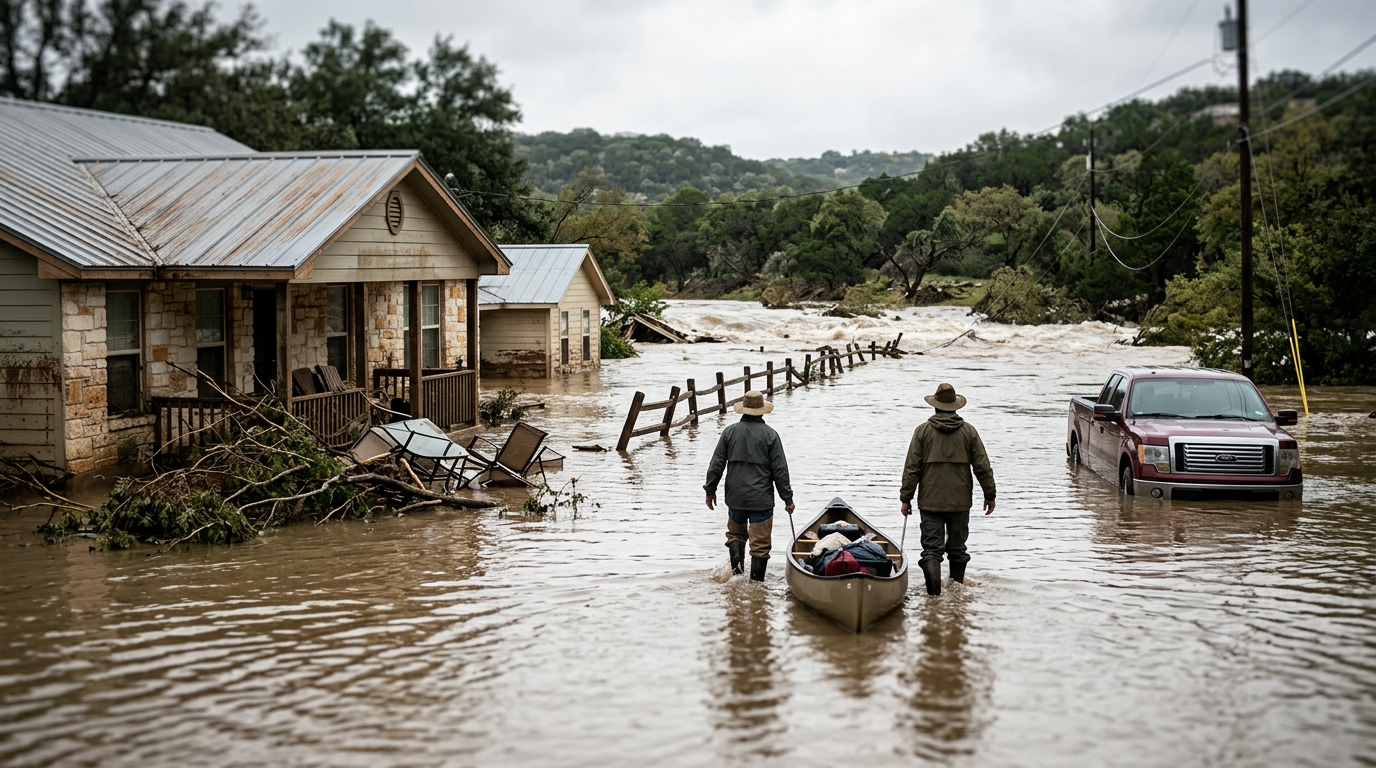
Residents in the Texas Hill Country faced a morning of intense peril as historic rainfall levels triggered flash flood emergencies across Kerr and Uvalde counties. The Guadalupe River, a central lifeline for both recreation and local ecosystems, transformed into a dangerous torrent overnight following localized rain totals that exceeded typical monthly averages in a matter of hours. Local authorities were forced to navigate a rapidly evolving crisis, issuing shelter-in-place mandates as roads became impassable and traditional escape routes were cut off by rising waters. The intensity of the precipitation caught many by surprise, despite the general susceptibility of this region to rapid hydrological shifts. Historically, the Texas Hill Country is known as 'Flash Flood Alley' due to its thin soils and limestone topography, which do not absorb water effectively, leading to immediate runoff into river basins. This latest event mirrors past historical floods in 1978 and 2002, which reshaped local infrastructure and led to stricter zoning laws near the riverbanks. As the water reached the critical flood stage, the National Weather Service escalated its warnings to a Flash Flood Emergency, a designation reserved for rare, life-threatening situations where significant damage is imminent. Local volunteer fire departments and swift-water rescue teams were deployed to the most vulnerable areas, particularly focusing on low-water crossings that are notorious for trapping motorists. Public safety officials emphasized that the volume of water moving through the Guadalupe was sufficient to move large debris, including trees and vehicles, posing a risk to any structures within the floodplain.
Texas relevance
This event directly impacts the infrastructure and economy of Kerrville and the surrounding Hill Country, a region vital to the Texas domestic tourism industry and agriculture. The Guadalupe River serves as a primary water source for municipal systems, and the excessive silt and debris from this flood will likely necessitate extensive repairs and water treatment adjustments for weeks. Furthermore, the damage to low-water crossings in Kerr and Uvalde counties will disrupt regional logistics and emergency response times for months, requiring state-level funding from the Texas Department of Transportation for restoration. Central Texas residents must remain vigilant as these weather patterns often shift eastward toward San Antonio and Austin, stressing the I-35 corridor's drainage systems.
The Hydrology of the Guadalupe River Surge
The Guadalupe River is uniquely susceptible to rapid rises due to the steep terrain of the Edwards Plateau. When heavy rain falls over the rocky landscape, the lack of absorption results in a massive volume of water funneling directly into the river channel. In this specific incident, the surge was so rapid that sensors recorded water level rises of several feet within a thirty-minute window. This 'wall of water' phenomenon is what makes flash floods in the Hill Country significantly more dangerous than slow-rising river floods in East Texas.
Hydrologists noted that the soil moisture prior to the event was already elevated due to recent scattered showers, meaning the ground reached saturation almost instantly. As the Guadalupe River crested, it breached banks that had remained dry for years, impacting homes and businesses that were previously thought to be at a safe elevation. The speed of the current was measured at rates capable of eroding riverbanks and destroying private docks, which adds a secondary layer of property damage to the immediate flood risk.
Emergency Response and Shelter-in-Place Mandates
In Kerrville, the decision to issue a shelter-in-place order was driven by the sheer number of flooded roads within the city limits. Law enforcement recognized that attempting to evacuate residents during the peak of the storm could actually increase the casualty count, as many deaths during Texas floods occur when vehicles are swept away. By instructing citizens to stay where they were and climb to higher ground if necessary, officials minimized the risk of 'mobile entrapment' at low-water crossings.
Emergency operations centers in both Kerr and Uvalde counties were activated to the highest level, coordinating between the Texas Department of Public Safety and local sheriff offices. These teams utilized high-profile vehicles and aviation assets to assess the damage from above, identifying stranded clusters of people who were unable to communicate via cell service. The coordination effort focused on prioritizing life-safety over property protection, a standard protocol in flash flood emergencies.
Impact on Uvalde County and Agricultural Interests
While Kerrville saw significant urban impact, Uvalde County faced different challenges related to its agricultural and ranching landscape. The floods submerged vast tracts of pastureland, threatening livestock and damaging vital fencing infrastructure. Farmers in the region now face the prospect of soil erosion and the loss of seasonal crops that were nearing harvest. The economic ripple effect of this flood will likely be felt at local cooperatives and markets throughout the South Texas region.
The drainage basins in Uvalde also contribute to the recharge of the Edwards Aquifer, but extreme flooding events can sometimes lead to contamination concerns. Runoff carrying debris, chemicals, and silt can enter the karst features of the aquifer, potentially impacting water quality for downstream users. Local groundwater districts are expected to begin monitoring programs as soon as the floodwaters recede to ensure the safety of the municipal and private well water supplies.
Modern Technology and Early Warning Systems
This event highlighted the importance of the Wireless Emergency Alerts (WEA) system, which pushed notifications directly to mobile devices in the affected polygons. These alerts are credited with waking residents during the overnight hours, providing them the critical minutes needed to move valuables and seek safety. However, the event also exposed gaps in coverage in more remote parts of the Hill Country where cellular tower density is low, leaving some residents to rely on traditional weather radios or visual cues.
Moving forward, the Texas Division of Emergency Management is looking into expanding its network of river gauges and rain sensors. Real-time data is the only way to accurately predict the downstream timing of a flood crest. During this event, the data from gauges upstream provided at least a twenty-minute lead time for communities further down the Guadalupe basin, showing that investment in technical monitoring directly translates to lives saved during climate extremes.
Recovery and Long-Term Infrastructure Planning
As the water recedes, the long process of damage assessment begins. Kerr County officials will be working with FEMA and the Small Business Administration to determine if the area qualifies for federal disaster assistance. The immediate priority is the inspection of bridges and roads that may have suffered structural compromise during the surge. Many of the older bridges in the Hill Country were not designed for the hydraulic pressures exerted by a flood of this magnitude, and hidden scour damage is a major concern for engineers.
Long-term, this event will likely influence local building codes and floodplain management. Cities like Kerrville are increasingly looking at green infrastructure and detention ponds to mitigate the speed of runoff. However, the primary challenge remains the cost of retrofitting historic districts that were built long before modern flood modeling existed. The state's role in providing low-interest loans and grants for these projects will be a major topic of discussion in the upcoming legislative session.
Safety Protocols for Future Hill Country Floods
The mantra 'Turn Around, Don't Drown' remains the most effective safety advice for Texas drivers, yet emergency responders still had to perform multiple rescues. Educating the public on the power of moving water is a constant battle for local safety departments. Just six inches of fast-moving water can knock an adult off their feet, and twelve inches can carry away a small car. The turbidity of the Guadalupe during this flood meant that drivers could not see if the road beneath the water had been washed away, creating a deadly trap.
Residents are encouraged to build an emergency kit that includes at least three days of food and water, along with necessary medications and flashlights. In the Hill Country, being 'flushed' into a situation where one is isolated on high ground without utilities is a common occurrence. Community-led initiatives, such as local ham radio clubs and neighborhood watch groups, proved their worth during this crisis by providing ground-truth reports to the emergency operations center when traditional communication lines were stressed.
Analysis
OPINION: The recurring nature of these catastrophic floods in the Hill Country highlights a persistent challenge for Texas infrastructure planning. While the state has invested billions through the Texas Water Development Board, the localized intensity of 'micro-bursts' often outpaces existing drainage capacities in rural counties. This event should serve as a wake-up call for the legislature to further prioritize the Flood Infrastructure Fund, ensuring that smaller counties like Kerr and Uvalde have the resources to build resilient culverts and warning systems that don't rely solely on localized tax bases. Furthermore, the reliance on high-water rescues underscores the need for continued funding for Texas Task Force 1 and other professionalized search-and-rescue assets that serve as the backbone of our state's disaster response.
Source attribution
This story was reported using a public release from the Texas Standard. Keep TX Red rewrote the coverage independently and links to the official statement for verification.
Frequently Asked Questions
- What is the difference between a Flash Flood Warning and a Flash Flood Emergency?
- A Flash Flood Warning means that flooding is imminent or occurring. A Flash Flood Emergency is a rarer and more severe alert used only when a major threat to human life and catastrophic damage is happening due to extreme rainfall or a dam failure. It signals that immediate action is required to survive.
- Why is the Texas Hill Country so prone to flash flooding?
- The region, often called 'Flash Flood Alley,' features thin soil and rocky limestone terrain that cannot absorb heavy rainfall. This results in nearly all precipitation becoming surface runoff that flows rapidly into narrow river valleys and canyons, causing water levels to rise vertically by double digits in minutes.
- What should I do if I am caught in a shelter-in-place order due to flooding?
- Stay inside your home or a sturdy building. Move to the highest floor possible if water enters the building, but avoid the attic unless there is an exit to the roof. Do not attempt to drive, as most flood fatalities occur in vehicles when drivers underestimate the depth or speed of moving water.
Official Sources
Take the next step
Browse the Newsroom →Read more about Keep Texas Red → Our full guide to what Keep Texas Red means and why Texans support it.
Related Articles



Get Texas updates delivered weekly.
Independent Texas reporting on politics, policy, and daily life. One email a week. Unsubscribe anytime.
Keep TX Red Newsroom
The Keep Texas Red Editorial Staff produces nonpartisan explainers, policy breakdowns, and educational resources to help Texans understand how their government works. All content is reviewed for accuracy and updated regularly.
About Keep TX Red →