Governor Greg Abbott Issues Extreme Flood Warnings for Nueces River Basin Cities
Texas leaders warn of life-threatening flooding across South Central Texas and the Hill Country as torrential rains threaten to break historical records.
Editorial disclaimer: Opinions and analysis on Keep TX Red are editorial content — not statements of fact. See our editorial standards.
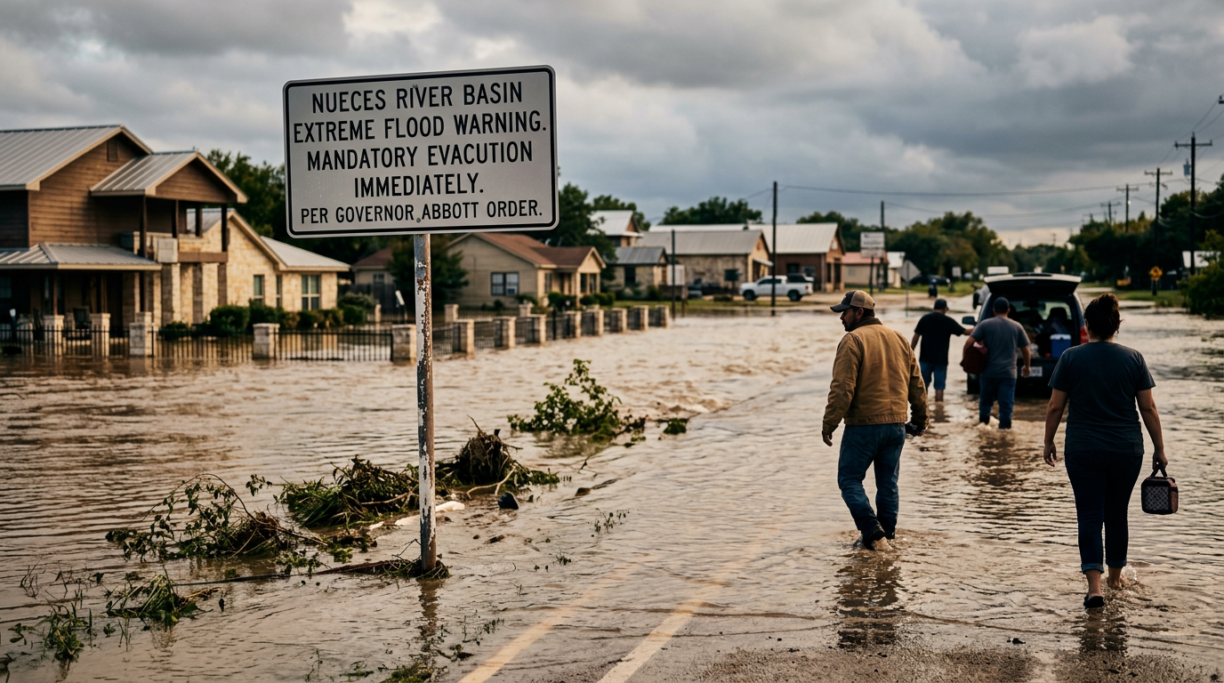
Officials in Texas are bracing for an unprecedented weather event as a massive storm system stalls over the central and southern portions of the state. Governor Greg Abbott has issued a stern warning to residents, particularly those located near the Nueces River Basin, regarding the potential for catastrophic flooding through the end of the week. Historically, the Hill Country and South Central Texas have been vulnerable to 'Flash Flood Alley' conditions, where rocky terrain and thin soil layers prevent rapid absorption of rainwater, leading to dangerous runoff into river systems. This current system is expected to deliver rainfall totals that could eclipse long-standing records for the month of July, turning small creeks into raging rivers within hours. Emergency response teams have been pre-positioned to assist with water rescues and evacuations if necessary.
Texas relevance
The impact of this storm is centered directly on the South Central and Hill Country regions of Texas. Communities along the Nueces River, ranging from Uvalde down through Corpus Christi, are on high alert. For Texans, these floods represent a significant risk to both rural ranching operations and urban infrastructure. Given the state's history with events like the 2015 Memorial Day floods and various tropical systems, the current mobilization of the Texas Division of Emergency Management (TDEM) highlights the serious nature of the threat to local residents and their property.
Historical Context of Hill Country Flooding
Texas has a long and storied history with devastating flood events, particularly in the region known as 'Flash Flood Alley.' This area, which stretches from the Red River down through the Balcones Escarpment, is one of the most flood-prone regions in the entire United States. The unique geography, characterized by steep limestone hills and shallow soil, prevents heavy rain from soaking into the ground. Instead, the water moves rapidly downhill, accumulating in river basins and canyons with terrifying speed.
Past events, such as the catastrophic floods of 1998 and 2015, have shown that urban sprawl has only complicated the state's response to these natural disasters. As more concrete and asphalt cover the earth, the volume of runoff increases, putting historic pressure on drainage systems that were designed for lower population densities. This week’s forecast suggests a repeat of these heavy-accumulation patterns, requiring a high level of vigilance from both local authorities and the civilian population.
The current atmospheric conditions involve a stationary front interacting with deep tropical moisture from the Gulf of Mexico. This combination is a classic recipe for the 'train effect,' where storms follow the same path for hours on end. When this happens over a saturated watershed like the Nueces or the Guadalupe, the results are almost always record-breaking and dangerous.
State and Local Emergency Mobilization
In response to the dire forecast, the Texas Division of Emergency Management has activated various state resources to support local jurisdictions. Governor Abbott has authorized the deployment of high-water recovery vehicles and search-and-rescue boat teams. These assets are being staged in areas expected to see the highest rainfall totals, ensuring that response times are minimized when the water begins to rise over low-water crossings.
Local officials in cities like San Antonio, Uvalde, and New Braunfels have also issued warnings to residents. Many of these municipalities have implemented pre-emptive closures of parks and river access points to prevent accidents. The emphasis remains on the 'Turn Around, Don't Drown' campaign, which remains the single most effective way to prevent flood-related fatalities in the state. Historically, the majority of flood deaths in Texas occur in vehicles when drivers underestimate the depth or power of moving water.
Furthermore, the Texas Department of Transportation (TxDOT) is monitoring highway sensors and bridge integrity throughout the affected corridors. Interstate 35 and Highway 90 are primary concern areas where flash flooding can lead to sudden closures, stranded motorists, and significant supply chain disruptions. Residents are encouraged to use official state maps to track road closures in real time.
The Specific Threat to the Nueces River Basin
While much of the state will see significant rain, the Nueces River Basin is currently identified as the 'bullseye' for this weather event. This basin drains a massive portion of the South Texas brush country and the southern edge of the Edwards Plateau. Because the river winds through several small towns before reaching large reservoirs, the timing of the flood crest is a critical concern for emergency planners.
Ranchers in the region are being advised to move livestock to higher ground immediately. In a matter of hours, low-lying pastures can become islands, or worse, completely submerged. This economic impact on the agricultural sector is a significant part of the disaster's total cost. The loss of fencing, equipment, and livestock can take years for a family-owned ranching operation to recover from, even with federal or state assistance.
Downstream, the impact will be felt in the various water systems that rely on these basins for municipal supply. While a massive influx of water can help fill reservoirs like Lake Corpus Christi, the initial surge often brings high levels of silt and debris. This can complicate water treatment processes for days after the rain has stopped, leading to potential boil water notices for residents in the coastal bend.
Infrastructure Under Pressure
One of the primary concerns for Texas engineers during record-breaking rain events is the integrity of low-water crossings. These structures are common throughout the Hill Country because they are cost-effective for rural roads, but they become deadly traps during sudden storms. State leaders have called for long-term investments in bridge height, but the sheer number of crossings in Texas makes this a multi-decade project.
Urban drainage systems are also being put to the test. In cities experiencing rapid growth, natural detention ponds have often been filled in to make way for housing developments. This forces water into pipes and culverts that may not have the capacity to handle record-breaking rainfall. Engineers will be closely watching how new developments in the corridor between Austin and San Antonio handle this week's surge.
Additionally, the Texas power grid remains a concern during extreme weather, though flood events typically pose less of a systemic threat than ice storms or extreme heat. However, localized outages are expected as high winds accompanying the storms may knock down trees and power lines. Energy providers have stated that they have crews on standby to manage these outages as soon as it is safe for them to operate in the field.
Safety Protocols for Texas Residents
As the storm progresses, the Department of Public Safety (DPS) is urging Texans to stay informed through multiple channels. Weather radios, local news alerts, and social media updates from emergency agencies are vital resources. Because cell towers can sometimes fail during severe weather, having a backup plan for communication within families is highly recommended by safety experts.
The risk of nighttime flooding is particularly acute during this storm cycle. When heavy rain occurs after dark, it is nearly impossible for drivers to see water on the road until it is too long. Officials suggest that residents should avoid all non-essential travel after sunset until the flood threat has passed. If water begins to enter a home, residents should move to the highest point possible but avoid getting trapped in an attic without an exit to the roof.
Preparation also includes securing outdoor furniture and trash cans, which can become projectiles in high winds or debris that clogs drainage outlets. Proper preparation now can prevent property damage and allow emergency services to focus their efforts on life-saving missions rather than preventable accidents.
Future Outlook and Recovery Efforts
Once the rain subsides, the focus will quickly shift to damage assessment and recovery. Under Texas law, a disaster declaration at the county level allows for the unlocking of specific emergency funds and resources. If the damage is widespread enough, the Governor may request a federal disaster declaration, which would bring in agencies like FEMA to provide individual and public assistance for rebuilding infrastructure.
Climate experts and meteorologists note that while Texas has always had cycles of drought and flood, the intensity of these events appears to be increasing. This trend necessitates a rethink of how the state manages its water resources. Plans for new reservoirs, improved flood-mapping technology, and updated building codes are all part of the legislative discussion in Austin as the state prepares for future growth.
In the short term, the rainfall may break records, but the long-term goal for Texas remains resilience. The spirit of neighbors helping neighbors, often seen during events like Hurricane Harvey, will likely be on display again as communities in the Nueces River Basin work together to recover from what is expected to be a historic weather event.
Analysis
The state's proactive communication regarding this weather event reflects a shift toward more aggressive emergency management under the current administration. By labeling the potential floods as 'life-threatening' and 'catastrophic' well before the peak rainfall, the Governor's office is attempting to mitigate the loss of life seen in previous decade-defining floods. While the rain is much needed to alleviate persistent drought conditions in some aquifers, the intensity of this specific event poses a net danger that outweighs the agricultural benefits. This situation also tests the resilience of Texas infrastructure, particularly aging dams and roadway drainage systems in rapidly growing counties like Hays and Comal.
Source attribution
This story was reported using a public release from the Texas Standard. Keep TX Red rewrote the coverage independently and links to the official statement for verification.
Frequently Asked Questions
- What areas in Texas are at the highest risk?
- The highest risk is currently centered on the Nueces River Basin, the Hill Country, and portions of South Central Texas, including cities like Uvalde and San Antonio.
- How long is the flood threat expected to last?
- The current weather system is expected to cause dangerous conditions through at least Thursday, though river flooding may persist for days after the rain stops.
- What should I do if my home begins to flood?
- You should immediately move to the highest level of the building. Do not enter an attic unless there is a clear exit to the roof, and call 911 if you are in immediate danger.
- Is the state providing emergency assistance?
- Yes, the Texas Division of Emergency Management (TDEM) has mobilized water rescue teams, high-water vehicles, and other resources to the affected regions.
Official Sources
Take the next step
Browse the Newsroom →Read more about Keep Texas Red → Our full guide to what Keep Texas Red means and why Texans support it.
Related Articles



Get Texas updates delivered weekly.
Independent Texas reporting on politics, policy, and daily life. One email a week. Unsubscribe anytime.
Keep TX Red Newsroom
The Keep Texas Red Editorial Staff produces nonpartisan explainers, policy breakdowns, and educational resources to help Texans understand how their government works. All content is reviewed for accuracy and updated regularly.
About Keep TX Red →