Abbott Issues Dire Warning as Texas River Basins Brace for Downstream Crests
While major rainfall has ceased, North and East Texas rivers continue to rise, prompting new safety warnings for downstream residents.
Editorial disclaimer: Opinions and analysis on Keep TX Red are editorial content — not statements of fact. See our editorial standards.
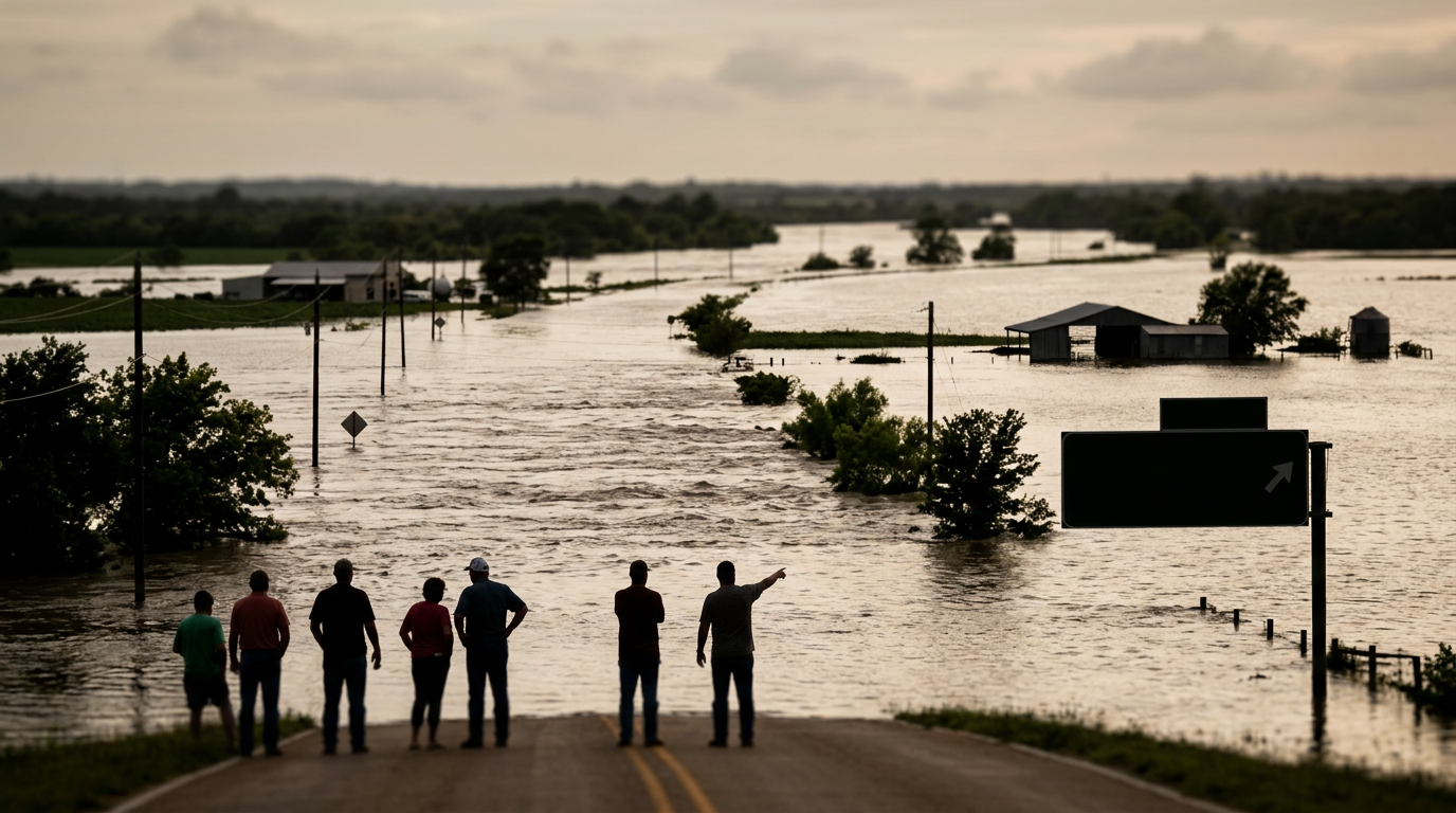
On July 16, 2026, Governor Greg Abbott updated the state on the severe weather recovery efforts across North and East Texas, noting that while the heaviest rainfall has ended, the danger remains acute for many communities. The Governor cautioned residents that the volume of water currently moving through the state's river systems means that peak flooding is still occurring in several downstream basins. This transition from active storming to secondary flooding marks a critical phase in the state’s emergency response where the threat of drowning and property damage persists despite clear skies. Historically, East Texas has faced similar challenges during extreme wet seasons where the Trinity and Neches rivers become slow-moving but destructive forces several days after a storm passes. The delay between the end of precipitation and the peak of the river level is a hallmark of the Texas coastal plain's geography, where flat terrain slows the exit of water toward the Gulf of Mexico.
Texas relevance
This update directly impacts residents in East and Southeast Texas, particularly those living near major river tributaries that are currently receiving runoff from upstream counties. For Texans in these regions, the state's warning serves as a reminder that local conditions can deteriorate even when rain is no longer falling locally. State resources, including the Texas Division of Emergency Management, remain deployed to coordinate with local municipal leaders to monitor levee integrity and road closures that disrupt daily life and commerce in the impacted areas. Historically, the Brazos and Trinity basins have seen some of their most significant infrastructure damage not during the rain itself, but in the week following, as saturated embankments fail and soil loses all load-bearing capacity.
The Danger of Receding Waters
Governor Abbott emphasized that the conclusion of active rainfall does not equal an end to the emergency. For many rural Texas counties, the geography involves vast floodplains that take days to process the billions of gallons of water deposited by recent storms. The Governor noted that the primary risk now lies in the slow movement of these massive volumes of water as they travel south toward the Gulf of Mexico.
Emergency officials are concerned that residents may develop a false sense of security once the clouds part. Historical precedents in Texas show that the highest death tolls often occur during the runoff phase when drivers attempt to cross flooded roadways that appear shallow but contain swift, powerful currents. State agencies are maintaining high-alert status to prevent such tragedies in the coming days.
The current saturated state of the ground across East Texas means that any localized rainfall, however minor, would immediately contribute to runoff rather than being absorbed. This lack of absorption capacity turns small creeks into major hazards almost instantly, requiring constant monitoring by local drainage districts.
Infrastructure Under Pressure
Local infrastructure across hardest-hit counties is currently under significant stress as water levels approach or exceed record crests. Bridges and culverts that were weakened by initial saturation are now being tested by the sustained weight and pressure of high-standing water. State engineers are working alongside local public works departments to identify high-risk zones where structural failure could lead to sudden road collapses.
Furthermore, the saturation of the soil means that even minor additional runoff could trigger localized landslides or further erosion along riverbanks. This environmental instability makes the recovery process more complex, as heavy equipment cannot safely navigate mud-slicked areas to repair power lines or clear debris until the ground dries sufficiently.
In many of these counties, the damage to secondary farm-to-market roads can isolate entire communities for days. The Texas Department of Transportation is currently surveying these routes using aerial drones to assess viability before sending in ground crews for repairs, ensuring that the safety of state workers remains a priority during the cresting phase.
Coordination of State Resources
The Texas Division of Emergency Management has been tasked with overseeing the distribution of resources to counties that are geographically situated downstream. This proactive approach involves prepositioning rescue boats, high-profile vehicles, and medical supplies in areas where river gauges indicate a high probability of over-bank flooding within the next 48 to 72 hours.
Abbott's administration is also focusing on the long-term economic impact on these communities. By declaring emergency status early, the state allows local governments to access contingency funds and eventually seek federal assistance if the damage thresholds are met. This administrative support is vital for small towns that do not have the independent budget capacity to handle catastrophic infrastructure repairs.
Search and rescue teams from the Texas A&M Task Force 1 remain on standby in the region. These specialists are trained for the specific hazards associated with swift-water environments, which differ significantly from the standing water often found in urban flooding scenarios.
Navigating Downstream Impacts
The phenomenon of downstream flooding is a recurring challenge for the Texas water management system. As water moves through the various river authorities—such as those managing the Trinity or the Brazos—operators must balance the release of water from reservoirs. If reservoirs are too full, they must release water, which can exacerbate flooding for those living below the dams.
Governor Abbott noted that coordination between these water authorities is a top priority to ensure that releases are managed as safely as possible. Residents in these low-lying areas are encouraged to stay subscribed to local emergency alerts, as the timing of a river crest can change based on how water moves through various control structures and natural bottlenecks.
The impact of these releases is felt most heavily in agricultural sectors, where late-season crops can be completely decimated by prolonged inundation. State agricultural experts are already beginning to assess the potential loss of yield for farmers in the path of the river surges.
Public Safety and Movement Controls
Law enforcement in the affected counties has been instructed to strictly enforce road closures. The 'Turn Around, Don't Drown' campaign remains the central message for the Texas Department of Public Safety as they patrol inundated zones. Because river water often obscures the fact that the road underneath has been washed away, visual assessments by civilians are frequently inaccurate.
In addition to road hazards, officials are warning about the displacement of local wildlife. High water levels often force snakes and other animals into residential areas, creating secondary safety concerns for homeowners who are beginning to assess property damage. The state recommends that residents wear protective clothing and proceed with caution when entering outbuildings or flooded yards.
Timeline for Recovery and Restoration
The full timeline for recovery will not be clear until all major river systems have crest-level readings that show a consistent downward trend. For certain communities in the lower Trinity basin, this could take another five to seven days. Only after the water recedes can utility companies safely begin the process of drying out and re-energizing electrical substations that were submerged.
Public health officials are also monitoring for the potential of waterborne illnesses that often follow large-scale flooding events. Ensuring a clean supply of drinking water remains a priority for the state, with mobile filtration units being deployed to areas where municipal water systems have been compromised by the floodwaters.
Governor Abbott remains in constant contact with the leaders of the affected counties to ensure that the transition from emergency response to community rebuilding is seamless. The state's focus will eventually shift to debris removal and the restoration of public utilities, but that phase is currently on hold for communities still waiting for the peak water levels.
Analysis
OPINION: The state's messaging highlights a sophisticated understanding of Texas hydrology that has evolved since the catastrophic events of Hurricane Harvey. By emphasizing the 'downstream effect,' the Abbott administration is attempting to combat the 'sunlight fallacy'—the dangerous tendency for residents to venture out into flood zones as soon as the sun appears. This proactive communication strategy is likely intended to reduce the strain on first responders by limiting the number of high-water rescues caused by travelers who misjudge the depth of moving water on rural highways. Furthermore, by framing this as an ongoing crisis despite the clear weather, the Governor is setting the stage for the necessary federal disaster declarations that will be required to rebuild the aging bridge infrastructure in the impacted rural counties.
Source attribution
This story was reported using a public release from the Texas Tribune. Keep TX Red rewrote the coverage independently and links to the official statement for verification.
Frequently Asked Questions
- What did Governor Abbott say about the rain status?
- The Governor stated that the worst of the active rain has passed, but he warned that the resulting water moving through rivers continues to pose a significant danger to downstream communities.
- Why is the flooding still a threat if the rain has stopped?
- In Texas, large storm systems deposit massive amounts of water that eventually collect in river basins. This water takes time to move south, meaning rivers can reach flood stage and 'crest' days after the rain ends.
- Which areas of Texas are most at risk right now?
- The primary areas of concern are the river basins in North, East, and Southeast Texas that are currently receiving runoff from the recent heavy rainfall events.
Official Sources
Take the next step
Browse the Newsroom →Read more about Keep Texas Red → Our full guide to what Keep Texas Red means and why Texans support it.
Related Articles



Get Texas updates delivered weekly.
Independent Texas reporting on politics, policy, and daily life. One email a week. Unsubscribe anytime.
Keep TX Red Newsroom
The Keep Texas Red Editorial Staff produces nonpartisan explainers, policy breakdowns, and educational resources to help Texans understand how their government works. All content is reviewed for accuracy and updated regularly.
About Keep TX Red →