Severe Weather Hits Boerne as River Road Shuts Down Following Heavy Rains
Boerne officials have closed River Road as intense rainfall causes rising water levels, creating dangerous travel conditions for Kendall County residents.
Editorial disclaimer: Opinions and analysis on Keep TX Red are editorial content — not statements of fact. See our editorial standards.
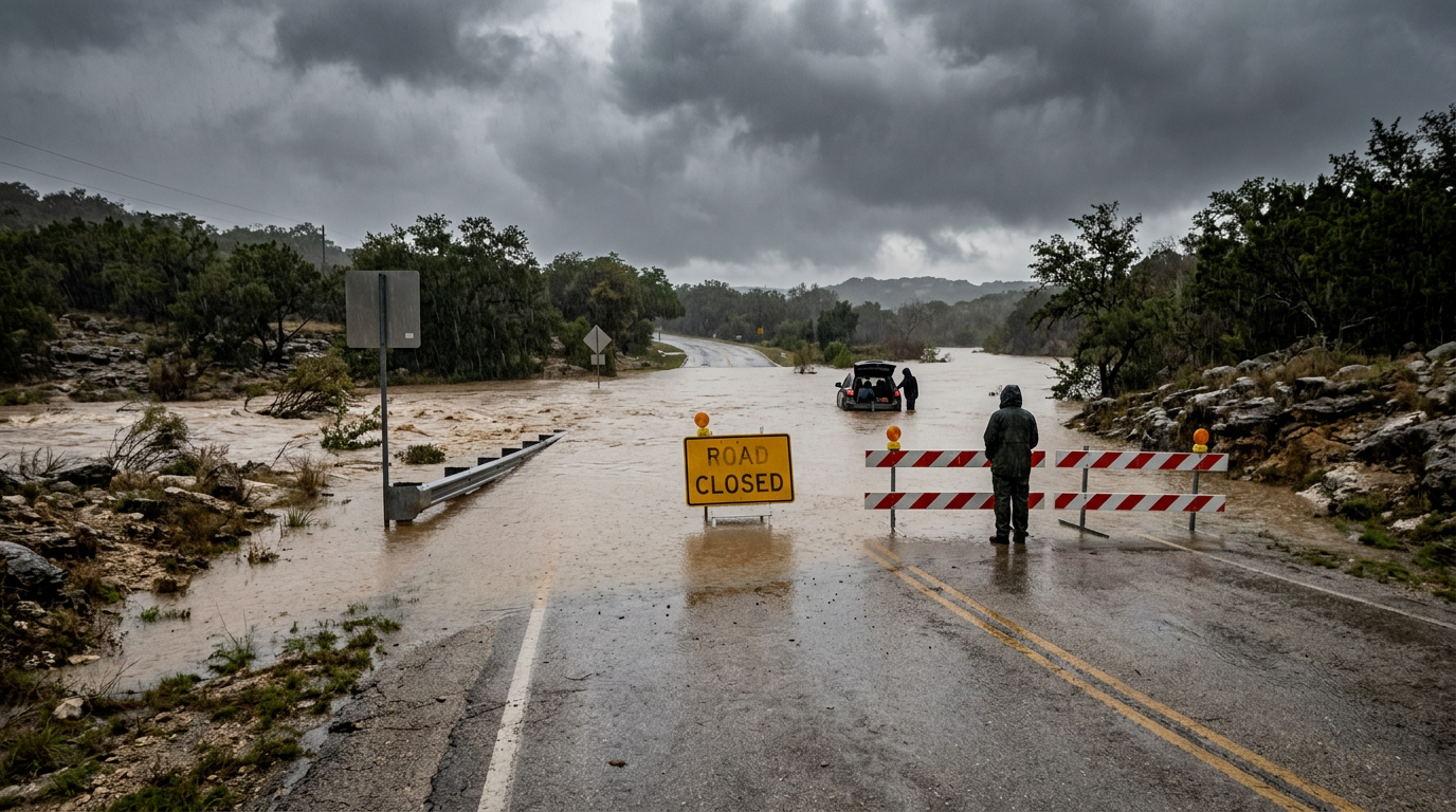
Heavy rainfall swept through Boerne on July 15, 2026, prompting city officials to close River Road as water levels began to threaten public safety. The sudden increase in precipitation intensity caught several commuters off guard, leading to immediate traffic diversions. Historically, the Texas Hill Country is susceptible to rapid runoff due to its rocky terrain and limestone bed, which prevents the soil from absorbing heavy downpours quickly. This incident follows a pattern of flash flood vulnerability in the Kendall County area, where low-water crossings often become impassable within minutes of a significant weather event. Local meteorological reports indicate that the rain began intensifying in the early afternoon, leading to the proactive decision by local authorities to seal off flood-prone sectors near Cibolo Creek. As the storm system stalled over the region, the volume of water quickly exceeded the capacity of traditional drainage systems, forcing a rapid response from municipal emergency management teams. Residents living in the surrounding hill country areas were advised to remain indoors as the surge moved downstream toward the more densely populated city center. The persistent nature of this particular storm cell suggests that Boerne may experience several rounds of high-water conditions before the system finally exits the corridor. This situation emphasizes the ongoing reality of weather volatility in Central Texas, where clear skies can transition into hazardous flash floods in less than an hour.
Texas relevance
The closure of River Road is a significant event for Boerne and the broader Kendall County region, as this thoroughfare serves as a vital corridor for local traffic and visitors to the historic downtown district. In Texas, where 'Turn Around, Don't Drown' is a standard safety protocol, the rapid rise of water in the Hill Country poses a unique threat to motorists. The geographic makeup of the region means that even moderate rain in surrounding hills can accumulate into dangerous surges in Boerne's lower elevations. Residents across Central Texas must remain vigilant during such weather patterns, as localized flooding can occur far from the center of a storm cell. This specific area of Boerne is notorious for high-water incidents, making the current closure a critical safety measure for the community. Furthermore, as Boerne continues to grow in population, the impact of these road closures on regional commerce and daily commuting routes becomes more pronounced, requiring more robust communication from county officials to the public.
Immediate Traffic Impact and River Road Closure
The closure of River Road was implemented shortly after rainfall rates escalated on the afternoon of July 15. Local enforcement and city maintenance crews identified that portions of the road were no longer safe for standard passenger vehicles. By placing barriers at key intersections, the city aims to prevent water-related rescues, which frequently occur when drivers underestimate the depth or velocity of water moving across the asphalt. This specific stretch of roadway is particularly vulnerable because it sits at a low elevation relative to the adjacent banks of the creek, meaning even a minor crest can put inches of water onto the driving surface.
Traffic has been rerouted to secondary streets, causing minor delays throughout the Boerne city limits. Officials are urging residents to avoid the River Road area entirely until the water recedes and the pavement is inspected for structural integrity. The decision to close the road reflects the city's ongoing commitment to mitigating the risks associated with the volatile weather patterns common to the Hill Country. In addition to police presence, electronic signage has been deployed to ensure that tourists unfamiliar with the local terrain do not inadvertently wander into a flood zone while looking for downtown attractions.
The ripple effect of the closure has been felt on nearby Highway 46 and Main Street, where displaced drivers have sought alternative routes. Local business owners along the River Road corridor have also taken precautions, with many placing sandbags at entrances to prevent minor seepage if the water continues to climb. While no structural damage to buildings has been reported yet, the city remains in a state of high alert as long as the rain continues to fall with high intensity.
Geographic Factors Influencing Boerne Flooding
Boerne’s physical location makes it a funnel for runoff from the north and west. Because the city is built around the banks of Cibolo Creek and other smaller tributaries, it serves as a natural collection point for rainwater moving toward the Gulf Coast plains. The limestone bedrock that characterizes much of the Texas Hill Country acts as a barrier to absorption, meaning that moisture remains on the surface and moves quickly into drainage channels. This 'flashy' nature of the watershed means that the delay between a downpour and a flood is incredibly short compared to other Texas regions with sandier soil.
During this current weather event, the saturation of the ground has happened rapidly. When the soil reaches its capacity, the excess water has nowhere to go but into the streets and lowest points of the topography. River Road, situated near the water's edge, is notoriously the first major infrastructure piece to suffer during these environmental shifts, requiring constant monitoring by the Boerne Public Works department. Geologists often note that the Edwards Plateau, which Boerne sits upon, is one of the most flash-flood prone regions in the United States due to these exact physical characteristics.
The impact is further exacerbated by the varying elevations within Kendall County. Higher terrain to the west can receive rain that doesn't immediately cause issues locally, but hours later, that water arrives in the Boerne city limits as a fast-moving surge. This necessitates a 'look upstream' approach to flood management, where officials must track weather radar miles away to predict how the water levels at River Road will change in the coming hours.
Emergency Response and Public Safety Measures
Public safety departments in Kendall County have been placed on high alert as the storm system moves through the region. First responders are monitoring known low-water crossings and are prepared to deploy swift water rescue teams if necessary. The objective is to ensure that no motorist is trapped by the sudden surges that can occur in the Boerne area, especially during the late afternoon and evening hours when visibility is reduced. Crews have been stationed near known 'hot spots' to allow for a faster response time should a vehicle become disabled in the rising tide.
Local officials have reminded the public that just six inches of fast-moving water can knock an adult off their feet, and twelve inches can sweep away a small car. The closure of River Road is just one part of a comprehensive emergency management plan designed to keep residents informed and out of harm's way. Barriers will remain in place until weather reports indicate a significant decrease in rain probability and creek levels stabilize. Safety officials emphasize that even after the rain stops, the danger persists until the runoff from higher elevations has fully passed through the system.
Collaboration between the Kendall County Sheriff’s Office and Boerne Police is vital during these events to manage the flow of traffic around the closed zones. They utilize a network of remote cameras and water sensors to track the depth of the water in real-time. This technology allows them to pull the trigger on road closures precisely when the data suggests a safety threshold has been crossed, rather than waiting for a visual confirmation that may come too late to prevent an accident.
Historical Context of River Road Infrastructure
River Road has long been a point of focus for Boerne's urban planners. Over the decades, various drainage improvements have been made to try and lessen the frequency of closures, yet the power of the Hill Country's flash floods often exceeds the capacity of modern engineering. Local residents are well-accustomed to these temporary disruptions, though recent years have seen more frequent and intense rain cycles that challenge existing infrastructure. The road's history is essentially a history of the city's relationship with Cibolo Creek—a balance between utilizing the scenic waterway and respecting its destructive potential.
In the past, similar storms have caused damage to the landscaping and business signage along the corridor. By closing the road early, the city not only protects drivers but also prevents vehicles from becoming debris that could potentially clog drainage culverts or damage bridge supports further downstream. This proactive stance is a result of years of data collection regarding how Boerne responds to concentrated moisture events. Past failures in the region, including major floods in the 1990s and early 2000s, have taught local leaders that early intervention is the most cost-effective way to manage storm risks.
Future plans for the area include potential elevation projects or the construction of more sophisticated bypasses, but the cost and environmental impact of such projects are significant hurdles. For now, the strategy remains one of tactical retreat: closing the road when nature demands it and reopening it only when safety can be guaranteed. This seasonal rhythm has become part of the cultural fabric of the town, where 'River Road is closed' serves as a local shorthand for the onset of a significant weather event.
Guidance for Residents and Commuters
For those living in or traveling through Boerne, authorities recommend staying tuned to local weather broadcasts and checking real-time traffic maps before departing. If a road is blocked by a yellow or orange barricade, motorists should never attempt to drive around it. The surface of the road underneath the water can be washed away, leaving hidden hazards that are not visible even in daylight. In some cases, the asphalt itself can be underscored by moving water, creating a sinkhole effect that only becomes apparent when a vehicle adds weight to the surface.
Property owners near the creek are also advised to secure loose outdoor items, such as lawn furniture or trash bins, which can be swept into the water and contribute to blockages. As the rain continues to pick up in intensity, the primary focus remains on the preservation of life and the prevention of unnecessary property damage in the flood zone. Residents are encouraged to report any blocked storm drains or downed trees that may further impede the flow of water through the city's drainage network.
Finally, the city asks for patience as maintenance crews work through the storm. Once the water recedes, there is often a significant amount of silt, mud, and debris left on the road surface. This material must be cleared before the road is safe for high-speed travel, as wet mud can be as slick as ice for tires. The reopening of River Road will be announced through official social media channels once a full safety inspection of the bridges and pavement has been completed.
Source attribution
This story was reported using a public release from the Texas Storm Video (Google News). Keep TX Red rewrote the coverage independently and links to the official statement for verification.
Frequently Asked Questions
- Why was River Road closed in Boerne today?
- River Road was closed due to increasing rain intensity that caused water to rise across the roadway. The City of Boerne implements these closures to prevent motorists from entering hazardous floodwaters that can sweep vehicles off the road.
- What should I do if I encounter a flooded road in Kendall County?
- You should never attempt to drive through water on the road. The safest action is to turn around and find an alternative route. Even shallow-looking water can be deep enough to stall an engine or hide a washed-out section of pavement.
- How long will the closure last?
- The duration of the closure depends on the weather. Barriers normally remain in place until the rain stops, the water recedes below the level of the road, and city crews can inspect the area for debris or damage.
Official Sources
Take the next step
Browse the Newsroom →Read more about Keep Texas Red → Our full guide to what Keep Texas Red means and why Texans support it.
Related Articles



Get Texas updates delivered weekly.
Independent Texas reporting on politics, policy, and daily life. One email a week. Unsubscribe anytime.
Keep TX Red Newsroom
The Keep Texas Red Editorial Staff produces nonpartisan explainers, policy breakdowns, and educational resources to help Texans understand how their government works. All content is reviewed for accuracy and updated regularly.
About Keep TX Red →