Severe Weather Alert: Tornado Sighting Reported Near San Antonio Metropolitan Area
Emergency officials and weather spotters confirm a tornado sighting in the San Antonio area on July 15, 2026, amid a volatile weather pattern.
Editorial disclaimer: Opinions and analysis on Keep TX Red are editorial content — not statements of fact. See our editorial standards.
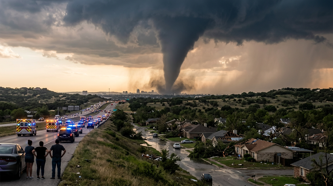
On the afternoon of July 15, 2026, a tornado was officially spotted in the San Antonio metropolitan area, triggering immediate responses from local weather observers and news outlets like FOX 7 Austin. This event occurred during a period of heightened atmospheric instability across Central and South Texas, necessitating rapid communication of safety protocols for residents in the path of the storm. Historically, the Interstate 35 corridor has been a frequent site for atmospheric collisions that produce sudden tornadic activity, particularly when Gulf moisture meets dry lines tracking from the west. The sighting serves as a stark reminder of the summer storm season's volatility in the Lone Star State, where localized convective systems can rapidly evolve into dangerous rotating cells without significant advance warning.
Texas relevance
This weather event specifically impacts the San Antonio and Bexar County regions, which serve as a primary population hub for the state of Texas. Considering the dense concentration of infrastructure and residential neighborhoods in San Antonio, even a brief tornadic touchdown can have significant implications for local commerce and public safety. Residents along the Edwards Plateau and the Balcones Escarpment are uniquely familiar with these patterns, as the local topography can often exacerbate wind shear during severe summer storm fronts. Texas residents in this corridor must maintain high levels of situational awareness given how quickly weather systems transition from the Hill Country into the dense urban centers of San Antonio and New Braunfels.
Visual Confirmation and Reporting Logistics
The sighting was corroborated by visual reports in the field, marking a significant escalation in the day's weather severity. Unlike radar-indicated rotation which relies on technology for detection, a confirmed sighting provides an immediate and undeniable confirmation of a funnel reaching the ground. This distinction often triggers more aggressive emergency sirens and mobile alert protocols throughout the impacted municipalities, as the time for theoretical preparation has passed and the time for immediate action has arrived.
Local media outlets, including FOX 7 in nearby Austin, monitored the development closely as the storm system moved through the San Antonio sector. Coordination between meteorologists and ground-level spotters is vital in these scenarios to ensure that the public receives the most accurate and real-time information possible. This specific sighting underscores the volatile nature of the current weather pattern affecting the San Antonio-New Braunfels metropolitan area, where rapid heating often fuels explosive storm growth in the late afternoon hours.
The reporting process involves a multi-tiered communication strategy. When a spotter identifies a funnel, the information is relayed to the National Weather Service, which then pushes the data to the Emergency Alert System. This system is designed to override local broadcasts and send haptic alerts to cell phones, providing a critical safety net for those who may not be watching local news. In a high-traffic city like San Antonio, these seconds can be the difference between a safe shelter and a dangerous situation on the roadways.
Historical Context of South Texas Storms
South Texas has a long history of dealing with unpredictable tornadic activity, though it is often less frequent than the activity seen in the northern 'Tornado Alley' region of the state. However, when these events occur in the San Antonio basin, the risk to life and property is heightened due to the city's status as one of the most populous in the nation. Previous incidents in the region have demonstrated that small-scale tornadoes can form rapidly within larger squall lines, often obscured by heavy rainfall or the encroaching evening darkness.
The geography of Bexar County, situated between the coastal plains and the Hill Country, creates a mixing bowl for different air masses. When hot, humid air from the Gulf of Mexico meets cooler, unstable air from the north or west, it provides the energy necessary for the rapid development of supercells. This July event is a reminder that summer heat can act as a catalyst for severe thunderstorms capable of producing rotation, challenging the misconception that tornadoes are strictly a springtime phenomenon in Texas.
Local historians and emergency planners often point to the 1997 Jarrell tornado or the 2017 San Antonio outbreaks as benchmarks for how devastating these systems can be when they interact with the unique topography of Central Texas. The Balcones Escarpment, a geological fault zone, can sometimes enhance the lift and shear required for a storm to begin rotating. This makes the I-35 corridor a high-stakes environment for weather monitoring during the summer months when atmospheric energy is at its peak.
Public Safety Measures and Infrastructure Impact
As the reported tornado tracked through the area, local authorities emphasized the importance of seeking shelter in interior rooms and avoiding windows. For a city like San Antonio, which features significant highway infrastructure including Loop 1604 and I-10, weather events like this pose a direct threat to commuters and long-haul truckers. Low visibility and high winds are often the primary drivers of traffic accidents during these sudden atmospheric shifts, creating secondary hazards for emergency responders.
Infrastructure resilience is also a key concern during tornadic sightings. Power grids and local utility providers often pre-stage crews when sightings are confirmed to address potential outages caused by downed lines or debris. In typical South Texas fashion, these storms often move with significant speed, leaving officials with a narrow window to assess damage and redirect emergency services to the hardest-hit zones. This rapid movement also means that clearing roadways of debris becomes a top priority to maintain access for ambulances and fire trucks.
The impact on local commercial centers and schools cannot be understated. San Antonio’s massive sprawl means a single storm cell can affect diverse areas, from the South Side historic districts to the high-tech corridors in the Northwest. Facility managers in these areas are trained to enact emergency protocols, bringing employees and visitors into reinforced safety zones. This proactive approach to safety is a hallmark of the Texas 'Stay Weather Aware' culture that has become standard practice for large-scale operations across the state.
Stakeholders and Emergency Management Roles
Multiple stakeholders play a role in managing a localized tornado event. The San Antonio Office of Emergency Management (SAOEM) works in tandem with Bexar County officials to coordinate the response across overlapping jurisdictions. These agencies maintain the city's network of sirens and manage the digital communication platforms that keep the public informed. Their focus is on both the immediate threat and the potential for flooding, which often follows severe tornadic storms in the San Antonio river basin.
Law enforcement agencies, including the San Antonio Police Department and the Bexar County Sheriff's Office, transition into a safety and traffic management role during these incidents. Officers are often the first to report visual debris or blocked roads, providing a boots-on-the-ground perspective that complements meteorological data. Their presence on the highways is crucial for deterring drivers from seeking shelter under overpasses, a dangerous practice that can lead to wind-tunnel effects and pile-up accidents.
The private sector, particularly large retailers and logistics hubs located near the I-35 and I-10 junction, also serves as a critical stakeholder. These entities often have their own weather monitoring systems and designated safe rooms to protect their workforce. By cooperating with local authorities and following standardized evacuation and shelter protocols, these businesses help minimize the human cost of severe weather events in a region defined by its rapid growth and industrial activity.
The Role of Skywarn and Community Spotters
Ground-level confirmation frequently comes from the Skywarn network or other trained community spotters who provide a 'human element' to meteorological data. These individuals are trained to identify the specific wall clouds and funnel formations that signify a true tornado. Their reports are channeled directly to the National Weather Service, which then updates the status of warnings for the general public. This network is particularly valuable in Texas, where the vast landscape can sometimes have gaps in radar coverage at lower altitudes.
In this instance, the sighting in the San Antonio area allowed for more precise warnings to be issued for neighborhoods in the direct line of the storm's path. While radar can identify a broad area of rotation, a visual sighting provides the exact coordinates of the threat. This collaborative effort between citizens and professional meteorologists is a cornerstone of the Texas emergency response system, fostering a community-wide culture of vigilance and preparedness.
Volunteer spotters often undergo regular training sessions provided by the National Weather Service to keep their skills sharp. They learn to distinguish between harmless 'scud' clouds and the genuine rotation of a developing funnel. By providing real-time ground truth, these volunteers help reduce the number of false alarms, ensuring that when a warning is issued, the public takes it seriously. Their contribution is especially vital during summer months when thermal updrafts can create visual anomalies that confuse automated systems.
Looking Ahead: Post-Storm Assessment and Future Preparedness
Following the sighting, the standard procedure involves a meticulous assessment of the area to determine if any damage correlates with a touchdown. If structural damage is found, the National Weather Service typically dispatches a survey team to rank the tornado on the Enhanced Fujita (EF) scale. This ranking is based on wind speed estimates derived from the level of destruction observed at the site, providing essential data for future building codes and insurance assessments in Texas.
For the residents of San Antonio and Bexar County, the immediate aftermath of such a storm involves checking on neighbors and clearing debris from roadways. Even if the tornado remains aloft or results in a brief touchdown with minimal damage, the event serves as a critical drill for the city's emergency management offices. Understanding the movement and behavior of this specific storm will likely help refine future forecasting models for the Central Texas region, particularly regarding how storms interact with urban heat islands.
Long-term recovery and preparedness remain the focus after the clouds clear. Local government agencies use these events to identify weaknesses in the warning system or areas where infrastructure could be reinforced. For individual Texans, it is an opportune time to restock emergency kits, review home insurance policies for wind coverage, and ensure that every family member knows the designated shelter spot. As Texas continues to see weather patterns become more intense and localized, the lessons learned from the July 15 event will be foundational for the state's ongoing resilience efforts.
Source attribution
This story was reported using a public release from the Texas Weather Video (Google News). Keep TX Red rewrote the coverage independently and links to the official statement for verification.
Frequently Asked Questions
- What should residents do when a tornado is spotted in the area?
- Residents should immediately move to the lowest floor of a sturdy building, ideally in an interior room such as a closet or bathroom, away from windows. If you are in a vehicle, try to find a sturdy shelter. Do not seek shelter under highway overpasses, as these can increase wind speeds and leave you vulnerable to flying debris.
- How does a confirmed sighting differ from a radar-indicated warning?
- A radar-indicated warning means that meteorological equipment has detected rotation within a storm that could produce a tornado. A confirmed sighting means that a reliable source, such as a weather spotter or law enforcement officer, has actually seen the funnel or tornado on the ground, indicating an imminent threat.
- Why is the I-35 corridor through San Antonio prone to these events?
- The region sits at a geographic transition zone where different air masses—typically dry air from the west and moist air from the Gulf—frequently collide. The elevation changes of the Balcones Escarpment can also influence wind patterns, sometimes providing the mechanical lift and rotation needed for tornado formation.
- What is the EF scale and how is it used in Texas?
- The Enhanced Fujita (EF) scale is used by the National Weather Service to rate the intensity of a tornado based on the damage it causes. After a storm, survey teams examine broken trees, damaged roofs, and destroyed structures to estimate wind speeds. This scale ranges from EF0 (weakest) to EF5 (most violent) and helps Texas officials track historical trends in storm intensity.
Official Sources
Take the next step
Browse the Newsroom →Read more about Keep Texas Red → Our full guide to what Keep Texas Red means and why Texans support it.
Related Articles



Get Texas updates delivered weekly.
Independent Texas reporting on politics, policy, and daily life. One email a week. Unsubscribe anytime.
Keep TX Red Newsroom
The Keep Texas Red Editorial Staff produces nonpartisan explainers, policy breakdowns, and educational resources to help Texans understand how their government works. All content is reviewed for accuracy and updated regularly.
About Keep TX Red →