Severe Texas Storms: Radar Confirms Tornado Near Major City Amid Flash Flood Emergency
A radar-confirmed tornado and widespread flash flooding strike Texas on July 15, 2026, creating dangerous conditions near major urban centers.
Editorial disclaimer: Opinions and analysis on Keep TX Red are editorial content — not statements of fact. See our editorial standards.
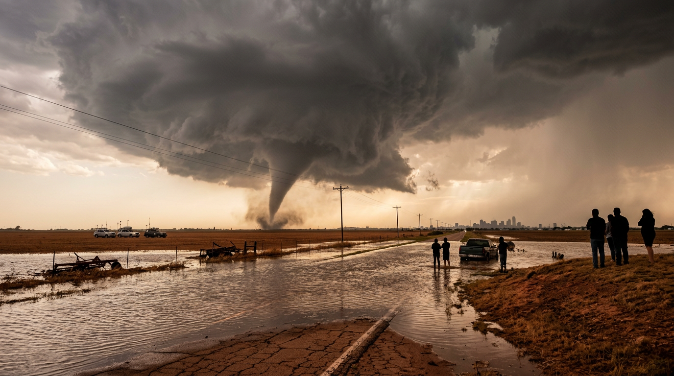
On July 15, 2026, a severe weather system moved through Texas, resulting in a radar-confirmed tornado landing near a major metropolitan area. This touchdown occurred as the state was already struggling with widespread and persistent flash flooding, complicating emergency response efforts across the region. The National Weather Service tracked the rotation through radar imaging, allowing for immediate warnings to be issued to residents in the direct path of the storm. Historically, Texas often faces a dual threat of wind and water during the mid-summer months, where tropical moisture meets cold fronts to create volatile atmospheric conditions. This specific event follows a pattern of high-intensity storm cells that have increasingly impacted the state's urban corridors over the last several years. By observing the distinct signature of a debris ball, meteorologists were able to determine that this was not merely a threat of potential rotation, but an active event on the ground that required immediate life-safety precautions. The sheer volume of water accompanying this system saturated the local landscape, ensuring that even after the wind threat subsided, the danger remained through rising water levels across key drainage basins.
Texas relevance
Residents in Texas, particularly those near the state's major population centers, are directly impacted by this intersection of tornadic activity and severe rain. In North and Central Texas, the infrastructure is often tested by rapid-onset flooding, which can turn suburban streets into dangerous waterways within minutes. This specific event serves as a critical reminder for Texans about the necessity of having multiple ways to receive weather alerts, as the radar-confirmed nature of the tornado meant that touchdown was imminent or already occurring when the localized data was processed. The local stake is high, as these storms threaten both physical property and the safety of the millions of people living in the state’s urban triangle. The geographical spread of these storms emphasizes the vulnerability of Texas highways, where thousands of commuters navigate areas that lack sufficient natural drainage during peak rainfall events.
The Mechanism of Radar Confirmation
A radar-confirmed tornado represents a high level of certainty for meteorologists and local emergency management. Unlike a 'radar-indicated' storm, which shows signs of rotation that might lead to a tornado, a confirmed status usually involves radar detecting a debris ball. This occurs when the tornado begins lifting objects off the ground, which the radar then identifies as non-meteorological targets. For Texans in the path, this distinction is the difference between a possibility and a confirmed reality.
The use of dual-polarization radar technology has significantly improved the ability of Texas-based weather stations to identify these threats in real-time. By analyzing the horizontal and vertical pulses of the radar, specialists can distinguish between heavy rain, hail, and the debris characteristic of a tornado touchdown. During this July 15 event, these technological tools provided the data necessary to upgrade warnings even when visibility was obscured by the ongoing torrential rainfall. This precision is vital in Texas, where rain-wrapped tornadoes are frequent and often impossible to spot with the naked eye until they are extremely close.
Relentless Rainfall and Urban Flooding
The flash flooding accompanying this storm system has been described as relentless, saturating the ground and overwhelming drainage systems. In many major Texas cities, the asphalt and concrete surfaces prevent water from being absorbed into the ground, leading to dangerous runoff. This creates a situation where even minor low-lying areas become impassable for standard vehicles, leading to high-water rescues and road closures. The volume of water falling in such a short window essentially bypasses the intended capacity of local storm drains.
Flash flood warnings were issued in tandem with tornado watches, creating a complex safety scenario for residents. While the standard advice for a tornado is to seek shelter in an interior room on the lowest floor, flooding risks sometimes complicate this by forcing residents to avoid basements or ground-level areas prone to water ingress. This dual threat requires a high degree of situational awareness and the balancing of differing safety protocols. Many Texans found themselves deciding between the risk of high winds above and rising waters below.
Current Impact on Regional Infrastructure
As the storm progressed, utility providers and local municipalities began reporting the initial impacts on regional infrastructure. High winds associated with the tornadic activity have the potential to down power lines and damage electrical substations, leading to widespread outages. Simultaneously, the heavy rainfall places immense pressure on the state's levee and dam systems, which are monitored heavily during such 'relentless' precipitation events. The stress on the electrical grid is often exacerbated by falling trees that have been loosened by the oversaturated soil.
Transportation across the impacted major city faced significant delays and hazards. Major highways were monitored for ponding and debris, while local airports adjusted flight schedules to account for the proximity of the tornado. The combination of wind and water creates a multifaceted challenge for repair crews, who often cannot safely begin restoration work until the secondary threat of flooding has receded. This creates a lag time between the storm's end and the return of essential services, testing the resilience of local communities.
Historical Context of Texas Summer Storms
While springtime is traditionally viewed as the peak of the tornado season in the Lone Star State, mid-summer events like this one are not without precedent. Large-scale moisture surges from the Gulf of Mexico provide the fuel, while occasional weak troughs or boundaries provide the spark. Historical data shows that these summer events can be particularly dangerous because they occur during a time when the public may not be as 'weather-aware' as they are during the volatile months of April and May.
Previous major flood events in Texas cities, such as those seen in Houston or Dallas over the past decade, have rewritten the record books for rainfall totals. This specific July 15 event follows that trend, where the total accumulation of water over a 24-hour period can exceed several inches, surpassing the monthly average for some regions in a single afternoon. Adapting to this 'new normal' involves both individual preparation and large-scale state planning for water management.
Emergency Response and Public Safety Measures
Local emergency management agencies in the affected areas activated their emergency operations centers to coordinate the response. This includes deploying first responders to areas with the highest risk of structural damage or flooding trapping. Public safety officials used various communication channels, including wireless emergency alerts and local sirens, to ensure that the radar-confirmed status of the tornado reached as many people as possible. Effective inter-agency communication is the backbone of these operations, ensuring that police, fire, and EMS are not sent into zones where flooding has rendered roads structurally unsound.
The priority for these agencies remains life safety and the prevention of avoidable accidents. Motorists are consistently reminded through the 'Turn Around, Don't Drown' campaign not to drive through flooded roadways, which remains a leading cause of weather-related casualties in Texas. As the storm system continues to move through the state, these measures remain in place to protect the public from the secondary effects of the storm, such as downed lines and weakened structures. The state's volunteer organizations, including various search and rescue teams, also remain on standby to assist with the aftermath.
Long-Term Stakeholders and Recovery Factors
The stakeholders in these weather events extend beyond the immediate residents to include insurance providers, agricultural interests, and state legislators. The cost of damage from combined wind and flood events can run into the hundreds of millions, affecting insurance premiums for all Texans. For farmers and ranchers on the outskirts of the major cities, the flooding can be both a blessing for parched land and a curse for ripening crops, depending on the duration of the standing water.
Looking forward, the focus will shift from immediate safety to the assessment of structural damage. Municipalities will likely review the performance of their drainage basins to determine where overflow occurred and how to prevent it in future seasons. For the average Texan, the aftermath of this event will involve cleaning up debris, filing insurance claims, and preparing for the next inevitable wave of subtropical weather. The resilience of the Texas spirit is often tested by these elements, but the community focus on rebuilding remains a consistent theme.
Analysis
OPINION: The intersection of heavy urban development and increasing storm volatility in Texas is reaching a critical juncture. While emergency communication technology has improved, allowing for 'radar-confirmed' status to reach smartphones faster than ever, the physical infrastructure of our major cities remains a bottleneck. Flash flooding is no longer a peripheral concern; it is a primary threat that rivals wind damage in both cost and casualty potential. The state must continue to prioritize comprehensive drainage upgrades and bridge reinforcements to ensure that during these 'relentless' events, our population centers do not become traps for trapped motorists and residents.
Source attribution
This story was reported using a public release from the Texas Weather Video (Google News). Keep TX Red rewrote the coverage independently and links to the official statement for verification.
Frequently Asked Questions
- What is the difference between radar-confirmed and radar-indicated?
- A radar-indicated tornado means that weather radar has detected rotation within a storm that could produce a tornado, whereas a radar-confirmed tornado means that the radar has detected actual debris or there has been a visual confirmation of the tornado on the ground. Confirmed status indicates a much more immediate and definite threat.
- How should I choose a shelter if there is both a tornado and a flood?
- General safety guidelines suggest staying on the lowest floor of a sturdy building for a tornado, but if you are in a flood-prone area or see water rising, you must avoid basements and underground areas. Seek an interior room on the lowest level that is not currently at risk of flooding.
- Why is the flooding described as 'relentless' in this storm?
- The term 'relentless' refers to the persistent nature of the rainfall, where storm cells 'train' or move over the same area repeatedly. This constant downpour prevents the ground from absorbing water and prevents drainage systems from clearing the streets, leading to sustained flood conditions.
Official Sources
Take the next step
Browse the Newsroom →Read more about Keep Texas Red → Our full guide to what Keep Texas Red means and why Texans support it.
Related Articles



Get Texas updates delivered weekly.
Independent Texas reporting on politics, policy, and daily life. One email a week. Unsubscribe anytime.
Keep TX Red Newsroom
The Keep Texas Red Editorial Staff produces nonpartisan explainers, policy breakdowns, and educational resources to help Texans understand how their government works. All content is reviewed for accuracy and updated regularly.
About Keep TX Red →