North Texas Weather Alert: Tracking Isolated Storm Potentials for the Metroplex
Meteorologists are monitoring North Texas for isolated storm developments on July 15 as humidity and afternoon heat collide over the Metroplex.
Editorial disclaimer: Opinions and analysis on Keep TX Red are editorial content — not statements of fact. See our editorial standards.
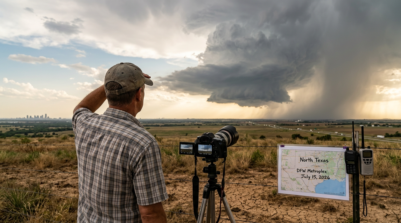
Weather conditions across North Texas are currently under close observation as meteorologists track the development of isolated storm cells throughout the region on July 15, 2026. These potential storms are the result of a typical summer atmospheric setup where high moisture levels interact with intense afternoon solar heating. While the activity is expected to be scattered rather than widespread, the intensity of individual cells can cause sudden shifts in local conditions. Historically, summer storms in this corridor are known for being unpredictable and highly localized, often affecting one neighborhood while leaving an adjacent one entirely dry. Historically, North Texas weather in mid-July is dominated by a heat dome, but small disturbances frequently pierce this shield. This current pattern follows a trend of increasing atmospheric volatility during the peak summer months in the Southern Plains. Residents across the Dallas-Fort Worth area are encouraged to maintain awareness of changing sky conditions, as these isolated cells can transition from a growing cloud to a mature thunderstorm in a relatively short timeframe. This phenomenon, often referred to as 'pop-up' convection, serves as a primary source of precipitation for the region when traditional cold fronts remain stalled far to the north.
Texas relevance
This weather event is centered specifically on North Texas, directly impacting the millions of residents living within the Dallas, Fort Worth, and Denton metropolitan areas. Texas weather is inherently volatile due to the convergence of dry air from the West and humid air from the Gulf of Mexico. For local commuters on major arteries like I-30, I-35, and the Dallas North Tollway, even isolated storms can lead to significant disruptions. The stability of the Texas power grid and the management of local water runoff also depend heavily on the frequency and severity of these summer convective events.
Atmospheric Dynamics Driving the Storms
The primary driver behind the current weather activity is the combination of surface heating and low-level moisture. As temperatures rise throughout the day, the air near the ground becomes less dense and begins to rise. If there is enough moisture present, this rising air cools and condenses into clouds, eventually forming the towering cumulonimbus structures associated with thunderstorms.
In North Texas, this process is often amplified by local convergence zones. These are areas where winds from different directions meet, forcing air upward more aggressively. Even without a major cold front, these localized boundaries can serve as the spark for intense, short-lived rain events and lightning displays that characterize the July forecast. The lack of a steering current means these storms often linger over a specific area, increasing the risk of ponding.
The Stakeholders of Summer Storms
Multiple regional stakeholders are closely watching these developments beyond just the general public. Municipal water managers in cities like Arlington and Plano rely on these summer rains to maintain lake levels, which can drop rapidly due to evaporation during July and August heatwaves. Agricultural interests on the outskirts of the Metroplex also depend on these showers to sustain crops without over-relying on irrigation systems.
Construction crews and outdoor contractors comprise another major stakeholder group. In the Texas heat, work schedules are often pushed to the early morning hours to avoid peak temperatures. When afternoon storms develop, they can disrupt roofing, road paving, and residential builds. For these professionals, an accurate local forecast is not just a convenience but a critical factor in logistical planning and workplace safety.
Localized Impacts and Variability
One of the most challenging aspects of isolated storms is their high degree of variability. Unlike a large tropical system or a massive cold front, isolated storms are characterized by their small geographic footprint. A single storm cell might cover only a few square miles, dumping heavy rain and causing temporary flooding in a specific suburb while the rest of the Metroplex remains under clear skies.
Because these storms are so localized, broad-scale forecasting can only indicate the 'chance' of rain rather than a certainty for any specific address. This necessitates a proactive approach for those with outdoor plans or those traveling between cities in the North Texas region. The unpredictability of where exactly a cell will 'pop' is a standard feature of the Texas summer climate, often resulting in vast differences in rainfall totals across just a single county.
Safety Precautions and Preparedness
While isolated storms rarely reach the catastrophic levels of springtime supercells, they still pose significant risks, primarily from cloud-to-ground lightning and microburst winds. Lightning can strike several miles away from the heavy rain core, making it dangerous for those who wait until the rain begins before seeking shelter. Meteorologists stress the 'When Thunder Roars, Go Indoors' protocol as the primary defense against these systems.
Additionally, the heat index remains a concern alongside the storm threat. In the hours preceding storm development, humidity levels often spike, making the ambient temperature feel significantly hotter than the thermometer suggests. Residents are advised to stay hydrated and monitor both the radar and the heat advisories that often coincide with these summer weather patterns, especially when humidity levels exceed 60 percent.
Long-Term Climate History in the Region
North Texas has a long history of intense summer heat punctuated by these sudden convective outbursts. Looking back at historical records, the month of July often sees the transition from the wet spring months to the 'dog days' of summer. While the total volume of rain decreases compared to May, the intensity of individual events can be just as fierce, often producing small hail or damaging wind gusts known as downbursts.
In prior decades, these storms were often referred to by locals as 'heat breakers.' Even a 20-minute shower can drop the ambient temperature by 15 to 20 degrees, providing a temporary respite from the Texas sun. However, this cooling effect is usually short-lived, as the remaining moisture on the ground quickly evaporates, leading to even higher humidity levels in the hours following the storm's departure.
Impact on Infrastructure and Travel
Transportation across the North Texas region is frequently affected by sudden downpours. Visibility on North Texas highways can drop to near zero in seconds during a heavy cell, increasing the risk of multi-vehicle accidents. Furthermore, frequent cloud-to-ground lightning can occasionally impact regional airports, leading to temporary ground stops at DFW International and Love Field as ground crews move to safety.
Local municipalities also monitor these storms for their impact on drainage systems. In parts of Dallas and Fort Worth where urban development is dense, short bursts of extreme rainfall can overwhelm street gutters, leading to dangerous standing water on frontage roads. Urban planners continue to use data from these recurring summer events to improve the resilience of North Texas infrastructure and manage the vast storm drain networks.
Future Outlook and Timeline
Meteorologists expect this isolated storm pattern to persist through the end of the week. As the ridge of high pressure remains centered to the west over the Texas Panhandle and New Mexico, the North Texas region sits on the edge of the more unstable air. This 'periphery' location is prime territory for daily convective growth. Each day will likely follow a similar pattern: clear mornings, building clouds by 2:00 PM, and isolated cells through the evening commute.
What changes next will involve the movement of the high-pressure system. If it moves directly over the Metroplex, the sinking air will suppress all storm development, likely leading to more extreme heat. If it shifts further east or west, it could open the door for more organized storm complexes to track into the region from Oklahoma. For now, the 'isolated' status remains the most probable scenario for DFW residents.
Reader Context and Digital Tools
In the digital age, residents have more tools than ever to track these micro-events. High-resolution radar apps allow individuals to see storm developments in real-time at the street level. This is particularly useful for North Texans who work in landscaping, transportation, or outdoor recreation. Being able to visualize the movement of a cell even five minutes in advance can be the difference between getting caught in a downpour and finding adequate cover.
The impact on local events, such as summer youth sports and outdoor festivals, is also significant. Many local parks and recreation departments utilize automated lightning detection systems that sound sirens when a strike occurs within a predetermined radius. These systems, combined with real-time weather monitoring, have significantly reduced the number of lightning-related injuries in North Texas over the last twenty years.
Analysis
While these storms are isolated, they represent a significant variable for the Texas energy landscape. High humidity leading up to these storms increases the heat index, driving up air conditioning demand across the Metroplex. If these storms fail to materialize, the lack of cloud cover can lead to record-breaking afternoon highs, putting additional strain on the ERCOT power grid. Conversely, the lightning associated with these cells poses a risk to outdoor workers and regional transmission infrastructure. The high-risk, high-reward nature of North Texas summer cooling—where a storm brings relief but also potential hazard—remains a staple of the regional economy.
Source attribution
This story was reported using a public release from the Texas Storm Video (Google News). Keep TX Red rewrote the coverage independently and links to the official statement for verification.
Frequently Asked Questions
- Will it rain across the entire Dallas-Fort Worth area?
- No, these are isolated storms. This means that while some areas may experience heavy rain and lightning, many parts of the Metroplex will remain dry throughout the day. It is common for one side of a city to see a storm while the other remains sunny.
- What is causing these storms if there is no cold front?
- These are 'convective' storms driven by intense daytime heating. When the air near the ground gets hot enough, it rises and interacts with moisture in the atmosphere to create localized storm cells, even without a traditional frontal boundary.
- Are there any severe weather warnings currently in effect?
- Standard warnings for isolated thunderstorms are issued on a cell-by-cell basis by the National Weather Service. Residents should monitor local weather apps or radio for immediate alerts if a cell develops in their specific vicinity, as these can form very rapidly.
- How long do these isolated summer storms usually last?
- Most isolated summer cells in North Texas have a lifecycle of 30 to 60 minutes. They typically peak during the hottest part of the afternoon and begin to dissipate as the sun goes down and the surface temperature begins to drop.
Official Sources
Take the next step
Browse the Newsroom →Read more about Keep Texas Red → Our full guide to what Keep Texas Red means and why Texans support it.
Related Articles



Get Texas updates delivered weekly.
Independent Texas reporting on politics, policy, and daily life. One email a week. Unsubscribe anytime.
Keep TX Red Newsroom
The Keep Texas Red Editorial Staff produces nonpartisan explainers, policy breakdowns, and educational resources to help Texans understand how their government works. All content is reviewed for accuracy and updated regularly.
About Keep TX Red →