Statewide Emergency Response Triggered as Flash Flooding Hits Central Texas Regions
Texas activates emergency resources on July 14 as flash flooding creates dangerous road conditions and prompts water rescues across the state.
Editorial disclaimer: Opinions and analysis on Keep TX Red are editorial content — not statements of fact. See our editorial standards.
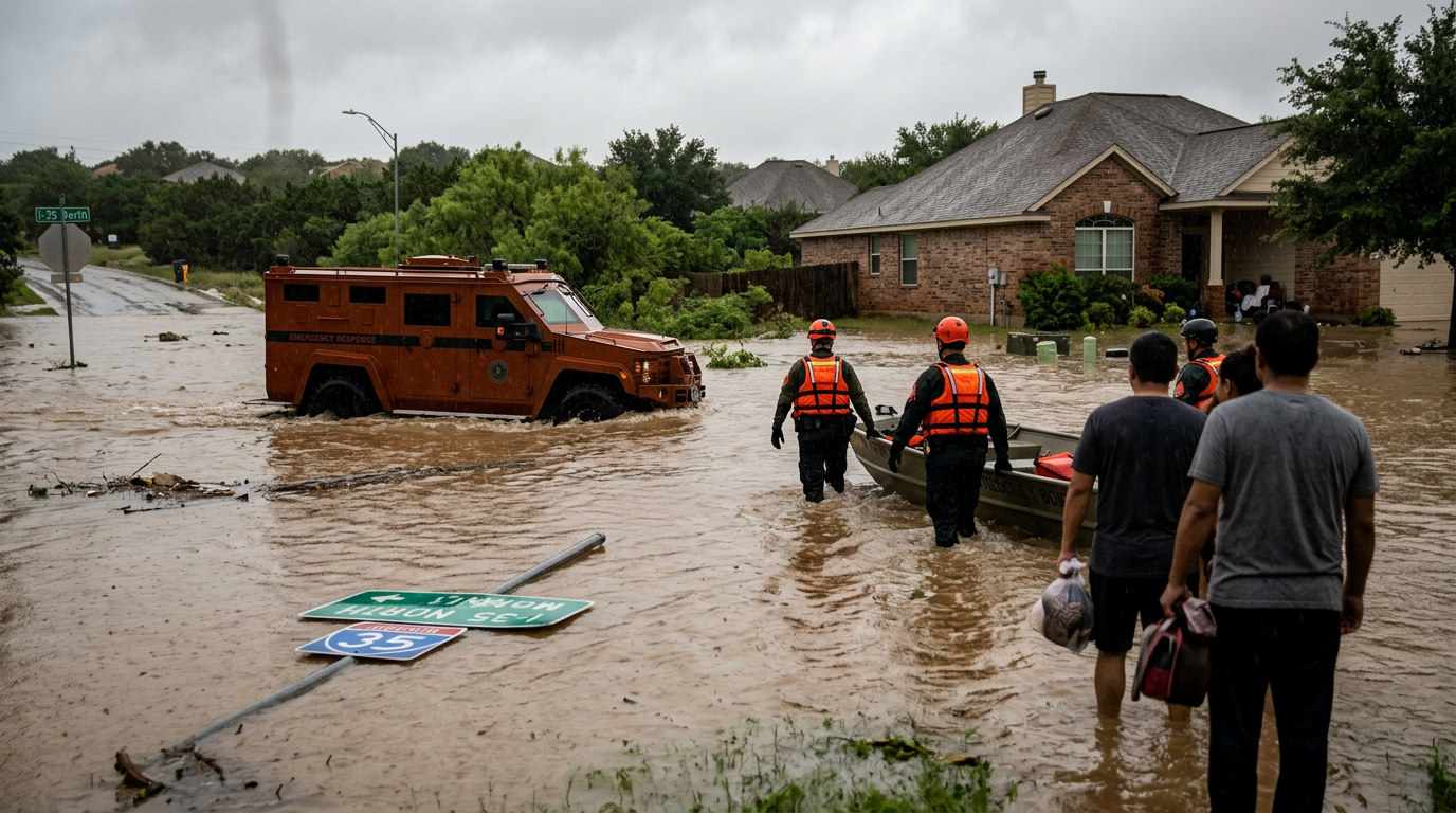
State emergency officials moved into high alert on July 14, 2026, as significant rainfall across Texas led to widespread flash flooding. The Texas Division of Emergency Management coordinated the activation of resources to assist local municipalities struggling with rising water levels. The rapid nature of the weather event prompted state leaders to mobilize assets including water rescue teams and specialized equipment to high-risk zones. This activation follows a period of intense atmospheric instability that has plagued the region throughout the week, leading to saturated ground and limited drainage capacity. Historically, Texas utilizes a tiered emergency response system where local authorities manage initial impacts before requesting state intervention. The current activation signifies that the flooding has reached a threshold where local capabilities require augmentation from state-level personnel and machinery. This proactive stance is designed to mitigate life-threats by ensuring that assets are pre-positioned near anticipated trouble spots rather than waiting for a crisis to fully manifest in isolated communities. This response strategy has been refined over decades of dealing with the unique topography of the Texas Hill Country and the Interstate 35 corridor, which are notoriously susceptible to rapid-onset flood events.
Texas relevance
The flooding event on July 14 specifically impacts Texas commuters and residents in zones prone to rapid water accumulation, such as the Hill Country and coastal plains. For Texans, these activations mean that state-funded resources are being diverted to traffic management and life-saving operations, directly affecting local infrastructure availability. In cities like Austin, San Antonio, and New Braunfels, the interaction between urban runoff and natural creek swells poses a recurring threat to the Texas grid and transit routes. This activation ensures that state troopers and emergency responders are stationed at known 'hot spots' across the Lone Star State to prevent motorists from entering lethal high-water zones.
Deployment of Regional Water Rescue Assets
The activation includes the mobilization of specialized rescue teams trained for high-water navigation. These units are equipped with flat-bottom boats and high-clearance vehicles that can navigate streets traditional emergency vehicles cannot reach. By deploying these assets early, the state aims to avoid the delays often associated with sudden road closures that isolate neighborhoods.
Local sheriff offices and fire departments across the impacted regions are working in tandem with state personnel to identify the hardest-hit areas. This collaborative effort ensures that calls for service are prioritized based on the severity of the flood threat. Residents in low-lying areas have been advised to remain vigilant as the activation remains in effect through the evening hours.
The coordination involves the Texas A&M Task Force 1 and other highly specialized urban search and rescue teams. These professionals are seasoned in the specific challenges of Texas floods, where currents can become unexpectedly strong due to the state's varied elevation and rocky terrain.
Infrastructural Impact and Road Closures
A primary concern of the emergency response is the integrity of Texas low-water crossings. These areas are notoriously dangerous during flash flood events, as just a few inches of moving water can displace passenger vehicles. State troopers and highway maintenance crews are actively scouting these locations to implement temporary barriers where water has crested the roadway.
Beyond immediate hazards, the state is monitoring the long-term impact on drainage systems. Debris washed into culverts can exacerbate flooding by causing water to back up into residential areas. The emergency response units are tasked with reporting these blockages so that cleanup crews can be dispatched once the water levels recede safely.
Transportation officials are also keeping a close eye on major arteries like I-35 and MoPac, where large volumes of water can accumulate in underpasses. The goal is to keep these economic lifelines open while ensuring that no Texan is caught in a life-threatening situation during their evening commute.
Coordination and Command Center Operations
The State Operations Center (SOC) serves as the hub for this emergency activation. From this location, officials track weather patterns in real-time and allocate manpower to the sectors where rainfall is heaviest. This centralized approach allows for a more efficient distribution of resources than if each county acted entirely in isolation.
Data from the National Weather Service is fed directly into these command posts, allowing for predictive modeling. This helps the state anticipate which rivers and creeks will crest next, providing a crucial window for evacuation orders or road closures before the situation becomes life-threatening.
The SOC also acts as a liaison between energy providers and emergency crews. Ensuring that critical infrastructure remains powered—or that power is safely cut in areas with submerged electrical boxes—is a vital component of the day's operations. This integrated strategy minimizes secondary hazards like electrocution or gas leaks.
Stakeholders and Community Involvement
While the state provides the heavy machinery, the success of these activations often rests on the cooperation of local stakeholders. River authorities, such as the Lower Colorado River Authority (LCRA), work closely with state emergency managers to control dam releases and manage flow rates. This technical coordination prevents downstream communities from experiencing artificial surges during an already natural crisis.
Non-profit organizations and volunteer groups are also integrated into the state's framework. Groups like the Texas Baptist Men or local food banks often begin staging resources early in an activation, preparing to provide meals and supplies if the flooding leads to prolonged displacements.
Communication with the public is maintained through various digital channels. State leaders utilize emergency broadcast systems and social media to provide direct instructions to residents. This multi-platform approach ensures that even those in rural areas or without traditional television access receive the necessary safety warnings.
Public Safety Protocols: Turn Around Don't Drown
State officials are reiterating the importance of the 'Turn Around Don't Drown' campaign during this activation. A significant percentage of flood-related fatalities in Texas occur when drivers attempt to navigate through water covering the road. The emergency response teams are tasked with educating the public and enforcing closures to prevent these avoidable tragedies.
Residents are encouraged to sign up for local emergency alerts and keep emergency kits on hand. As the state resources remain deployed, the focus shifts regularly from active rescue to preventative measures. This includes ensuring that power companies are informed of potential substation flooding that could lead to outages across the region.
The physical force of moving water is often underestimated. State responders emphasize that just six inches of fast-moving water can knock over an adult, and twelve inches can carry away a small sedan. These statistics are the driving force behind the aggressive road closure policies seen during this July 14 event.
Long-Term Recovery and Future Planning
While the current focus is on immediate safety, the state activation also sets the stage for damage assessment. Once the flooding subsides, these same emergency units will transition into documenting the impact on public infrastructure. This documentation is vital for securing state and federal funding for repairs and future flood mitigation projects.
The frequency of these activation events in Texas has led to calls for reinforced drainage infrastructure. As today's event proves, the state must remain prepared for sudden shifts in weather that can saturate the landscape in a matter of hours. The emergency crews currently in the field represent the front line of this ongoing struggle against Texas's volatile weather patterns.
Future planning involves analyzing the data collected during this July 14 activation. Traffic flow patterns, water levels at specific crossings, and response times for rescue teams will all be reviewed. This continuous feedback loop allows the Texas Division of Emergency Management to refine their maps and improve resource allocation for the next inevitable weather event.
Analysis
The decision to activate state resources underscores a growing trend in Texas emergency management: pre-emptive mobilization. By moving equipment before the rain peaks, the state reduces the lag time during the 'golden hour' of rescue operations. However, this recurring need for emergency intervention highlights a persistent challenge for Texas lawmakers regarding infrastructure. While the immediate response saves lives, the long-term fiscal impact of repetitive flood damage to state highways and local bridges remains a significant point of discussion in the legislature. This event serves as a reminder that as the Texas population grows in flood-prone zones, the demand for these high-cost state activations will likely increase.
Source attribution
This story was reported using a public release from the Texas Emergency Video (Google News). Keep TX Red rewrote the coverage independently and links to the official statement for verification.
Frequently Asked Questions
- What does a state emergency activation mean for civilians?
- It means the state is mobilizing personnel and equipment, such as water rescue teams and high-clearance vehicles, to assist local authorities in managing a crisis that exceeds local capabilities. For civilians, it often means more road closures and a larger police presence near flooded areas.
- Why is flash flooding so dangerous in Texas specifically?
- Texas has unique geography, including the Hill Country, where rain runs off rocky terrain quickly into creeks and rivers, causing water levels to rise with very little warning. This is often referred to as 'Flash Flood Alley.'
- How can I stay updated on road closures and flood levels?
- Residents should monitor local news, use state-verified traffic apps like DriveTexas.org, and follow the Texas Department of Transportation (TxDOT) for real-time updates on flooded roadways and highway status.
- What should I do if I see a flooded road without a barrier?
- Never attempt to cross it. Report the location to local non-emergency services if possible, but prioritize your own safety by turning around and finding an alternate route. Many Texas roads flood too quickly for crews to place barriers at every crossing immediately.
Official Sources
Take the next step
Browse the Newsroom →Read more about Keep Texas Red → Our full guide to what Keep Texas Red means and why Texans support it.
Related Articles



Get Texas updates delivered weekly.
Independent Texas reporting on politics, policy, and daily life. One email a week. Unsubscribe anytime.
Keep TX Red Newsroom
The Keep Texas Red Editorial Staff produces nonpartisan explainers, policy breakdowns, and educational resources to help Texans understand how their government works. All content is reviewed for accuracy and updated regularly.
About Keep TX Red →