Severe Flood Warning Issued for Texas Hill Country and Edwards Plateau Tonight
Meteorologists warn of major flooding risks across Central Texas and the Edwards Plateau as heavy storms move in on July 14.
Editorial disclaimer: Opinions and analysis on Keep TX Red are editorial content — not statements of fact. See our editorial standards.
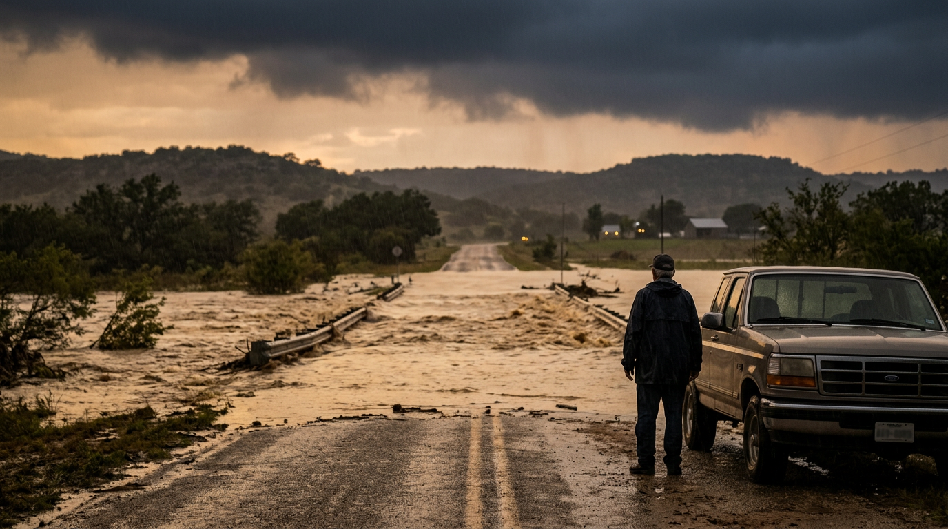
Weather authorities have identified an imminent threat of heavy flooding for several regions in Texas on the night of July 14, 2026. The Texas Hill Country and the Edwards Plateau have been singled out as the areas facing the most significant danger from the incoming storm systems. According to reports from the Texas Storm Chasers, the atmospheric conditions present a serious risk that could lead to rapid water rise and hazardous travel conditions throughout these specific sectors of the state. Historically, the Edwards Plateau and Hill Country are susceptible to rapid runoff due to the rugged terrain and limestone-rich geography, which often prevents soil from absorbing water efficiently during intense downpours. This specific weather event is driven by a deep plume of tropical moisture that is currently colliding with the unique topography of Central Texas, creating a scenario where localized rainfall amounts could exceed several inches in a very short duration.
Texas relevance
Residents in Central Texas and the western reaches of the Hill Country are under direct threat from this weather event. This region includes several key population centers and popular outdoor recreation areas where rapid flooding can trap motorists or campers. In Texas, flash flooding is consistently one of the leading weather-related causes of property damage and personal injury, making any high-level alert for the Edwards Plateau a matter of critical public safety for the local community. The state has a long-standing history of managing 'Flash Flood Alley,' and tonight's forecast serves as a reminder of the inherent geographic vulnerabilities found in the heart of Texas.
Geographic Areas at the Highest Risk
The primary focus of the current weather alert is centered on the Edwards Plateau and the Texas Hill Country. These areas are characterized by hills and rocky terrain that contribute to quick-flowing runoff into creek beds and low-water crossings. When heavy moisture moves over these regions, the water concentrates quickly in valleys, often catching those in low-lying areas by surprise.
Forecasters indicate that the intensity of the rainfall expected tonight could overwhelm local drainage systems. This is not a localized rain event but a broad system that is expected to drop significant volume across multiple counties. Public safety officials typically advise against any non-essential travel in these zones once the heavy rain commences due to the unpredictable nature of Texas flash floods.
Counties surrounding the San Antonio and Austin corridors are particularly vulnerable, as the urban sprawl onto the Edwards Plateau creates more impervious surfaces. This means that instead of water soaking into the ground, it flows immediately toward the nearest stream. For residents in cities like Kerrville, Fredericksburg, and Boerne, the natural drainage basins are expected to reach capacity rapidly as the storm system entrenches itself over the region.
Timing and Storm Evolution
The timeline for the flooding threat is concentrated on the evening and overnight hours of July 14, 2026. Nighttime flooding is particularly dangerous because it is more difficult for drivers to gauge the depth of water on the roadway. The Texas Storm Chasers have emphasized that the threat level is high, suggesting that the volume of rain expected over a short period is the primary concern for emergency planners.
As the storm system progresses, it is expected to stall or slow down over the Edwards Plateau. This slow movement is a classic precursor to major flood events in the Lone Star State, as it allows rain to accumulate in the same watershed for several hours. Residents are encouraged to stay tuned to local weather updates as the system evolves throughout the night.
The danger doesn't stay confined to the initial downpour. Often, the peak flood stage for regional rivers occurs hours after the rain has stopped as the runoff works its way through the intricate network of Texas waterways. Emergency management teams are coordinating with the National Weather Service to monitor river gauges along the Frio, Llano, and Guadalupe rivers, which are often the first to swell under these conditions.
Historical Context for Texas Flooding
The Texas Hill Country is often referred to as 'Flash Flood Alley' due to its unique meteorological and topographical features. The region sits at a crossroads where warm, moist air from the Gulf of Mexico often meets cooler fronts or terrain-forced lifting. This combination has historically led to some of the most record-breaking rainfall events in American history, including the catastrophic floods that have impacted the region over the last century.
Preparation for these events in Texas has become more sophisticated over the years, with increased sensor arrays in riverbeds and better satellite tracking. However, the fundamental risk remains the same: the ground in the Edwards Plateau is often too hard to soak up massive amounts of water quickly. This leads to a high percentage of rainfall becoming immediate surface runoff, which fuels the rapid rise of local rivers.
State leaders have historically invested millions into flood mitigation and roadway signage to warn against crossing flooded streets. Despite these technological and infrastructural advances, the sheer power of Texas storms often proves to be a challenge. The 2026 event is a continuation of this cycle, demanding that new residents and long-time locals alike remain vigilant as climate patterns fluctuate.
Impact on Transportation and Public Safety
Low-water crossings are the most significant hazard for residents in these regions during tonight’s storm. Texas has thousands of these crossings, many of which are located in the Hill Country and the Edwards Plateau. These areas can go from dry to impassable in a matter of minutes, and even a few inches of moving water can be enough to sweep a vehicle off the road.
Emergency services across the impacted counties are likely to be on high alert throughout the night. High-water rescues are a common necessity during major flooding threats of this magnitude. Residents should remember the standard safety protocol: 'Turn Around, Don't Drown.' Attempting to cross a flooded roadway is the most frequent cause of weather-related fatalities during events like the one forecast for tonight.
Stakeholders in the transportation sector, including TxDOT, often monitor high-risk bridges and underpasses during such alerts. As the moisture builds over the Edwards Plateau, road closures may be implemented without warning. For those living in rural areas, the threat of being cut off from main roads is high, as the small bridges designed for low-flow conditions are easily topped by flash flood debris and surges.
Weather Patterns and Moisture Influx
The current threat is driven by an influx of atmospheric moisture that is being funneled directly into the heart of Texas. When this moisture interacts with the rising elevation of the Edwards Plateau, it creates a 'lifting' effect that enhances rainfall totals. This lifting, known as orographic lift, is a major reason why the Hill Country often receives much higher rainfall totals than the surrounding flatlands.
Meteorological data suggests that the storms tonight could produce rainfall rates of several inches per hour in the most intense cells. If these cells train over the same area—a phenomenon where storms follow each other like train cars—the flooding potential increases exponentially. This specific pattern is what has triggered the major flooding warning for the Edwards Plateau tonight.
The presence of a stalled frontal boundary near the region is further exacerbating the risk. This boundary acts as a conveyor belt, repeatedly drawing in moist air from the South. Such setups have historically led to multi-day flooding events, and while the current focus is on the night of July 14, officials are watching the potential for saturated soils to make subsequent rainfall events even more hazardous over the coming week.
Preparedness for Rural Landowners and Campers
Rural property owners in the Edwards Plateau face unique challenges during major flood threats. Livestock management becomes a priority, as floodwaters can rapidly cut off grazing pastures from safe high ground. Ranchers are often advised to move herds to elevated locations well before the heavy rain develops to prevent animals from being trapped in rising creek bottoms.
For recreational visitors and campers along the Blanco and Guadalupe rivers, tonight’s warning is especially critical. The 'hill effect' can cause rivers to rise miles away from where it is actually raining, causing a sudden wall of water to move downstream into clear-weather areas. This phenomenon has led to some of the most tragic incidents in Hill Country history, making it vital to monitor weather apps and emergency radios even if the sky seems clear at your specific campsite.
Local emergency management agencies (EMAs) often utilize reverse-911 systems to warn residents in these remote areas. Ensuring that mobile devices are set to receive emergency alerts is a foundational step in surviving a Texas flash flood event. With communication towers occasionally being knocked offline by severe storms, having a secondary way to receive news, such as a hand-cranked radio, is highly recommended for those outside of major urban centers.
Source attribution
This story was reported using a public release from the Texas Storm Video (Google News). Keep TX Red rewrote the coverage independently and links to the official statement for verification.
Frequently Asked Questions
- Which specific Texas regions are at the most risk tonight?
- The highest risk for major flooding is currently forecast for the Texas Hill Country and the Edwards Plateau. Residents in these central and western Texas areas should be prepared for sudden water rises.
- What makes the Hill Country particularly dangerous during heavy rain?
- The Hill Country features rocky soil and steep terrain that does not absorb water well. This leads to rapid runoff into streams and rivers, creating flash flood conditions much faster than in flatter parts of the state.
- Why is the flooding threat considered a 'major' concern tonight?
- The threat is elevated due to the expected volume of rainfall and the potential for storms to move slowly over the same regions, allowing water to accumulate in watersheds that are already prone to flooding.
Official Sources
Take the next step
Browse the Newsroom →Read more about Keep Texas Red → Our full guide to what Keep Texas Red means and why Texans support it.
Related Articles



Get Texas updates delivered weekly.
Independent Texas reporting on politics, policy, and daily life. One email a week. Unsubscribe anytime.
Keep TX Red Newsroom
The Keep Texas Red Editorial Staff produces nonpartisan explainers, policy breakdowns, and educational resources to help Texans understand how their government works. All content is reviewed for accuracy and updated regularly.
About Keep TX Red →