Hill Country Flash Flood Warnings Remain Active as Severe Storms Stall Over Central Texas
Emergency officials warn of life-threatening flash floods across the Texas Hill Country as storms trigger high-water rescues and road closures.
Editorial disclaimer: Opinions and analysis on Keep TX Red are editorial content — not statements of fact. See our editorial standards.
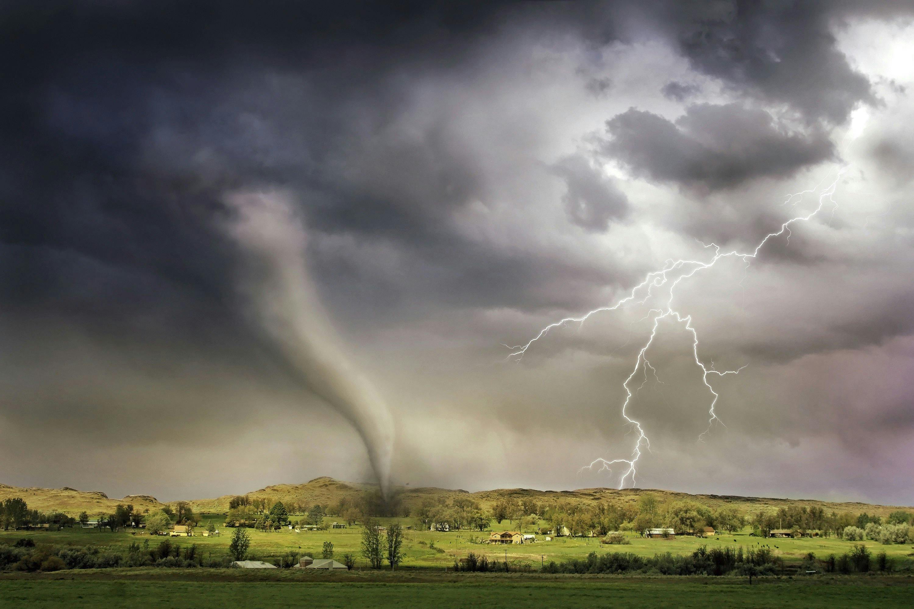
Extreme weather patterns have converged over the Texas Hill Country, resulting in life-threatening flash flood warnings that encompass several counties. On July 14, 2026, consistent heavy rainfall began saturating the region's unique karst topography, which is historically prone to rapid runoff and sudden water rises. Local emergency management agencies have already initiated response protocols as water levels in creeks and low-lying areas reached critical stages during the mid-day hours. Historically, the Hill Country is known as 'Flash Flood Alley' due to its steep terrain and thin soil, and this latest system follows a pattern of stationary fronts that trap moisture over the Balcones Escarpment. Unlike typical summer showers, this weather event involves a slow-moving atmospheric disturbance that is recycling moisture from the Gulf of Mexico, leading to rainfall rates that exceed the drainage capacity of local infrastructure. Authorities throughout the impacted zones are reporting that standard drainage systems are overwhelmed, causing immediate hazards for commuters and residents in rural subdivisions.
Texas relevance
This weather event directly impacts the safety and infrastructure of Central Texas, specifically targeting the Interstate 35 corridor and the surrounding Hill Country communities. For Texans living in Travis, Hays, Blanco, and Burnet counties, the immediate threat involves dangerous low-water crossings which serve as primary transit points for thousands of daily commuters. The state's Department of Transportation (TxDOT) has mobilized teams to monitor bridge integrity and road conditions, emphasizing that the rapid rise of water in this specific Texas region can trap motorists within seconds. Furthermore, the economic impact of stalled transportation and potential damage to Texas agricultural interests in the rural outskirts adds a layer of urgency to the state's emergency response efforts.
Historical Context of Flash Flood Alley
The Texas Hill Country occupies a geographical position that meteorologists frequently refer to as one of the most flood-prone regions in the United States. This area, stretching from the edge of the Balcones Escarpment toward the west, features rocky soil and steep limestone hills that do not absorb water efficiently. During intense rain events, the water moves rapidly into narrow canyons and riverbeds, causing what are known as 'wall of water' surges that can travel miles downstream from where the actual rain fell.
Over the past century, Texas has seen several catastrophic events in this corridor, including the historic floods of 1998 and 2015. These events serve as a sobering reminder of why modern weather alerts are so critical. The current storm system mirrors the behavior of these past disasters, characterized by a sluggish movement that allows rain to accumulate in the same basins for hours or even days, quickly turning localized showers into regional emergencies.
Emergency Response and High-Water Rescues
As of late afternoon on July 14, first responders in multiple jurisdictions have been dispatched to assist motorists who underestimated the depth of moving water. Reports from local sheriff's offices indicate that several vehicles were swept off roadways near traditional low-water crossings. Rescue teams, including specialized swift-water units, have been staged at high-risk locations to decrease response times as the rain persists.
Emergency management officials are stressing the importance of physical barriers. In many parts of rural Texas, automated gates and warning lights are used to signal when a road is impassable, but these systems can fail during extreme electrical storms. Residents are encouraged to check local county emergency portals rather than relying on visual assessments of the road, as nighttime conditions significantly increase the danger of being caught in a rising current.
Impact on Central Texas Infrastructure
The sheer volume of water is testing the limits of North and Central Texas infrastructure. Major arteries that connect rural communities to urban centers like Austin and San Antonio are seeing significant debris accumulation. Culverts designed for standard rainfall are currently blocked by uprooted vegetation and sediment, causing water to spill over onto the pavement and erode the shoulders of highways.
State engineers are particularly concerned about the long-term stability of smaller county bridges. While the primary interstate system is designed for high-capacity drainage, the secondary roads that many Hill Country residents rely on for their daily needs are frequently the first to suffer structural damage. Ongoing monitoring by local public works departments will be necessary even after the rain stops to ensure that road surfaces have not been undermined by the floodwaters.
Understanding the Meteorological Drivers
The cause of this specific deluge is a combination of a stationary boundary and an unusually high amount of precipitable water in the atmosphere. Meteorologists noted that the storm cells are 'training,' a phenomenon where new storms form and follow the exact same path as the previous ones, like cars on a train track. This leads to hyper-localized totals where one town may receive two inches while a neighbor just ten miles away receives ten inches.
This pattern is particularly dangerous in the Hill Country because the water eventually funnels into major river systems like the Guadalupe, Llano, and Colorado rivers. Even if the rain ceases in one area, the runoff from upstream can cause downstream flooding hours later. The National Weather Service continues to update the duration of these warnings as the atmospheric conditions show little sign of the front moving out of the region before the weekend.
Public Safety Guidelines and Resources
Texans are reminded that six inches of fast-moving water is enough to knock an adult off their feet, and just twelve inches can float most small cars. The pressure exerted by moving water is immense; even a heavy SUV can be pushed off the road if the water reaches the chassis. Public safety officials reiterate that motorists should never attempt to drive around barricades, as the road underneath the water may have already collapsed.
For those residing in flood plains, the recommendation is to have a 'go-bag' ready and to monitor NOAA weather radios for updates that do not rely on cellular networks, which can become congested or fail during severe weather. Local shelters are being identified by county officials in the event that evacuations become necessary for residents living near riverbanks or in low-lying mobile home parks.
Long-Term Repercussions for the Region
Beyond the immediate threat to life, these flood events have a significant impact on the Texas Hill Country's ecology and economy. The massive influx of water can flush pollutants and silt into the Edwards Aquifer, the primary water source for millions of Texans. While the rain is often welcomed during periods of drought, the violent nature of flash flooding can damage the recharge zones and lead to temporary water quality issues for municipal systems.
Tourism, a major driver for Hill Country towns like Fredericksburg and Wimberley, also takes a hit during these periods. Parks and river access points are often closed for weeks following a major flood to allow for debris removal and safety inspections. Local businesses in these areas often see a sharp decline in foot traffic, highlighting the interconnectedness of Texas weather and the local economy.
Monitoring Tools for Texas Residents
To stay informed, residents are encouraged to use the 'LCRA RiverSnort' and other real-time monitoring tools that track river levels and rainfall totals across the basin. These tools provide minute-by-minute data that can be life-saving for those living near the water's edge. Additionally, the Texas Department of Public Safety recommends downloading the official state emergency apps that provide push notifications for localized weather alerts.
Community members are also urged to look out for neighbors, particularly the elderly or those with limited mobility, who may not have access to digital alerts. In rural Texas, the tradition of checking on one's community is often the most effective form of emergency response. As the system continues to move through the area, staying home and off the roads is the single most effective way to ensure personal safety and allow emergency crews to do their work.
Analysis
Opinion: While weather events are natural, the recurring nature of these 'once-in-a-century' floods suggests that Texas must continue to prioritize robust infrastructure funding rather than temporary fixes. The rapid population growth in the Hill Country has replaced thousands of acres of permeable soil with concrete, exacerbating the runoff issues we see today. Local leaders must balance the state's economic boom with advanced hydrological planning to ensure that the charm of the Hill Country doesn't become a permanent liability during the rainy season. Relying solely on 'Turn Around, Don't Drown' campaigns is no longer sufficient; the state requires a modernized approach to drainage that accounts for the increased density of our suburban corridors.
Source attribution
This story was reported using a public release from the Texas Standard. Keep TX Red rewrote the coverage independently and links to the official statement for verification.
Frequently Asked Questions
- What should I do if I am caught in my car during a flood?
- If you are in a vehicle and water begins to rise around you, remain calm. If the water is not moving, you may be able to exit the vehicle and move to higher ground. However, if the water is moving, do not enter it. If your vehicle is swept away, stay inside until it settles. If water enters the vehicle, climb onto the roof. Always prioritize reaching a higher elevation over staying with your property.
- How can I check which Texas roads are closed due to flooding?
- The most reliable source for road closures in Texas is DriveTexas.org, managed by the Texas Department of Transportation (TxDOT). This site provides a real-time map of closures due to flooding, construction, and accidents. You can also monitor local county sheriff's office social media pages for the most immediate updates on local low-water crossings.
- Why is the Hill Country more prone to flooding than other parts of Texas?
- The Hill Country sits atop the Balcones Escarpment, where the land rises sharply. This terrain forces moist air upward, triggering rain. Additionally, the region has very thin soil over solid limestone rock. Because the rock cannot absorb water, the rainfall immediately runs off into riverbeds and streets, causing water levels to rise much faster than they would in the sandy soils of East Texas or the flat plains of North Texas.
Official Sources
Take the next step
Browse the Newsroom →Read more about Keep Texas Red → Our full guide to what Keep Texas Red means and why Texans support it.
Related Articles



Get Texas updates delivered weekly.
Independent Texas reporting on politics, policy, and daily life. One email a week. Unsubscribe anytime.
Keep TX Red Newsroom
The Keep Texas Red Editorial Staff produces nonpartisan explainers, policy breakdowns, and educational resources to help Texans understand how their government works. All content is reviewed for accuracy and updated regularly.
About Keep TX Red →