Global Seismic Activity Monitoring: Significant Pacific Earthquake Recorded with Texas Geologic Context
A major 6.4 magnitude earthquake strikes off Papua New Guinea, highlighting the importance of seismic monitoring and Texas emergency readiness.
Editorial disclaimer: Opinions and analysis on Keep TX Red are editorial content — not statements of fact. See our editorial standards.
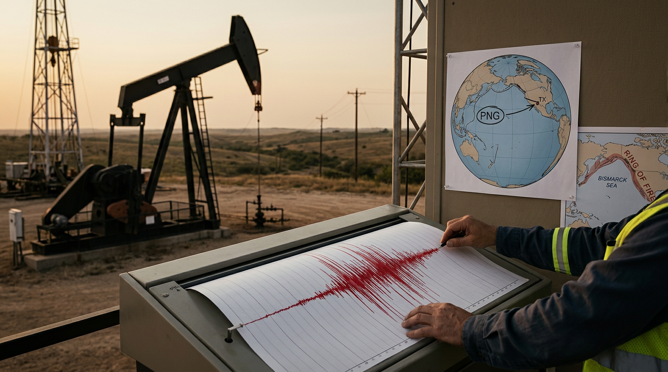
On July 13, 2026, a significant seismic event occurred in the Pacific region when a magnitude 6.4 earthquake was recorded approximately 191 kilometers southeast of Lorengau, Papua New Guinea. The United States Geological Survey (USGS) tracked the event at a depth of 10.0 kilometers, characterizing it as a shallow crustal earthquake. While the event took place in the 'Ring of Fire,' it serves as a critical data point for geological monitoring stations located throughout the United States, including those operated within the Lone Star State. This event follows a historical pattern of intense seismic activity in the Bismarck Sea region, where tectonic plate boundaries frequently shift, creating energy releases that are felt across vast oceanic distances. Texas has a storied history with seismic monitoring, dating back to the establishment of early stations that tracked both domestic and international vibrations. By observing distant tremors like this one, researchers in Texas institutions can better calibrate sensitive equipment used to monitor local activity in the Permian Basin and along the Balcones Fault. Understanding the global interconnectedness of tectonic movements allows state agencies to improve structural integrity requirements for infrastructure. This specific event, while located thousands of miles away, provides essential data regarding wave propagation that helps global analysts understand the potential risk of tsunamis or secondary tremors that could impact international shipping routes vital to Texas ports.
Texas relevance
The relevance of this Pacific earthquake to Texas lies in the shared responsibility of seismic data integration and the economic ties between the Gulf Coast and Pacific trade routes. Texas maintains one of the most robust seismic monitoring networks in the country, TexNet, managed by the Bureau of Economic Geology at the University of Texas at Austin. While Papua New Guinea is distant, the same technology used to track this 6.4 magnitude event is utilized daily to monitor the increasing frequency of minor quakes in West Texas and the Eagle Ford Shale. Furthermore, Texas energy interests and maritime logistics rely heavily on the stability of Pacific infrastructure; seismic events in these regions can disrupt global supply chains that flow directly into the Port of Houston and the Port of Corpus Christi.
Technical Details of the Lorengau Seismic Event
The earthquake struck at 08:53 UTC, a time when data centers globally were synchronized to capture the primary and secondary waves. The 6.4 magnitude classification places this event in the 'strong' category, capable of causing significant damage to poorly constructed buildings, though its offshore location mitigated initial reports of human casualties. The USGS utilized its 'PAGER' system, which resulted in a green alert level, suggesting a low probability of fatalities and economic losses due to the epicenter's distance from major population centers.
A depth of 10 kilometers is considered shallow in geological terms, meaning the energy released has less crust to travel through before reaching the surface. This often results in more intense shaking at the epicenter compared to deep-focus earthquakes. For Texas researchers, shallow quakes are of particular interest because many induced seismic events in the central United States also occur at relatively shallow depths, making the wave behavior of this Papua New Guinea event a useful comparative model for local study.
The Texas Connection to Pacific Seismic Activity
Texas is not often the first state people associate with earthquakes, yet the state is home to several significant fault lines and regions of industrial-related seismic activity. The data from large international events like the 6.4 magnitude quake near Lorengau is transmitted to facilities such as the Cecil and Ida Green Texas Seismological Network. These facilities use global data to verify the precision of their sensors, ensuring that when a tremor occurs in Scurry County or the Delaware Basin, the readings are accurate and reliable for public safety alerts.
Additionally, the Texas economy is a maritime economy. Events in the South Pacific can trigger tsunami warnings that affect the entire Pacific Rim, impacting the movement of goods destined for the United States. While this specific event did not trigger a massive trans-oceanic wave, the protocols followed by Texas emergency management teams during these windows are vital practice for real-world scenarios. It highlights the need for continued investment in the state's own early warning systems and infrastructure resilience.
Infrastructure and Building Codes in Focus
When powerful earthquakes occur globally, engineers in Texas take note. The state’s rapid population growth has led to massive construction projects in areas previously thought to be seismically inactive. Modern building codes in cities like Austin and San Antonio are beginning to reflect a more nuanced understanding of soil dynamics and vibration resistance. Analyzing how structures in Papua New Guinea survived or failed during a 6.4 magnitude shake provides empirical evidence that can be used to refine Texas construction standards.
There is also the consideration of the Texas power grid and energy infrastructure. Vast networks of pipelines crisscross the state, and many are designed to withstand significant environmental stress. Observing the effects of high-magnitude shocks on oceanic and coastal energy platforms abroad helps Texas energy producers prepare for potential shifts in the Gulf of Mexico or inland. The goal is to ensure that Texas remains the most resilient energy producer in the world, unhindered by unforeseen geological shifts.
Texas Research Institutions and Global Science
Universities across Texas, from Texas A&M to Southern Methodist University, maintain world-class departments dedicated to geophysics. These institutions often collaborate with the USGS to map the earth’s interior. A 6.4 magnitude quake provides a 'signal' that travels through the planet's core and mantle, essentially acting as a natural sonar that scientists use to see deep underground. This research is not merely academic; it has direct applications in oil and gas exploration, helping to map reservoirs more accurately.
By participating in the analysis of these events, Texas scientists maintain their status as leaders in the field. This expertise allows the state to advocate for its own interests at the federal level, particularly when discussing environmental regulations. If Texas can demonstrate a superior understanding of seismic risks through its own research, it can effectively argue against one-size-fits-all federal mandates that may not account for the specific geological realities of the Southwest.
Historical Comparison of Major Tremors
In comparison to historically devastating events, a 6.4 magnitude quake is notable but frequently occurs along the Pacific's active margins. For context, the largest earthquake ever recorded in Texas was the 1931 Valentine earthquake, which had a magnitude of approximately 6.0. The fact that an event in Papua New Guinea exceeds the strength of Texas’s historical record serves as a reminder of the power of natural forces and the importance of never becoming complacent regarding emergency preparedness.
History shows that geological activity often comes in clusters or cycles. While there is no direct evidence that an earthquake in the South Pacific triggers one in Texas, both are part of a global system of pressure and release. By studying the timeline of these occurrences, analysts can better understand the 'budget' of tectonic energy worldwide. This helps in developing long-term strategies for protecting vulnerable assets, such as historical sites in West Texas or high-density urban centers along the coastal plains.
Future Outlook for Seismic Monitoring in the Lone Star State
Looking ahead, Texas is poised to increase its density of seismic sensors. The Legislature has historically supported the expansion of TexNet to address public concerns regarding minor tremors felt in North and West Texas. Large-scale events like the one near Lorengau provide the necessary justification for these expenditures, as they demonstrate the unpredictable nature of the earth's crust. Ensuring that Texas has the best available data prevents panic and allows for a measured, fact-based response to any local activity.
Future technological integration may include AI-driven analysis of seismic waves, a field where Texas tech hubs could lead the way. By processing the massive amounts of data generated by global 6.4 magnitude events, Texas can develop more sophisticated predictive models. These models will eventually serve as the backbone for state-level emergency response plans, ensuring that the government is prepared to protect lives and property without relying on slow-moving federal bureaucracies.
Analysis
From a policy perspective, the recording of high-magnitude global events underscores the necessity for Texas to maintain its own independent geological research capabilities. Critics often argue that overseas seismic events have little impact on domestic life, yet the reality of a globalized economy means that a major disaster in a key shipping lane can have immediate inflationary effects at Texas grocery stores and gas stations. By remaining a leader in geological sciences, Texas ensures that its unique soil compositions and fault lines—such as those near Dallas or El Paso—are understood within the context of global tectonic shifts. This provides a scientific basis for resisting federal overreach in land management by proving that Texas possesses the expertise to manage its own environmental and geological safety protocols.
Source attribution
This story was reported using a public release from the USGS Earthquakes — Texas. Keep TX Red rewrote the coverage independently and links to the official statement for verification.
Frequently Asked Questions
- Why should Texans care about an earthquake in Papua New Guinea?
- While the physical shaking does not reach Texas, the data gathered is crucial for Texas scientists to calibrate seismic monitoring equipment. Additionally, major events in the Pacific can impact global shipping and trade routes that are vital to the Texas economy and its major ports.
- Was there any damage reported from this 6.4 magnitude event?
- Due to the epicenter being located nearly 200 kilometers offshore, the initial reports by the USGS (PAGER Green) suggested that both human and economic losses were likely minimal. The primary impact was felt as moderate shaking in coastal communities near Lorengau.
- How does this compare to earthquakes in Texas?
- A 6.4 magnitude earthquake is significantly stronger than the vast majority of tremors recorded in Texas. For example, most quakes in West Texas range between magnitudes 2.0 and 4.0. The strongest in Texas history was a 6.0, making the Lorengau event more powerful than any recorded in the state's history.
- What is TexNet and how does it help?
- TexNet is the official Texas Seismological Network managed by the University of Texas at Austin. It provides real-time data on seismic activity within the state. Monitoring global events like the 6.4 magnitude quake helps researchers ensure that TexNet’s sensors are accurate and provide reliable information to the public and policymakers.
Official Sources
Take the next step
Browse the Newsroom →Read more about Keep Texas Red → Our full guide to what Keep Texas Red means and why Texans support it.
Related Articles



Get Texas updates delivered weekly.
Independent Texas reporting on politics, policy, and daily life. One email a week. Unsubscribe anytime.
Keep TX Red Newsroom
The Keep Texas Red Editorial Staff produces nonpartisan explainers, policy breakdowns, and educational resources to help Texans understand how their government works. All content is reviewed for accuracy and updated regularly.
About Keep TX Red →