Central and South Texas Face Extreme Flooding Following 11 Inches of Rainfall
Massive rainfall totals have triggered flooding in Central and South Texas, with some areas reporting up to 11 inches of water accumulation.
Editorial disclaimer: Opinions and analysis on Keep TX Red are editorial content — not statements of fact. See our editorial standards.
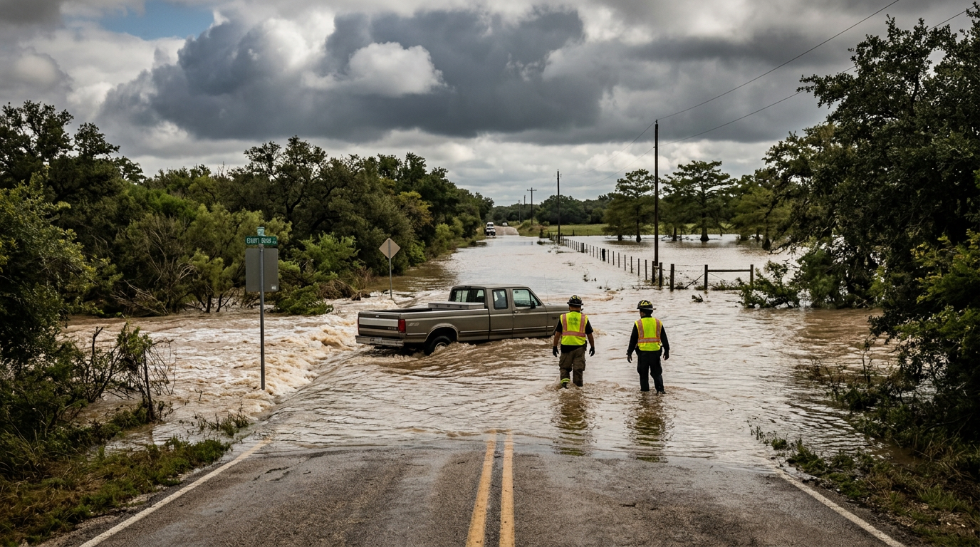
Heavy atmospheric instability across the Lone Star State has culminated in a significant weather event, with rain gauges in Central and South Texas recording as much as 11 inches of precipitation. This deluge, occurring in mid-July, has transformed dry creek beds into rushing torrents and inundated low-lying roadways across several counties. Local authorities and emergency services have been placed on high alert as the water levels continue to challenge existing drainage infrastructure and rural low-water crossings. Historically, this region is no stranger to 'Flash Flood Alley' dynamics, where rapid accumulation on limestone terrain leads to immediate runoff. The current event follows a pattern of intense, localized storms that can drop a month's worth of rain in several hours, a phenomenon that has historically shaped the Texas landscape and its water management policies. This specific event demonstrates the sheer unpredictability of July weather systems in the region, which often alternate between extreme heat waves and tropical-infused moisture surges that overwhelm local systems. The historical context of flooding in the Hill Country and the San Antonio basin is grounded in the geography of the Balcones Escarpment. This geological feature serves as a literal wall that forces moist air upward, leading to the rapid cooling and condensation that generates these massive 11-inch downpours. Previous major flood events, such as those in 1998 and 2002, serve as the benchmark for local emergency preparedness teams. By comparing this current 11-inch event to past data, meteorologists can better predict which rivers, such as the Guadalupe or the Frio, are likely to crest above flood stage. The resilience of the state’s emergency alert systems is being put to the test as officials work to provide real-time updates to millions of residents scattered across several distinct geographic zones.
Texas relevance
Residents in Central and South Texas are the primary stakeholders in this developing situation, as the 11-inch rainfall totals directly impact communities from the San Antonio metro area out toward the Hill Country. Texas infrastructure, specifically in the I-35 and I-10 corridors, often faces significant strain during these 'rain bombs' where volume exceeds the capacity of culverts and urban drainage systems. For Texans, these floods represent more than just a commute delay; they affect property values, agricultural yields, and the essential safety of the state's highly traveled secondary roads. The recurring nature of such events in the state underscores the ongoing need for robust flood mitigation efforts and constant vigilance by the Texas Department of Transportation and local emergency management coordinators. The economic reality for Texans involves balancing the benefits of replenishing the Edward’s Aquifer with the immediate physical damage inflicted on homes and municipal property by rapid water surges.
Rainfall Totals and Geographical Impact
The sheer volume of water reported in this event has caught many by surprise, even in a state known for its dramatic weather shifts. Reports indicate that the highest concentrations of rainfall, reaching the 11-inch mark, were concentrated in specific pockets where storm cells stagnated. This lack of movement allowed moisture to dump continuously over the same watersheds, leading to a rapid rise in river and stream levels that exceeded initial forecasts. The geographic spread of this event covers a wide swath of the state, from the coastal plains to the rocky elevations of the interior.
While the most severe flooding was reported in South and Central Texas, the ripple effects are being felt throughout the surrounding counties. In rural areas, the ground quickly reached a point of saturation, meaning any additional moisture immediately became runoff. This has led to the pooling of water in fields and pastures, posing various challenges for the regional agricultural sector which often oscillates between drought conditions and extreme wet-weather events. Ranchers in the area have had to move livestock to higher ground as the sheer speed of the rising water levels made traditional grazing lands untenable.
Infrastructure and Roadway Challenges
Texas transportation networks are under significant stress as water covers key transit points. In the Hill Country specifically, the prevalence of low-water crossings makes travel particularly perilous during 11-inch rain events. Local law enforcement has emphasized the importance of 'Turn Around, Don't Drown' protocols, as many of the flood-prone areas lack physical barriers to prevent vehicles from entering high water. This is a critical concern on farm-to-market roads where visibility can be limited during heavy downpours.
Public works departments are currently monitoring bridges and drainage tunnels for debris blockages. High-velocity water often carries large limbs, trash, and sediment that can clog infrastructure, leading to secondary flooding in residential neighborhoods. The cost of repairing washed-out roads and damaged culverts is expected to be a significant line item for county budgets in the wake of this storm system. Maintenance crews are on standby to clear these blockages as soon as the water recedes to a safe enough level for heavy equipment operation.
Historical Context of Flash Flood Alley
The region affected by this 11-inch rain event is historically categorized by meteorologists as part of 'Flash Flood Alley,' one of the most flood-prone regions in North America. The combination of steep terrain and thin soil over limestone means that rain does not soak into the ground; it moves downhill instantly. This geographical reality has dictated Texas building codes and emergency response training for decades. Looking back at historical records, events like the 1921 San Antonio flood and the 1998 floods prove that the region is uniquely vulnerable to these specific atmospheric conditions.
Understanding this history is vital for current residents, especially the influx of new arrivals to the state who may not be familiar with the speed at which a dry creek can become a lethal river. State agencies often use these events to update the Flood Insurance Rate Maps (FIRMs), which impact how and where Texans can build their homes. The 11-inch total observed recently will likely be used to further refine these models, ensuring that future infrastructure is built to survive such massive hydraulic pressure.
Atmospheric Conditions and Climate Factors
Meteorologists point to a combination of high tropical moisture and a slow-moving frontal boundary as the catalyst for this specific event. In South Texas, the proximity to the Gulf of Mexico provides a nearly endless supply of moisture, which, when lifted by atmospheric disturbances, can result in the extreme totals seen today. The 11-inch figure is particularly notable as it represents a significant portion of the annual rainfall for many of the affected cities. When a 'blocked' pattern occurs in the upper atmosphere, storm systems can stall, leading to the catastrophic localized totals recorded.
The geography of Central Texas, characterized by the Balcones Escarpment, often acts as a ramp for moist air, further intensifying rainfall in a process known as orographic lift. This transition zone between the coastal plains and the higher hill country is globally recognized for its potential to produce record-breaking short-duration rainfall totals, a fact that was once again proven during this July weather event. Experts analyze the interactions between the low-level jet stream from the Gulf and the thermal boundaries sitting over the Texas interior to predict these sudden escalations in storm intensity.
The Role of Stakeholders in Disaster Recovery
Multiple stakeholders are currently engaged in the response and recovery effort across San Antonio and the surrounding areas. The Texas Division of Emergency Management (TDEM) works in tandem with local mayors and county judges to determine if thresholds for disaster declarations have been met. This coordination is essential for unlocking state and federal resources that can assist with long-term infrastructure repair. On a smaller scale, neighborhood organizations and local nonprofits play a vital role in assisting displaced families who may have experienced property damage from the 11-inch deluge.
Private sector stakeholders, including the insurance industry and construction firms, also anticipate a busy period following the event. For many Texas homeowners, navigating the complexities of flood vs. water damage claims becomes a full-time job in the aftermath of such storms. The resilience of the Texas economy is often tested by these events, which can temporarily disrupt supply chains along the I-35 corridor, a major artery for North American trade. Efforts to harden these logistics hubs against flooding remain a top priority for state economic planners.
Future Outlook and Mitigation Strategies
As the water eventually recedes, the conversation will likely shift toward Texas' long-term flood resilience. Events involving double-digit rainfall totals provide critical data points for engineers and planners who design the state's reservoirs and flood bypasses. These storms test the limits of current master drainage plans and highlight areas where further investment in green infrastructure or retention ponds may be required. Enhancing the 'Blue Hole' and other natural drainage systems is often discussed alongside traditional concrete solutions.
Furthermore, the economic impact of such a massive rain event will be evaluated over the coming months. From insurance claims to state disaster declarations, the financial footprint of 11 inches of rain is vast. For many Texas homeowners, this serves as a stark reminder of the importance of flood insurance, even for those who do not live in traditionally designated high-risk flood zones. The state continues to explore innovative ways to manage runoff, such as aquifer storage and recovery, which could turn a flooding disaster into a long-term water security benefit.
Analysis
The occurrence of an 11-inch rain event in July highlights an interesting paradox for Texas water management. While much of the state often grapples with drought and water restrictions during the peak of summer, these excessive rain events provide a necessary, albeit violent, recharge for the state’s underground aquifers. However, the policy challenge remains: how can Texas better capture this runoff rather than allowing it to cause destruction as it moves toward the Gulf? The current scenario suggests that despite millions invested in the Texas State Water Plan, localized 'Flash Flood Alley' events still possess the power to paralyze major transit hubs. From a policy perspective, this may trigger renewed calls for state funding directed toward smaller county-level infrastructure projects rather than just massive reservoir construction, as the immediate danger lies in the failure of small low-water crossings that serve rural Texas populations.
Source attribution
This story was reported using a public release from the Texas Weather Video (Google News). Keep TX Red rewrote the coverage independently and links to the official statement for verification.
Frequently Asked Questions
- How much rain actually fell in Central and South Texas?
- While totals varied by location, the most severely impacted areas reported up to 11 inches of rainfall within a short window, leading to significant flash flooding and runoff issues. Rainfall gauges in the coastal plains and Hill Country both saw extreme spikes over a 24-hour period.
- Which areas are most affected by the flooding?
- The flooding is primarily concentrated in Central and South Texas, including regions around San Antonio and the Hill Country, where the terrain is particularly prone to rapid water accumulation. Low-lying areas near the Balcones Escarpment are under the highest risk.
- Is it safe to drive in these conditions?
- Authorities advise against unnecessary travel in the affected zones. Many roads are submerged, and conditions can change rapidly. Drivers are reminded to never attempt to cross flooded roadways, as even a small amount of moving water can sweep a vehicle away. 'Turn Around, Don't Drown' is the official guidance.
- What should residents do if their property is flooding?
- Residents should prioritize personal safety by moving to higher ground and avoiding contact with floodwaters, which may be contaminated or hide electrical hazards. Contact local emergency services if immediate rescue is required and document all damage for insurance purposes once it is safe to do so.
Official Sources
Take the next step
Browse the Newsroom →Read more about Keep Texas Red → Our full guide to what Keep Texas Red means and why Texans support it.
Related Articles



Get Texas updates delivered weekly.
Independent Texas reporting on politics, policy, and daily life. One email a week. Unsubscribe anytime.
Keep TX Red Newsroom
The Keep Texas Red Editorial Staff produces nonpartisan explainers, policy breakdowns, and educational resources to help Texans understand how their government works. All content is reviewed for accuracy and updated regularly.
About Keep TX Red →