Governor Abbott Mobilizes State Emergency Units as Severe Storms Target Central and North Texas
Governor Abbott activates state emergency resources as heavy rainfall and severe storms threaten Texas communities with flood risks through the week.
Editorial disclaimer: Opinions and analysis on Keep TX Red are editorial content — not statements of fact. See our editorial standards.
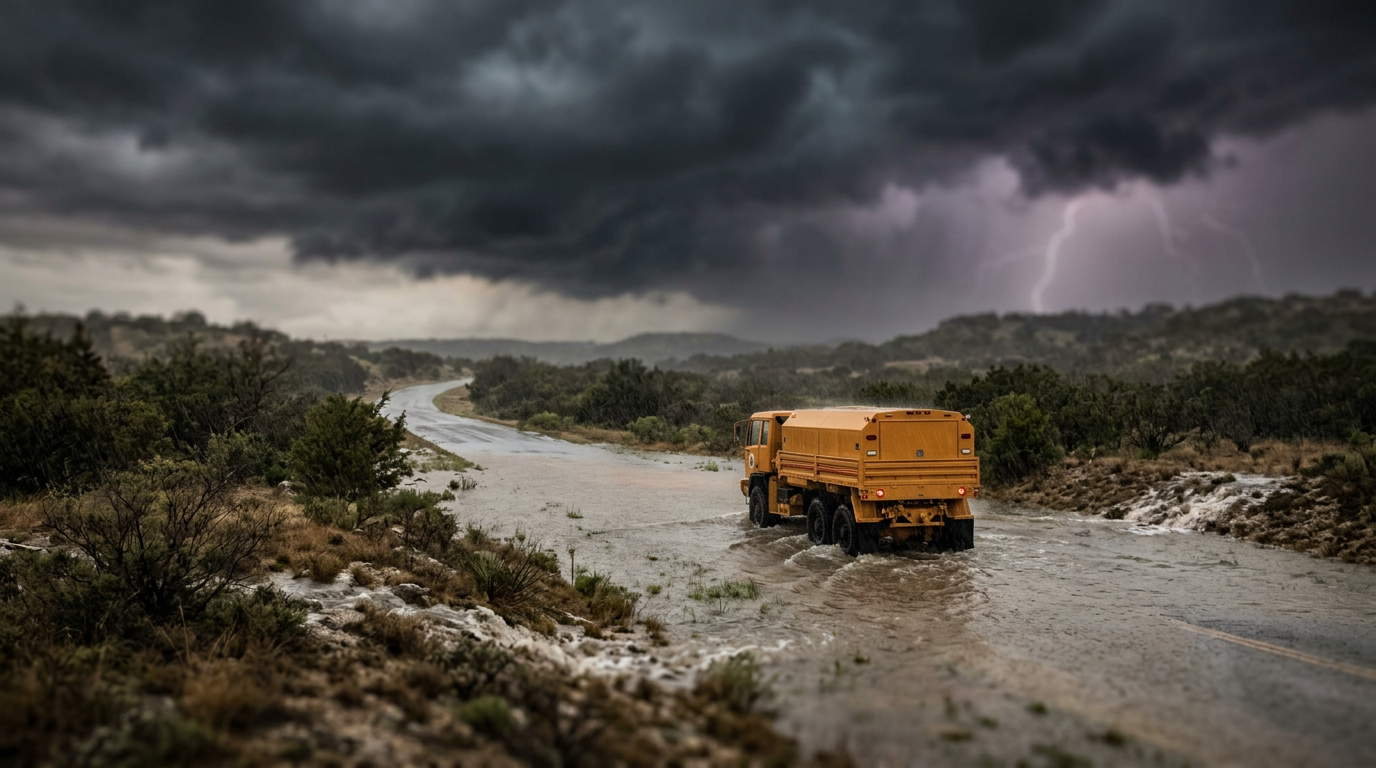
Governor Greg Abbott has directed the Texas Division of Emergency Management (TDEM) to mobilize a wide array of state emergency response resources in anticipation of a significant storm system moving across the state. With heavy rainfall, lightning, and potential flash flooding forecast for large portions of Central, North, and East Texas, the Governor’s proactive measures are designed to ensure state agencies can support local governments immediately as weather conditions deteriorate. Historically, Texas has shifted toward this proactive mobilization model following major flood events where local infrastructure was overwhelmed before state aid could arrive. By positioning water rescue teams and logistical support before the rain begins, the state aims to reduce the response time for life-saving interventions. This activation includes a variety of specialized units, ranging from search and rescue personnel to medical strike teams, all of whom are now on high alert to assist throughout the duration of the weather event.
Texas relevance
Texas residents in major metropolitan hubs like Austin, Dallas-Fort Worth, and San Antonio are directly under the path of these incoming atmospheric disturbances. Texas is geographically prone to rapid flash flooding due to its varying topography and the prevalence of dry creek beds that can fill in minutes during torrential downpours. Following the precedent of the 2015 Memorial Day floods and more recent catastrophic rains in the Hill Country, state leadership now treats these mid-summer atmospheric shifts with high-level coordination to prevent the loss of life on Texas roadways and in low-lying residential areas.
The Specific Resources Mobilized for Texas Communities
The state’s emergency response involves a multi-agency effort managed under the Division of Emergency Management. Key participants include the Texas A&M Engineering Extension Service, which provides the highly trained Texas A&M Task Force 1 search and rescue teams. These teams are specifically equipped for swift water rescues, a critical necessity in the flash-flood prone regions of the Balcones Escarpment and the I-35 corridor.
In addition to water rescue units, the Texas Department of State Health Services (DSHS) has placed Emergency Medical Task Force (EMTF) units on standby. These units are capable of providing field medical support and coordinating hospital transfers if local facilities become cut off by rising waters. The Texas Department of Transportation is also staging heavy equipment to clear debris from highways and monitor low-water crossings, which remain the leading site of weather-related fatalities in the state.
Furthermore, the Texas Parks and Wildlife Department has readied its fleet of shallow-draft boats and airboats. These vessels are essential for reaching residents in rural areas where standard rescue vehicles cannot navigate. The coordination of these diverse agencies ensures that whether a crisis occurs in an urban Dallas neighborhood or a rural East Texas county, the state has the specific tool required for the environment.
Understanding the Meteorological Threat to the Region
Current meteorological data indicates a slow-moving cold front intersecting with warm, moist air from the Gulf of Mexico. This combination is expected to create a 'stalled' weather pattern, which is a significant concern for Texas hydrologists. Stalled systems allow for multiple rounds of heavy rain to fall over the same saturated soil, leading to rapid runoff and river flooding.
Forecasters are predicting rainfall totals that could exceed five to seven inches in localized pockets over a 48-hour period. While the rain might be welcomed by those facing drought conditions, the rate at which it is expected to fall—sometimes two inches per hour—is too fast for the soil to absorb. This creates an immediate risk for flash flooding in urban areas where concrete surfaces prevent natural drainage.
The Governor’s office has emphasized that the threat is not limited to rain alone. These storm cells are also capable of producing high winds and frequent cloud-to-ground lightning. State officials are urging Texans to secure any outdoor property that could become a projectile in high winds and to have multiple ways to receive weather alerts, especially during the overnight hours when residents are most vulnerable.
State Leadership and Local Government Coordination
In Texas, emergency management is a joint effort between local mayors, county judges, and the state executive. Governor Abbott’s activation order serves as a formal signal to local jurisdictions that state-funded assets are available at no immediate cost for emergency operations. This removes the administrative hurdles that sometimes slow down inter-jurisdictional aid during a crisis.
TDEM Chief Nim Kidd has been in constant communication with regional coordinators to assess the needs of individual counties. By staging equipment in strategic locations such as San Antonio and Fort Worth, the state can deploy assets to a disaster site within two hours, rather than waiting for a request to move from the state capital in Austin. This localized staging is a result of years of refinement in the state's emergency response playbook.
The Governor also reminded Texans that while the state is providing these resources, personal responsibility remains the first line of defense. The 'Turn Around, Don't Drown' campaign is being emphasized heavily, as the majority of flood-related deaths in Texas occur when drivers attempt to navigate flooded roadways. State troopers and local police will be monitoring high-risk areas to enforce road closures as they become necessary.
Impact on Infrastructure and Public Utilities
Large-scale rainfall events often put a strain on the state's infrastructure beyond just the roads. Utility providers across the state have been notified to prepare for potential power outages caused by wind or lightning strikes. The Texas energy grid remains a point of public interest, though these types of summer storms typically impact localized distribution lines rather than large-scale generation capacity.
Water treatment plants in Central Texas are also on alert. Excessive runoff can increase the turbidity of water sources, sometimes leading to temporary boil water notices in smaller municipalities. By activating the state's emergency resources, the Governor is also ensuring that clean water supplies and mobile treatment units can be moved into affected areas if local infrastructure is compromised.
Additionally, the Texas Department of Public Safety (DPS) is prepping for increased patrol presence. These officers are tasked not only with traffic control but also with assisting stranded motorists and providing security in evacuated areas. The comprehensive nature of this mobilization ensures that the secondary effects of the storm, such as logistics and security, are handled alongside the primary search and rescue missions.
Historical Context of Flash Floods in Texas
Texas has a long and tragic history with flash flooding, often referred to as 'Flash Flood Alley' due to the geography of the Central Texas region. The thin soil and limestone layers of the Hill Country mean that water cannot penetrate the ground, leading to massive surges in river levels. Historical events, such as the 1921 San Antonio flood or the 1998 floods, have taught state officials that these storms must be respected from the outset.
Modern technology and satellite imaging have significantly improved the ability of the state to predict where the heaviest rain will fall, but the 'micro-burst' nature of Texas storms still presents challenges. In 2015, the Blanco River rose nearly 30 feet in just a few hours, catching many off guard despite warnings. The Governor’s current activation is a direct response to those lessons, ensuring that the 'boots on the ground' are already in the region before the rivers begin to rise.
This level of preparation also serves as a message to the federal government. By exhaustively utilizing state resources first, Texas strengthens its position when applying for federal disaster declarations later. It demonstrates that the state has fulfilled its duty to protect its citizens and that any further damage is beyond the scope of state-level capacity, facilitating a smoother transition to FEMA assistance if the damage proves to be catastrophic.
Analysis
The decision to activate state resources ahead of time reflects a modern shift in Texas disaster management strategy—moving from a 'reactive' posture to a 'pre-emptive' one. While some may view the mobilization of search and rescue teams for a rainfall event as overly cautious, the unpredictable nature of Texas 'Training' storms—where rain stays over the same area for hours—makes this a prudent use of state power. Politically, Governor Abbott continues to leverage the Texas Division of Emergency Management as a high-visibility example of state government efficiency, signaling to constituents that the executive branch is focused on public safety regardless of the season.
Source attribution
This story was reported using a public release from the Governor Abbott — Video Moments (Google News). Keep TX Red rewrote the coverage independently and links to the official statement for verification.
Frequently Asked Questions
- What state agencies are involved in this activation?
- Several agencies are involved, including the Texas Division of Emergency Management (TDEM), Texas A&M Task Force 1, the Texas Department of Public Safety, Texas Parks and Wildlife Department, and the Texas Department of State Health Services. Each agency provides specialized support like water rescue, medical assistance, or debris removal.
- Which areas of Texas are at the highest risk?
- The focus is currently on North, Central, and East Texas. Cities along the I-35 and I-45 corridors are particularly vulnerable to flash flooding as the weather system moves through these regions during the middle of the week.
- How can residents prepare for the incoming rain?
- Residents should secure loose outdoor items, stay tuned to local weather forecasts, and ensure they have a way to receive emergency alerts. Most importantly, everyone is urged to follow the 'Turn Around, Don't Drown' rule and avoid driving through any water on the roadway, as it only takes a few inches to sweep a vehicle away.
Official Sources
Take the next step
Browse the Newsroom →Read more about Keep Texas Red → Our full guide to what Keep Texas Red means and why Texans support it.
Related Articles



Get Texas updates delivered weekly.
Independent Texas reporting on politics, policy, and daily life. One email a week. Unsubscribe anytime.
Keep TX Red Newsroom
The Keep Texas Red Editorial Staff produces nonpartisan explainers, policy breakdowns, and educational resources to help Texans understand how their government works. All content is reviewed for accuracy and updated regularly.
About Keep TX Red →