Central Texas Under Flood Advisory as Heavy Rains Hit Austin Metro Area
The National Weather Service warns Austin residents of potential street flooding and drainage issues following a surge of rainfall across Central Texas.
Editorial disclaimer: Opinions and analysis on Keep TX Red are editorial content — not statements of fact. See our editorial standards.
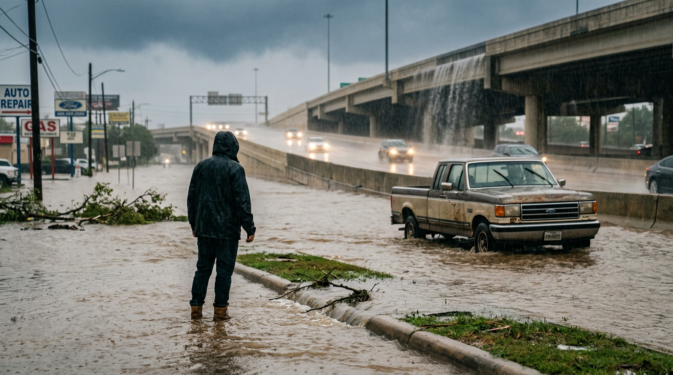
The National Weather Service has issued a formal flood advisory for the Austin area and broader Central Texas region following a significant weather event on July 13, 2026. This advisory comes as heavy downpours began saturating the soil and overwhelming local drainage systems in urban corridors. Historically, the Interstate 35 corridor through Central Texas is particularly susceptible to rapid water accumulation due to the unique topography of the Hill Country and the high percentage of impervious surfaces in the expanding Austin metroplex. Local officials are urging commuters to exercise extreme caution as water levels rise on several key thoroughfares during the evening hours. The region has a documented history of rapid-onset weather changes, where dry creek beds can transform into raging torrents in less than an hour, making these official notifications vital for public safety. Weather patterns in the Edwards Plateau frequently interact with moisture streams from the Gulf of Mexico, creating a recipe for sudden, localized deluges. In this instance, the atmospheric conditions aligned to stall moisture over the capital city, prompting meteorologists to move from standard monitoring to active advisory status. The advisory serves as a middle-tier alert, signaling that while widespread catastrophe is not expected, the common hazards of urban life—such as stalled vehicles and flooded basements—are a high probability if residents do not adjust their behavior. Emergency management teams across Travis County are currently on standby, monitoring water gauges that feed into the region's sophisticated early warning network.
Texas relevance
Residents in Austin, Travis County, and surrounding municipalities must remain alert to changing conditions as the region is known for 'Flash Flood Alley' characteristics. Even minor advisories in Central Texas can lead to hazardous low-water crossing conditions, which are a leading cause of weather-related emergencies in the state. This event highlights the ongoing need for infrastructure resilience in one of the fastest-growing regions in Texas. Texas is uniquely positioned at the crossroads of multiple climate zones, which often results in the Central Texas region receiving more rain in a single afternoon than some states receive in a month. This geographic reality has led to the development of the Texas Floodplain Management Association and aggressive local zoning laws aimed at mitigating the risks associated with the state's frequent and intense precipitation cycles.
Understanding the Scope of the Advisory
The flood advisory issued by the National Weather Service is a specific notification meant to inform the public that weather conditions may cause significant inconveniences. While not as severe as a flood warning, the advisory indicates that if caution is not exercised, these conditions could lead to situations that threaten life or property. This particular event is focused on poor drainage areas where water cannot move away as quickly as it is falling from the sky. The designation is a tool used by the NWS to bridge the gap between general rain and life-threatening flash flood emergencies.
The advisory impacts a large geographic swath of the Central Texas region, including major urban centers and suburban communities. Meteorologists have noted that the rainfall rates in some localized spots were high enough to cause immediate ponding on roadways. This is especially dangerous for evening commuters who may find themselves driving into standing water as visibility decreases with the setting sun. Historically, Texas weather agencies have found that the majority of traffic accidents during these events occur because drivers underestimate the depth of water on the asphalt.
Impact on Central Texas Infrastructure
As Austin continues to grow, the amount of concrete and asphalt prevents rainwater from soaking naturally into the ground. This leads to increased runoff that flows into creeks like Shoal Creek, Waller Creek, and Onion Creek. During this latest advisory, these sensitive areas are being monitored closely by city engineers and emergency management personnel to ensure that spillways and drainage pipes are functioning as intended. The rapid urbanization of the I-35 corridor has essentially created an artificial funnel for rainwater, increasing the stakes for every storm system that enters the area.
The surrounding counties, including Williamson and Hays, also face similar challenges. In rural areas, the primary concern shifts from street ponding to the rapid rise of water over low-water crossings. Texas leads the nation in many years for water-related vehicle rescues, making these weather events a top priority for local fire and rescue teams who are stationed near known trouble spots. These teams utilize high-water vehicles and specialized boat units to respond to incidents where the natural geography of the Hill Country causes roads to become submerged in a matter of minutes.
Historical Context of Central Texas Flash Flooding
To understand the current advisory, one must look at the history of the Balcones Escarpment, which acts as a physical ramp that forces moist air upward, triggering heavy rainfall. This geological feature is why Central Texas is known as Flash Flood Alley. Significant events in the past, such as the 1981 Memorial Day Floods or the 2015 Halloween floods, have shaped how local governments handle these advisories today. Each notification is based on decades of data regarding how much rain our local basins can handle before they overflow.
For decades, the City of Austin has invested millions into buyout programs and retention ponds to mitigate this risk. However, as the city expands further into former ranch lands, the natural sponges of the earth are replaced by rooftops and roads. This shift means that even a moderate storm, like the one currently passing through the region, requires a high level of vigilance from both public works departments and the average citizen living in the floodplain.
Safety Recommendations for Motorists
The most consistent advice offered by Texas authorities during these periods is to avoid driving through any area where water covers the road. It is often impossible to tell how deep the water is or if the road underneath has been washed away by the current. Most flood-related deaths in Texas involve vehicles, and authorities emphasize that even a few inches of moving water can exert enough force to sweep a car off the pavement. The power of moving water is frequently underestimated, especially by those new to the Texas climate.
For those who must be on the road in Central Texas during this advisory, reducing speed is critical. Hydroplaning occurs when a layer of water builds up between the tires and the road surface, leading to a loss of steering and braking control. Extra following distance is recommended between vehicles to allow for the increased stopping distances required on wet Texas highways. Furthermore, motorists should be aware that nighttime flooding is significantly more dangerous because the visual cues of rising water are obscured by darkness.
Meteorological Drivers Behind the Rain
The current weather pattern bringing these storms to Central Texas involves a mixture of high atmospheric moisture and a slow-moving boundary that serves as a catalyst for storm development. Because the systems are moving slowly, they have the capacity to dump more rain over a single location than faster-moving fronts might. This 'training' of storms—where one cell follows another over the same area—is what typically triggers the issuance of advisories by the National Weather Service. It is the duration of the rainfall, rather than just the intensity, that often causes the most problems.
While July in Texas is often associated with extreme heat and dry spells, sporadic tropical moisture can shift the balance quickly. These sudden shifts are a hallmark of the regional climate, requiring residents to stay updated via local news outlets and weather apps. The current advisory is expected to remain in effect until the heaviest bands of rain depart the metro area. Meteorologists are keeping a close eye on the upper-level winds, which will eventually steer this moisture out of the region and back toward the coast.
Long-Term Preparation and Mitigation
Incidents like this serve as a reminder for Texas homeowners to inspect their own property for drainage issues. Keeping gutters clear and ensuring that yard runoff flows away from the home's foundation can prevent localized flooding from becoming a costly repair problem. Community-wide, the city of Austin frequently reviews its flood maps to account for new developments and changing weather patterns. These map updates are critical for insurance purposes and for informing residents of their actual risk levels.
Furthermore, the public is encouraged to sign up for local emergency alerts. These systems provide real-time updates directly to smartphones, offering specific information about closed roads or rising creek levels. Staying informed is the first line of defense against the unpredictable nature of Texas weather, particularly in a region as prone to sudden flooding as Central Texas. By utilizing tools like WarnCentralTexas.org, residents can receive location-specific data that helps them make better decisions during active weather events.
Source attribution
This story was reported using a public release from the Texas Weather Video (Google News). Keep TX Red rewrote the coverage independently and links to the official statement for verification.
Frequently Asked Questions
- What is the difference between a flood advisory and a flood warning?
- A flood advisory is issued when flooding is not expected to be bad enough to issue a warning but may cause significant inconvenience and could lead to situations that may threaten life and property if caution is not exercised. A flood warning is issued when flooding is imminent or occurring and poses a direct threat to safety.
- Which areas in Austin are most prone to flooding?
- Low-lying areas near creeks such as Onion Creek, Shoal Creek, and Waller Creek are historically prone to flooding. Additionally, underpasses and areas with poor street drainage in the downtown corridor often see significant water accumulation during heavy rains due to the high density of impervious surfaces.
- How can I track road closures in Central Texas?
- Texas residents can use resources like ATXfloods.com for real-time information on low-water crossing closures in the Austin area, or DriveTexas.org for statewide highway conditions and flood-related closures provided by the Texas Department of Transportation.
Official Sources
Take the next step
Browse the Newsroom →Read more about Keep Texas Red → Our full guide to what Keep Texas Red means and why Texans support it.
Related Articles



Get Texas updates delivered weekly.
Independent Texas reporting on politics, policy, and daily life. One email a week. Unsubscribe anytime.
Keep TX Red Newsroom
The Keep Texas Red Editorial Staff produces nonpartisan explainers, policy breakdowns, and educational resources to help Texans understand how their government works. All content is reviewed for accuracy and updated regularly.
About Keep TX Red →