Governor Abbott Mobilizes Texas Emergency Teams as Flash Flood Risks Surge Statewide
Texas Governor Greg Abbott activates the TDEM and state resources to combat heavy rainfall and flash flood threats across North and West Texas regions.
Editorial disclaimer: Opinions and analysis on Keep TX Red are editorial content — not statements of fact. See our editorial standards.
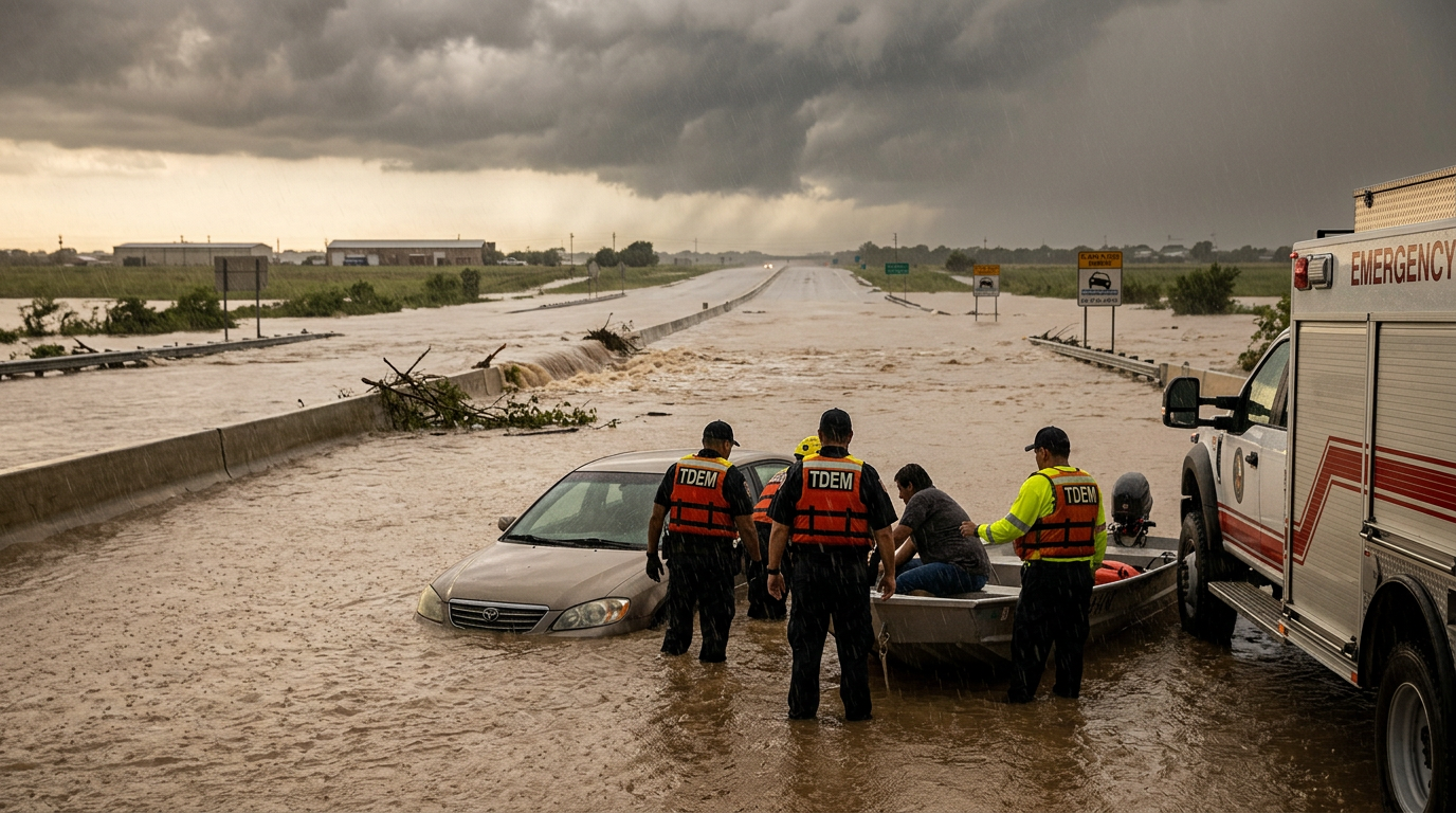
Governor Greg Abbott has initiated a formal state-level response by directing the Texas Division of Emergency Management (TDEM) to deploy critical assets in anticipation of severe weather patterns. This mobilization follows meteorological reports indicating a high probability of heavy precipitation capable of triggering flash floods across numerous counties. Historically, Texas has utilized this pre-emptive activation strategy to reduce response times for water rescues and infrastructure repair, a practice that became standardized after the devastating impacts of major 21st-century storm cycles. By positioning equipment and personnel before the first raindrops fall, the state aims to secure localized areas that typically face the brunt of slow-moving atmospheric disturbances. The current activation involves a broad coalition of state agencies, each specializing in logistics, search and rescue, and public safety communications to ensure that local jurisdictions are not overwhelmed by the incoming moisture-laden systems.
Texas relevance
This mobilization directly impacts residents across North and West Texas, where the terrain often facilitates rapid runoff and dangerous roadway conditions. In Texas, flash flooding remains one of the primary causes of weather-related fatalities, particularly in regions where dry creek beds can become raging rivers in a matter of minutes. The state's investment in these resources underscores the specific vulnerability of Texas infrastructure during high-volume rainfall events in the summer and transition months. Local officials in cities ranging from the Panhandle down through the DFW metroplex are currently coordinating with state liaisons to monitor high-risk intersection and low-water crossings that have historically proven hazardous to Texas drivers.
The Mechanism of State Emergency Activation
When the Governor triggers a state-level emergency response through the TDEM, it sets in motion a sophisticated bureaucratic and logistical engine designed to support municipal authorities. This process begins with the activation of the State Operations Center, which serves as the central hub for real-time intelligence and resource allocation. By moving state assets into position early, Texas avoids the delays associated with transporting heavy equipment, such as high-profile vehicles and boat squads, across the vast geography of the state once floodwaters have already closed major transit arteries.
The coordination involves several key players, including the Texas Department of Public Safety and the Texas A&M Task Force 1. These units are specifically trained for the unique challenges posed by the state's diverse geography, from the urban concrete jungles of the I-35 corridor to the rural expanses of the western plains. The goal is to provide a safety net that allows local fire departments and police units to focus on immediate neighborhood needs while the state handles large-scale logistics and secondary support operations during the duration of the weather event.
Furthermore, this activation allows for the rapid distribution of equipment like generators, sandbags, and mobile communication towers. In many parts of Texas, traditional power grids can be compromised during severe storms, making these portable assets vital for maintaining public order and medical services. The proactive nature of this order reflects a shift in Texas emergency policy toward mitigation rather than just reactive measures, aiming to save both lives and taxpayer dollars by reducing the severity of storm-related damages through early intervention.
Meteorological Drivers Behind the Current Threat
The National Weather Service has identified a moisture-rich weather pattern currently stalling over large portions of the state. Unlike fast-moving cold fronts that pass through in a matter of hours, these slow-moving systems are notorious for dropping several inches of rain over a localized area in a very short timeframe. In West Texas, where the ground can often be hardened by heat, the soil's inability to absorb rapid moisture leads to instantaneous runoff, creating what experts call 'flash' conditions that offer very little warning to residents.
In North Texas, the concern shifts toward the saturation of existing drainage systems. As multiple rounds of storms move through, the cumulative effect of the rainfall increases the risk of river flooding and urban street flooding. State meteorologists are closely watching a series of atmospheric disturbances that are tapping into Gulf moisture, funneling it directly into the heart of the state. This setup is a classic precursor to significant flood events in Texas history, prompting the Governor's office to take no chances with the safety of the public.
The unpredictability of these convective storm cells means that while some areas may see only minor showers, a neighboring county could experience a life-threatening deluge. This geographic volatility is why the TDEM mobilization covers such a wide expanse of the state. Emergency managers are preparing for 'training' storms—a phenomenon where storms follow the same path repeatedly—which can lead to catastrophic water accumulation even in areas not typically prone to major flooding.
Public Safety Protocols and 'Turn Around, Don\'t Drown'
A central pillar of the state's messaging during these activations is the 'Turn Around, Don't Drown' campaign. State officials emphasize that a significant percentage of flood-related deaths in Texas occur when drivers attempt to navigate through standing water. It only takes six inches of fast-moving water to knock an adult off their feet, and just twelve inches of water can carry away most small cars. Governor Abbott’s recent directive includes instructions for state troopers to assist in road closures to prevent such tragedies.
Texans are encouraged to utilize resources like DriveTexas.org to monitor road conditions and avoid areas marked as hazardous. The state is also reminding residents that nighttime driving during a flash flood is particularly dangerous, as it becomes nearly impossible to judge the depth or speed of water crossing a roadway. By following guidance from local law enforcement and staying off the roads during the peak of the storms, citizens can significantly reduce the burden on emergency first responders.
Emergency kits and family communication plans are also being recommended by state agencies. Given the possibility of localized power outages and road blockages, the TDEM suggests that families have at least three days of supplies on hand. This level of preparedness at the individual level complements the state’s high-level mobilization, creating a multi-tiered defense against the environmental threats posed by the incoming storm systems.
Environmental Impact on Texas Infrastructure
The impact of recurring heavy rainfall goes beyond immediate safety concerns; it also poses long-term challenges for Texas infrastructure. Constant flooding and receding water can undermine the integrity of bridge supports and erode the sub-base of state highways. By activating response teams early, the Texas Department of Transportation (TxDOT) can more quickly assess damage and begin repairs, ensuring that the state's vital economic supply chains remain operational even after the weather clears.
Additionally, the Texas Commission on Environmental Quality (TCEQ) often monitors water runoff during these events to manage the impact on local reservoirs and wastewater systems. Heavy rains can lead to overflow situations that require careful management to protect the state's drinking water supply. The coordinated state response ensures that these environmental specialists are integrated into the broader emergency management framework, providing a holistic approach to the storm's aftermath.
Agricultural areas in West Texas also face a dual-edged sword with these rain events. While the moisture is often needed for crops, the intensity of a flash flood can wash away topsoil and damage young plants. State agricultural liaisons are part of the communication chain during these activations, helping farmers and ranchers prepare for potential livestock evacuations or field damage. This comprehensive look at the state's various sectors demonstrates why a Governor-led activation is necessary for a state as large and economically diverse as Texas.
Inter-Agency Cooperation and Future Outlook
The success of these mobilizations relies heavily on the 'whole-of-government' approach that has become the hallmark of Texas emergency management. This involves not just state agencies, but also volunteer organizations like the Texas Voluntary Organizations Active in Disaster (TXVOAD). These groups provide essential services such as feeding stations and temporary shelter, allowing state resources to remain focused on the technical aspects of rescue and infrastructure security.
Looking forward, the frequency of these activations may increase as weather patterns become more volatile. Texas continues to invest in better flood mapping and early warning systems to give the TDEM even more precise data during these events. The current deployment serves as both a necessary immediate response and a refinement of the state's long-term disaster readiness capabilities, ensuring that Texas remains one of the most prepared states in the nation for atmospheric emergencies.
As the storm system eventually moves out of the region, the state will transition from an active response phase to a recovery and assessment phase. During this time, the state will work with local counties to document damages, which is a critical step in securing federal disaster assistance if the thresholds are met. Governor Abbott's early activation ensures that all necessary documentation begins the moment the first responders hit the ground, streamlining the path to recovery for affected Texas communities.
Source attribution
This story was reported using a public release from the Office of the Governor. Keep TX Red rewrote the coverage independently and links to the official statement for verification.
Frequently Asked Questions
- What does the 'activation' of state resources actually mean?
- It means that the Governor has authorized the Texas Division of Emergency Management to move personnel, specialized equipment, and supplies into position before the storm hits. This includes high-profile vehicles for water rescues and coordination teams to assist local mayors and county judges.
- Which parts of Texas are most at risk during this event?
- Currently, the National Weather Service is highlighting North and West Texas as the primary areas of concern. However, moisture-rich patterns can shift, so residents across the central and eastern portions of the state should also remain vigilant.
- How can I check if roads in my area are flooded?
- The best resource for real-time road conditions in Texas is DriveTexas.org, which is maintained by the Texas Department of Transportation. It provides updates on closures, construction, and hazardous conditions caused by weather.
- Why is flash flooding considered so dangerous in Texas?
- Texas has a unique geography with many low-water crossings and rocky terrain that does not absorb water quickly. This causes water levels to rise rapidly and with immense force, often catching drivers and hikers off guard.
Official Sources
Take the next step
Browse the Newsroom →Read more about Keep Texas Red → Our full guide to what Keep Texas Red means and why Texans support it.
Related Articles



Get Texas updates delivered weekly.
Independent Texas reporting on politics, policy, and daily life. One email a week. Unsubscribe anytime.
Keep TX Red Newsroom
The Keep Texas Red Editorial Staff produces nonpartisan explainers, policy breakdowns, and educational resources to help Texans understand how their government works. All content is reviewed for accuracy and updated regularly.
About Keep TX Red →