New Advanced Flood Monitoring Technology Developed by UT Arlington for Hill Country Safety
University of Texas at Arlington researchers launched a $4 million hydrological modeling project to protect the Texas Hill Country from flash floods.
Editorial disclaimer: Opinions and analysis on Keep TX Red are editorial content — not statements of fact. See our editorial standards.
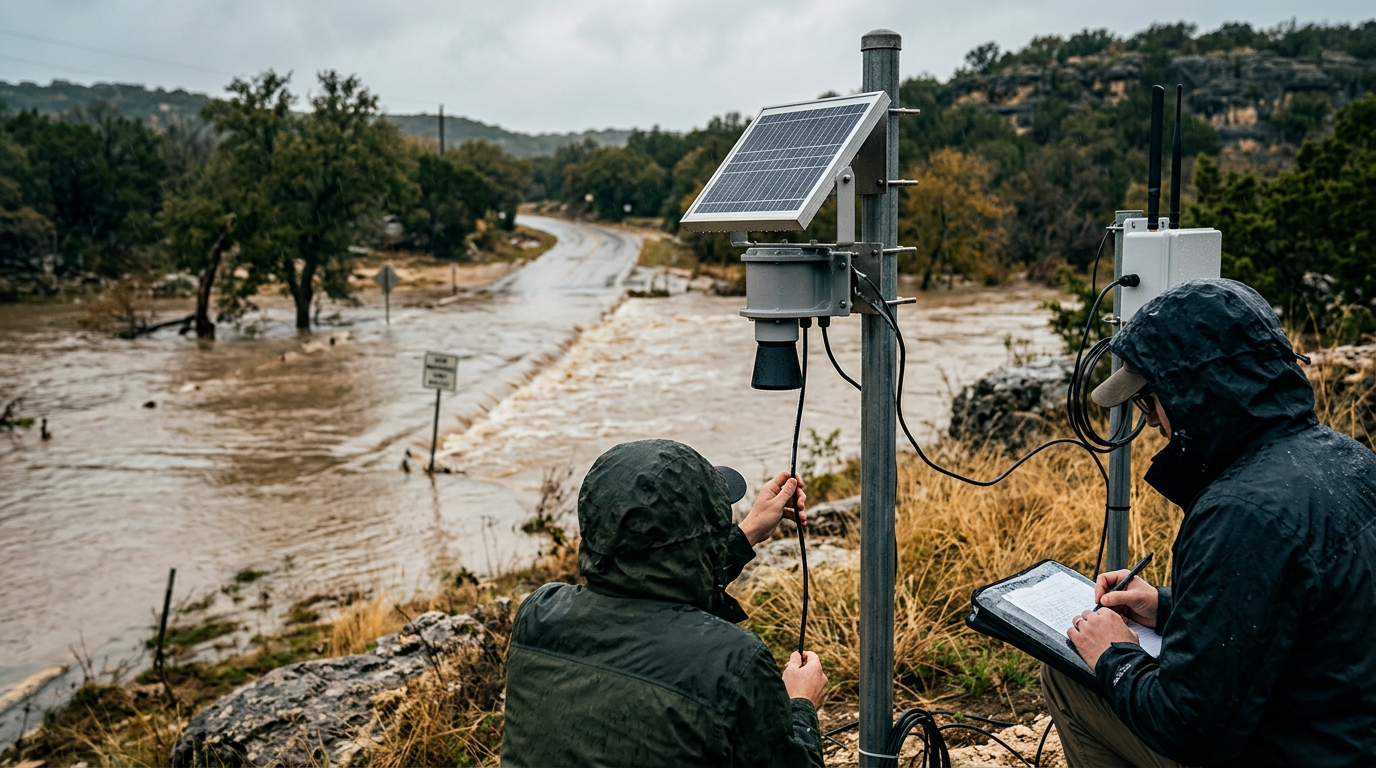
Researchers at the University of Texas at Arlington have embarked on a mission to revolutionize how regional authorities track and predict severe weather events. Led by Dr. Nick Fang, a dedicated team of engineers and data scientists is utilizing a $4 million grant to establish a high-tech flood warning network focused primarily on the Kerrville area and the broader Hill Country region. This initiative comes as a direct response to a series of destructive flooding incidents that plagued Central Texas in previous years, highlighting a desperate need for modernization in hydraulic infrastructure. Historically, flash flooding has been the number one weather-related killer in Texas, particularly in the 'Flash Flood Alley' corridor where thin soils and steep terrain result in rapid runoff. This project seeks to move beyond traditional reactive measures by implementing proactive digital defenses. The system utilizes what experts call 'hydrological modeling,' which integrates real-time weather data with topographical maps and soil saturation levels to predict water movements before they reach dangerous thresholds. By calculating how much rainfall the ground can absorb versus how much will flow into tributaries, the team can provide early warnings with significantly higher accuracy than existing broad-scale weather alerts. This context is vital because the Hill Country’s unique limestone geography often causes water to rise several feet in a matter of minutes, leaving residents with very narrow windows for evacuation. The UT Arlington project aims to stretch that window, providing local first responders and homeowners with the critical minutes necessary to save lives and move property to higher ground.
Texas relevance
This project is specifically tailored to the Kerrville and Guadalupe River basin, a region of Texas that has faced billions of dollars in damage from water-related disasters over the last decade. Texas leads the nation in many categories of extreme weather, and the Hill Country’s specific vulnerability makes it a proving ground for new safety technology. By testing these systems in rural and semi-rural Texas communities, researchers are creating a blueprint that could eventually be deployed across the entire state, from the Panhandle to the Gulf Coast. The success of this grant-funded research directly affects the tax base and insurance premiums of Texas residents, as better mitigation strategies typically lead to decreased emergency spending and lower recovery costs for the state government.
The Science Behind Hydrological Modeling
At the core of Dr. Fang’s research is the discipline of hydrological modeling, a field that combines fluid mechanics with data science. Unlike simple rain gauges that tell you how much rain has already fallen, these models simulate the entire lifecycle of a storm. They account for how fast water travels over specific types of central Texas brush, how much the Guadalupe River banks can contain, and where the 'choke points' are in local creek beds.
The UTA team is building a digital twin of the Kerrville landscape. By inputting different rainfall scenarios, they can see exactly which streets will underpass first and which low-water crossings will become impassable. This allows the city to pre-position emergency vehicles and close roads before the water even arrives, significantly reducing the likelihood of high-water rescues that put both civilians and first responders at risk.
Furthermore, the integration of radar data and ground-level sensors creates a redundant network. If a single sensor is damaged by debris during a storm, the hydrological model can use data from surrounding areas and satellite imagery to fill in the gaps. This resilience is a key feature of the new system, ensuring that data keeps flowing even in the most extreme conditions.
Addressing the 'Flash Flood Alley' Risk
The transition zone between the Edwards Plateau and the Balcones Escarpment is often referred to by meteorologists as 'Flash Flood Alley.' The geography of this area is such that warm, moist air from the Gulf of Mexico is forced upward, leading to concentrated, heavy downpours. When this rain hits the rocky soil of the Hill Country, it has nowhere to go but down into the valleys, creating wall-like surges of water.
Residents in Kerrville and surrounding counties have long lived with the threat of these sudden rises. Many existing warning systems rely on a 'one size fits all' approach from the National Weather Service, which might issue a warning for an entire county even if only one small creek is flooding. The UT Arlington system is designed to provide localized, street-level granularity that makes warnings more credible and actionable for the average citizen.
By focusing on specific watersheds, the research team is helping to eliminate 'warning fatigue.' When residents receive alerts that are physically relevant to their immediate location, they are much more likely to take protective action. This psychological aspect of emergency management is just as important as the raw engineering data provided by the new sensors.
Economic Impact and Long-Term Savings
While a $4 million grant is a significant upfront investment, the potential return on investment for Texas is massive. A single major flood event in the Hill Country can result in tens of millions of dollars in infrastructure damage, including destroyed bridges, washed-out roads, and flooded municipal buildings. By providing better data, this system helps city planners design more resilient infrastructure in the future.
Insurance rates are another critical factor. As the state grows and more people move into the beautiful but high-risk areas of the Hill Country, the cost of flood insurance continues to rise. Tech-driven mitigation strategies can lead to revised flood zone maps. If a community can prove it has superior monitoring and management systems in place, it may eventually benefit from more stable insurance premiums for its residents.
The project also creates a pipeline for high-tech jobs within the state. Graduate students and researchers at UT Arlington are gaining hands-on experience that will likely lead to the creation of private-sector consulting firms and tech startups right here in Texas. This reinforces the state's position as a leader in both civil engineering and emergency technology.
Community Collaboration in Kerrville
One of the unique aspects of this project is the close collaboration between academia and local government. Dr. Fang’s team is not working in a vacuum; they are consulting with Kerrville city officials and local emergency coordinators to ensure the user interface of the warning system is intuitive. A highly accurate model is useless if a local sheriff cannot interpret the results quickly during a power outage.
Public town halls and meetings have helped the researchers identify 'problem spots' that only longtime residents know about. These anecdotal insights are being encoded into the digital model to ensure that it reflects the lived reality of the Guadalupe River's behavior. This grassroots approach ensures that the technology serves the people rather than just being a theoretical exercise.
As the system goes live, there will likely be training sessions for local volunteer fire departments and first response teams. This ensures that the entire community is synchronized when the next storm clouds gather over the western horizon, turning a high-tech tool into a common-sense community asset.
Future Expansion Across the Lone Star State
The Kerrville project is essentially a pilot program. If the hydrological modeling proves effective during the next few hurricane and thunderstorm seasons, there is high potential for the Texas Water Development Board to look at expanding the system statewide. Areas like the Interstate 35 corridor, which is seeing rapid urban development, could benefit immensely from this type of precise water tracking.
Urbanization creates impervious cover—pavement and rooftops—which changes how water behaves. The models being perfected by UT Arlington can be adjusted to account for urban sprawl, making them just as useful for DFW or Austin as they are for the rural Hill Country. The scalability of the software is one of its most promising features.
In the long run, this could lead to an integrated 'Texas Flood Grid' where data is shared seamlessly between cities, river authorities, and state agencies. Such a network would represent a historic leap forward in how the state manages its most precious and potentially most dangerous resource: water.
Analysis
Investment in predictive technology represents a shift in Texas policy from 'recovery' to 'mitigation.' While state agencies have traditionally focused on rebuilding after a disaster, the funding of this UT Arlington study suggests that the Texas Legislature and academic institutions are prioritizing the prevention of loss. This tech-heavy approach also highlights the growing importance of the University of Texas system in solving practical, everyday problems for rural Texans. If successful, this hydrological model could become the gold standard for flood management, potentially reducing the reliance on the Federal Emergency Management Agency (FEMA) by solving problems at the local and state levels first.
Source attribution
This story was reported using a public release from the Texas Standard. Keep TX Red rewrote the coverage independently and links to the official statement for verification.
Frequently Asked Questions
- Why was Kerrville chosen for this project?
- Kerrville and the surrounding Hill Country are part of 'Flash Flood Alley,' a region where the geography and soil types lead to exceptionally fast and dangerous water rises, making it a critical area for advanced monitoring.
- How does 'hydrological modeling' differ from a standard weather report?
- While a weather report tells you how much rain to expect, hydrological modeling calculates what happens after the rain hits the ground. It factors in terrain, soil wetness, and river levels to predict specific flooding threats on a street-by-street basis.
- Who is funding the UT Arlington flood research?
- The project is funded by a $4 million grant, reflecting a cooperative effort between academic researchers and state/federal stakeholders interested in improving disaster resilience in Texas.
- Will this system be available to the general public?
- The primary goal is to provide local emergency managers with better data to issue more accurate alerts, though many of these projects eventually include public-facing maps or notification apps for residents.
Official Sources
Take the next step
Browse the Newsroom →Read more about Keep Texas Red → Our full guide to what Keep Texas Red means and why Texans support it.
Related Articles



Get Texas updates delivered weekly.
Independent Texas reporting on politics, policy, and daily life. One email a week. Unsubscribe anytime.
Keep TX Red Newsroom
The Keep Texas Red Editorial Staff produces nonpartisan explainers, policy breakdowns, and educational resources to help Texans understand how their government works. All content is reviewed for accuracy and updated regularly.
About Keep TX Red →