Guadalupe River Flood Anniversary Highlights Gaps in Texas Emergency Alert Systems
A year after devastating floods claimed 130 lives along the Guadalupe River, Texas officials face pressure to modernize aging emergency alert systems.
Editorial disclaimer: Opinions and analysis on Keep TX Red are editorial content — not statements of fact. See our editorial standards.
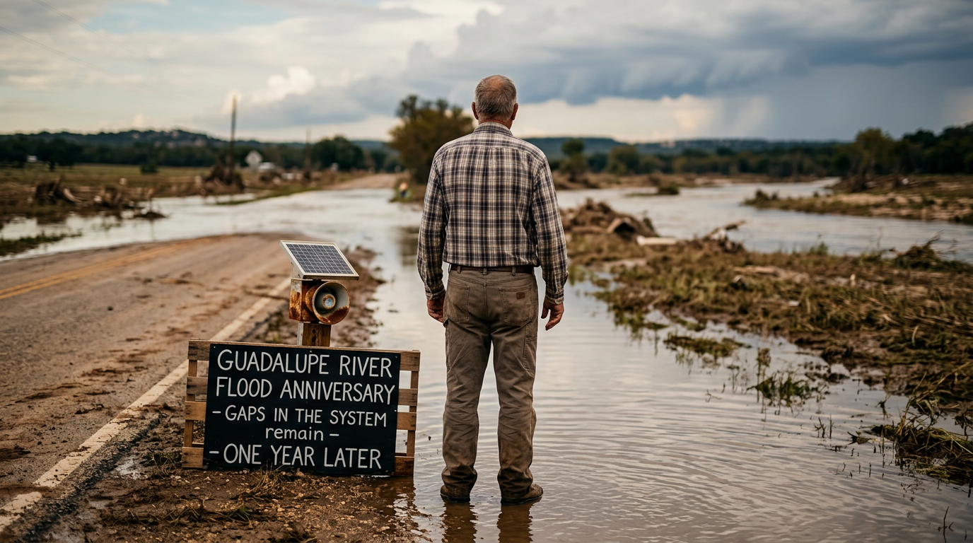
One year after the catastrophic flooding events along the Guadalupe River, the state of Texas finds itself at a critical crossroads regarding infrastructure investment and digital alert accuracy. The original disaster, which resulted in the loss of over 130 residents, remains one of the most significant weather events in the recent memory of the Texas Hill Country. Historically, the Guadalupe River has been prone to flash flooding due to the unique karst topography of the region, where rapid runoff can transform a scenic waterway into a violent torrent in minutes. Previous legislative sessions have addressed statewide water planning, but the specific logistics of real-time cellular alerts in rural river basins remain a point of contention for survivors and policymakers alike. Investigations over the past twelve months have highlighted systemic delays in the transmission of Emergency Alert System (EAS) messages to mobile devices. Despite the availability of modern geolocation technology, many victims reported receiving notifications only after water had already entered their dwellings. This anniversary serves as a somber reminder of the limitations inherent in current meteorological forecasting when applied to the localized, intense rainfall patterns that define Central Texas. Community leaders are now calling for a comprehensive overhaul of how the state integrates local river gauges with the upstream notification chain to prevent a recurrence of the 2025 fatalities. As the region enters another peak storm season, the lingering trauma of the 130-plus lives lost has fueled a new wave of civic activism. Local municipalities are no longer waiting solely on federal or state mandates; instead, they are exploring independent gauge networks and localized sirens to supplement the standard digital warnings. This shift represents a broader trend in Texas where counties are taking increased ownership of their specific environmental risks, acknowledging that a one-size-fits-all approach from Austin may not handle the rapid onset of a Hill Country wall of water.
Texas relevance
This issue is central to the safety of residents in the Texas Hill Country, specifically within Comal, Guadalupe, and Hays counties. As one of the fast-growing regions in the United States, the Guadalupe River basin attracts thousands of new residents annually who may be unfamiliar with the speed at which Texas rivers can rise. The state has a vested interest in ensuring that its tourism hubs—such as New Braunfels and Gruene—remain safe for visitors while protecting the property values and lives of permanent citizens. Furthermore, the debates regarding the Texas Water Development Board's funding priorities directly impact how these river communities will build future levees and spillways.
The Geographic Vulnerability of the Hill Country
The Guadalupe River winds through some of the most challenging terrain in the southern United States. Its headwaters in Kerr County collect runoff from steep limestone hills, funneling water into narrow canyons that create a hydraulic effect. When a stationary front sits over this region, the resulting 'Flash Flood Alley' becomes a corridor of extreme danger. This is not a new phenomenon; the 1972 and 1998 floods were previous benchmarks of destruction, yet the 2025 event surpassed them in human cost due to increased residential density near the banks.
Compounding the geographic danger is the soil composition of Central Texas. With thin topsoil sitting atop solid rock, the ground has almost zero absorption capacity during heavy rain. This means that nearly 100% of rainfall becomes immediate runoff. The 2025 disaster proved that even modern forecasting models struggle to predict exactly which tributary will swell first, leading to a 'blind spot' in the early minutes of a flash flood event where reaction time is most critical.
Failures in the Early Warning Chain
In the aftermath of the tragedy, a review of communication logs revealed that several automated river gauges failed to transmit data once water levels reached certain 'action stages.' These gauges, which are often maintained by a patchwork of local, state, and federal agencies, are the primary source of truth for weather services. When the hardware failed under the pressure of the rising river, the meteorologists lost the ability to provide accurate 'lead time' for downstream communities like Seguin and Victoria.
Furthermore, the distribution of Wireless Emergency Alerts (WEA) faced significant latency. In rural stretches of the Guadalupe, cellular coverage is inconsistent at best. During the storm, several towers lost power or were overwhelmed by signal traffic, preventing the critical 'seek higher ground' messages from reaching the residents in the flood's path. This technological bottleneck has become the focal point of current legislative inquiries into state-sponsored disaster response protocols.
Accountability and Legal Hurdles
Families of the victims have begun seeking answers regarding the operation of dams and spillways along the river. During the peak of the flood, decisions had to be made regarding the release of water from reservoirs to prevent dam failure. However, these releases often exacerbate flooding for those immediately downstream. The tension between protecting infrastructure and protecting individual homes has led to a series of legal filings aimed at clarifying the liability of river authorities during 'Acts of God.'
The state has traditionally held a high bar for sovereign immunity in these cases, but the scale of the 130-person death toll has shifted the political landscape. Lawmakers are facing pressure to create a more transparent 'Release Protocol' that gives downstream residents a guaranteed window of time to evacuate before dam gates are opened. This debate mirrors similar discussions held in the wake of Hurricane Harvey, albeit on a much more localized and rapid scale.
Local vs. State Response Strategies
Because of the delays seen in 2025, many Hill Country towns are moving toward decentralized warning systems. This includes the installation of high-decibel air raid sirens, which are seen as a 'low-tech' but highly reliable backup to cellular alerts. These sirens can be triggered by local sheriff's offices based on visual sightings or local gauge data, bypassing the federal bottleneck of NWS authorization. While expensive to maintain, local officials argue the cost is negligible compared to the loss of life.
On the state level, the emphasis has been on improving the 'West Texas to Gulf' data pipeline. By integrating more high-resolution radar data with advanced hydrologic modeling, the state hopes to provide an extra 15 to 30 minutes of warning. For a river that can rise ten feet in an hour, those few minutes are often the difference between a successful evacuation and a fatal entrapment in a low-water crossing.
The Economic Impact on River Communities
The floods of 2025 did not just take lives; they devastated the local economy. The Guadalupe River is a primary driver of tourism revenue for the state, supporting thousands of jobs in the outdoor recreation and hospitality sectors. In the year since the disaster, many small businesses have struggled to rebuild as insurance premiums in the floodplain have skyrocketed. Some outfitters have been forced to close permanently, unable to secure the necessary coverage to operate on the water.
There is also the significant cost of debris removal and infrastructure repair. Hundreds of millions of dollars have been allocated for the reconstruction of bridges and public parks, but much of that work remains in the planning phase. The slow pace of recovery has frustrated residents who feel that the state's 'Economic Miracle' should include a more robust safety net for communities that provide such a large portion of the state's cultural and recreational identity.
Preparing for the Next 'Big One'
Climatologists suggest that the frequency of '100-year' flood events in Texas is increasing, making the lessons of the last year even more urgent. Preparedness now involves more than just better radios; it requires a fundamental change in how Texas approaches land use and development. There is a growing movement to restrict new construction in identified floodways, though this faces stiff opposition from property rights advocates and developers who argue it stifles growth.
For the average Texan living near the water, the anniversary is a time for personal audits of safety plans. Emergency kits, designated meeting spots on high ground, and manual weather radios are now becoming standard household items in the Guadalupe basin. As the state reflects on the tragic outcome of a year ago, the consensus is clear: while we cannot stop the rain, we must ensure that no Texan ever dies because a text message arrived five minutes too late.
Analysis
The tragic loss of life during the 2025 floods exposes a dangerous gap between Texas's rapid population growth and its lagging emergency infrastructure. While the state prides itself on a hands-off regulatory environment, the failure of basic public safety alerts is an area where the government has a clear and unavoidable responsibility. The current reliance on cell towers that can be knocked out by the very storms they are warning against is a technical flaw that requires hardened infrastructure. If Texas is to remain an attractive place for families to settle, it must prove that it can protect them from predictable natural cycles with the same vigor it defends the state's economic interests.
Source attribution
This story was reported using a public release from the Texas Standard. Keep TX Red rewrote the coverage independently and links to the official statement for verification.
Frequently Asked Questions
- Why is the Guadalupe River so prone to flash flooding?
- The river runs through the Texas Hill Country, which has rocky soil that doesn't absorb water and steep terrain that causes rapid runoff. This creates 'walls of water' that can rise much faster than in other parts of the country.
- What has the state done to improve warning times since 2025?
- The state has begun a review of the Emergency Alert System (EAS) and is working to integrate more river gauges into the National Weather Service's automated warning platform, though many rural areas still face communication gaps.
- How many people died in the 2025 event?
- Reports indicate that more than 130 individuals lost their lives across multiple counties during the 2025 flood event along the Guadalupe River.
Official Sources
Take the next step
Browse the Newsroom →Read more about Keep Texas Red → Our full guide to what Keep Texas Red means and why Texans support it.
Related Articles



Get Texas updates delivered weekly.
Independent Texas reporting on politics, policy, and daily life. One email a week. Unsubscribe anytime.
Keep TX Red Newsroom
The Keep Texas Red Editorial Staff produces nonpartisan explainers, policy breakdowns, and educational resources to help Texans understand how their government works. All content is reviewed for accuracy and updated regularly.
About Keep TX Red →