North Texas Braces for Potential Predawn Thunderstorms Monday
Forecasters track weather systems moving into North Texas before the Monday morning commute, with impacts expected along the Red River and DFW.
Editorial disclaimer: Opinions and analysis on Keep TX Red are editorial content — not statements of fact. See our editorial standards.
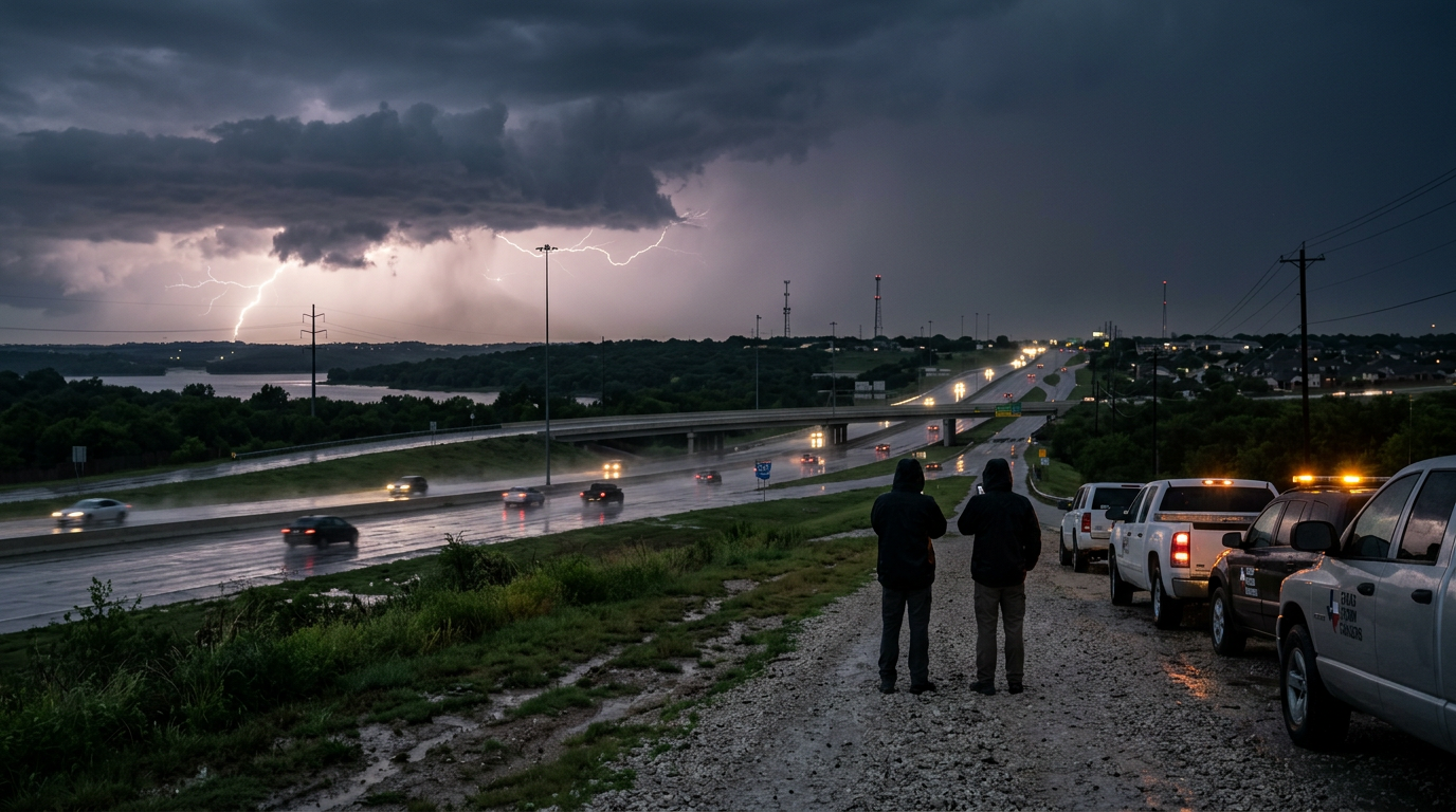
Weather monitoring agencies and the Texas Storm Chasers have identified a window for convective activity across the North Texas region starting in the early hours of Monday morning. As atmospheric instability increases overnight, forecasters expect storm cells to materialize near the Red River before pushing south toward the heavily populated Dallas-Fort Worth metroplex. This timing is particularly significant as it precedes the traditional sunrise, raising concerns for low-visibility driving conditions during the initial stages of the workweek. Because these storms are developing in the overnight hours, residents are encouraged to have multiple ways to receive weather alerts that can wake them in the event of severe warnings. Historically, North Texas has served as a collision point for dry air from the west and humid air from the Gulf, making the predawn hours a frequent theater for sudden atmospheric shifts. This specific event follows a pattern of late-spring volatility where daytime heating builds energy that is finally released after the sun sets and the 'cap' on the atmosphere weakens.
Texas relevance
Texas residents in the Dallas, Fort Worth, and Denton areas are directly in the projected path of this weather system. The Interstate 35 corridor frequently experiences significant travel delays when heavy rain coincides with morning rush hour, and this specific setup highlights the recurring volatility of the North Texas climate during the late spring and early summer transitions. Given the history of rapid storm intensification in this region, local emergency management offices often remain on high alert when predawn systems are forecasted. For millions of Texans, the threat of hydroplaning on the region's complex highway interchanges remains a high-priority safety concern every time a storm front moves through the Metroplex.
Timing and Regional Progression
The current meteorological outlook suggests that the primary window for development begins as early as 4:00 AM on Monday. These storm cells are anticipated to originate in the northwestern portions of the state and move in a southeasterly direction. Initial activity is likely to be concentrated near the Oklahoma-Texas border, specifically impacting counties along the Red River before the leading edge reaches the northern suburbs of the DFW area.
By 6:00 AM, the coverage of these storms may expand, coinciding with the earliest waves of the Monday morning commute. While the system's exact intensity remains under observation, the primary threats identified by the Texas Storm Chasers include localized heavy downpours and frequent cloud-to-ground lightning. The rapid arrival of these storms before full daylight can complicate visual assessments by local spotters and residents alike. Residents should monitor radar closely starting at approximately 3:00 AM for early signs of anvil cloud formation overhead.
Atmospheric Indicators and Instability
Meteorologists are tracking a specific cap of warm air that has been suppressing storm development throughout the previous day. As evening temperatures cool and a low-level jet stream accelerates over North Texas, this cap is expected to weaken. Once the atmospheric inhibition is removed, the available moisture from the Gulf of Mexico provides the necessary fuel for thunderstorms to trigger along any lingering surface boundaries or outflow from previous systems.
The complexity of this forecast lies in the localized nature of the convective initiation. Not every neighborhood in North Texas will experience a direct hit; however, the probability of scattered development is sufficient for widespread rain chances. Forecasters look specifically at the 'triple point' where different air masses meet, often a harbinger for the most active weather in the Texas plains. This convergence of dry air, moist air, and thermal energy is the engine that drives the state's most impactful weather events.
Historical Context for North Texas Storms
June in North Texas is historically a transitional period where the extreme heat of summer begins to compete with the final vestiges of spring storm systems. Predawn events are common in this region because they are often the result of decaying storm complexes that originate in the Texas Panhandle or Oklahoma the previous evening. These 'Mesoscale Convective Systems' frequently survive long enough to reach the Interstate 20 and Interstate 30 corridors just as the sun begins to rise.
Previous years have shown that these early morning systems can provide beneficial rainfall to parched Texas soil, but they also carry the risk of flash flooding in urban areas. The concrete-heavy geography of the Dallas-Fort Worth area means that heavy rain falling in a short duration has nowhere to go, often leading to rapid water accumulation on service roads and low-water crossings. This phenomenon is exacerbated during the early summer when the ground may already be hardened by rising seasonal temperatures, reducing natural absorption rates.
Impact on Transportation and Infrastructure
For the millions of Texans who utilize the regional highway system, Monday morning storms present a significant logistical challenge. The National Weather Service often emphasizes that the first few minutes of rainfall can be the most dangerous for drivers, as water mixes with accumulated oil and debris on the road surface. With the projected timing falling so close to sunrise, visibility will be at a minimum, requiring extra caution on major arteries like the North Texas Tollway and I-35E.
Local energy providers also monitor these events closely. While lightning is the primary concern for power reliability, the gusty winds often associated with the leading edge of Texas storms can cause localized outages by tossing debris into power lines. Residents are advised to secure loose outdoor furniture and equipment on Sunday evening to mitigate potential damage from unexpected wind gusts during the night. The threat of small hail, while secondary, can also lead to superficial damage on vehicles left unsheltered.
Stakeholders and Emergency Management
Multiple agencies across the North Texas region are coordinating to manage the potential impact of these Monday morning storms. From the Texas Department of Transportation to local police departments, the focus is on maintaining traffic flow and ensuring that emergency responders can reach incidents despite adverse weather conditions. These stakeholders rely on high-fidelity data from the National Weather Service in Fort Worth to determine where to pre-position high-water rescue equipment or utility repair crews.
Public works departments in cities like McKinney, Plano, and Arlington are also on alert to clear drainage inlets that might be blocked by early-season yard debris. The proactive management of local infrastructure is a critical component of Texas's strategy to handle sudden convective events. By preparing well before the first raindrops fall, local municipalities aim to reduce the economic impact of storm-induced closures and delays that can ripple throughout the state's economy.
Long-Term Outlook and Future Changes
As we progress further into the summer season, the nature of Texas storms will likely shift from these organized frontal systems to more isolated, heat-driven 'pop-up' storms. However, until the late-summer high pressure fully settles over the state, North Texas remains vulnerable to these early morning surprises. Climate experts suggest that while the frequency of these events may vary, the intensity of rainfall within them is a recurring theme in modern Texas weather patterns.
Moving forward, the integration of better satellite imagery and mobile notification systems will continue to serve as the primary defense for residents. The 'Always Ready' culture in Texas means that families are increasingly adept at reading radar and understanding meteorological jargon once reserved for professionals. As the DFW population continues to grow into more rural areas, the density of people in the path of these storms makes every forecast more critical than the last.
Safety Recommendations and Preparedness
Because this weather event is slated to occur while many residents are sleeping, the importance of weather radios and smartphone notifications cannot be overstated. A standard siren system is intended for outdoor warning only and may not be audible inside a home during a heavy thunderstorm. Ensuring that 'Do Not Disturb' settings on mobile devices allow for emergency alerts is a critical step for North Texas families.
Furthermore, if the storms produce the anticipated heavy rainfall, the phrase 'Turn Around, Don't Drown' remains the gold standard for Texas safety. Many of the flood-related incidents in the DFW area occur in the dark when drivers cannot accurately judge the depth of water covering a roadway. Staying tuned to local broadcasts from groups like the Texas Storm Chasers can provide real-time updates on which specific areas are seeing the highest impacts, allowing commuters to plan alternate routes.
Analysis
The upcoming weather event highlights a recurring challenge for Texas infrastructure: the management of urban runoff during high-intensity, short-duration events. While the meteorological setup appears standard for June, the timing is the true variable. A storm hitting at 4:00 AM requires a different level of public readiness than one occurring during the evening news. The reliance on digital alerting systems is paramount here, as traditional sirens may not penetrate the heavy sleep of a Monday morning. Furthermore, the reliance on groups like the Texas Storm Chasers reflects the growing trend of Texans seeking localized, real-time data over broad regional forecasts. This shift towards hyper-local awareness is a byproduct of the state's sprawling development, where weather conditions in Frisco can differ drastically from those in Waxahachie.
Source attribution
This story was reported using a public release from the Texas Storm Video (Google News). Keep TX Red rewrote the coverage independently and links to the official statement for verification.
Frequently Asked Questions
- What time are the storms expected to start?
- Current projections from weather monitoring groups indicate that storm cells could begin forming as early as 4:00 AM on Monday morning. The activity is expected to persist through the early commute hours before potentially clearing out later in the day.
- Which parts of Texas are most at risk?
- The primary focus is on North Texas, specifically counties situated between the Oklahoma border and the DFW area. Cities like Denton, Sherman, Dallas, and Fort Worth are all within the potential path of these predawn developments.
- Will these storms be severe?
- While widespread severe weather is not currently the primary forecast, the storms have the potential to produce heavy localized rain, frequent lightning, and gusty winds. Any storm in North Texas during this time of year has the capacity to intensify quickly, so continued monitoring is advised.
Official Sources
Take the next step
Browse the Newsroom →Read more about Keep Texas Red → Our full guide to what Keep Texas Red means and why Texans support it.
Related Articles



Get Texas updates delivered weekly.
Independent Texas reporting on politics, policy, and daily life. One email a week. Unsubscribe anytime.
Keep TX Red Newsroom
The Keep Texas Red Editorial Staff produces nonpartisan explainers, policy breakdowns, and educational resources to help Texans understand how their government works. All content is reviewed for accuracy and updated regularly.
About Keep TX Red →