Severe Storm System Sweeps Across Texas with Flooding and High Winds
A powerful weather system brings flash flood risks and damaging wind threats to East Texas this Tuesday morning.
Editorial disclaimer: Opinions and analysis on Keep TX Red are editorial content — not statements of fact. See our editorial standards.
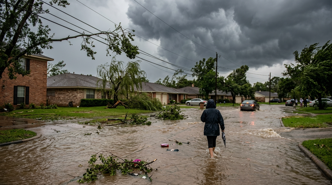
On Tuesday, May 26, 2026, a significant weather system is advancing across the state of Texas, bringing a variety of severe atmospheric threats. The system is moving in an eastward trajectory, carrying the potential for intense flash flooding, high-velocity winds, and the formation of hail in affected regions. This weather event marks a period of heightened atmospheric instability common during the transitional spring months in the Southern Plains. Residents across the eastern half of the state are advised to monitor local conditions as the system progresses throughout the day. Historically, these spring setups in Texas involve the clash of dry air moving off the high deserts and moist air streaming from the Gulf, creating a volatile environment often seen in late May. Historically, this week has been the anniversary of several major weather events in Texas, including the 2015 Memorial Day floods, reminding residents that the end of May is often the peak of the state's severe weather season. Forecast models indicate that the primary threat window remains open through the afternoon hours as the front gains energy from the heat of the day. The sheer scale of the system suggests that multi-county alerts will remain active as the line of storms solidifies into a bow echo or a semi-organized squall line.
Texas relevance
Weather events of this magnitude frequently impact the Texas triangle and Gulf Coast regions, necessitating localized emergency management responses. Historically, East Texas has been vulnerable to rapid-onset flash flooding due to its soil composition and dense river systems. This specific event targets some of the state's most populous corridors, potentially creating hazardous conditions for commuters on major interstates such as I-20, I-45, and I-10. Preparedness in Texas often involves securing outdoor property against high winds and finding covered parking to mitigate the risks associated with falling hail. These storms highlight the vital importance of the Texas infrastructure grid, as wind-related damage to power lines remains one of the most common causes of multi-day outages in the Piney Woods and Coastal Bend regions. State agencies often coordinate with local municipalities to ensure that drainage systems are cleared of debris prior to these events, though the volume of water expected today may test even the most robust urban planning efforts in areas like Houston and Tyler.
Anatomy of the Eastward Movement
The current weather pattern is characterized by a rapid shift from West and Central Texas toward the eastern state lines. As the system moves, it encounters richer moisture from the Gulf of Mexico, which often fuels the intensity of individual storm cells. This transition can lead to the clustering of storms, increasing the likelihood of sustained precipitation over single areas. The atmospheric dynamics today include a steep lapse rate, which allows for rapid vertical development of clouds, a precursor to the severe turbulence felt by air travelers at major hubs like DFW and Houston Intercontinental.
Forecasters with the Texas Storm Chasers have identified that the primary forward motion of the system is steady but aggressive. This speed determines which communities will experience the brunt of the secondary threats, such as damaging winds, which can reach speeds capable of downing power lines and large tree branches. The timing of this movement coincides with peak morning and afternoon activities for many Texans, creating a situation where the storm front may impact the evening commute for those in the far eastern counties and toward the Louisiana border.
The movement is not just a linear progression but involves a series of 'training' cells where one storm follows another over the same geographic footprint. This behavior is particularly dangerous in the Texas landscape where elevation changes are subtle, leading to unpredictable water flow patterns once the soil reaches its saturation point. State officials are monitoring the speed of the front closely, as a slower progression could exponentially increase the final rainfall totals recorded in the Piney Woods region.
Flash Flooding and Hydrological Risks
The threat of flash flooding is perhaps the most dangerous component of the current activity. Because these storms are carrying significant moisture, rainfall rates can exceed the drainage capacity of municipal infrastructures. In urban centers like Dallas, Houston, or Tyler, paved surfaces exacerbate runoff, leading to water accumulation on low-lying roads and underpasses. The unpredictability of these surges means that a dry road can become submerged in a matter of minutes, leaving little time for driver reaction.
Rural areas are not exempt from these risks, as creeks and small tributaries can rise within minutes of a heavy downpour. Residents are cautioned against driving through standing water, a leading cause of weather-related casualties in the state. The ground saturation from any previous rain events may also play a role in how quickly flash flood conditions materialize. In East Texas, the dense vegetation can sometimes mask the rising water levels in ditches and coulees, adding another layer of danger for those living in or traveling through wooded terrain.
Hydrologists point out that the river basins in the eastern part of the state are notoriously slow to drain. When a storm system dumps several inches of rain in a short window, the impact is felt for days afterward as the water moves through the winding river systems of the Sabine, Neches, and Trinity. This requires ranchers and homeowners in low-lying areas to move livestock and valuables to higher ground well before the rain begins, as access roads can be cut off significantly earlier than the actual peak of the flooding.
Wind Damage and Structural Hazards
Direct wind damage is a major concern as the storm line matures. Straight-line winds, which are often mistaken for tornadic activity, can produce gusts strong enough to peel shingles from roofs and flip unsecured outdoor equipment. The Texas Storm Chasers emphasize that these winds can develop suddenly within the core of the storm as it moves east. These winds are often the result of downdrafts, where cold air sinks rapidly and spreads out upon hitting the ground, creating a wall of air that can push down older structures and weaker trees.
Infrastructure resilience is tested during these sessions. Power outages are a common secondary effect of wind-driven debris impacting transformers or distribution lines. Utility crews across East Texas often remain on standby during these events to address localized outages as soon as it is safe for personnel to operate in the field. The heavy presence of oak and pine trees in the path of the storm increases the risk of 'leaf load' damage, where wet leaves make branches heavier and more susceptible to snapping under the pressure of 60-mile-per-hour gusts.
For owners of commercial property and those in the agricultural sector, wind damage is often the costliest part of a storm. Large storage sheds, center-pivot irrigation systems, and unfinished construction projects are particularly vulnerable. The state's building codes in coastal and near-coastal regions have been updated over the years to account for these risks, but older inland structures remain at risk when the pressure gradients between the storm and the surrounding air reach these extreme levels.
Hail Formation and Property Protection
Atmospheric conditions today are conducive to the growth of hail within stronger updrafts. While the size of the hail can vary, even small stones can cause significant damage to sensitive crops and personal vehicles. The occurrence of hail is often localized, meaning one neighborhood may see significant accumulation while an adjacent area sees only heavy rain. This variability makes it difficult for meteorologists to pin down a specific 'hail path,' requiring residents to remain vigilant whenever a severe thunderstorm warning is issued for their county.
For many Texans, hail represents a significant insurance risk. Property owners are encouraged to move vehicles under carports or into garages when a storm warning is issued. Additionally, the impact of hail on residential roofing can lead to long-term leaks if not inspected following the passage of the storm front. In recent years, Texas has seen a rise in hail-related insurance claims, leading to changes in how policies are structured, making proactive protection an essential financial move for the average homeowner.
The physics of hail formation today involve high-altitude freezing levels and strong vertical lift. When the system interacts with the warmer air near the surface, the moisture is thrust upward into the freezing layers where it aggregates into ice. If the updraft is strong enough, the ice stones can cycle multiple times, growing in size before falling to the earth. Today's forecast suggests that while 'gorilla hail' is not the primary expectation, 'quarter-sized' stones are a distinct possibility for the Interstate 35 corridor and points east.
Historical Context of Texas May Storms
May is statistically the most active month for severe weather in the Lone Star State. This period represents the 'Grand Finale' of the spring storm season before the summer high pressure settles in and brings the heat. Historically, the storms of late May have been responsible for some of the state's most significant hydrological disasters. By looking at previous years, emergency managers have refined their response strategies, focusing on the speed of communication through digital channels to reach a mobile population.
The shift from West to East is a classic Texas setup. Earlier in the morning, these storms may have started as isolated cells in the Permian Basin or the Hill Country before organizing into the more massive line currently threatening the eastern third of the state. This evolution is driven by the 'Dryline,' a invisible boundary that separates the dry air from the west and the humid air from the Gulf. When this boundary pushes east, it acts like a snowplow, lifting the moist air and triggering the violent storms currently being observed.
The cultural impact of these storms is also a part of the Texas identity. Spring storms are often met with a mix of relief (for the rain they bring to agricultural areas) and caution (for the danger they pose). In the 21st century, social media and real-time storm chasing have turned these events into shared experiences, where communities share photos and warnings in real-time, often providing the most immediate notice to neighbors downwind of a developing cell.
Infrastructure and Future Preparedness
As the storm system clears the state, the focus will inevitably shift toward recovery and the durability of Texas infrastructure. The state has invested heavily in flood mitigation projects, particularly in the wake of the 2017 hurricane season, but many interior counties are still catching up to the needs of their growing populations. Today's rainfall totals will provide critical data for engineers who are tasked with designing the next generation of drainage and runaway systems in burgeoning suburban communities north of Houston and east of Dallas.
Communications infrastructure is also under the microscope during these events. The ability of cellular towers to remain operational during high winds and heavy precipitation is vital for the emergency alerts that keep the public safe. Today's system serves as a live-fire test for the state's upgraded alert systems, which now integrate more precise GPS targeting to ensure that only those in the direct path of danger are alerted, reducing 'warning fatigue' among the general populace.
In the long term, these recurring severe weather events underscore the necessity of personal preparedness kits. Experts recommend that every Texas household maintains a 'go-bag' and a stationary emergency kit that includes batteries, clean water, and physical maps. As the climate and weather patterns continue to evolve, the ability of individual citizens to weather the first 24 hours of an emergency without outside assistance remains a cornerstone of the state's overall resilience strategy.
Analysis
While this system follows a typical meteorological pattern for late May, the timing during a busy travel week emphasizes the logistical vulnerabilities of the Texas highway system. The shift toward the east is expected to bring the most intense rain to regions that have already seen significant rainfall this season, increasing the likelihood of saturated ground leading to immediate runoff. For residents, this serves as a reminder that localized 'micro-events' within a larger storm front can cause disparate levels of damage within the same city.
Source attribution
This story was reported using a public release from the Texas Storm Video (Google News). Keep TX Red rewrote the coverage independently and links to the official statement for verification.
Frequently Asked Questions
- What areas of Texas are most at risk today?
- The primary risk zones are located in the eastern half of the state as the storm system moves out of Central Texas. This includes major metropolitan areas like the DFW Metroplex, Greater Houston, and Tyler, as well as rural counties situated in the path of the eastward-moving front toward the Louisiana border.
- What should I do if I encounter a flooded road?
- The standard safety protocol is 'Turn Around, Don't Drown.' Most vehicles can be swept away by as little as six inches of moving water. Visibility during these storms may be low, making it difficult to judge the depth of standing water or whether the road surface underneath has been washed away.
- Are tornadoes expected with this system?
- While the primary reports focus on damaging winds, hail, and flooding, residents should always remain alert for tornado warnings. Severe thunderstorms in Texas can occasionally produce brief, rain-wrapped tornadoes with little advance notice, especially within the leading edge of a squall line.
- How can I protect my vehicle from hail?
- The most effective method is to move the vehicle into a permanent structure like a garage or carport. If you are caught on the road, try to find a gas station canopy or a public parking garage. Avoid stopping under highway overpasses, as this creates a significant traffic hazard and does not provide total protection from wind-blown hail.
Official Sources
Take the next step
Browse the Newsroom →Read more about Keep Texas Red → Our full guide to what Keep Texas Red means and why Texans support it.
Related Articles



Get Texas updates delivered weekly.
Independent Texas reporting on politics, policy, and daily life. One email a week. Unsubscribe anytime.
Keep TX Red Newsroom
The Keep Texas Red Editorial Staff produces nonpartisan explainers, policy breakdowns, and educational resources to help Texans understand how their government works. All content is reviewed for accuracy and updated regularly.
About Keep TX Red →