Severe Weather Watch: Texas Storm Chasers Track Systems Across Texoma and North Texas
Texas Storm Chasers launched live coverage on May 8 as severe weather systems moved through North Texas and the Texoma region.
Editorial disclaimer: Opinions and analysis on Keep TX Red are editorial content — not statements of fact. See our editorial standards.
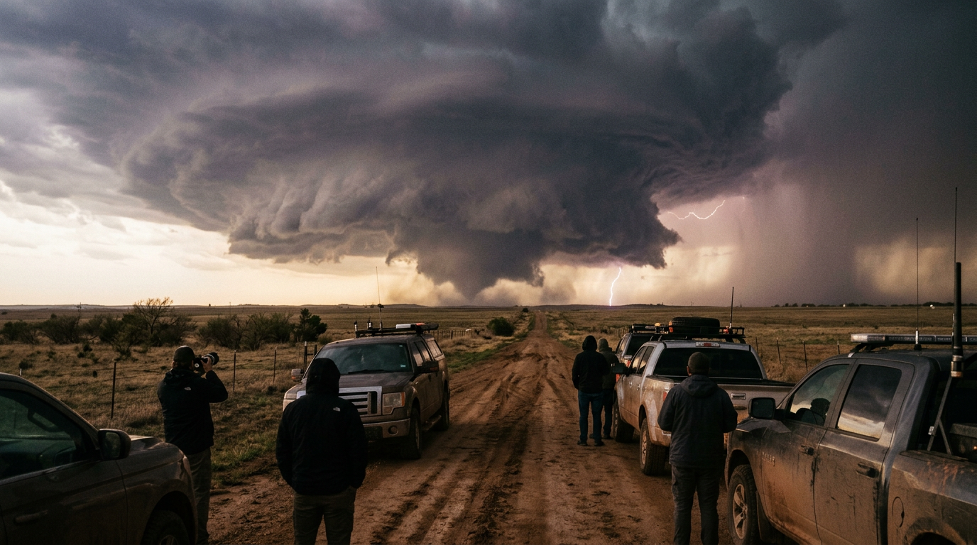
On the evening of May 8, 2026, the Texas Storm Chasers initiated intensive live coverage as a wave of severe weather moved through the Texoma and North Texas regions. Led by the broadcaster known as Baldy-in-Chief, the organization provided real-time updates to residents in the path of developing storm cells. The event highlights the recurring seasonal volatility of the Red River valley, where atmospheric instability often leads to rapid convective activity during the spring months. Historically, North Texas serves as a focal point for storm systems that originate in the western plains before gaining intensity as they move toward more populated corridors. This specific event saw a convergence of high-level moisture and cold fronts that typical Texas spring afternoons produce, culminating in a series of tracked cells that required constant observation. Unlike automated radar apps, these live sessions provide a human element that interprets the velocity and rotation of systems for the layperson. The context for this monitoring is rooted in the long-standing tradition of amateur and professional storm chasing within the Lone Star State. Texas has more tornadoes on average per year than any other state in the nation, making the role of independent chasers a vital component of the state's safety ecosystem. Over the last decade, the shift from traditional radio alerts to high-definition digital streaming has changed how Texans in rural areas like Texoma prepare for weather emergencies. This live coverage serves as a modern digital fire watch, keeping a sentinel eye on the horizon as the dry line pushes east and meets the humid air of the Gulf, creating the explosive potential that characterizes May in the northern reaches of the state.
Texas relevance
The current weather event is directly impacting the Texoma region and the broader North Texas area, including dozens of counties that rely on the Red River as a geographic boundary. Residents in these specific Texas communities face significant atmospheric threats during the spring season, making local monitoring efforts essential for public safety and preparedness. Texas has a long history of severe convective storms that can shift rapidly, and the North Texas infrastructure is frequently tested by high winds and intense precipitation during these transit periods. Specifically, the I-35 and US-75 corridors are major transit arteries that become hazardous during these events, impacting everything from local commerce to interstate trucking operations centered in North Texas hubs.
The Geographic Focus on Texoma
The Texoma region, which straddles the border between North Texas and southern Oklahoma, is frequently a high-activity zone for severe weather. Because the area contains a mix of rural ranch land and growing residential hubs like Sherman and Denison, the movement of a storm system through this corridor requires detailed tracking to ensure that smaller communities receive adequate warning. The topography of the Red River basin can sometimes influence the longevity of a storm cell, as moisture levels near the water can interact with cooling evening temperatures.
On May 8, the focus remained on how these systems would interact with the cooling evening air and the existing moisture levels near the Red River. Residents in these counties often experience storm systems that move with varying speeds, making the live-streamed documentation provided by the Texas Storm Chasers a vital tool for those tracking specific cell locations in relation to their homes. The predictability of these storms is often hampered by the complex micro-climates found across the North Texas plains, where a difference of ten miles can mean the difference between a light rain and damaging hail.
Technical Monitoring and Live Reporting
The broadcast utilized real-time data to illustrate the path of the storms as they encroached upon the North Texas landscape. This form of reporting allows for a level of interaction and visual confirmation that standard automated alerts may lack, giving the public a view of the storm's structure as it develops over the horizon. The use of chase vehicles equipped with high-gain antennas and mobile radar connections allows these teams to stay ahead of the cell, providing a perspective that fixed-location news cameras cannot match.
Monitoring these systems involves looking for specific signatures in the atmosphere that indicate severity, such as wall clouds or rapid vertical development. By providing a live venue for this information, the Texas Storm Chasers ensure that the data is contextualized for the average viewer who may be unfamiliar with complex meteorological charts but needs to understand the immediate impact on their local travel or safety. This educational aspect helps the public recognize when a storm is 'recycling'—a process where it regains strength after a temporary lull.
Historical Context of May Storms in Texas
Texas is no stranger to the volatile climate cycles of May, a month typically identified as one of the most active for severe weather across the central and northern parts of the state. The convergence of different air masses—dry air from the west, cold air from the north, and warm, moist air from the Gulf—creates an environment where storms can become stationary or move rapidly through the I-35 corridor and beyond into the Texoma basin. Historical records show that many of the state's most significant weather events have occurred within this specific calendar window.
The events of May 8 represent a standard but high-risk example of these seasonal patterns. As the storm cells move east and northeast, they interact with varying terrain, which can influence their intensity. Continuous documentation of these changes helps build a historical record of how North Texas weather behaves under specific pressure and temperature conditions. By cataloging these events live, chasers are providing future researchers with a treasure trove of ground-level observations that supplement satellite and radar imagery.
The Evolution of Storm Chasing Stakeholders
The stakeholder landscape for Texas weather has expanded significantly over the last two decades. While the National Weather Service remains the authoritative body, groups like the Texas Storm Chasers have become essential intermediaries. These groups often consist of veteran meteorologists, experienced hobbyists, and digital media experts who collaborate to keep the public informed. Their stake in the process is driven by a mix of civic duty and the desire to provide specialized coverage that major networks, which must cover entire metropolitan areas, may overlook in favor of broader stories.
Local emergency management coordinators also rely on these independent chasers for 'ground truth' reports. When a chaser confirms a developing funnel or a specific hail size on camera, those reports are often fed back into the official system to trigger sirens and emergency alerts. This collaborative ecosystem between high-tech chasing crews and public safety officials ensures that the information gap is bridged during the most dangerous minutes of a weather event.
Infrastructure and Economic Impact
Severe weather in North Texas does more than just threaten safety; it has a massive economic impact on the region's infrastructure. Every major storm event that passes through Texoma and the Dallas-Fort Worth metroplex puts stress on the power grid, telecommunications, and transportation networks. High winds and large hail are responsible for millions of dollars in property damage annually, making real-time tracking an essential service for businesses that need to move assets or protect equipment before a storm hits.
Furthermore, the agricultural sector in the Texoma region is particularly sensitive to these events. Farmers and ranchers depend on accurate timing to move livestock or secure equipment. When live trackers provide an extra thirty minutes of lead time by identifying a specific cell's velocity, they are effectively providing an economic buffer for the rural Texas economy. This highlights the multi-faceted importance of storm chasing beyond the thrill of the hunt; it is a critical support mechanism for Texas industry.
Looking Ahead: The Future of Texas Weather Monitoring
As the evening progressed on May 8, the trajectory of the storms remained a primary concern for those in the potential path of the weather cells. The transition from late evening into the overnight hours often brings additional challenges, as visibility decreases and the storm dynamics change with the loss of solar heating. This 'nocturnal phase' is when live tracking becomes most critical, as residents may be asleep and unable to see the horizon for themselves.
Meteorological organizations will continue to watch these systems as they clear the Texoma area and head further into North and East Texas. The data gathered during this live event will likely inform how future storms in this specific geographic cycle are handled, providing a blueprint for public communication during the remainder of the Texas spring storm season. As technology improves, we can expect to see even more precise tracking, but the human interpretation provided by chasers will remain the gold standard for localized reporting.
Analysis
The decision by independent organizations like the Texas Storm Chasers to provide live, localized coverage reflects a shift in how residents consume emergency information. While traditional meteorological services provide the baseline data, the specific focus on Texoma suggests that specialized weather systems are increasingly filling the gap for hyper-local reporting during high-risk windows. This trend underscores the necessity of continuous monitoring in regions of the state where weather can escalate from a standard rain event to a severe cell in a matter of minutes. By removing the lag time between radar updates and public dissemination, these chasers provide a literal 'eyes on the ground' perspective that can save lives when minutes count. It also highlights the growing reliance on community-funded weather networks to supplement the National Weather Service's broader regional alerts, creating a more robust safety net for the Texas public.
Source attribution
This story was reported using a public release from the Texas Storm Video (Google News). Keep TX Red rewrote the coverage independently and links to the official statement for verification.
Frequently Asked Questions
- What areas were most affected by the weather on May 8?
- The storms primarily impacted the North Texas region and the Texoma area, which includes communities along the border of Texas and Oklahoma, specifically focused on counties near the Red River and the I-35 corridor.
- Who provided the live updates for these storms?
- The updates were provided by the Texas Storm Chasers, with the live broadcast led by the individual known as Baldy-in-Chief, utilizing mobile tracking technology.
- Why is the Texoma region significant for weather tracking?
- The Texoma region is a frequent corridor for severe weather development in the spring, where atmospheric conditions often lead to the formation of intense storm cells due to the convergence of different air masses.
- How does live storm chasing improve public safety?
- It provides real-time 'ground truth' that confirms what radar is seeing, often giving the public and emergency managers more accurate information regarding hail size, wind speed, and potential rotation.
- Is May the most dangerous month for Texas weather?
- Statistically, May is one of the most active months for severe convective storms and tornadoes in North Texas, making it a critical period for weather awareness.
Official Sources
Take the next step
Browse the Newsroom →Read more about Keep Texas Red → Our full guide to what Keep Texas Red means and why Texans support it.
Related Articles



Get Texas updates delivered weekly.
Independent Texas reporting on politics, policy, and daily life. One email a week. Unsubscribe anytime.
Keep TX Red Newsroom
The Keep Texas Red Editorial Staff produces nonpartisan explainers, policy breakdowns, and educational resources to help Texans understand how their government works. All content is reviewed for accuracy and updated regularly.
About Keep TX Red →