Exploring the Heart of the Lone Star State Through Hidden Backroad Journeys
Discover overlooked Texas road trip routes this summer, from the rolling Hill Country to the historic Piney Woods and the vast West Texas horizons.
Editorial disclaimer: Opinions and analysis on Keep TX Red are editorial content — not statements of fact. See our editorial standards.
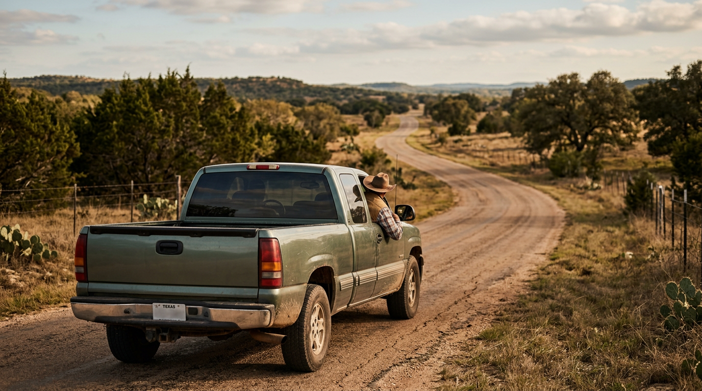
As temperatures rise across the Southern United States, travelers are increasingly seeking alternatives to the overcrowded tourist traps of the Gulf Coast and major metropolitan theme parks. Historically, the Texas travel industry has relied heavily on the 'Big Three' destinations—Austin, San Antonio, and the Galveston shoreline. However, a new trend is emerging among residents and visitors alike: a preference for the state's vast network of secondary highways and rural backroads. These routes offer a window into the authentic regional cultures that define the Lone Star State, providing a slower pace of travel that emphasizes scenic landscapes, local food, and small-town heritage sites. This shift toward domestic, rural exploration follows a broader national interest in 'slow travel,' where the journey itself becomes the primary focus of the vacation rather than just the destination. Developing a map for these underrated routes requires an understanding of the state's diverse ecoregions. From the dense forests of East Texas to the high desert plateaus of the Trans-Pecos, each route presents a distinct environmental and cultural snapshot. For instance, the drive through the rolling hills of Central Texas offers more than just bluebonnets; it provides access to specialized agricultural centers and historic German-influenced settlements. Similarly, moving northward into the Cross Timbers region reveals a transition from grassy plains to rugged limestone outcroppings, a geography that supported the early cattle trails of the 19th century. By moving beyond the interstate highway system, motorists can engage with the local economies of small towns that often go unnoticed by the millions of travelers passing through on I-10 or I-35.
Texas relevance
Texas is the second-largest state in the union, spanning over 268,597 square miles and possessing a state highway system that covers nearly 80,000 miles. For Texans, the road trip is more than a vacation; it is a cultural rite of passage and a vital economic driver for rural municipalities. These lesser-known routes are particularly relevant to the state's economy because they distribute tourism dollars into communities that do not benefit from major urban infrastructure. Towns from Marfa in the west to Jefferson in the east rely on 'heritage tourism' to sustain local businesses, museums, and historical preservation efforts. Furthermore, exploring these routes allows residents to connect with the specific history of the Texas Revolution and the subsequent development of the cattle and oil industries that built the state's modern wealth.
The Willow City Loop and the Central Hill Country
Located just north of Fredericksburg, the Willow City Loop is often cited as one of the most beautiful drives in the Central Texas region. While it is famous for its spring wildflower displays, the summer months reveal a different side of the landscape, characterized by dramatic granite outcroppings and rugged canyons. The thirteen-mile stretch is a narrow road that winds through private ranch lands, offering a rare glimpse into the topographical diversity of the Llano Uplift. Travelers here can see the ancient Precambrian rocks that form the backbone of the region, some of the oldest geological formations in North America.
Visiting this area requires a sense of respect for local property, as much of the scenic beauty resides on active Texas ranches. The route leads toward the town of Llano, the self-proclaimed 'Deer Capital of Texas,' where the historical town square remains a hub of activity. Stopping in these smaller towns allows travelers to experience authentic Texas barbecue and visit local boutiques that represent the traditional craftsmanship of the Hill Country. The proximity to the Enchanted Rock State Natural Area also provides an opportunity for evening hiking and stargazing, away from the light pollution of the major cities.
Exploring the Piney Woods and Historic East Texas
Heading east toward the border with Louisiana, the landscape shifts from rocky hills to towering loblolly pines and dense hardwood forests. The Piney Woods region offers a cool canopy for summer travelers, with routes like the Texas Forest Trail providing a guided experience through the state's timber country. This area is rich in Caddo Indian history and early European settlement stories. Cities like Nacogdoches, the oldest town in Texas, serve as anchors for these road trips, offering brick-paved streets and Spanish colonial heritage sites that predate the Texas Republic.
The drive along State Highway 21, also known as the Old San Antonio Road or El Camino Real de los Tejas, is perhaps the most historic route in the state. This trail was used for centuries by indigenous groups, Spanish explorers, and early American pioneers. Traveling through the Davy Crockett National Forest or the Caddo Lake area provides a stark contrast to the arid climates found in the west. The slow-moving waters of the bayous and the massive cypress trees draped in Spanish moss offer a serene environment for those looking to escape the hustle of Houston or Dallas.
The Vast Horizons of the Davis Mountains and Big Bend
West Texas is often misunderstood as a flat, desolate expanse, but the route leading into the Davis Mountains tells a different story. The Highway 118 loop, starting from Fort Davis, climbs into the higher elevations where the temperature is significantly cooler than the surrounding Chihuahuan Desert. This 'Sky Island' ecosystem provides a verdant oasis for wildlife and flora that cannot be found elsewhere in the state. The drive culminates at the McDonald Observatory, where the high altitude and dry air provide some of the clearest views of the cosmos in the continental United States.
Continuing south toward Big Bend National Park via the River Road (FM 170) is widely considered one of the most scenic drives in the nation. It follows the Rio Grande through steep volcanic cliffs and deep river canyons. This route is not for the faint of heart, as it involves sharp turns and steep grades, but the payoff is an unparalleled look at the raw, untamed beauty of the Texas borderlands. The small ghost towns and desert art colonies along the way, such as Terlingua, offer a unique subculture that blends rugged independence with creative expression.
Canyonlands and Plains of the Texas Panhandle
In the northern reaches of the state, the Llano Estacado gives way to the dramatic chasms of the Palo Duro Canyon. Known as the 'Grand Canyon of Texas,' this area offers a stunning drive down into the canyon floor, where the red clay walls tower hundreds of feet above the road. The route through the Panhandle is often associated with the legendary Route 66, but the secondary roads leading to the Caprock Canyons State Park provide a more intimate look at the bison herds that once roamed the Southern Plains by the millions.
Traveling through this region highlights the agricultural prowess of Texas, as the roads are lined with vast fields of cotton, corn, and sorghum. The small communities of the Panhandle maintain a strong connection to their pioneer roots, with local museums dedicated to the history of the railroad and the early days of ranching. For modern travelers, these routes offer a sense of scale and solitude that is difficult to find in more populated areas, making it an ideal choice for those seeking a true 'getaway' from the connectivity of modern life.
The Coastal Bend Beyond the Resorts
While South Padre Island and Corpus Christi receive much of the headlines, the small fishing villages along the Coastal Bend offer a different kind of summer experience. Highway 35, which hugs the coastline from Port Aransas toward the Matagorda Bay, passes through birding sanctuaries and historic port towns like Rockport and Fulton. The area is a haven for naturalists, particularly during the summer when various migratory species are present in the salt marshes and inlets.
The charm of this route lies in its lack of commercialization compared to the major resort cities. Local seafood shacks, bait shops, and public piers define the landscape. This area was also the site of early French and Spanish exploration, with the remains of La Salle's ship, the La Belle, having been discovered in the nearby waters. Exploring the Coastal Bend provides a chance to understand the delicate balance between the industrial importance of the Texas coast and the ecological preservation required to protect its unique marine life.
Analysis
The push for underrated road trips reflects a strategic move for Texas tourism. By decentralizing the flow of travelers, the state can mitigate the strain on infrastructure in over-capacity areas like Austin or Fredericksburg. For the individual traveler, these routes offer a hedge against inflation; small-town Texas remains significantly more affordable than the skyrocketing prices of city-center entertainment districts. Politically and socially, these trips foster a greater sense of state unity by bringing urban dwellers into the rural heartland, encouraging a mutual appreciation for the diverse lifestyles that exist within the same state borders. As the state continues to grow at an unprecedented rate, preserving the viability of these rural gems becomes essential to maintaining the unique character of Texas.
Source attribution
This story was reported using a public release from the Texas Travel Stories (Google News). Keep TX Red rewrote the coverage independently and links to the official statement for verification.
Frequently Asked Questions
- What is the best time of year to explore these Texas routes?
- While the article focuses on summer travel, many of these routes are excellent year-round. However, the Davis Mountains and the Panhandle offer cooler temperatures in the summer due to their higher elevation and northern latitude. If you are specifically looking for wildflowers, the Hill Country routes are best in late March and April.
- Are these underrated routes safe for solo travelers?
- Yes, Texas backroads are generally very safe. However, because some of these areas are remote—particularly in West Texas and the Panhandle—it is essential to ensure your vehicle is in good repair, your gas tank is full, and you have documented your route, as cell service can be spotty in deep canyons or desert stretches.
- Do I need any special permits to drive on the Willow City Loop?
- No permits are required as it is a public road. However, travelers must remain inside their vehicles or on the roadway at all times. The land on either side of the road is privately owned ranch land, and trespassing is strictly forbidden and heavily enforced by local law enforcement.
Official Sources
Take the next step
Browse the Newsroom →Read more about Keep Texas Red → Our full guide to what Keep Texas Red means and why Texans support it.
Related Articles



Get Texas updates delivered weekly.
Independent Texas reporting on politics, policy, and daily life. One email a week. Unsubscribe anytime.
Keep TX Red Newsroom
The Keep Texas Red Editorial Staff produces nonpartisan explainers, policy breakdowns, and educational resources to help Texans understand how their government works. All content is reviewed for accuracy and updated regularly.
About Keep TX Red →