Severe Weather Alert: Large Hail and High Winds Forecast Across Texas Through Midweek
Texas faces a multi-day severe weather threat starting April 11, with meteorologists warning of large hail, damaging wind gusts, and flood risks.
Editorial disclaimer: Opinions and analysis on Keep TX Red are editorial content — not statements of fact. See our editorial standards.
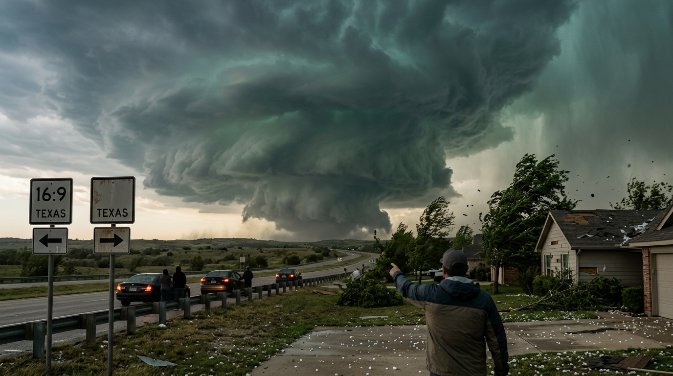
Texas is bracing for a multi-day stretch of volatile weather as a series of storm systems moves across the state beginning April 11 and lasting through the middle of the week. Meteorologists are closely monitoring the atmosphere for the development of supercell thunderstorms capable of producing large hail and destructive straight-line winds. Historically, April serves as a peak month for severe weather in the Lone Star State due to the collision of dry air from the west and moist Gulf air from the south. This current setup follows a similar pattern seen in previous active spring seasons, where stationary fronts serve as the primary catalyst for repeated rounds of heavy rain and turbulence. The persistence of a moist air mass trapped beneath an unstable upper-level flow creates the ideal conditions for long-lived storm complexes to traverse several hundred miles, impacting multiple major metropolitan hubs within a single afternoon. Forecast models suggest that atmospheric energy will reset each morning, leading to a daily afternoon surge in thunderstorm activity that could catch commuters off guard. Property owners are advised that the rapid transition from sunny skies to severe conditions is a hallmark of this particular meteorological setup.
Texas relevance
Residents throughout Texas, particularly those in the Interstate 35 corridor and the Panhandle, must maintain high situational awareness during this period. Texas infrastructure is often tested during these spring outbreaks, where rapid-onset flooding can overwhelm metropolitan drainage systems in cities like Dallas, Austin, and San Antonio. The agricultural sector in West Texas also remains on high alert, as large hail during this stage of the growing season can lead to significant crop losses. Local emergency management offices across the state are preparing for potential power outages and property damage resulting from the forecasted wind gusts. This event is significant because it mimics the 2015 and 2019 spring patterns where cumulative rainfall overwhelmed regional reservoirs, leading to several weeks of high-water conditions. With the ground already saturated in parts of North Texas, the risk of downed trees and utility poles increased proportionally, as high winds are more likely to uproot trees in wet soil.
The Evolution of the Current Storm System
The current atmospheric disturbance is characterized by a high degree of instability fueled by significant moisture return from the Gulf of Mexico. As an upper-level low-pressure system interacts with this moisture, the threat of severe thunderstorms increases across vast swaths of the state. Forecasters expect the initial wave of activity to begin in the western regions before gradually marching eastward across the high plains and into the central counties.
Unlike fast-moving cold fronts that clear the state quickly, this system is part of a slower-moving weather pattern. This longevity contributes to the midweek threat, as several impulses of energy are expected to trigger new rounds of convective activity each afternoon and evening. The primary concern during the daylight hours remains the development of discrete cells that possess the rotational energy required for severe hail. These individual cells, often referred to as supercells, can remain active for several hours before merging into larger squall lines late at night.
By the time these storms reach the more populated corridors of the I-35 and I-45, they often transition from a hail threat to a wind and flood threat. This transition occurs as the individual storm cells cluster together, creating a unified front of high-pressure air that pushes forward at high speeds across the flat Texas landscape. This pattern requires constant monitoring of radar by residents in the path of the storm.
Large Hail and Damaging Wind Hazards
One of the primary threats identified for the midweek period is the potential for significant hail. The cooling temperatures in the upper atmosphere are conducive to hail growth within the strongest updrafts. Texans are encouraged to protect outdoor property and move vehicles under cover, as even brief bursts of hail can cause extensive aesthetic and structural damage to homes and businesses. Many insurance providers in Texas classify these April events as 'catastrophic' due to the widespread nature of roof and vehicle claims.
In addition to hail, straight-line winds present a major risk to the state's power grid. Wind gusts associated with these thunderstorms can reach speeds that down power lines and uproot trees. Utility companies across the state often pre-position crews during these stretches to ensure that any interruptions to service involve minimal downtime for residential and commercial customers. These 'microbursts' or downbursts can occasionally produce damage equivalent to a weak tornado, making it vital to treat wind warnings with high priority.
The economic impact of wind and hail in Texas often exceeds billions of dollars annually. Because the state acts as a focal point for the dryline—a boundary between dry continental air and moist maritime air—the volatility of these storms is higher than in many other regions. Homeowners are advised to clear loose debris from their yards and ensure that trampolines or patio furniture are properly secured before the storm fronts arrive.
Flood Risks and Saturated Soil Concerns
As multiple rounds of rain pass over the same geographic areas, the risk of localized flooding increases significantly. Saturated soils have a diminished capacity to absorb additional rainfall, leading to rapid runoff into creeks and low-lying roadways. This 'training' effect, where storms follow one another in a linear fashion, is a hallmark of Texas spring weather and often leads to dangerous driving conditions. Small tributaries that usually appear dry can flash into torrents within minutes.
Flash flooding remains a leading cause of weather-related fatalities in the state. Emergency officials remind motorists to avoid driving through standing water, especially at night when depth is difficult to perceive. The duration of this weather event means that flood risks may actually peak toward the end of the week as river levels continue to rise from cumulative precipitation and runoff from higher elevations.
In urban areas like Houston or the DFW Metroplex, concrete surfaces exacerbate the flooding risk by preventing natural drainage. This puts a massive strain on the municipal pump systems and drainage bayous designed to channel water toward the Gulf. Residents in flood-prone zones should monitor the stages of nearby creeks and be prepared to move to higher ground if local authorities issue evacuation orders or high-water alerts.
Regional Forecast Variability and Stakeholder Impact
While the entire state is under a general threat, specific regions will face varying degrees of severity. The Panhandle and West Texas are more likely to see the initial development of dryline storms, which are often the most prolific hail producers. These storms typically form in the late afternoon and can travel hundreds of miles before losing intensity. This puts agricultural stakeholders at high risk, as winter wheat and emerging corn crops can be destroyed in minutes.
Central and North Texas may see more organized clusters of storms that bring a higher threat of heavy rain and wind. The interaction between the cap—a layer of warm air aloft that prevents storm formation—and the advancing surface boundaries will determine exactly where the most intense weather breaks out each day. A stronger cap might limit the number of storms but increase the severity of those that do form by allowing energy to build up beneath the atmospheric lid.
The impact on local schools and businesses during these periods is also significant. Many districts in North Texas have protocols for 'shelter-in-place' during dismissal times if severe warnings are active. Employers should consider flexible schedules for staff who may need to commute through areas under flood watches. Coordination between the National Weather Service and local municipalities is at its highest during these multi-day severe weather windows.
Historical Context and Future Outlook
Texas has a long history of severe spring weather cycles that define the state's climate. The current pattern of back-to-back storm systems is reminiscent of the major outbreaks in the mid-2000s that led to improved radar technology across the state. These events serve as a reminder of why Texas leads the nation in several severe weather categories. The predictability of these systems has improved, but the sheer power of the thunderstorms remains a constant challenge for infrastructure and safety.
What changes next will largely depend on the movement of the jet stream. If the jet stream stays in its current meridional (wavy) pattern, Texas could see another round of storms following a brief weekend respite. Meteorologists note that as the state enters late April and early May, the frequency of these systems typically increases, suggesting this week's activity is only the beginning of the peak severe season.
Residents are encouraged to use this time to review their emergency plans. The repetitive nature of this week's forecast provides a unique opportunity to identify weaknesses in home preparation or travel routes. As the storms clear out toward the end of the week, the humidity may drop, but the potential for a renewed surge of Gulf moisture means that the reprieve could be temporary. Staying informed through trusted local outlets remains the best defense against the unpredictable nature of Texas weather.
Source attribution
This story was reported using a public release from the Texas Storm Video (Google News). Keep TX Red rewrote the coverage independently and links to the official statement for verification.
Frequently Asked Questions
- What parts of Texas are at the highest risk?
- While the threat covers most of the state, the Panhandle and North/Central Texas are currently at a higher risk for severe thunderstorms. However, weather patterns can shift quickly, so residents in South and East Texas should also monitor local updates.
- Will there be a risk of tornadoes?
- Spring storm systems in Texas often carry a localized risk of tornadoes within certain cells. While large hail and wind are the primary hazards identified for this week, the atmospheric instability is sufficient to support brief tornadic activity.
- How can I protect my home from hail damage?
- If possible, ensure your roof is in good repair and clear gutters to prevent water backup. Moving vehicles into garages or under carports is the most effective way to prevent vehicle loss during a hail storm.
- Is it safe to drive during these storms?
- Driving is discouraged during active warnings. If you must travel, avoid low-lying crossings and never drive around barricades. Visibility in these storms can drop to near zero due to heavy rain and wind-blown debris.
Official Sources
Take the next step
Browse the Newsroom →Read more about Keep Texas Red → Our full guide to what Keep Texas Red means and why Texans support it.
Related Articles



Get Texas updates delivered weekly.
Independent Texas reporting on politics, policy, and daily life. One email a week. Unsubscribe anytime.
Keep TX Red Newsroom
The Keep Texas Red Editorial Staff produces nonpartisan explainers, policy breakdowns, and educational resources to help Texans understand how their government works. All content is reviewed for accuracy and updated regularly.
About Keep TX Red →