Severe Weather Alert: Large Hail and Damaging Winds Forecast for Texas This Weekend
Meteorologists warn of a significant severe weather system approaching Texas, bringing threats of heavy rain, high winds, and hail starting Saturday.
Editorial disclaimer: Opinions and analysis on Keep TX Red are editorial content — not statements of fact. See our editorial standards.
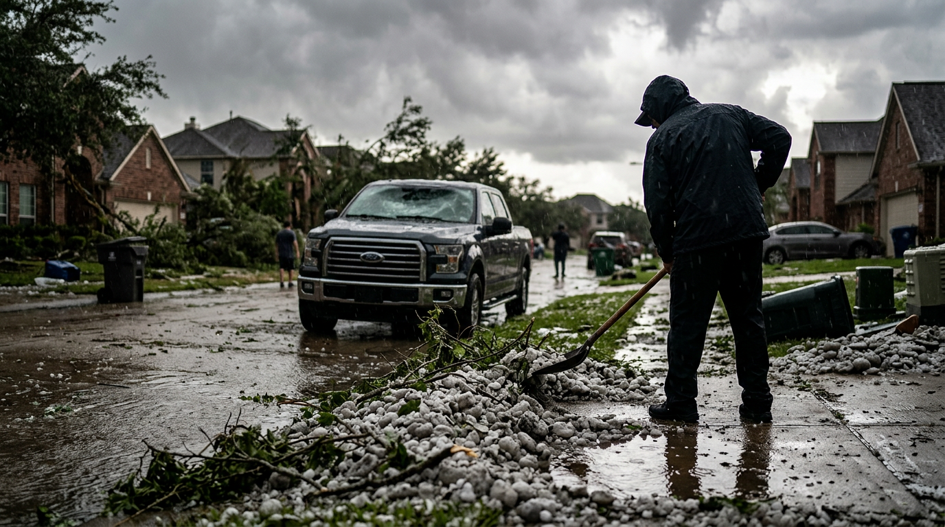
Texas is preparing for a significant shift in atmospheric conditions as a severe weather system is projected to sweep across the state this coming weekend. Meteorological reports indicate that a combination of warm, moist air from the Gulf of Mexico and an advancing upper-level disturbance will create a volatile environment conducive to storm development. Residents should expect the arrival of these systems starting late Friday, with the most intense activity likely concentrated throughout Saturday and Sunday morning. Historically, April serves as a peak month for severe weather in the Lone Star State, and this system follows the established seasonal pattern of high-energy convective events. The clash between cooler northern air and the humid warmth of the coastal plains often turns the region into a corridor for atmospheric instability, a phenomenon documented in Texas weather history for decades. Contextually, Texas weather in April is notorious for producing some of the most expensive hailstorms in the country. Previous years have seen multi-billion dollar claims resulting from similar weekend storm fronts that tracked over densely populated metro areas. This specific system appears to be feeding off a sharp dryline—a boundary between dry and moist air masses—extending from West Texas into the heart of the state. This boundary often acts as a trigger for high-velocity updrafts, which are the essential building blocks for the supercell structures meteorologists are currently tracking. Local officials are emphasizing the importance of staying informed, as these systems can transition from general rain showers to severe, life-threatening events in less than an hour.
Texas relevance
This weather event has a direct impact on the safety and infrastructure of major Texas regions, specifically North and Central Texas. Residents in the Dallas-Fort Worth metroplex and the Austin-San Antonio corridor are advised to monitor local alerts closely, as these high-population areas are within the projected path of the heaviest rainfall and potential hail. In Texas, unpredictable spring weather often results in rapid shifts in road conditions, making weekend travel particularly hazardous on major thoroughfares like I-35 and I-10. Historically, these corridors see an increase in motor vehicle accidents during the first hour of heavy rainfall when road oils mix with water, creating slick surfaces across the Blackland Prairie and Hill Country regions.
Projected Storm Timing and Path
The timeline for this severe weather event suggests a multi-phase arrival. Initial storm cells are expected to form in the western portions of the state before organizing into a more cohesive line of storms as they move eastward. The interaction between dry line boundaries in West Texas and the more humid air in the eastern half of the state will serve as the primary engine for these disturbances.
By Saturday afternoon, the risk for severe development increases significantly. Forecasters are watching for the development of supercell structures that could produce isolated but intense damage. As the evening progresses, these individual cells are expected to merge into a cluster or a squall line, shifting the primary threat from discrete hail events to widespread damaging straight-line winds as the system moves toward the Gulf Coast. Residents in West Texas may see the first signs of this shift early Friday evening, while the most populous central corridors will feel the impact late Saturday night.
The speed at which the front moves will determine how much flooding occurs. If the line of storms stalls over the I-35 corridor, rain totals could spike beyond initial estimates. Currently, the steering winds at the mid-levels of the atmosphere suggest a steady eastward progression, but any deviation in the upper-level trough could slow the system down, leading to prolonged exposure to heavy lightning and precipitation in the Brazos Valley and East Texas.
Hail and Wind Hazards
One of the primary concerns for this weekend is the potential for large hail. Atmospheric sounding data suggests that the upper-level temperature profile is cold enough to support the growth of significant hailstones within the strongest updrafts. Property owners are encouraged to secure vehicles and outdoor equipment, as hail in Texas frequently causes substantial damage to roofs and surface structures during the spring cycle.
In addition to the hail threat, damaging wind gusts are a major component of this forecast. Estimations of wind speeds suggest they could reach levels capable of downing tree limbs and impacting power lines. Utility companies across the state often increase staffing levels during such forecasts to address potential outages caused by these convective wind events, which can strike with little warning as a storm front passes.
Microbursts, which are sudden and powerful localized downdrafts, are also a possibility with this system. These events can cause damage comparable to small tornadoes and are notoriously difficult to predict far in advance. Property owners should ensure that loose outdoor items, such as patio furniture and trampolines, are anchored or stored inside to prevent them from becoming airborne hazards during the high-wind phases of the storm.
Heavy Rainfall and Localized Flooding
While wind and hail often capture the most attention, the threat of heavy rainfall poses a secondary but serious risk. The moisture-rich environment means that some of these storms will be efficient rain-producers, dropping several inches of water in a short duration. For areas with saturated soils or poor drainage, this increases the likelihood of flash flooding in low-lying areas and urban centers.
Texas drivers are reminded of the 'Turn Around, Don't Drown' protocol, especially in Central Texas where low-water crossings can become dangerous rapidly. Because the storms are expected to move somewhat slowly in certain sectors, the cumulative rainfall totals could exceed seasonal averages for the month in just forty-eight hours, putting pressure on local creek and river systems.
Urban flood zones in Houston and Dallas are particularly vulnerable to short-duration, high-intensity rainfall. When precipitation rates exceed two inches per hour, concrete-heavy infrastructures struggle to divert the volume into drainage systems. This often leads to temporary ponding on frontage roads and highway underpasses, which can trap motorists during the Saturday evening commute.
Historical Context of Texas Spring Storms
Spring in Texas is defined by a meteorological battleground. The state is uniquely positioned between the high deserts of the West and the tropical Gulf to the Southeast. This weekend’s storm is a classic example of what happens when these air masses collide. In the past, similar setups in April have led to the 'Mayfest Storm' of 1995 or the 2012 hailstorm that devastated parts of the Metroplex.
The frequency of these events has led to Texas having some of the most robust weather tracking infrastructure in the world. From the specialized radar networks at local universities to the statewide emergency broadcast system, the tools used to monitor this weekend's activity are designed to provide as much lead time as possible. However, the human element—staying alert and reacting quickly—remains the most critical factor in safety.
Stakeholders including the Texas Department of Transportation and local emergency management offices are already in a state of heightened readiness. For these organizations, the primary goal is rapid response to road blockages and power disruptions. Residents are encouraged to view these recurring seasonal events not as a cause for panic, but as a prompt for habitual readiness and property maintenance.
The Role of the Dryline in Storm Formation
A key character in this weekend's weather drama is the West Texas dryline. This boundary separates scorched, dry air from the desert from the moist, humid air moving inland from the Gulf. When this line pushes eastward during the late afternoon, it can act as a physical ramp, forcing the moist air upward where it rapidly cools and condenses into massive storm clouds.
Meteorologists track the movement of the dryline with extreme precision because its position determines exactly which counties will see the first 'explosive' growth of storm cells. For this system, the dryline is expected to oscillate near the Concho Valley and the Big Country before surging toward the I-35 corridor. This transition zone is traditionally where the largest hailstones are formed as they are suspended in powerful updrafts.
The interaction along the dryline can also create enough directional wind shear to allow storms to rotate. While the primary focus of the current alerts is hail and wind, any rotating storm warrants immediate cover. The National Weather Service will likely issue specific warnings as these cells cross the dryline and interact with the atmospheric instability present in the eastern half of the state.
Preparation and Safety Recommendations
Preparation is the key to managing Texas's volatile weather. Emergency management officials recommend that every household has multiple ways to receive weather alerts, such as a NOAA weather radio or localized mobile apps. Relying on a single source is risky, particularly if power outages affect cellular towers or residential internet connections during the height of the storm.
Families should also review their severe weather shelter plans. This includes identifying the most central, interior room on the lowest floor of a building, away from windows. While the current forecast focuses on hail and wind, the dynamic nature of Texas spring storms means that quick-forming circulations are always a possibility within localized storm cells.
Beyond physical safety, there is a financial aspect to preparation. Taking photographs of roofs, windows, and vehicles before the storms arrive can provide valuable documentation for insurance claims should hail damage occur. It is also recommended to ensure that phone batteries are fully charged and that emergency kits—containing water, flashlights, and first aid supplies—are easily accessible.
Long-Term Atmospheric Outlook
This weekend's activity is part of a broader shift in the regional climate pattern as we move deeper into the spring season. The transition from winter to summer in Texas is characterized by these clashes of air masses, which act as the catalyst for the state’s most severe weather. Meteorologists look for these patterns to understand how the rest of the season might unfold regarding moisture levels and storm frequency.
Following the passage of this weekend's front, a temporary stabilization of the atmosphere is expected. However, the moisture return from the Gulf is usually rapid this time of year, meaning that after a few days of clearer skies, the ingredients for the next round of storms could begin to reassemble by the following week. Continuous monitoring of the seven-day forecast is essential for those with outdoor plans.
For the agricultural sector, this rain is a double-edged sword. While many parts of the state benefit from the moisture for spring planting, the accompanying hail and wind can damage young crops. Farmers across the Rolling Plains and the Cross Timbers regions are keeping a close eye on the severity of the cells, as a single high-intensity hail event can wipe out a season's initial progress.
Source attribution
This story was reported using a public release from the Texas Storm Video (Google News). Keep TX Red rewrote the coverage independently and links to the official statement for verification.
Frequently Asked Questions
- When will the storms start in Texas?
- The initial storm development is expected to begin late Friday evening in the western parts of the state, with the most widespread and severe activity occurring throughout the day on Saturday and into Sunday morning for Central and North Texas.
- What are the main threats with this weather system?
- The primary hazards identified by meteorologists include large hail, damaging straight-line winds exceeding 60 mph, and heavy rainfall that could lead to localized flash flooding in low-lying areas.
- How should I prepare my property for hail?
- Move vehicles into garages or carports if possible. Ensure that outdoor furniture, trash bins, and other loose items are secured or moved indoors to prevent them from becoming projectiles in high winds.
- Which regions of Texas are most at risk this weekend?
- While much of the state will see rain, the greatest risk for severe weather—including hail and high winds—is currently centered on North and Central Texas, including Dallas, Fort Worth, Austin, and San Antonio.
Official Sources
Take the next step
Browse the Newsroom →Read more about Keep Texas Red → Our full guide to what Keep Texas Red means and why Texans support it.
Related Articles



Get Texas updates delivered weekly.
Independent Texas reporting on politics, policy, and daily life. One email a week. Unsubscribe anytime.
Keep TX Red Newsroom
The Keep Texas Red Editorial Staff produces nonpartisan explainers, policy breakdowns, and educational resources to help Texans understand how their government works. All content is reviewed for accuracy and updated regularly.
About Keep TX Red →