Exploring the Vital Role of Texas Waterways in State Identity and Conservation
A look at the iconic rivers of Texas and their significance to the state's environmental health, history, and recreation as the seasons change.
Editorial disclaimer: Opinions and analysis on Keep TX Red are editorial content — not statements of fact. See our editorial standards.
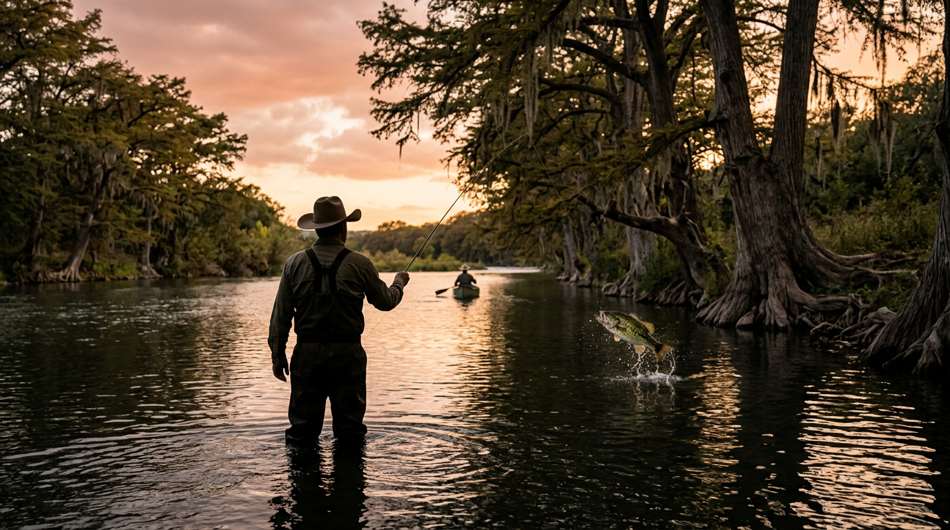
Water serves as the lifeblood of Texas, defining its borders and providing the foundation for its most cherished traditions. From the cypress-lined banks of the Frio to the wide expanse of the Rio Grande, the state’s rivers are more than just geographical features; they are cultural touchstones that have shaped settlement patterns for centuries. As modern life pulls Texans toward urban centers, these natural corridors remain the primary escape for residents seeking a connection to the environment. Historically, Texas water law and management have been at the forefront of policy debates, reflecting the scarcity and value of these resources in a diverse landscape that transitions from humid eastern forests to the arid western deserts. The enduring appeal of these waterways reminds the public of the delicate balance required to maintain them for future generations.
Texas relevance
These water systems are crucial to Texas not just for beauty, but for the economic vitality of rural communities and the sustainability of major cities like Austin, San Antonio, and Houston. Historically, the Texas Legislature has wrestled with 'Rule of Capture' precedents and groundwater management, but the surface water in these rivers remains a strictly regulated public resource. For many Texans, the image of a flowing river is synonymous with the state's tourism industry, particularly in the Hill Country where floating the Guadalupe or Comal provides millions in annual revenue. Preservation efforts led by groups such as the Texas Parks and Wildlife Department ensure that despite extreme weather fluctuations and population growth, these basins remain accessible for public use and ecological stability.
The Geographic Diversity of Texas Water Basins
Texas is home to 15 major river basins and eight coastal basins, each offering a distinct ecosystem that reflects the varied terrain of the state. In the eastern regions, rivers like the Sabine and Neches meander through deep pine forests and swamps, creating slow-moving, tea-colored waters rich in tannins. These rivers were historically the highways of the lumber industry, allowing early settlers to move goods toward the Gulf of Mexico. The humidity of the region keeps these basins lush, providing a stark contrast to the rocky, rugged canyons found further west.
As one moves into the central heart of Texas, the topography shifts to the limestone-carved valleys of the Edwards Plateau. Here, the rivers are characterized by crystal-clear, spring-fed waters that maintain consistent temperatures year-round. The Guadalupe and the San Marcos rivers are the crown jewels of this region, famous for their white-water rapids and limestone bluffs. These central waterways are critical for supporting unique endangered species, such as the Texas Blind Salamander, which depends on the purity of the Edwards Aquifer outlets that feed these rivers.
To the west, the Rio Grande acts as a massive international boundary and a lifeline for the Chihuahuan Desert. The sheer scale of the canyons in Big Bend National Park illustrates the raw power of water as an architect of the Texas landscape. Despite the aridity of the surrounding land, the river supports a vibrant ribbon of life that serves as a migratory path for birds and a vital resource for agriculture. Understanding these distinct zones is essential for any Texan who wishes to appreciate the full scope of the state’s natural heritage.
Historical Significance and Settlement Patterns
The story of Texas is written along its riverbanks. Long before the first Europeans arrived, indigenous groups established complex societies near reliable water sources like the Brazos and the Colorado. These rivers provided not only sustenance but also strategic defensive positions and trade routes. When Spanish explorers and later German immigrants arrived, they navigated inland via these waterways, founding towns that would eventually grow into the bustling metropolises we recognize today. The proximity to water determined which communities flourished and which faded into history.
New Braunfels and Gruene are prime examples of settlements that leveraged the power of the river. The Comal River, one of the shortest in the world, powered early mills and provided the cooling needed for industry. Further south, the San Antonio River was the anchor for the Mission system, including the Alamo. The irrigation canals, or acequias, built by the Spanish were early marvels of engineering that allowed for the cultivation of arid land and proved that water management was the key to surviving the often harsh Texas climate.
During the era of the Republic of Texas and early statehood, the rivers were also the primary means of commercial transport before the advent of the railroad. Steamboats once puffed their way up the Trinity and Brazos rivers, bringing cotton to the ports and manufactured goods to the interior. While many of these rivers are no longer navigable by large commercial vessels due to siltation and damming, their role as the 'spine' of Texas commerce cannot be overstated. They dictated where our roads were built and where our capital was ultimately placed.
The Economics of River Recreation
Outdoor recreation is a multi-billion dollar industry in Texas, and the state’s rivers are the primary engine driving this economic activity. Every summer, thousands of 'tubers' descend upon the Hill Country, supporting hundreds of local businesses ranging from outfitters and shuttle services to restaurants and hotels. This seasonal influx is the lifeblood of small towns that might otherwise struggle. The Texas travel industry relies heavily on the marketing of these natural escapes to both domestic and international visitors.
Beyond the casual floater, the rivers support a robust network of professional guides and outdoor enthusiasts. Fly fishing for the Guadalupe Bass (the state fish) attracts anglers from across the country, while kayakers and canoeists seek out the remote stretches of the Devils River for multi-day expeditions. These activities create a cycle of investment in local economies and foster a community of stakeholders who are deeply invested in the health of the water. When river levels drop due to drought, the economic impact is felt immediately in the pocketbooks of rural Texas families.
The state also benefits from the taxes and fees associated with these activities. Revenue from fishing licenses, park entry fees, and sales taxes on outdoor gear flows back into the state treasury, much of it earmarked for conservation and law enforcement. The Game Wardens of the Texas Parks and Wildlife Department play a dual role as first responders and environmental protectors, ensuring that the heavy use of these rivers does not lead to their degradation. The balance between economic exploitation and environmental protection remains a permanent fixture of Texas legislative policy.
Conservation Law and Property Rights
Texas water law is famously complex, often described as a 'collision' between Spanish civil law, English common law, and modern statutory additions. One of the most significant points of contention is the accessibility of rivers that run through private land. In Texas, the bed of a navigable stream is owned by the state, and the public has the right to use the water for recreation, even if the surrounding land is privately owned. This leads to frequent disputes between landowners and recreationalists regarding trespassing and noise.
The management of river flow is largely handled by 'River Authorities,' which are unique political subdivisions in Texas. Organizations like the Lower Colorado River Authority (LCRA) and the Brazos River Authority (BRA) manage dams, reservoirs, and water rights. Their primary mission is to ensure a steady supply of water for agriculture and urban use, but they must also manage flood control. The delicate act of releasing water from dams can impact downstream habitats and the ability of recreational users to enjoy the river safely.
Environmental groups and conservative legislators often find rare common ground in the protection of these watersheds. While the motivations may differ—some focusing on biodiversity and others on the preservation of property values and heritage—the result is a shared realization that once a river is polluted or dried up, it is nearly impossible to restore. Recent legislative sessions have seen increased funding for the State Water Plan, which emphasizes desalination and reuse, but the natural health of the rivers remains the benchmark by which Texas success is measured.
The Impact of Weather Cycles on Waterways
Texans are well-acquainted with the cycle of 'flood and drought' that defines the state's meteorology. Rivers like the Frio and the Blanco can transform from gentle trickles into raging torrents within minutes during a flash flood event. These events are a natural part of the Texas landscape, scouring the riverbeds and clearing out debris, but they also pose a significant risk to life and property. The iconic cypress trees that line many Texas rivers have evolved to withstand these forces, with deep root systems that anchor them against the current.
Conversely, extended periods of drought can cause even some of the largest rivers to run dry in certain stretches. This has catastrophic effects on local wildlife and the recreational economy. During the historic drought of 2011, many river-based businesses were forced to close, and the lack of flow led to increased temperatures and decreased oxygen levels in the water, resulting in massive fish kills. These cycles serve as a stark reminder of the limitations of our natural resources and the importance of long-term planning.
As Texas experiences shifts in weather patterns, the management of these rivers becomes more challenging. Improved forecasting and the use of 'smart' dam systems are helping authorities mitigate the extremes, but the fundamental nature of the Texas river remains wild and unpredictable. Respecting this volatility is a hallmark of the Texas outdoor experience, requiring visitors to be weather-aware and prepared for the changing conditions of the Lone Star State’s backwaters.
Analysis
Opinion: While visual tributes to Texas rivers evoke a sense of nostalgia, they should also serve as a call to action regarding water conservation and property rights. The tension between urban water demand and rural preservation is a defining political struggle in the Lone Star State. As more people move to Texas, the demand on our river systems increases, making the beauty we see in these photos a fragile reality that requires diligent stewardship and limited government overreach to remain intact.
Source attribution
This story was reported using a public release from the Unusual Texas / Only In Texas (Google News). Keep TX Red rewrote the coverage independently and links to the official statement for verification.
Frequently Asked Questions
- What is the most popular river for recreation in Texas?
- The Guadalupe River is widely considered the most popular for recreation, particularly for tubing and trout fishing. Its location in the Hill Country and the steady flow provided by the Canyon Lake Dam make it a consistent destination throughout the summer months.
- Are the rivers in Texas public or private?
- Under Texas law, the water in a river and the bed of a navigable stream belong to the state and are held in trust for the public. However, the land on either side of the river is often private property. Public users must enter and exit at designated access points to avoid trespassing charges.
- How does Texas protect its rivers from pollution?
- Texas protects its waterways through a combination of state agencies, primarily the Texas Commission on Environmental Quality (TCEQ) and the Texas Parks and Wildlife Department. These agencies monitor water quality, enforce anti-dumping laws, and regulate industrial discharge to ensure the rivers remain safe for people and wildlife.
Official Sources
Take the next step
Browse the Newsroom →Read more about Keep Texas Red → Our full guide to what Keep Texas Red means and why Texans support it.
Related Articles



Get Texas updates delivered weekly.
Independent Texas reporting on politics, policy, and daily life. One email a week. Unsubscribe anytime.
Keep TX Red Newsroom
The Keep Texas Red Editorial Staff produces nonpartisan explainers, policy breakdowns, and educational resources to help Texans understand how their government works. All content is reviewed for accuracy and updated regularly.
About Keep TX Red →