Federal Government Proceeds with $2.6 Billion Border Barrier in Rugged Big Bend Region
U.S. Customs and Border Protection moves forward with multi-billion dollar vehicle barriers across the impassable canyon lands of West Texas.
Editorial disclaimer: Opinions and analysis on Keep TX Red are editorial content — not statements of fact. See our editorial standards.
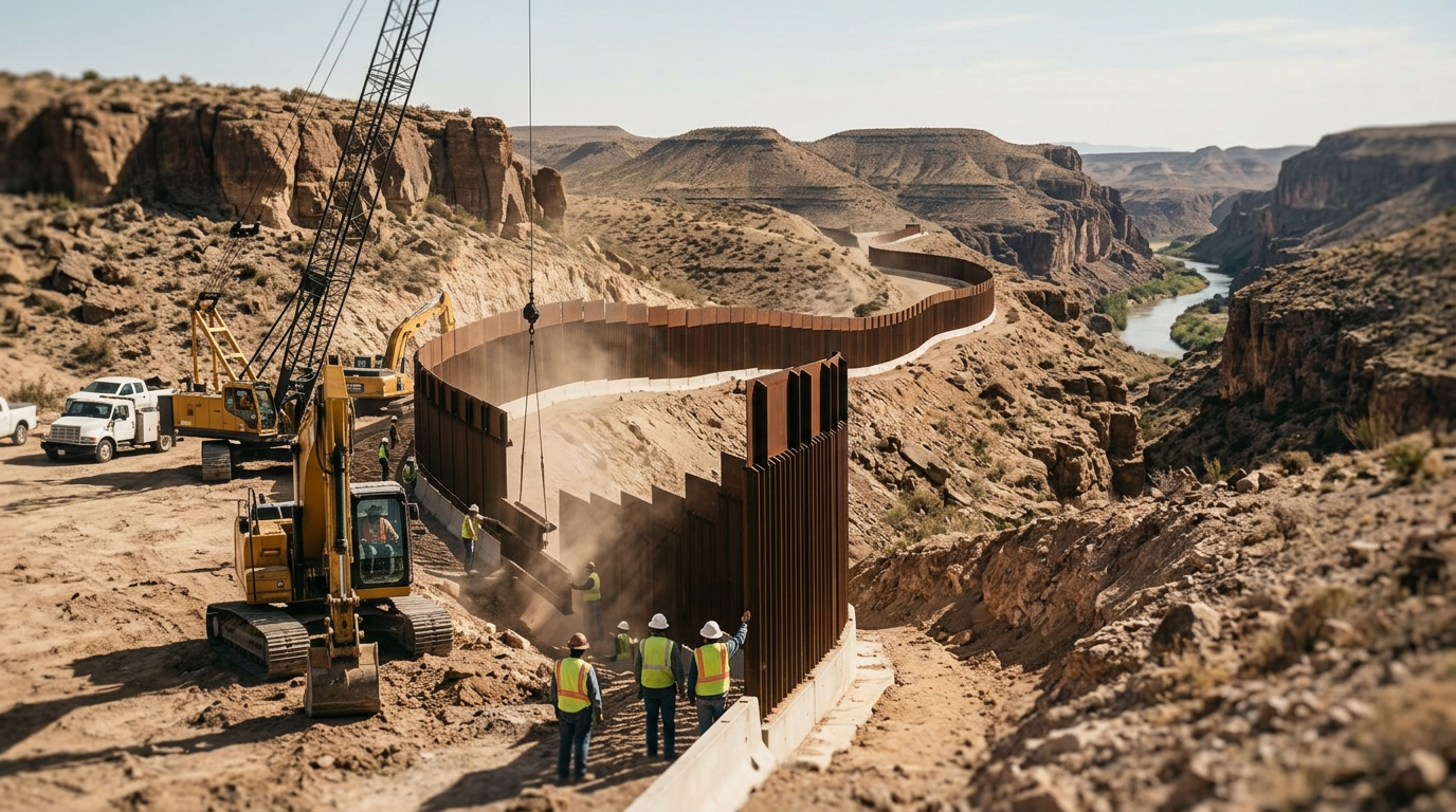
The federal government has initiated a massive infrastructure project valued at $2.6 billion to install vehicle barriers across the Big Bend sector of West Texas. This initiative, facilitated by U.S. Customs and Border Protection (CBP), targets some of the most remote and geographically challenging terrain in the United States. Historically, the Rio Grande's deep canyons and the sheer cliffs of the Chihuahuan Desert have served as a natural deterrent to vehicular traffic, as the landscape features vertical drops and narrow passages that are physically impossible for standard or even off-road vehicles to traverse. This current push represents a continuation of border hardening strategies that emerged in the early 2000s with the Secure Fence Act and intensified during subsequent federal administrations. The project covers hundreds of miles where the river winds through steep limestone walls, stretching across Brewster and Presidio counties. While previous security efforts focused on urban areas like El Paso or the flat ranch lands of the Rio Grande Valley, this development marks a shift toward securing the vast, uninhabited stretches of the high desert. Local residents and geologists have long pointed out that the natural topography of the Big Bend region poses a greater obstacle than any man-made structure could provide. Nevertheless, the federal procurement process is moving forward, with contracts aimed at creating a continuous barrier system regardless of the underlying geological verticality.
Texas relevance
This project directly impacts the West Texas landscape, specifically touching the boundaries of Big Bend National Park and the neighboring Big Bend Ranch State Park. For Texans, this represents a significant federal footprint on state lands and private property along the Rio Grande. The allocation of $2.6 billion has major implications for the local economy in Alpine, Marfa, and Terlingua, where construction crews and federal agents will likely increase the demand for housing and services. Furthermore, the environmental and aesthetic preservation of the Big Bend region—a crown jewel of Texas tourism—is a central concern for state stakeholders who worry about the permanent alteration of the desert vista.
Geological Realities of the Big Bend Sector
The Big Bend region is defined by its extreme elevation changes and the deep cuts of the Rio Grande. In places like Santa Elena Canyon, the walls rise 1,500 feet from the riverbed, creating a natural fortress. Most of the territory earmarked for the new $2.6 billion barrier consists of these sheer rock faces and boulders the size of small houses. Experts note that there are zero recorded instances of vehicles attempting to cross the border through these specific canyon segments because there are no roads leading to the water on either side.
Engineering such a barrier presents unprecedented challenges. To install the planned steel posts, construction crews must navigate heavy machinery into sensitive wilderness areas where even hiking is difficult. Geologists warn that drilling into the limestone might cause instability, potentially leading to rockslides that could fill the river or destroy the very barrier being installed. The disconnect between federal engineering plans and the actual physical reality of the Chihuahuan Desert remains a primary point of contention for local observers.
Fiscal Breakdown and Federal Contracting
The $2.6 billion price tag is among the highest ever recorded for a single segment of border security infrastructure. This cost covers not only the physical materials but also the immense logistical burden of transporting steel and concrete into the roadless backcountry of West Texas. Federal contractors often face higher premiums when working in the Big Bend sector due to the lack of local suppliers and the extreme heat which limits working hours during the summer months.
A significant portion of the budget is expected to go toward land acquisition and legal fees. While much of the land is federally owned, there are pockets of private ranch land that the government must secure through eminent domain. These legal battles often last years, driving up the total project cost far beyond the initial construction estimates. Taxpayers in Texas and across the country are essentially funding a project that costs nearly $15 million per mile in some of the most inaccessible terrain on the planet.
Historical Context of the Frontier
For over a century, the border in Big Bend was largely defined by its isolation rather than its infrastructure. During the Mexican Revolution, the U.S. Army patrolled these canyons on horseback, recognizing that the land itself was the most effective barrier. Even during the height of 20th-century border expansions, Big Bend was frequently left out of fencing plans because the cost-to-benefit ratio was seen as unfavorable compared to high-traffic zones like McAllen or Laredo.
The sudden shift to prioritize a vehicle barrier in this region suggests a change in federal strategy that favors total perimeter closure. This 'wall-to-wall' philosophy assumes that leaving any gap, even one protected by a 1,000-foot cliff, creates a psychological or tactical vulnerability. This pivot ignores decades of precedent where the desert's natural hostility served as a sufficient guard against large-scale vehicular crossings.
Environmental Concerns and National Park Limits
Big Bend National Park is one of the few places in Texas with 'International Biosphere Reserve' status. The construction of a massive steel and concrete barrier threatens to disrupt migratory corridors for wildlife, including the black bear and the mountain lion, which move between the Chisos and Sierra del Carmen mountains. Naturalists argue that once these trails are blocked by vehicle barriers, the genetic diversity of these species could plummet as populations are isolated on either side of the river.
Beyond wildlife, the visual impact of the barrier is a concern for the Texas travel industry. The park attracts nearly half a million visitors annually, many of whom come to experience the 'untainted' wilderness of the last frontier. A towering industrial barrier running through the scenic canyons could significantly alter the visitor experience, potentially impacting the local economy that relies heavily on eco-tourism and outdoor recreation.
Logistics of 'Vehicular' Deterrence
Customs and Border Protection officials justify the project by stating that a physical barrier provides 'situational awareness' and slows down any potential illegal activity. However, the term 'vehicle barrier' is specific to preventing the movement of cars and trucks. In the Santa Elena and Boquillas regions, the only vehicles capable of operating are specialized river rafts or perhaps mules. The project does not explicitly address foot traffic, which is the only way humans currently navigate these canyon passes.
Tactically, the logic of a vehicle barrier in a canyon depends on the idea that smugglers might eventually develop the technology or infrastructure to build roads through the desert. Critics argue this is a projection of a future threat that has no basis in current border dynamics. They suggest that the $2.6 billion could be redirected toward high-tech surveillance drones that could monitor these canyons from the air without physical disruption to the ground.
Local Government and Community Response
Reaction among West Texas county officials has been mixed. Some see the project as a necessary step in securing the sovereignty of the border, regardless of the cost. Others, particularly in Brewster County, have expressed frustration over the lack of consultation regarding the placement of the barrier. Local leaders often find themselves caught between the desire for increased security and the need to protect the natural assets that drive their specific regional economy.
Public meetings in Alpine and Presidio have seen residents voice concerns about the 'militarization' of their backyard. For generations, the border in these areas was a fluid concept where people crossed to trade in small villages like Boquillas. The installation of a multi-billion dollar barrier formalizes a divide that has historically been bridged by the river and mutual desert survival, marking a definitive end to an era of rural border cooperation.
Analysis
From a policy perspective, the decision to fund vehicle barriers in areas where vehicles cannot physically operate raises questions about the efficiency of top-down federal mandates. While securing the border is a core constitutional priority and a major concern for most Texans, the application of a one-size-fits-all engineering solution to the unique cliffs of West Texas may be seen as an expensive symbolic gesture rather than a tactical necessity. Critics within the region argue that these billions could be more effectively spent on technology like autonomous sensors or increased boots-on-the-ground, which would provide actual surveillance in the canyons rather than static steel in the rock. However, proponents of the project argue that a continuous line is necessary to prevent any potential gaps in national sovereignty, ensuring that no sector of the border is left legally or physically 'open.'
Source attribution
This story was reported using a public release from the Texas Monthly. Keep TX Red rewrote the coverage independently and links to the official statement for verification.
Frequently Asked Questions
- Why is the government building a vehicle barrier where there are no roads?
- Federal officials from CBP argue that a continuous barrier is necessary to eliminate any perceived gaps in the border. Even if the land is currently impassable for cars, they believe a physical structure ensures long-term security and prevents future attempts at crossing.
- Will this construction affect Big Bend National Park?
- Yes, parts of the project are slated to run along the boundaries of the park and state park lands. This could lead to temporary closures of certain areas during construction and a permanent change to the landscape's appearance and wildlife movement patterns.
- How much will the project cost per mile?
- Because of the difficulty of the terrain and the need to transport materials into remote desert areas, the estimated cost is approximately $15 million per mile, bringing the total for the segment to $2.6 billion.
- Can standard vehicles even cross the Rio Grande in these areas?
- Generally, no. In the Big Bend canyons, the river is flanked by vertical rock walls or deep, silty mud that is inaccessible to trucks or cars. Most border activity in this sector involves individuals traveling on foot or via small watercraft.
Official Sources
Take the next step
Browse the Newsroom →Read more about Keep Texas Red → Our full guide to what Keep Texas Red means and why Texans support it.
Get Texas updates delivered weekly.
Independent Texas reporting on politics, policy, and daily life. One email a week. Unsubscribe anytime.
Keep TX Red Newsroom
The Keep Texas Red Editorial Staff produces nonpartisan explainers, policy breakdowns, and educational resources to help Texans understand how their government works. All content is reviewed for accuracy and updated regularly.
About Keep TX Red →